var Uttarakhandplaces =
{
menusystembengali :
" "+
"এই পাতার জায়গাসমূহঃ-"+
"মেনু দেখতে ক্লিক করুন"+
" •হৃষিকেশ"+
" •কর্ণপ্রয়াগ "+
" •নৌটি-গ্রাম"+
" •আদি-বদ্রী"+
" •কল্পেশ্বর "+
" •অনুসূয়া"+
" •গোপেশ্বর"+
" •হরিদ্বার"+
" •ধারচুলা"+
" •মুন্সিয়ারী"+
" •পিথোরাগড়"+
" •টনকপুর",
menusystemenglish :
" "+
"Places in This Page:-"+
"Click To See Menu"+
" •Hrisekesh"+
" •Karnaprayag "+
" •Nauti-Village"+
" •Adi-Badri"+
" •Kalpeshwar "+
" •Anusuya"+
" •Gopeshwar"+
" •Haridwar"+
" •Dharchula"+
" •Munsiyari"+
" •Pithoragarh"+
" •Tanakpur",
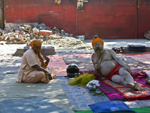
hrisekeshbengali : "হৃষিকেশঃ-হৃষীকেশ ভারতের একটা সুপরিচিত পবিত্র জনপদ যা বহু কথা ও কাহিনীতে রঙিন হয়ে আছে। একসময় রাভ্য ঋষি, গঙ্গা নদীর তীরে বসে কঠোর তপস্যা করেন। তাঁর তপস্যায় সন্তুষ্ট হয়ে ভগবান বিষ্ণু তাঁর কাছে হৃষীকেশের (চেতনা বা জ্ঞানের ভগবান) বেশ নিয়ে হাজির হ’ন। তখন থেকে জায়গাটার নাম হৃষীকেশ হয়ে গেছে। অন্য এক লোককথায় ভগবান রাম, রাবণকে ধ্বংস করা জন্য এখানে কঠোর সাধনায় বসেন ও বিভিন্ন কাজের জন্যে নদী পার হতে হয়। তাই এখানে রাম ঝোলা, লক্ষ্মণ ঝোলা ইত্যাদি নামগুলো এসেছে।"+
"
"+
"শব্দঃ প্রতিবেদনঃ "+
""+
"ভিডিও"+
"স্লাইডশোর জন্যে নীচের ছবিতে ক্লিক করুন "+
"
"+
"পেজ মেনুতে যান",
hrisekeshenglish : "Hrisekesh:-Hrishikesh is a well-known holy town of India which is colorful in many words and stories of writing. Once upon a time, the sage Ravya sat on the banks of the river Ganges and did severe austerities. Satisfied with his austerities, Lord Vishnu came to him with an appearance of Hrishikesh (Lord of Consciousness or Wisdom). Since then, the name of the place has become Hrishikesh. In another folklore, Lord Rama sits here in hard pursuit to destroy Ravana and has to cross the river for various purposes. That is why the names Ram Jhola, Lakshman Jhola etc. have come here."+
"
"+
"Sound Stream: "+
""+
"Video"+
"Click any Picture for Slide Show "+
"
"+
"Go To Page Menu",
photohrisekesh :
""+
" "+
" "+
""+
"",
karnaprayagbengali : "কর্ণপ্রয়াগঃ-অলকানন্দা ও পিণ্ডার নদীর সংগমে পটে আঁকা কর্ণপ্রয়াগ, পঞ্চপ্রয়াগের একটা প্রয়াগ। এই পবিত্র জনপদ ভূপৃষ্ঠ থেকে প্রায় ১,৪৫১ মিটার উচ্চতায় অবস্থিত। দৃশ্যত এই খেলনা জনপদ মহাভারতে কর্ণের শহর বলে বর্ণিত। কর্ণপ্রয়াগ কুমায়ুন ও গাড়োয়ালের সংযোগস্থল বলে এর গুরুত্ব অনেক। ঘন সবুজ জঙ্গল সমৃদ্ধ পাহাড়ের পরিপ্রেক্ষিত, ফেনায়িত নদীর জলতরঙ্গ, প্রকৃতির আদিম পরিবেষ্টন এই সব মিলিয়ে কর্ণপ্রয়াগ সত্যি সত্যিই পর্যটকদের পুলকিত করে। এই কর্ণপ্রয়াগেই শ্রদ্ধা জানানো যাবে বহু পুরানো সতীমাতার নামে উৎসর্গীকৃত উমাদেবী মন্দিরে যিনি এখানে পার্বতী নামে জন্মগ্রহণ করেন ও পরবর্তীকালে ভগবান শিবের স্ত্রী রূপে আবির্ভূত হ’ন। এক সময় বিখ্যাত সন্ন্যাসী ও দার্শনিক স্বামী বিবেকানন্দ তাঁর গুরুভাইদের নিয়ে এখানে আসেন ও একটানা আঠারো দিন ধরে ধ্যান করেন। এখান থেকে ঘোরার অনেক জায়গা আছে যার মধ্যে নৌটি গ্রাম ও আদি বদ্রী মন্দির উল্লেখযোগ্য। হিন্দু পুরাণ অনুযায়ী কর্ণপ্রয়াগ সেই জায়গা যেখানে পাওয়ান দেব ও কুন্তি দেবীর ছেলে কর্ণ এক গভীর ধ্যানে মগ্ন ছিলেন। তাঁর নিষ্ঠা ও একাগ্রতায় অত্যন্ত সন্তুষ্ট হয়ে সূর্যদেব তাঁকে দুটো রক্ষাকবচ দেন। একটা কবচ ও অন্যটা কানের দুল যাদের স্বর্গীয় ক্ষমতা আছে। আবার কোনও কোনও লোককথা বলে যে এখানে কর্ণের মৃতদেহের সৎকার করা হয় বলে এখানকার নাম কর্ণপ্রয়াগ। "+
"Read More..."+
"
"+
"শব্দঃ প্রতিবেদনঃ "+
""+
"ভিডিও"+
"স্লাইডশোর জন্যে নীচের ছবিতে ক্লিক করুন "+
"
"+
"পেজ মেনুতে যান",
karnaprayagenglish : "Karnaprayag:-Like a drawing on a canvas, Karnaprayag, is situated on the confluence of Alaknanda and Pinder rivers, is a prayag of Panchprayag. This holy town is located at an altitude of about 1,451 meters above the ground. Apparently, this toy town is described in the Mahabharata as the city of Karna. Karnaprayag is the junction of Kumayun and Garhwal. Karnaprayag really fascinates the tourists with the view of the dense green forest rich hills, the water waves of the foamy river and the primitive surroundings of nature. It is in this Karnaprayag that one can pay homage to the Umadevi temple dedicated to a very old Satimata who was born here as Parvati and later reappeared as the wife of Lord Shiva. At one time the famous monk and philosopher Swami Vivekananda came here with his followers and meditated continuously for eighteen days. There are many places to visit from here, among which Nauti village and Adi Badri temple are notable. According to Hindu mythology, Karnaprayag is the place where Karna, the son of Pawan Dev and Kunti Devi, was in deep meditation. Extremely satisfied with his devotion and concentration, Suryadev gave him two bodyguards. One is an amulet and the other is an ear ring that has heavenly powers. Some people say that Karna's body is buried here, hence the name Karnaprayag. "+
"Read More..."+
"
"+
"Sound Stream: "+
""+
"Video"+
"Click any Picture for Slide Show "+
"
"+
"Go To Page Menu",
photokarnaprayag :
""+
" "+
" "+
" "+
" "+
" "+
""+
"",
nautibengali : "নৌটি গ্রামঃ-চামোলি জেলার কর্ণপ্রয়াগ থেকে মাত্র ২৪ কি.মি. দূরে ৩৭০ মিটার উচ্চতায় অবস্থিত নৌটি এক ঘুমন্ত পাহাড়ি গ্রাম যার আদিম সৌন্দর্য আজও বর্তমান। সভ্যতা ও তার বিকাশের বিভিন্ন আনুষঙ্গিক উপকরণের ফলে অনেক পাহাড়ি গ্রাম নষ্ট হয়ে গেলেও, নৌটির ওপর তার প্রভাব সেভাবে পড়েনি। পরিবেশ বাঁচানের অনুভবের জন্যে সেখানকার মানুষজনকে ধন্যবাদ জানাই। এই গ্রামকে বলা হয় সতীমাতা ও নন্দাদেবীর গ্রাম ও তাঁর পবিত্র নিলয়। প্রতি বার বছর অন্তর এখান থেকেই শুরু হয় রাজজাট যাত্রা যা গাড়োয়াল ও কুমায়ুনের সর্ববৃহৎ ও সর্বদীর্ঘ যাত্রা। এখান থেকে বিভিন্ন বিপদসংকুল এলাকা পরিক্রমা করে এই যাত্রা শেষ হয় রূপকুণ্ড, শৈলসমুদ্র পেরিয়ে হোমকুণ্ডে। সঙ্গে থাকে চার সিংওয়ালা একটি ভেড়া। ভেড়াটা হোমকুণ্ড থেকে রন্টি স্যাডেল হয়ে নন্দাঘুন্টি পর্বতের দিকে চলে যায় ও সেখানেই যাত্রা শেষ হয়। এই ২৯০ কি.মি. পদযাত্রায় প্রায় ২০ দিন সময় লাগে। প্রথমদিকে অসংখ্য মানুষ থাকলেও শেষের দিকে তা হাতে গোনায় পরিণত হয়। লোককথা অনুযায়ী ভগবান শিবের সঙ্গিনী এই গ্রামেই জন্মগ্রহণ করেন। তিনি যখন গ্রাম ছেড়ে বা বাপের বাড়ি ছেড়ে নন্দাদেবী পর্বতে চলে যান তখন ওনাকে সম্মান জানাতেই এ যাত্রা। আগস্ট মাসে খুব বৃষ্টি হয় ও তা নন্দাদেবী চলে যাবার শোকে চোখের জল হিসাবে বর্ণনা করা হয়। এই যাত্রার প্রধান পুরোহিত থাকেন এই গ্রামের নন্দাদেবী মন্দিরের কাছেই। নৌটি গ্রামের প্রাকৃতিক সৌন্দর্য সবাইকে মুগ্ধ করে বিশেষতঃ নন্দাঘুন্টির ওপর সূর্যাস্ত ও সূর্যোদয়ের দৃশ্য। গ্রামের সরল সাদাসিধে মানুষের সান্নিধ্য মানুষকে আনন্দ দেয়। সবুজের ঘেরাটোপে অবস্থিত নন্দাদেবী মন্দির গ্রামের পবিত্র মন্দির। এই মন্দির ছাড়াও এখানে একটা শিব মন্দির আছে। থাকার জন্যে গাড়োয়াল মণ্ডল বিকাশ নিগমের একটা সুন্দর বাংলো আছে। "+
"Read More..."+
"
"+
"শব্দঃ প্রতিবেদনঃ "+
""+
"ভিডিও"+
"স্লাইডশোর জন্যে নীচের ছবিতে ক্লিক করুন "+
"
"+
"পেজ মেনুতে যান",
nautienglish : "Nauti village:-Nauti, situated at an altitude of 360 meters at a distance of 24 km from Karnaprayag of Chamoli district, is a sleeping hilly village whose primitive beauty is still present today. Although many hilly villages perished as a result of various aspects of urbanization and its development, its impact on the Nauti was not so great. Thanks to the people there for the feeling of saving the environment. This village is called the village of Satimata and Nanda Devi and her holy abode. Every twelve years the Rajjat Jatra starts from here which is the biggest and longest journey of Garhwal and Kumayun. From here the journey ends at Roopkund, traversing various perilous areas, crossing the Sailasamudra to Homkund. Accompanied by a sheep with four horns. The sheep climb from Homkund to Ronti Saddle towards Nandaghunti mountain and the journey ended there. This 290 km walk takes about 20 days. In the beginning there were many people but at the end it turned into a handful. According to folklore, Lord Shiva's companion was born in this village. When she leaves the village or leaves her father's house and goes to Nanda Devi Mountain, this journey is to pay homage to her. There is a lot of rain in August and it is described as tears in the mourning of Nanda Devi's departure. The chief priest of this procession lives near the Nanda Devi temple in this village. The natural beauty of Nauti village fascinates everyone, especially the view of sunset and sunrise over Nandaghunti. The proximity of the simple village people brings joy to the tourists. Nanda Devi temple located in the green enclosure is the holy temple of the village. Apart from this temple, there is a Shiva temple here. The Garhwal Mandal Development Corporation has a beautiful bungalow to stay in. "+
"Read More..."+
"
"+
"Sound Stream: "+
""+
"Video"+
"Click any Picture for Slide Show "+
"
"+
"Go To Page Menu",
photonauti :
""+
" "+
" "+
" "+
" "+
" "+
" "+
" "+
""+
"",
adiBadribengali : "আদি বদ্রীঃ-আদি বদ্রী উত্তরাখণ্ডের বদ্রীক্ষেত্রের বিখ্যাত সপ্ত বদ্রীর একটি বদ্রী। এখানে ষোলোটা মন্দিরের একটি গ্রুপ রয়েছে যা তৈরি হয়েছে গুপ্ত আমলে বলে মনে করা হয়, যদিও ইতিহাস অনুযায়ী এগুলো তৈরি হয়েছে আদি শঙ্করাচারিয়ার আমলে। এই বদ্রীর ষোলটা মন্দিরের মধ্যে সবথেকে বিখ্যাত নারায়ণ মন্দির যেখানে পিরামিডের মতো দেখতে একটা উঁচু বেদির ওপর কালো পাথরের নারায়ণ প্রতিষ্ঠা করা আছে। এটা মনে করা হয় যে ভগবান বিষ্ণু সত্য, ত্রেতা ও দাপর যুগে আদি বদ্রীতে বাস করতেন। কলি যুগে তিনি তাঁর বাসস্থান স্থানান্তরিত করেন বদ্রীনাথে। আগে খুব খারাপ রাস্তার জন্য ভক্তজন বদ্রীনাথে যেতে পারতেন না, তাই আদি বদ্রীতে তাঁদের ভক্তি নিবেদন করতেন। এখনও বদ্রীনাথের রাস্তা প্রাকৃতিক কারণে বা বদ্রীবিশাল মন্দির বন্ধ হয়ে গেলে মানুষজন এখানেই পুজো দেন। প্রাচীন মুনি ঋষিরা তাঁদের ভবিষ্যতদ্রষ্টা যোগ মহিমায় ঘোষণা করেন যে কলি যুগের পর আসবে সত্যযুগ ও ভগবান বিষ্ণু তখন তাঁর নিলয় ভবিষ্যবদ্রীতে স্থানান্তরিত করবেন। অন্য এক মতে বলে যে মহর্ষি বেদাভ্যাস যিনি বেদ ধর্মগ্রন্থকে ঋগ্বেদ, সামবেদ, যজুর্বেদ ও অথর্ববেদ এই চার ভাগে ভাগ করেন তিনি এখানে বসে শ্রীমদ্ভগবদগীতা রচনা করেন। "+
"Read More..."+
"
"+
"শব্দঃ প্রতিবেদনঃ "+
""+
"ভিডিও"+
"স্লাইডশোর জন্যে নীচের ছবিতে ক্লিক করুন "+
"
"+
"পেজ মেনুতে যান",
adiBadrienglish : "Adi Badri:-Adi Badri is one of the famous seven Badris of Badri zone of Uttarakhand. There is a group of sixteen temples here which are believed to have been built during the Gupta period, although according to history they were built during the Adi Shankaracharya period. The most famous of the sixteen temples of this Badri is the Narayan Temple where a black stone Narayan is erected on a high altar that looks like a pyramid. It is believed that Lord Vishnu lived in Adi Badri in the age of Satya, Treta and Dapar. During the Kali or modern period he shifted his residence to Badrinath. Earlier devotees could not go to Badrinath due to bad roads, so they used to offer their devotion at Adi Badrinath. People still worship here when the road to Badrinath is closed due to natural causes or the Badribishal temple is closed. The ancient sages in their fortune-telling yoga majesty announced that Satya Yuga would come after Kali Yuga and Lord Vishnu would then move his ventricle to Bhavishya Badri. According to another, Maharshi Bedavasya, who divides the Vedic scriptures into Rigveda, Samveda, Yajurveda and Atharvaveda, sits here and composes Srimad-Bhagavatgita. "+
"Read More..."+
"
"+
"Sound Stream: "+
""+
"Video"+
"Click any Picture for Slide Show "+
"
"+
"Go To Page Menu",
photoadiBadri :
""+
" "+
" "+
""+
"",
kalpeshwarbengali : "কল্পেশ্বরঃ-কল্পেশ্বর পঞ্চকেদার তীর্থযাত্রার শেষ মন্দির ও এটাই পঞ্চকেদারের একমাত্র মন্দির যা সারা বছর খোলা থাকে। ভগবান শিব এখানে পূজিত হ’ন জটাধারী শিব রূপে। কল্পেশ্বর যাবার রাস্তাটা বড় সুন্দর। গভীর অরণ্য ও পান্না সবুজ ক্ষেতের মধ্যে দিয়ে রাস্তা, যা চলে গেছে একেবারে মন্দির অব্দি। বর্তমানে মন্দির অব্দি গাড়ি হয়ে গেছে তাই কারুরই হেঁটে যাবার উৎসাহ খুব একটা নেই। এখানে একটা পুরানো কল্পতরু গাছ আছে যেখানে প্রার্থনা করলে যা চায় তা পাওয়া যায় বলে স্থানীয় মানুষদের বিশ্বাস। কল্পেশ্বর নিয়ে অনেক কথা ও কাহিনী প্রচলিত আছে। প্রথমটা এইরকম। কুরুক্ষেত্রের রক্তক্ষয়ী যুদ্ধে পাণ্ডবরা তাঁদের হত্যালীলা চালানোর অপরাধে ভগবান শিবের কাছ থেকে ক্ষমা প্রার্থনা করার জন্যে অজ্ঞাতবাসে চলে আসেন। তাঁরা ভগবান শিবকে সমস্ত জায়গায় খুঁজতে শুরু করেন কিন্তু কিছুতেই সন্ধান পেলেন না। অনেক খোঁজার পর তাঁরা একটা ষাঁড়ের রূপ ধারণকারী শিবকে দেখতে পা’ন। ভীম তখন বলপূর্বক সেই ষাঁড়ের লেজ ধরে টানাটানি শুরু করেন কিন্তু সেই মুহূর্তে ষাঁড় মাটিতে ঢুকে যায়। পরবর্তীকালে বিভিন্ন রূপে কেদারক্ষেত্রের বিভিন্ন জায়গায় সেই ষাঁড়ের দেহের বিভিন্ন অংশ দেখা যায়। কল্পেশ্বরে শিবের জটা পাওয়া যায়। অন্য এক কাহিনী মতে প্রচণ্ড ক্রোধী মুণি দুর্বাসা ঐ কল্পবৃক্ষের নীচে বসে ধ্যান করেছিলেন তাই এই জায়গার নাম কল্পেশ্বর হয়েছে। "+
"Read More..."+
"
"+
"শব্দঃ প্রতিবেদনঃ "+
""+
"ভিডিও"+
"স্লাইডশোর জন্যে নীচের ছবিতে ক্লিক করুন "+
"
"+
"পেজ মেনুতে যান",
kalpeshwarenglish : "Kalpeshwar:-Kalpeshwar is the last temple of Panchkedar pilgrimage and it is the only temple of Panchkedar which is open all year round. Lord Shiva is worshiped here in the form of Jatadhari Shiva. The road to Kalpeshwar is very beautiful. The road through the deep forest and emerald green fields, which is going to the temple. At present, the road almost reached the door to the temple, so that people go by car, and no one is encouraged to walk. There is an old kalpataru tree where the locals believe that if you pray you will get what you want. There are many stories and tales about Kalpeshwar. The first is like this. In the bloody battle of Kurukshetra, the Pandavas went into hiding to seek forgiveness from Lord Shiva for their killing. They started looking for Lord Shiva everywhere but found nothing. After much searching, they find Shiva in the form of a bull. Bhim then forcibly grabbed the bull's tail and started pulling it but at that moment the bull went to the ground. Later, different parts of the bull's body were seen in different forms in different places of Kedarkshetra. Shiva's braid is found in Kalpeshwar. According to another story, a very angry sage Durbasa was meditating under that kalpavriksha, hence the name Kalpeshwar. "+
"Read More..."+
"
"+
"Sound Stream: "+
""+
"Video"+
"Click any Picture for Slide Show "+
"
"+
"Go To Page Menu",
photokalpeshwar :
""+
" "+
" "+
" "+
" "+
" "+
" "+
" "+
""+
"",
anusuyabengali : "অনুসূয়াঃ-চামোলী জেলার সদর দপ্তর গোপেশ্বর থেকে মাত্র ১২ কি.মি. দূরে ঘন জঙ্গলের ঘেরাটোপে অনুসূয়া দেবী মন্দির অবস্থিত। এই মন্দির চামোলি জেলার একটা অন্যতম বিখ্যাত তীর্থস্থান যা দেবী সতীর নামে উৎসর্গ করা হয়েছে। দেবী সতী, সপ্ত ঋষির অন্যতম, মহাপ্রাজ্ঞ অত্রিমুণির স্ত্রী ছিলেন। দেবী তাঁর সমস্ত কিছু স্বামীর উদ্দেশ্যে উৎসর্গ করেন। প্রতিবছর ডিসেম্বর মাসে দত্তত্রেয়ী জয়ন্তী অনুষ্ঠিত হয় যেখানে বড় মেলা হয় ও অনেক পর্যটক ও ভক্তের সমাগম হয়। অনুসূয়া দেবীর মন্দির সম্বন্ধে অনেক লৌকিক উপাখ্যান শোনা যায়। একসময় ব্রহ্মা, বিষ্ণু ও মহেশ্বর, তাঁদের স্ত্রীদের সরস্বতী, লক্ষ্মী ও পার্বতীর পরামর্শে, অনুসূয়া দেবীর ক্ষমতা পরীক্ষা করতে আসেন। তাঁরা ব্রাহ্মণের বেশে অনুসূয়া দেবীর আশ্রমে আসেন। ব্রাহ্মণ দেখে অনুসূয়া দেবী তাঁদের খাবার অনুরোধ করেন কিন্তু দেবতারা সর্ত দেন যে তাঁরা একটি সর্তেই খেতে পারেন যদি দেবী বস্ত্রহীন অবস্থায় তাঁদের খাবার পরিবেশন করেন। দেবীর তো মাথায় হাত ও তখন তিনি অত্রিমুণির শরণাপন্ন হ’ন। অত্রিমুণি তাঁর দিব্যচক্ষুতে ব্রাহ্মণদের আসল রূপ দেখতে পান ও অনুসূয়াদেবীকে সেইমতো পরামর্শ দেন। অনুসূয়াদেবী ব্রাহ্মণদের বলেন, তিনি সর্ত মানতে রাজী আছেন কিন্তু তাঁরও কিছু সর্ত আছে। তিনি ব্রাহ্মণরূপী দেবতার দলকে বলেন যে তাঁদেরকে তাঁর শিশু সন্তানের মতো ছোট হয়ে যেতে হবে। তাতে দেবতারা রাজী হ’ন ও অত্রিমুণির মন্ত্রে তাঁরা ছোট্ট শিশুতে পরিণত হ’ন। দিনে যায়, মাস যায় দেবতারা অনুসূয়া দেবীর সন্তান হয়ে আশ্রমেই থেকে যান। এদিকে তাঁদের স্ত্রীরা অত্যন্ত ব্যকুল হয়ে আসল ঘটনা জানতে পারেন। তখন দেবী অনুসূয়ার কাছে ক্ষমা প্রার্থনা করেন ও তাঁদের স্বামীদের ফিরিয়ে দিতে বলেন। তিনি রাজী হ’ন ও অত্রিমুণি আবার স্বর্গীয় জলের ছিটে দিয়ে তাঁদের আগের অবস্থায় ফিরিয়ে দেন। তখন থেকে ঐ জায়গার নাম নাকি সতী অনুসূয়া নামে পরিচিত ও ব্রহ্মা, বিষ্ণু ও মহেশ্বরকে অত্রিমুণির সন্তান বলা হয়। অত্রিমুণির আশ্রম অনুসূয়া দেবীর আশ্রম থেকে মাত্র দু কি.মি. দূরে অবস্থিত। আশ্রমটা একটা গুহা মন্দিরের মতো। লোককথা অনুযায়ী এই মন্দির হচ্ছে পৃথিবীর মধ্যে একমাত্র জায়গা যেখানে শ্রদ্ধা নিবেদন করার জন্যে একটা নদীর তীর ধরে প্রদক্ষিণ করতে হয়। "+
"Read More..."+
"
"+
"শব্দঃ প্রতিবেদনঃ "+
""+
"ভিডিও"+
"স্লাইডশোর জন্যে নীচের ছবিতে ক্লিক করুন "+
"
"+
"পেজ মেনুতে যান",
anusuyaenglish : "Anusuya:-Anusuya Devi temple is located in the thick forest at a distance of only 12 km from Gopeshwar, the headquarters of Chamoli district. This temple is one of the famous pilgrimage sites of Chamoli district which is dedicated to Goddess Sati. Goddess Sati was the wife of Atrimuni, one of the great sage seven sages. The goddess sacrifices everything to her husband. Dattatreya Jayanti is celebrated every year in December where big fairs are held and many tourists and devotees gather. Many folk tales are heard about the temple of Goddess Anusuya. Once upon a time Brahma, Vishnu and Maheshwar, on the advice of their wives Saraswati, Lakshmi and Parvati, came to test the power of Goddess Anusuya. They came to the ashram of Anusuya Devi in the appearance of a Brahmin. Seeing the Brahmins, the goddess Anusuya requests them to take food, but the gods told they can eat on one condition, only if the goddess serves their food without clothes. The goddess was shocked and then she requested protection from Atrimuni. Atrimuni saw the real form of Brahmins in his divine eyes and advised Anusuya Devi accordingly. Anusuadevi told the Brahmins that she was willing to accept the condition, but she also had some conditions. She told the group of Brahman like gods that they had to become as small as her infants. The gods agreed and they became little children in the intonation of Atrimuni. Day after day, month after month, the gods become the children of the goddess Anusuya and stay in the ashram. Meanwhile, their wives are very anxious and knew the facts. The goddess then apologized to Anusuya and asked her to return their husbands. She agreed and Atrimuni returns them to their former state with a splash of heavenly water. From then on, the place was known as Sati Anusuya and Brahma, Vishnu and Maheshwar were said to be the children of Atrimuni. Atrimuni's Ashram is only 2 km away from Anusuya Devi's Ashram. The ashram is like a cave temple. According to folklore, this temple is the only place in the world where one has to walk along the banks of a river to pay homage. "+
"Read More..."+
"
"+
"Sound Stream: "+
""+
"Video"+
"Click any Picture for Slide Show "+
"
"+
"Go To Page Menu",
photoanusuya :
""+
" "+
" "+
" "+
" "+
" "+
" "+
" "+
""+
"",
gopeshwarbengali : "গোপেশ্বরঃ-১,৩০০ মিটার উচ্চতায় অবস্থিত গোপেশ্বর উত্তরাখণ্ডের চামোলি জেলার সদর দপ্তর ও অন্যতম গুরুত্বপূর্ণ জনপদ। মূলত মন্দির, প্রাকৃতিক সৌন্দর্য ও সুন্দর আবহাওয়ার জন্যই বিখ্যাত এই জনপদ। কারও কারও মতে গোপেশ্বর নামটা এসেছে ভগবান শ্রীকৃষ্ণের নাম অনুসারে। গোপেশ্বরের মূল আকর্ষণ বহু পুরানো ভগবান শিবের মন্দির। সারা বছরই অসংখ্য তীর্থযাত্রী, পর্যটক, ভ্রমণার্থী এখানে আসেন। গোপেশ্বরকে ঘিরে রেখেছে গাড়োয়ালের বিখ্যাত মন্দিরগুলো যাদের মধ্যে তুঙ্গনাথ, অনুসূয়াদেবী, রুদ্রনাথ ও বদ্রীনাথ উল্লেখযোগ্য। অন্যান্য আকর্ষণের মধ্যে বৈতরণী কুণ্ড, মূর্তি ছাড়া একটা মন্দিরের গ্রুপ, ও ওক গাছের অনন্য দৃশ্য। এই এলাকা চতুর্দিকের পাহাড়ের ও তুষার কিরীটের আদিম ও অনন্ত স্ফুলিঙ্গ ছড়ানো প্রাকৃতিক দৃশ্যের ভাণ্ডার। গোপেশ্বর গর্ব করে তার সমৃদ্ধশালী ইতিহাসের জন্যে। গোপেশ্বর গাড়োয়াল রাজত্বের একটা অংশ ছিল ও অনেক পুরুষ ধরে তারা ক্ষমতা ধরে রাখে। পরবর্তীকালে গোর্খারা এই এলাকার দখল নেয় কিন্তু তারা ব্রিটিশের কাছে হেরে যায়। ১৯৯৭ সালের ১৬ সেপ্টেম্বর চামোলি জেলা ভেঙ্গে রুদ্রপ্রয়াগ জেলা তৈরি হয় ও তখন খেকে গোপেশ্বর চামোলির সদর দপ্তর হয়ে যায়। "+
"Read More..."+
"
"+
"শব্দঃ প্রতিবেদনঃ "+
""+
"ভিডিও"+
"স্লাইডশোর জন্যে নীচের ছবিতে ক্লিক করুন "+
"
"+
"পেজ মেনুতে যান",
gopeshwarenglish : "Gopeshwar:-At an altitude of 1,300 meters, Gopeshwar is the headquarters of Chamoli district in Uttarakhand and one of the most important towns. This town mainly famous for its temples, natural beauty and beautiful weather. According to some people, the name Gopeshwar comes from the name of Lord Krishna. The main attraction of Gopeshwar is the very old temple of Lord Shiva. Throughout the year innumerable pilgrims, tourists, travelers come here. Gopeshwar is surrounded by the famous temples of Garhwal, most notably Tungnath, Anusuadevi, Rudranath and Badrinath. Other attractions include the Baitarani Kunda, a group of temples without statues, and the unique view of the oak tree. The area is a treasure trove of landscapes surrounded by primitive and eternal sparks of mountains and snow crowns. Gopeshwar is proud of his rich history. Gopeshwar was a part of the Garhwal kingdom and they held power for many generations. The Gorkhas later occupied the area but lost to the British. Rudraprayag district was formed on 16 September 1997 when Chamoli district was divided and then Gopeshwar became the headquarters of Chamoli. "+
"Read More..."+
"
"+
"Sound Stream: "+
""+
"Video"+
"Click any Picture for Slide Show "+
"
"+
"Go To Page Menu",
photogopeshwar :
""+
" "+
" "+
" "+
" "+
" "+
" "+
" "+
""+
"",
haridwarbengali : "হরিদ্বারঃ-হরিদ্বারে ঢোকা মাত্র শোনা যায় মন্দিরের ঘণ্টা ও পুরোহিতদের সুরেলা গলায় ধর্মীয় প্রার্থনার সুর। এই শহর গুরুত্বপূর্ণ হয়ে আছে পবিত্র গঙ্গার জন্যে, যা প্রায় ৩১০ কি.মি. রাস্তা অতিক্রম করে প্রথম সমতলে আসে এই হরিদ্বারে ও পরে উত্তর ভারতের গাঙ্গেয় সমভূমি দিয়ে প্রবাহিত হয়ে সোজা পূর্ব ভারতের পশ্চিমবঙ্গের গঙ্গাসাগরেরে কাছে বঙ্গোপসাগরে মিলিত হয়েছে। তাই হরিদ্বার ও গঙ্গাসাগর হিন্দুদের কাছে অত্যন্ত পবিত্র স্থান। গঙ্গার প্রথম সমতলে প্রবেশ স্থান হরিদ্বারের পুরানো নাম ছিল গঙ্গাওয়াড়া। ভারতের সাতটা পবিত্র জায়গার মধ্যে হরিদ্বার একটা ও এই শহরকে বলা হয় বিষ্ণু ভগবানের তোরণদ্বার। ভারতের চারটে তীর্থস্থান যেখানে কুম্ভ মেলা অনুষ্ঠিত হয় তাদের মধ্যে একটা হল হরিদ্বার। হরিদ্বার এমন একটা শহর যাকে ঐতিহাসিক শহরের জীবন্ত উদাহরণ বলা যেতে পারে, যা কালের প্রবাহে নিশ্চিহ্ন হয়ে যায়নি। বুদ্ধদেব থেকে ব্রিটিশ আক্রমণ, হরিদ্বারের নাম বিভিন্ন জায়গায় দেখা যায়। এই জনপদের উল্লেখ বহু বইয়ে, ভাস্কর্যে, ও হিন্দু ধর্মগ্রন্থেও পাওয়া যায়। ময়ূরা রাজারা ও পরবর্তীকালে কুশান সাম্রাজ্যের রাজারা প্রথম থেকে তৃতীয় শতাব্দী অব্দি এখানে রাজত্ব করেন। রাজা হর্ষবর্ধনের রাজত্বে চীনা পরিব্রাজক হিউয়েন সাঙ এখানে আসেন ও তিনি হরিদ্বারের নাম উল্লেখ করেন। জাহাঙ্গীরের রাজত্বে এক ব্রিটিশ পর্যটক থমাস কোরিয়াট তাঁর কোরিয়াটস ক্রুডিটিস (Coryats Crudites) গ্রন্থে হরিদ্বারের নাম উল্লেখ করেন। পুরাণে বলে সমুদ্র মন্থনের সময় ঘটনাচক্রে মূল্যাতীত অমৃতের (যা খেলে নাকি অমর হয়ে যায়) কয়েক ফোঁটা চলকে চতুর্দিকে ছিটকে যায় ও তা পৃথিবীতে উজ্জয়িনী, নাসিক, এলাহাবাদ ও হরিদ্বারে এসে পড়ে। তাই এই সব জায়গায় প্রতি বার বছর অন্তর কুম্ভমেলা অনুষ্ঠিত হয়। এটা মনে করা হয় যে সেই অমৃতের ফোঁটা নাকি হর-কি-পাউরির কাছে ব্রহ্মকুণ্ডে এসে পড়ে। "+
"Read More..."+
"
"+
"শব্দঃ প্রতিবেদনঃ "+
""+
"ভিডিও"+
"স্লাইডশোর জন্যে নীচের ছবিতে ক্লিক করুন "+
"
"+
"পেজ মেনুতে যান",
haridwarenglish : "Haridwar:-As soon as you enter Haridwar, you can hear the temple bells and the melodious prayers of the priests. This city has become important for the holy Ganges, which is crossing about 310 km to first reach the plains at Haridwar, and then flows through the Gangetic plain of northern India and joins the Bay of Bengal near the Gangasagar of West Bengal in eastern India. That is why Haridwar and Gangasagar are very sacred places for Hindus. The old name of Haridwar, the entrance to the first plain of the Ganges, was Gangawara. Haridwar is one of the seven holy places of India and this city is called the archway of Lord Vishnu. Haridwar is one of the four places of pilgrimage in India where Kumbh Mela is held. Haridwar is a living example of a historic city that has not been wiped out by the passage of time. From Buddha to the British invasion, the name of Haridwar can be seen in different places. The town is mentioned in many books, sculptures, and Hindu scriptures. The Mayura kings and later the Kushan emperors ruled from the first to the third century. During the reign of King Harshavardhana, the Chinese traveler Hiuen Tsang came here and mentioned the name of Haridwar. Thomas Coriot, a British tourist during Jahangir's reign, mentioned Haridwar in his book Coryats Crudites. According to the Puranas, while churning the sea, a few drops of invaluable nectar (which is played or becomes immortal) accidentally splashes around and falls on the earth at Ujjain, Nasik, Allahabad and Haridwar. So Kumbh Mela is held in all these places every twelve years. It is believed that a drop of that nectar falls in Brahmakunda near Har-ki-Pauri. "+
"Read More..."+
"
"+
"Sound Stream: "+
""+
"Video"+
"Click any Picture for Slide Show "+
"
"+
"Go To Page Menu",
photoharidwar :
""+
" "+
" "+
" "+
" "+
" "+
" "+
" "+
""+
"",
dharchulabengali : "ধারচুলাঃ-তিন হাজার ফুট উচ্চতায় অবস্থিত ধারচুলা হলো, উত্তরাখণ্ডের পিথোরাগড় জেলার ইন্দো-নেপাল সীমান্তে অবস্থিত একটা ছোট্ট মনোরম পাহাড়ি শহর। উত্তরাখণ্ডের উত্তর দিকে হওয়ায়, ধারচুলা, হিমালয় শৃঙ্গ দ্বারা বেষ্টিত। ধারচুলার পশ্চিমে অবস্থিত তুষারাচ্ছাদিত বিশাল পঞ্চচুল্লী চূড়া, ধারচুলাকে জোহর উপত্যকা, এবং পূর্বে ওম পর্বত থেকে পৃথক করেছে। ধারচুলা কালী নদীর তীরে অবস্থিত, যা ভারত ও নেপালের মধ্যে সীমান্তরেখা তৈরি করেছে। সীমান্তরেখা থাকলেও, ধারচুলা একটা সেতুর মাধ্যমে, নেপালের সাথে সংযুক্ত, যেখানে নেপাল ও ভারতের মানুষজন যাতায়াত করে। উভয় শহরের মানুষেরই সাধারণ ঐতিহ্য, সংস্কৃতি, এবং জীবনধারা রয়েছে, ফলে পাসপোর্ট বা ভিসার কোনও কঠোর পরীক্ষা ছাড়াই, সীমান্তের ওপারে যাওয়ার অনুমতি রয়েছে, তবে বড় পণ্য দেয়া নেয়া করার জন্যে একটা কাস্টমস চেকপয়েন্ট রয়েছে। এখানকার মানুষজন কুমাউনি এবং দোতিয়ালি ভাষায় কথা বলে, তবে হিন্দিও বহুলভাবে কথিত হয়। ধারচুলা কাট্যুরি রাজবংশের সাথে সম্পর্কিত। এটা ট্রান্স-হিমালয়ান বাণিজ্য রুটের একটা প্রাচীন বাণিজ্য শহর ছিল। বাণিজ্য হতো বিনিময় প্রথার ওপর ভিত্তি করে, এবং তা ছিল ধারচুলার বাসিন্দাদের আয়ের একমাত্র উৎস। স্থানীয় হস্তশিল্প যেমন কার্পেট, যা দারি নামে পরিচিত, ও অন্যান্য হস্তশিল্পের উৎপাদন, খাদ্য ও পোশাকের জন্যে, তিব্বতিদের সাথে বিনিময় করা হতো। ১৯৬২ সালে ভারত-চীন যুদ্ধের পর, তিব্বতিদের সাথে সমস্ত বাণিজ্যিক সম্পর্ক বন্ধ হয়ে যায়।শহরটা রুং এবং শওকা উপজাতি অধ্যুষিত। এই দুই আদিবাসী নাম, প্রায়শই সমার্থক শব্দ হিসাবে ব্যবহৃত হয়, কারণ তাদের সাংস্কৃতিক বৈশিষ্ট্যে অনেক মিল আছে। দুই উপজাতিদেরই উচ্চতা কম, জীবন সহজ সরল, আর খুব অতিথিপরায়ণ। এরা ধারচুলা উপত্যকার আশপাশের পাহাড়ে যুগ যুগ ধরে বসবাস করে আসছে। ধারচুলা তার গতিশীলতা, সংস্কৃতি সংযুক্তি, এবং স্থিতিস্থাপকতার জন্যে বিখ্যাত। জলজীবী আন্তর্জাতিক মেলার সময় ধারচুলা, রুং, শওকা, নেপালি এবং অন্যান্য কুমাউনি মানুষজনের মিলনস্থল হয়ে যায়, যার সাংস্কৃতিক তাৎপর্য অপরিসীম। ধারচুলার কাছে কালী ও গোরি নদীর সঙ্গমস্থলে, প্রতি বছর নভেম্বর মাসে মেলা বসে। ধারচুলা দেখার সেরা সময় হল মার্চ থেকে জুন মাসের মধ্যে, আবার সেপ্টেম্বর থেকে ডিসেম্বরের মধ্যে। গ্রীষ্মকাল মনোরম, যেখানে শীতকাল ঠাণ্ডা এবং তুষারপাতের আশীর্বাদপূর্ণ। যদিও বর্তমানে গ্লোবাল ওয়ার্মিং নামক অদ্ভুত তাপ উৎপাদক সমস্যার জন্যে, বর্তমানে ধারচুলার গ্রীষ্মকাল মোটেই মনোরম নয়, একসময় ছিল। তা সত্যেও, বর্তমান জলবায়ু পরিস্থিতি, এই অঞ্চলের গাছপালা বৃদ্ধির অনুমতি দিয়েছে। ওক, পাইন, আপেল এবং দেবদারু গাছে পুরো অঞ্চলটা সবুজ করে রেখেছে। আর সেই জঙ্গল তৈরি করেছে এক প্রাণীজগৎ, যার মধ্যে রয়েছে চিতাবাঘ, ভাল্লুক, শেয়াল, বানর এবং হরিণের মতো বন্য প্রাণী। "+
"Read More..."+
"
"+
"শব্দঃ প্রতিবেদনঃ "+
""+
"ভিডিও"+
"স্লাইডশোর জন্যে নীচের ছবিতে ক্লিক করুন "+
"
"+
"পেজ মেনুতে যান",
dharchulaenglish : "Dharchula:-Located at an altitude of three thousand feet, Dharchula is a small picturesque hill town located on the Indo-Nepal border in Pithoragarh district of Uttarakhand. Being on the northern side of Uttarakhand, Dharchula is surrounded by Himalayan peaks. The huge snow-capped Panchchulli Peak, located to the west of Dharchula, separates Dharchula from the Johor Valley, and the Om Parbat to the east. Dharchula is located on the banks of the Kali River which forms the border between India and Nepal. Although there is a border line, Dharchula is connected to Nepal through a bridge where people from Nepal and India travel. The people of both cities have common traditions, cultures, and lifestyles, so it is allowed to cross the border without any strict passport or visa checks, but there is a customs checkpoint for taking large goods. The people here speak Kumauni and Dotiali, but Hindi is also widely spoken. Dharchula belongs to the Katuri dynasty. It was an ancient trading city on the Trans-Himalayan trade route. Trade was based on exchange, and was the only source of income for the inhabitants of Dharchula. Local handicrafts such as carpets, known here as Dari, and other handicrafts, were exchanged with the Tibetans for food and clothing. After the Sino-Indian War in 1962, all commercial relations with the Tibetans ceased.The town is inhabited by Rung and Shawka tribes. These two tribal names are often used as synonyms, as they have many similarities in cultural characteristics. Both tribes are short in stature, simple in life, and very hospitable. They have been living in the hills around Dharchula valley for ages. Dharchula is famous for its mobility, cultural attachment, and resilience. During Jaljibi International Fair, Dharchula becomes a meeting place of Rung, Shawka, Nepali and other Kumauni people, which has immense cultural significance. At the confluence of the Kali and Gori rivers near Dharchula, a fair is held in the month of November every year. The best time to visit Dharchula is between March and June, and again between September and December. Summers are pleasant, while winters are cold and blessed with snow. Although, due to the strange heat-producing problem of global warming, summers in Dharchula today are not as pleasant as they once were. Yet, the current climatic conditions have allowed the vegetation of the region to grow. Oak, pine, apple and cedar trees make the entire area green. And that forest has produced a fauna, including wild animals like leopards, bears, foxes, monkeys and deer. "+
"Read More..."+
"
"+
"Sound Stream: "+
""+
"Video"+
"Click any Picture for Slide Show "+
"
"+
"Go To Page Menu",
photodharchula :
""+
" "+
" "+
" "+
" "+
" "+
" "+
" "+
""+
"",
munsiyaribengali : "মুন্সিয়ারীঃ-বিশাল হিমালয়! হিমালয় এত শক্তিশালী যে, মানুষ নিজের অহংকার ভুলে, নিজে কত তুচ্ছ, কত নগণ্য, তা এই বিশালতার নিরিখে পরখ করতে পারে। মাইলের পর মাইল নীরবতা, নিজেকে জানার রাস্তা তৈরি করে, অগণিত তরঙ্গায়িত পর্বতশিখর, নিজের মধ্যে এক রহস্যময় কৌতূহলকে জাগিয়ে তোলে, আর সৌন্দর্যে মুগ্ধ হয়ে, মানুষ নিজেই নিজের ক্ষুদ্রতা বুঝতে পারে, প্রেমে পড়ে যায় এই বিশাল হিমালয়ের। আর ফিরতে পারে না, যতদিন সে বেঁচে থাকবে, হিমালয় তার অন্তরে থাকবে। প্রতিবার আমি যখন পাহাড়ে যাই, আমার ভেতরে হিমালয় প্রেমের অনুভূতি থাকে। উচ্চ অথচ শান্ত, রুক্ষ ও ধ্যানমগ্ন। পাহাড়, একটা খুব অদ্ভুত অনুভূতি, যা অন্য কোনও ল্যান্ডস্কেপ দিতে পারে না। এত মহিমান্বিত যে, কিছুই তাকে অতিক্রম করতে পারে না। হিমালয়ে আসলে, থাকে না কোন চিন্তা, কোন উদ্বেগ, কোন রুটিন কাজ, কোন আবেগ, থাকে শুধু সৌন্দর্যের প্রেম, যা বিমুগ্ধ নয়নে উপভোগ করতে হয়। মুন্সিয়ারীতে পৌঁছে মনে হয় যেন হিমালয়ের কোলে এসে হাজির হয়েছি। রহস্যময় পর্বত জাদু, আগে এত বাস্তব, এবং এত কাছাকাছি, কখনও মনে হয়নি। প্রচুর ট্রেক করেছি, হিমালয়ের অন্দরমহলেও জায়গা করে নিয়েছি, কিন্তু তা ছিল অ্যাডভেঞ্চার। তবে ঘুরতে এসে এরকম হিল স্টেশন, যেখানে সব কিছু পাওয়া যায়, তা আগে কখনও বুঝিনি। এমনকি এখানে আগেও এসেছি ট্রেকিং করতে, কিন্তু অ্যাডভেঞ্চারের নেশায় এই হীরের দেদীপ্যমানতা উপলব্ধি করিনি। কালের প্রবাহের সাথে আমার যৌবনের উত্তেজনার আগুনও ম্রিয়মাণ হয়ে পড়েছে। বয়সোচিত বীরত্বের নেশার রঙ ক্রমশ ফিকে হয়ে আসছে। তাই চিন্তাভাবনার মধ্যে অতিরিক্ত আত্মরক্ষাসুলভ সিদ্ধান্তের উপকরণ চলে আসছে। ঐসব রুটে ট্রেক করা আজ আর সম্ভব নয়, তবু পাহাড়ে এলেই মানসিকভাবে কেমন যুবক হয়ে যাই।উত্তরাখণ্ড, ভারতের উত্তর অংশের হিমালয় পর্বত রাজ্য, প্রধানত দুটো অঞ্চলে বিভক্ত, পশ্চিমে গাড়োয়াল, এবং পূর্বে কুমায়ুন। কুমায়ুন অঞ্চলের সবচেয়ে সুপরিচিত স্থান হল নৈনিতাল, আর সবচেয়ে দূরে এবং কম ঘন বসতিপূর্ণ স্থান হচ্ছে মুন্সিয়ারী। মুন্সিয়ারী, যার আক্ষরিক অর্থ তুষারযুক্ত স্থান। উত্তরাখণ্ডের কুমায়ুন অঞ্চলের প্রত্যন্ত কোণে ৭,২০০ ফুট উচ্চতায় অবস্থিত মুন্সিয়ারী, উত্তরাখণ্ডের অন্যান্য অঞ্চলের তুলনায় কম পরিচিত, কম ভ্রমণ করা, এবং যথার্থই রমণীয় একটা পাহাড়ি গ্রাম। গ্রামটা হিমালয় পর্বতমালার একদম গোড়ায় এবং গৌরিগঙ্গা নদীর তীরে অবস্থিত। মুন্সিয়ারী, লিটল কাশ্মীর নামেও পরিচিত। মুন্সিয়ারি তার বিচিত্রতা এবং পঞ্চচুল্লী চূড়ায় সূর্যাস্ত ও সূর্যোদয়ের জন্যে সুপরিচিত। এখান থেকে হিমালয়ের পাঁচ সহোদরা শৃঙ্গ, তাদের সেরা দৃশ্য পরিবেশন করে, আর তা উপভোগ করা যায় খুব সহজে ও বুটে একফোঁটা জল না লাগিয়ে। ভিড় থেকে দূরে একটা অফবিট অভিজ্ঞতা দেওয়া ছাড়াও, মুন্সিয়ারি থেকে শুরু হয় অসংখ্য হিমালয়ান ট্রেক রুট। তাই, মানুষজন এই জায়গাকে, ট্রেকারদের স্বর্গও বলে। এখানে নবীন প্রবীণ সবার জন্যেই বিভিন্ন মাত্রার স্বতন্ত্র ট্রেক বা অ্যাডভেঞ্চার বর্তমান। এখানকার কিছু উল্লেখযোগ্য ট্রেক হল নামিক গ্লেসিয়ার ট্রেক, মিলাম গ্লেসিয়ার ট্রেক, রালাম গ্লেসিয়ার ট্রেক ইত্যাদি। এখানে ট্রেক করতে গেলে ইনার লাইন পারমিট প্রয়োজন। তবে বর্তমানে কিছু ব্যবস্থা শিথিল করা হয়েছে। এ ছাড়াও একঘণ্টা থেকে সুরু করে এক দিনের মধ্যেও কিছু ট্রেক এখানে বর্তমান, যার মধ্যে দারকোট, দারান্টি, খালিয়া টপ ইত্যাদি উল্লেখযোগ্য। হোটেলের বারান্দায় বসেই হোক, ট্র্রেকিং বা অ্যাডভেঞ্চারই হোক, পঞ্চচুল্লীর সূর্যোদয় বা সূর্যাস্ত দেখাই হোক, বা প্রকৃতির সৌন্দর্য উপভোগ করাই হোক, মুন্সিয়ারীতে সবাইকে আসতেই হবে।মুন্সিয়ারীর রোজনামচা শুরু হয় লাজুক গোলাপি ভোরের মধ্যে দিয়ে, আর শেষ হয়, তুষারাবৃত পর্বতশৃঙ্গের ওপর আরক্ত সোনালী বর্ণের রঙিন সন্ধ্যা দিয়ে। গৌরি গঙ্গার তীরে মনোরম জায়গাগুলো এত সুন্দর যে, ছবি তুলতে তুলতে ক্যামেরার শাটারও ক্লান্ত হয়ে যায়। মার্চ থেকে এপ্রিলের মধ্যে মুন্সিয়ারি এক অন্য রূপে আবির্ভূত হয়। এই সময় পুরো জঙ্গলে, বাগানে, রাস্তার ধারে, গোলাপি, লাল, পাটল এবং সাদা রঙের রডোডেনড্রন ফুলের সাথে, মহিমান্বিত করা পঞ্চচুল্লীর চূড়ার মিলিত পরিমণ্ডল, এমন এক সৌন্দর্য সৃষ্টি করে, তা দেখে মনে হয় যেন, অত্যন্ত পারদর্শী এক ওয়েব ডেভেলপারের হিসেব করে সাজানো গোছানো একটা ইন্টারনেটের পাতা। এখানকার ঘন জঙ্গলে বিভিন্ন ধরনের পাখি যেমন বাজপাখি, কোকিল, ফ্যালকন, সার্পেন্ট ঈগল, আর চিতাবাঘ, মাউন্টেন বিয়ার এবং কস্তুরী হরিণের মতো বন্যপ্রাণীও রয়েছে।মুন্সিয়ারীর ইতিহাসঃ-কথিত আছে যে পাণ্ডবরা, স্বর্গে তাদের চূড়ান্ত যাত্রার জন্যে, মুন্সিয়ারি থেকেই রওনা হয়েছিল। মুন্সিয়ারি তিব্বত থেকে প্রাচীন সল্ট রুটের মধ্যেই পড়ে, এবং এটা জোহর উপত্যকার প্রবেশপথে অবস্থিত, যা গৌরিগঙ্গা নদীর পথ ধরে মিলাম হিমবাহের উৎস পর্যন্ত বিস্তৃত। এখানে প্রধানত শওকা বা ভেটিয়া সম্প্রদায়ের মানুষজন বসবাস করে, এবং তারাই এখানকার আদি অধিবাসী। তারা হিমালয়ের কঠিন গিরিপথ অতিক্রম করে, তিব্বতের সাথে সক্রিয়ভাবে বাণিজ্যে নিযুক্ত ছিল ও আধা-যাযাবর জীবনযাপন করতো। তিব্বত থেকে মুন্সিয়ারি পৌঁছতে তাদের সময় লাগতো প্রায় ২০-২৫ দিন। ১৯৬২ সালে তিব্বতের সীমান্ত সিল করে দেওয়া হলে, বাণিজ্য সম্পূর্ণভাবে বন্ধ হয়ে যায়, ও এই মানুষগুলোর জীবিকা চালানো কঠিন হয়ে পড়ে। প্রতিকূল জলবায়ুর কারণে এখানে কখনোই কৃষিকাজের খুব বেশি বিকাশ ঘটেনি। তাই তাদের অধিকাংশই দেশান্তরী হতে বাধ্য হয়। মুন্সিয়ারীর পূর্বে মিলাম, বুরফু ইত্যাদি গ্রামগুলো আজ অনেকটাই জনশূন্য। এই মানুষজন, বৃহত্তর উত্তরাখণ্ডের নৃ-ভাষাগত গোষ্ঠীর একটা অংশ। মুন্সিয়ারীর মানুষজন নন্দা দেবীর পূজা করে। তারা উত্তরাখণ্ডের যে কয়েকটি উপজাতি এখনও বর্ণপ্রথা অনুসরণ করে, তাদের মধ্যে অন্যতম। হিন্দুধর্ম প্রাথমিক ধর্ম হওয়ায়, শওকরা তাদের ধর্মীয় অনুষ্ঠান পরিচালনার জন্যে, হিন্দু ব্রাহ্মণদের ওপর নির্ভর করে। নন্দা দেবী তাদের প্রধান উপাস্য, এবং স্থানীয়রা তাকে অপরিসীম শ্রদ্ধা করে। তারা একটা পুরুষতান্ত্রিক ব্যবস্থা অনুসরণ করে, এবং তাদের সমাজ অনেক উপ-বর্ণ বা উপ-গোষ্ঠীতে বিভক্ত, যা গারখা নামে পরিচিত। স্থানীয়দের রীতিনীতি ও আইন, যে কোনও হিন্দু সমাজের মতোই। তবে, তাদের সমাজের কিছু সাংস্কৃতিক ও ধর্মীয় দিক, কুমাউনি এবং তিব্বতি জনগণের দ্বারা প্রভাবিত। "+
"Read More..."+
"
"+
"শব্দঃ প্রতিবেদনঃ "+
""+
"ভিডিও"+
"স্লাইডশোর জন্যে নীচের ছবিতে ক্লিক করুন "+
"
"+
"পেজ মেনুতে যান",
munsiyarienglish : "Munsiyari:-The vast Himalayas! The Himalayas are so powerful that people can forget their pride, and see how small and insignificant they are in the face of this immensity. Miles upon miles of silence, paving the way to self-knowledge, countless undulating mountain peaks, awaken a mysterious curiosity in oneself, and fascinated by the beauty, people realize their own smallness, falls in love with this vast Himalaya. There is no turning back, as long as one lives, the Himalayas will remain in their heart.Every time I go to the mountains, I feel a Himalayan prom inside me. Loud yet quiet, rough and meditative. Mountains, a very strange feeling, which no other landscape can give. So glorious that nothing can surpass it. In the Himalayas, there is no thought, no worry, no routine, no passion, only the love of beauty, to be enjoyed with captivated eyes. Arriving at Munsiyari, it seems, as if I have appeared in the lap of the Himalayas. Mysterious mountain magic, so real before, and so close, I never seemed. I did a lot of treks, even deep into the Himalayas, but that was adventure. But visiting such a hill station, where everything is available, never understood before. I have even been here earlier for trekking, but in the spirit of adventure, I never realized the brilliance of this diamond. With the passage of time the ardour of my youthful excitement has died down. The intoxicating colour of heroism is fading, with the passage of age. Hence additional self-defensive decision-making tools are coming into the thinking. It is no longer possible to trek on those routes, but when I come to the mountains, I become mentally young.Uttarakhand, a Himalayan Mountain state in the northern part of India, is mainly divided into two regions, Garhwal in the west, and Kumaon in the east. Nainital is the most well-known place in the Kumaon region, while Munsyari is the most remote and less densely populated. Munsiyari, which literally means snowy place. Located at an altitude of 7,200 feet in a remote corner of Uttarakhand's Kumaon region, Munsiyari is a lesser-known, less-travelled, and rightly picturesque, hilly village, than the rest of Uttarakhand. The village is located at the foothills of the Himalayas and on the banks of the Gauri Ganga River. Munsiyari is also known as Little Kashmir. Munsiyari is well known for its uniqueness and sunset and sunrise at Panchchulli Peak. From here, these five Himalayan peaks offer their best views, and can be enjoyed very easily and without getting a drop of water in one’s boots. Apart from offering an offbeat experience away from the crowds, numerous Himalayan trek routes start from Munsiyari. Hence, people call this place, trekker's paradise. There are different levels of unique treks or adventures for everyone, young and old. Some of the notable treks here are Namik Trek, Milam Trek, Ralam Glacier Trek etc. Inner line permit is required to trek here. But currently some measures have been relaxed. Apart from this, some treks ranging from one hour to one day are available here, including Darkot, Daranti, Khalia Top etc. Be it sitting on a hotel balcony, trekking or adventure, watching Panchchulli sunrise or sunset, or enjoying the beauty of nature, Munsiyari is a must visit for all.Munsiyari's routine begins with a shy rosy dawn, and ends with a rubicund golden sunset over the snow-capped peaks. The scenic spots on the banks of Gauri Ganga are so beautiful that even the shutter of the camera, gets tired of taking pictures. Between March and April, Munsiyari appears in a different form. At this time all over the forest, gardens, roadsides, overflowing with pink, red, purple and white coloured rhododendron flowers, combined with glorified Panchchulli peaks beauty, create a milieu, that looks like hand-picked design of a web page, created by an erudite web developer. The dense forests here are home to a variety of birds such as hawks, cuckoos, falcons, serpent eagles, and wildlife such as leopards, mountain bears and musk deer etc.History of Munsiyari:-It is said that the Pandavas, for their final journey to heaven, departed from Munsiyari. Munsiyari lies within the ancient Salt Route from Tibet, and is located at the entrance to the Johar Valley, which extends along the course of the Gauri Ganga River to the source of the Milam Glacier. It is mainly inhabited by people of the Shawka or Vetia community, who are the original inhabitants of the place. They traversed difficult Himalayan passes, who were actively engaged in trade with Tibet and led a semi-nomadic life. It took them about 20-25 days to reach Munsyari from Tibet. When the Tibetan border was sealed in 1962, trade was completely cut off, and livelihoods became difficult for these people. Due to unfavourable climate, agriculture had never developed much here. So, most of them are forced to migrate. Villages such as Milam, Burfu, east of Munsiyari are largely deserted today. These people are part of the larger Uttarakhand ethno-linguistic group. The people of Munsiyari worship Nanda Devi. They are one of the few tribes in Uttarakhand that still follow the caste system. Hinduism being the primary religion, the Shawkas are depended on Hindu Brahmins, to conduct their religious ceremonies. Nanda Devi is their main deity, and the locals hold her in immense reverence. They follow a patriarchal system, and their society is divided into many sub-castes or sub-groups, known as Garkhas. Local customs and laws are similar to any Hindu society. However, some cultural and religious aspects of their society, are influenced by Kumaon and Tibetan people. "+
"Read More..."+
"
"+
"Sound Stream: "+
""+
"Video"+
"Click any Picture for Slide Show "+
"
"+
"Go To Page Menu",
photomunsiyari :
""+
" "+
" "+
" "+
" "+
" "+
" "+
" "+
""+
"",
pithoragarhbengali : "পিথোরাগড়ঃ-পিথোরাগড় একটা সুন্দর হিল স্টেশন এবং প্রাকৃতিক সৌন্দর্যে সমৃদ্ধ। ভিড়কে দূরে রেখে যারা বেড়াতে চান, তাদের জন্যে পিথোরাগড় একটা স্বপ্নের গন্তব্যস্থল। তুষার-ঢাকা পর্বত দ্বারা বেষ্টিত, বিশেষ করে পঞ্চচুল্লী চূড়াগুলো, যা সবুজ সোর উপত্যকাকে অতিক্রম করে, অরণ্যের ভেতর দিয়ে, নদী এবং জলপ্রপাত পেরিয়ে আসে, তা পিথোরাগড় থেকে সুন্দর দেখা যায়। পিথোরাগড় শহর প্রকৃতি-প্রেমীদের এক স্বর্গরাজ্য। অপূর্ব প্রাকৃতিক সৌন্দর্যের জন্যে জনপ্রিয় পিথোরাগড়, লিটল কাশ্মীর নামে ব্যাপকভাবে পরিচিত। এখান থেকে হিমালয়ের সেরা দৃশ্য দেখা যায় যার মধ্যে নন্দা দেবী, পঞ্চচুল্লী, ত্রিশূল, নন্দাখাতের মতো কিছু শৃঙ্গের নাম উল্লেখযোগ্য। পিথোরাগড় জেলায় বিশ্বের সেরা কিছু হিমবাহ রয়েছে যেমন মিলাম হিমবাহ, সুন্দর ডোঙা হিমবাহ, রালাম হিমবাহ, নামিক হিমবাহ ইত্যাদি। পিথোরাগড়ের একটা শীতল জলবায়ু রয়েছে যা গ্রীষ্মকাল বাদে সারা বছর পিথোরাগড়কে আরামদায়ক করে তোলে। পিথোরাগড় তার বুগিয়াল বা মখমলের মতো সবুজ ঘাসের চারণভূমির জন্যেও বিখ্যাত।সমুদ্রপৃষ্ঠ থেকে ১,৬৪৫ মিটার উচ্চতায় অবস্থিত, পিথোরাগড় একই নামে জেলার সদর দফতর হিসেবে কাজ করে। পিথোরাগড় হলো একটা ছোট উপত্যকা যা প্রায় পাঁচ কিলোমিটার লম্বা এবং দু কিলোমিটার চওড়া। কুমায়ুন অঞ্চলের তৃতীয় বৃহত্তম শহর পিথোরাগড়, মিলাম হিমবাহ এবং দরমা উপত্যকায় ভ্রমণের সূচনা স্থান হিসেবে জনপ্রিয়। সীমান্ত শহর হওয়ার ফলে পিথোরাগড়, ভারতীয় সেনাবাহিনীর একটা গুরুত্বপূর্ণ ঘাঁটিও বটে। ঐতিহাসিকভাবে, কুমায়ুনে চাঁদ রাজাদের রাজত্বকালে, শহরটা ক্ষমতার একটা প্রধান কেন্দ্র ছিল, এবং আজও সেই সময়ের কিছু অবশিষ্টাংশ বিদ্যমান রয়েছে। গ্রীষ্মকাল আনন্দদায়ক হলেও শীতের মাসগুলোতে এখানে ঠাণ্ডা পড়ে। তবে গ্লোবাল ওয়ার্মিং-এর জন্যে বর্তমানে গ্রীষ্মকাল বেশ গরম হয়ে যায়। শহরে ভ্রমণের আদর্শ সময় জুলাই এবং নভেম্বর মাসের মধ্যে। কুমাউনি, হিন্দি এবং ইংরেজি এই অঞ্চলে কথিত তিনটে প্রধান ভাষা। পিথোরাগড় জেলার নামকরণ করা হয়েছে উত্তরাখণ্ডের কুমায়ুন অঞ্চলের পিথোরাগড় শহরের নামানুসারে।পুরো এলাকাটা ১৯৮১ সাল পর্যন্ত পর্যটকদের জন্যে বন্ধ ছিল। কিন্তু কৈলাস মানস সরোবর যাত্রা শুরু হওয়ার সাথে সাথে, এই এলাকায় পর্যটকদের আগ্রহ খুব বাড়তে থাকে। পিথোরাগড়ের সমস্ত অংশে সারা বছরই উৎসব ও ধর্মীয় অনুষ্ঠান হয়। দেবী ধুরা উৎসব, দুটো প্রতিদ্বন্দ্বী দলের দ্বারা, বিশাল আকারের পাথর নিক্ষেপের জন্যে বিখ্যাত। বিয়াস, চৌদাস এবং দরমা উপত্যকার কিছু আচার-অনুষ্ঠান উৎসব, বারো বছরে একবার হয়। কানার-ছিপলাকোটের উৎসব এই এলাকার আরেকটা বড় অনুষ্ঠান। শারদা নদীর তীরে অবস্থিত, পুণ্যগিরির মন্দিরে, উত্তরপ্রদেশের সমতলভূমি থেকে, সারা বছরই হাজার হাজার ভক্তের সমাগম হয়। জলজীবীতে, প্রতি শরৎকালে একটা মেলা অনুষ্ঠিত হয়, যেখান পশমী, তামার পাত্র এবং ছোট হিমালয়ান ঘোড়া কেনা বেচা হয়। "+
"Read More..."+
"
"+
"শব্দঃ প্রতিবেদনঃ "+
""+
"ভিডিও"+
"স্লাইডশোর জন্যে নীচের ছবিতে ক্লিক করুন "+
"
"+
"পেজ মেনুতে যান",
pithoragarhenglish : "Pithoragarh:-Pithoragarh is a beautiful hill station and rich in natural beauty. For those who want to escape the crowds, Pithoragarh is a dream destination. Surrounded by snow-capped mountains, especially the Panchchulli peaks, which cross the lush Soar valley through forests, past rivers and waterfalls, the view from Pithoragarh is beautiful. Pithoragarh city is a heaven for nature lovers. Pithoragarh, popular for its stunning natural beauty, is widely known as Little Kashmir. From here the best views of the Himalayas can be seen, among which some peaks like Nanda Devi, Panchchulli, Trishul, Nandakhat are worth mentioning. Pithoragarh district has some of the best glaciers in the world like Milam Glacier, Sundar Donga Glacier, Ralam Glacier, Namik Glacier etc. Pithoragarh has a cool climate which makes Pithoragarh comfortable throughout the year except summer. Pithoragarh is also famous for its Bugiyal or velvet green grass pastures.Located at an altitude of 1,645 meters above sea level, Pithoragarh serves as the district headquarters of the same name. Pithoragarh is a small valley about five kilometres long and two kilometres wide. The third largest city in the Kumaon region, Pithoragarh is popular as a starting point for treks to Milam Glacier and Darma Valley. Being a border town, Pithoragarh is also an important base of the Indian Army. Historically, during the reign of the Chand kings in Kumaon, the city was a major centre of power, and some remnants of that period still exist today. Summers are pleasant, and the winter months are cold here. But due to global warming, summers are getting hotter nowadays. The ideal time to visit the city is between the months of July and November. Kumauni, Hindi and English are the three main languages spoken in the region. Pithoragarh district is named after the city of Pithoragarh in the Kumaon region of Uttarakhand.The entire area was closed for tourists until 1981. But with the start of the Kailash Manas Sarovar Yatra, tourist interest in the area has grown by leaps and bounds. Festivals and religious events are held throughout the year in all parts of Pithoragarh. The Devi Dhura festival is famous for large-scale stone pelting by two rival groups. Some ritual festivals Beas, Chaudas and Darma valleys, occur once in twelve years. Kanar-Chiplakot festival is another big event of this area. Located on the banks of the Sharda River, the temple at Punyagiri, attracts thousands of devotees throughout the year from the plains of Uttar Pradesh. At Jaljeebi, a fair is held every autumn, where wool, copper pots and small Himalayan horses are bought and sold. "+
"Read More..."+
"
"+
"Sound Stream: "+
""+
"Video"+
"Click any Picture for Slide Show "+
"
"+
"Go To Page Menu",
photopithoragarh :
""+
" "+
" "+
" "+
" "+
" "+
" "+
" "+
""+
"",
tanakpurbengali : "টনকপুরঃ-টনকপুর, উত্তরাখণ্ডের চম্পাবত জেলার, হিমালয়ের পাদদেশে অবস্থিত এক অদ্ভুত সুন্দর শহর। এই শহর পূর্নগিরি মন্দিরের প্রবেশদ্বার নামেও পরিচিত, যা এখান থেকে প্রায় তিরিশ কিলোমিটার দূরে অবস্থিত। এই বিচিত্র শহর কুমায়ুন অঞ্চলের পার্বত্য অঞ্চলের সংযোগস্থল হিসেবেও কাজ করে, এবং এটা কৈলাস মানসরোবর তীর্থযাত্রার প্রথম স্থান। শারদা নদীর তীরে এবং নেপাল সীমান্ত সংলগ্ন এই মনোরম শহর, প্রাকৃতিক সৌন্দর্য, সাংস্কৃতিক ঐতিহ্য এবং আধ্যাত্মিক তাৎপর্যের এক নিখুঁত সংমিশ্রণ। টনকপুর নেপাল, কুমায়ুন এবং উত্তরপ্রদেশের সাথে সড়কপথে ও রেলপথে যুক্ত হওয়ার কারণে, কুমায়ুন অঞ্চলের একটা ব্যবসায়িক শহর হিসাবে আবির্ভূত হচ্ছে। দিল্লি, বেরেলি, হলদোয়ানি, পিথোরাগড় এবং অন্যান্য অনেক গন্তব্যস্থল থেকে টনকপুরে যাওয়ার পরিবহন সহজেই পাওয়া যায়। ধীরে ধীরে দেশের অগ্রগতি থেকে উপকৃত হয়ে, টনকপুরে রেস্তোরাঁ, এটিএম এবং পেট্রোল পাম্পের মতো সুবিধাও হয়েছে।এই মনোরম গন্তব্যস্থল, হিমালয়ের পাখিদের সুরেলা কিচিরমিচিরের সাথে, প্রতিধ্বনিত কুয়াশাচ্ছন্ন পাহাড়ের একটা মনোমুগ্ধকর দৃশ্য উপস্থাপন করে। জায়গাটা প্রকৃতির অনুগ্রহ প্রাপ্ত হওয়ায়, এখানে যে কেউ চিরন্তন আনন্দ উপভোগ করতে পারে। টনকপুরের আরামদায়ক প্রাকৃতিক পরিবেশে আরাম করা, নদীর ধারে হাঁটাহাঁটি করা, গ্রামে ভ্রমণের আনন্দ নেওয়া, রাতে আগুনের তাপ উপভোগ করা, এসবই এখানে পাওয়া যায়। যারা প্রকৃতির মাঝে আধ্যাত্মিকতা খোঁজে, তাদের জন্যে রয়েছে পূর্ণগিরি মন্দির। আশেপাশের কিছু জনপ্রিয় পর্যটন আকর্ষণ হল শারদা ঘাট, পঞ্চমুখী মহাদেব মন্দির, পুরনো জামা মসজিদ, টনকপুর মেথডিস্ট চার্চ, শ্যামলাতাল এবং শ্রী গুরু সিং সাহেবের গুরুদোয়ারা। অন্যান্য জনপ্রিয় পর্যটন স্থানগুলো যেগুল এখান থেকে সহজেই যাওয়া যায়, তা হলো বুম, আদ্যশক্তি পীঠ এবং স্বামী বিবেকানন্দ আশ্রম। টনকপুর রেল স্টেশন আর একটা দর্শনীয় গন্তব্যস্থল। পাহাড়ঘেরা এই শহর ও জনবিহীন রেলস্টেশন খুবই উপভোগ্য। বর্তমানে আধুনিকতার ছোঁয়া লাগলেও, পুরনো ভিত্তি এখনও বর্তমান।ইতিহাসঃ-উনবিংশ শতাব্দীর প্রথমার্ধ পর্যন্ত এটা একটা ছোট গ্রাম ছিল। এলাকাটা সম্পূর্ণরূপে ঘন জঙ্গলে আচ্ছাদিত ছিল এবং ব্রহ্মদেব মান্ডির আবাসস্থল ছিল, যা সপ্তম থেকে একাদশ শতাব্দীর মধ্যে কাতুরি রাজাদের দ্বারা নির্মিত হয়েছিল। শহরটা ১৮৮০ সালে গঠিত হয়েছিল এবং চম্পাওয়াত তহসিলের মহকুমা কর্মকর্তার শীতকালীন অফিস ছিল। "+
"Read More..."+
"
"+
"শব্দঃ প্রতিবেদনঃ "+
""+
"ভিডিও"+
"স্লাইডশোর জন্যে নীচের ছবিতে ক্লিক করুন "+
"
"+
"পেজ মেনুতে যান",
tanakpurenglish : "Tanakpur:-Tanakpur, in the Champabat district of Uttarakhand, is a quaint town nestled in the foothills of the Himalayas. This town is also known as the gateway to Purnagiri Temple, which is about thirty kilometres from here. This quaint town also serves as the junction of the hilly regions of the Kumaon region, and is the first stop of the Kailash Manas Sarovar pilgrimage. This picturesque city, situated on the banks of the Sharda River and adjacent to the Nepal border, is a perfect amalgamation of natural beauty, cultural heritage and spiritual significance. Tanakpur is emerging as a commercial city in the Kumaon region due to its road and rail connectivity with Nepal, Kumaon and Uttar Pradesh. Tanakpur transports are easily available from Delhi, Bareilly, Haldwani, Pithoragarh and many other destinations. Benefiting from the gradual progress of the country, Tanakpur is facilitated with restaurants, ATMs and petrol pumps.This picturesque destination offers a mesmerizing view of misty hills, echoing with the melodious chirping of Himalayan birds. As the place is graced by nature, one can enjoy eternal bliss here. Relaxing in the comfortable natural environment of Tanakpur, taking a walk along the river, enjoying a trip to the village, enjoying the warmth of fire at night, all these are available here. Purnagiri Temple is for those who seek spirituality amidst nature. Some of the popular tourist attractions in the vicinity are Sharda Ghat, Panchmukhi Mahadev Mandir, Old Jama Masjid, Tanakpur Methodist Church, Shyamalatal and Gurdwara of Sri Guru Singh Sahib. Other popular tourist spots, that are easily accessible from here, are Boom, Adyashakti Peeth, and Swami Vivekananda Ashram. Tanakpur Railway Station is another must-see destination. The hilly town and uninhabited railway station are very enjoyable. Although modernized today, the old foundations still exist.History:-It was a small village till the first half of the 19th century. The area was completely covered with dense forest and was home to the Brahmadeva Mandi, built by the Katuri kings between the seventh and eleventh centuries. The town was formed in 1880, and was the winter office of the Sub-Divisional Officer of Champawat Tehsil. "+
"Read More..."+
"
"+
"Sound Stream: "+
""+
"Video"+
"Click any Picture for Slide Show "+
"
 "+
"
"+
" "+
"
"+
" "+
"
"+
" "+
"
"+
" "+
"
"+
" "+
"
"+
" "+
"
"+
" "+
"
"+
" "+
"",
nautibengali : "নৌটি গ্রামঃ-চামোলি জেলার কর্ণপ্রয়াগ থেকে মাত্র ২৪ কি.মি. দূরে ৩৭০ মিটার উচ্চতায় অবস্থিত নৌটি এক ঘুমন্ত পাহাড়ি গ্রাম যার আদিম সৌন্দর্য আজও বর্তমান। সভ্যতা ও তার বিকাশের বিভিন্ন আনুষঙ্গিক উপকরণের ফলে অনেক পাহাড়ি গ্রাম নষ্ট হয়ে গেলেও, নৌটির ওপর তার প্রভাব সেভাবে পড়েনি। পরিবেশ বাঁচানের অনুভবের জন্যে সেখানকার মানুষজনকে ধন্যবাদ জানাই। এই গ্রামকে বলা হয় সতীমাতা ও নন্দাদেবীর গ্রাম ও তাঁর পবিত্র নিলয়। প্রতি বার বছর অন্তর এখান থেকেই শুরু হয় রাজজাট যাত্রা যা গাড়োয়াল ও কুমায়ুনের সর্ববৃহৎ ও সর্বদীর্ঘ যাত্রা। এখান থেকে বিভিন্ন বিপদসংকুল এলাকা পরিক্রমা করে এই যাত্রা শেষ হয় রূপকুণ্ড, শৈলসমুদ্র পেরিয়ে হোমকুণ্ডে। সঙ্গে থাকে চার সিংওয়ালা একটি ভেড়া। ভেড়াটা হোমকুণ্ড থেকে রন্টি স্যাডেল হয়ে নন্দাঘুন্টি পর্বতের দিকে চলে যায় ও সেখানেই যাত্রা শেষ হয়। এই ২৯০ কি.মি. পদযাত্রায় প্রায় ২০ দিন সময় লাগে। প্রথমদিকে অসংখ্য মানুষ থাকলেও শেষের দিকে তা হাতে গোনায় পরিণত হয়। লোককথা অনুযায়ী ভগবান শিবের সঙ্গিনী এই গ্রামেই জন্মগ্রহণ করেন। তিনি যখন গ্রাম ছেড়ে বা বাপের বাড়ি ছেড়ে নন্দাদেবী পর্বতে চলে যান তখন ওনাকে সম্মান জানাতেই এ যাত্রা। আগস্ট মাসে খুব বৃষ্টি হয় ও তা নন্দাদেবী চলে যাবার শোকে চোখের জল হিসাবে বর্ণনা করা হয়। এই যাত্রার প্রধান পুরোহিত থাকেন এই গ্রামের নন্দাদেবী মন্দিরের কাছেই। নৌটি গ্রামের প্রাকৃতিক সৌন্দর্য সবাইকে মুগ্ধ করে বিশেষতঃ নন্দাঘুন্টির ওপর সূর্যাস্ত ও সূর্যোদয়ের দৃশ্য। গ্রামের সরল সাদাসিধে মানুষের সান্নিধ্য মানুষকে আনন্দ দেয়। সবুজের ঘেরাটোপে অবস্থিত নন্দাদেবী মন্দির গ্রামের পবিত্র মন্দির। এই মন্দির ছাড়াও এখানে একটা শিব মন্দির আছে। থাকার জন্যে গাড়োয়াল মণ্ডল বিকাশ নিগমের একটা সুন্দর বাংলো আছে। "+
"Read More..."+
"
"+
"",
nautibengali : "নৌটি গ্রামঃ-চামোলি জেলার কর্ণপ্রয়াগ থেকে মাত্র ২৪ কি.মি. দূরে ৩৭০ মিটার উচ্চতায় অবস্থিত নৌটি এক ঘুমন্ত পাহাড়ি গ্রাম যার আদিম সৌন্দর্য আজও বর্তমান। সভ্যতা ও তার বিকাশের বিভিন্ন আনুষঙ্গিক উপকরণের ফলে অনেক পাহাড়ি গ্রাম নষ্ট হয়ে গেলেও, নৌটির ওপর তার প্রভাব সেভাবে পড়েনি। পরিবেশ বাঁচানের অনুভবের জন্যে সেখানকার মানুষজনকে ধন্যবাদ জানাই। এই গ্রামকে বলা হয় সতীমাতা ও নন্দাদেবীর গ্রাম ও তাঁর পবিত্র নিলয়। প্রতি বার বছর অন্তর এখান থেকেই শুরু হয় রাজজাট যাত্রা যা গাড়োয়াল ও কুমায়ুনের সর্ববৃহৎ ও সর্বদীর্ঘ যাত্রা। এখান থেকে বিভিন্ন বিপদসংকুল এলাকা পরিক্রমা করে এই যাত্রা শেষ হয় রূপকুণ্ড, শৈলসমুদ্র পেরিয়ে হোমকুণ্ডে। সঙ্গে থাকে চার সিংওয়ালা একটি ভেড়া। ভেড়াটা হোমকুণ্ড থেকে রন্টি স্যাডেল হয়ে নন্দাঘুন্টি পর্বতের দিকে চলে যায় ও সেখানেই যাত্রা শেষ হয়। এই ২৯০ কি.মি. পদযাত্রায় প্রায় ২০ দিন সময় লাগে। প্রথমদিকে অসংখ্য মানুষ থাকলেও শেষের দিকে তা হাতে গোনায় পরিণত হয়। লোককথা অনুযায়ী ভগবান শিবের সঙ্গিনী এই গ্রামেই জন্মগ্রহণ করেন। তিনি যখন গ্রাম ছেড়ে বা বাপের বাড়ি ছেড়ে নন্দাদেবী পর্বতে চলে যান তখন ওনাকে সম্মান জানাতেই এ যাত্রা। আগস্ট মাসে খুব বৃষ্টি হয় ও তা নন্দাদেবী চলে যাবার শোকে চোখের জল হিসাবে বর্ণনা করা হয়। এই যাত্রার প্রধান পুরোহিত থাকেন এই গ্রামের নন্দাদেবী মন্দিরের কাছেই। নৌটি গ্রামের প্রাকৃতিক সৌন্দর্য সবাইকে মুগ্ধ করে বিশেষতঃ নন্দাঘুন্টির ওপর সূর্যাস্ত ও সূর্যোদয়ের দৃশ্য। গ্রামের সরল সাদাসিধে মানুষের সান্নিধ্য মানুষকে আনন্দ দেয়। সবুজের ঘেরাটোপে অবস্থিত নন্দাদেবী মন্দির গ্রামের পবিত্র মন্দির। এই মন্দির ছাড়াও এখানে একটা শিব মন্দির আছে। থাকার জন্যে গাড়োয়াল মণ্ডল বিকাশ নিগমের একটা সুন্দর বাংলো আছে। "+
"Read More..."+
" "+
"
"+
" "+
"
"+
" "+
"
"+
" "+
"
"+
" "+
"
"+
" "+
"
"+
" "+
"
"+
" "+
"",
adiBadribengali : "আদি বদ্রীঃ-আদি বদ্রী উত্তরাখণ্ডের বদ্রীক্ষেত্রের বিখ্যাত সপ্ত বদ্রীর একটি বদ্রী। এখানে ষোলোটা মন্দিরের একটি গ্রুপ রয়েছে যা তৈরি হয়েছে গুপ্ত আমলে বলে মনে করা হয়, যদিও ইতিহাস অনুযায়ী এগুলো তৈরি হয়েছে আদি শঙ্করাচারিয়ার আমলে। এই বদ্রীর ষোলটা মন্দিরের মধ্যে সবথেকে বিখ্যাত নারায়ণ মন্দির যেখানে পিরামিডের মতো দেখতে একটা উঁচু বেদির ওপর কালো পাথরের নারায়ণ প্রতিষ্ঠা করা আছে। এটা মনে করা হয় যে ভগবান বিষ্ণু সত্য, ত্রেতা ও দাপর যুগে আদি বদ্রীতে বাস করতেন। কলি যুগে তিনি তাঁর বাসস্থান স্থানান্তরিত করেন বদ্রীনাথে। আগে খুব খারাপ রাস্তার জন্য ভক্তজন বদ্রীনাথে যেতে পারতেন না, তাই আদি বদ্রীতে তাঁদের ভক্তি নিবেদন করতেন। এখনও বদ্রীনাথের রাস্তা প্রাকৃতিক কারণে বা বদ্রীবিশাল মন্দির বন্ধ হয়ে গেলে মানুষজন এখানেই পুজো দেন। প্রাচীন মুনি ঋষিরা তাঁদের ভবিষ্যতদ্রষ্টা যোগ মহিমায় ঘোষণা করেন যে কলি যুগের পর আসবে সত্যযুগ ও ভগবান বিষ্ণু তখন তাঁর নিলয় ভবিষ্যবদ্রীতে স্থানান্তরিত করবেন। অন্য এক মতে বলে যে মহর্ষি বেদাভ্যাস যিনি বেদ ধর্মগ্রন্থকে ঋগ্বেদ, সামবেদ, যজুর্বেদ ও অথর্ববেদ এই চার ভাগে ভাগ করেন তিনি এখানে বসে শ্রীমদ্ভগবদগীতা রচনা করেন। "+
"Read More..."+
"
"+
"",
adiBadribengali : "আদি বদ্রীঃ-আদি বদ্রী উত্তরাখণ্ডের বদ্রীক্ষেত্রের বিখ্যাত সপ্ত বদ্রীর একটি বদ্রী। এখানে ষোলোটা মন্দিরের একটি গ্রুপ রয়েছে যা তৈরি হয়েছে গুপ্ত আমলে বলে মনে করা হয়, যদিও ইতিহাস অনুযায়ী এগুলো তৈরি হয়েছে আদি শঙ্করাচারিয়ার আমলে। এই বদ্রীর ষোলটা মন্দিরের মধ্যে সবথেকে বিখ্যাত নারায়ণ মন্দির যেখানে পিরামিডের মতো দেখতে একটা উঁচু বেদির ওপর কালো পাথরের নারায়ণ প্রতিষ্ঠা করা আছে। এটা মনে করা হয় যে ভগবান বিষ্ণু সত্য, ত্রেতা ও দাপর যুগে আদি বদ্রীতে বাস করতেন। কলি যুগে তিনি তাঁর বাসস্থান স্থানান্তরিত করেন বদ্রীনাথে। আগে খুব খারাপ রাস্তার জন্য ভক্তজন বদ্রীনাথে যেতে পারতেন না, তাই আদি বদ্রীতে তাঁদের ভক্তি নিবেদন করতেন। এখনও বদ্রীনাথের রাস্তা প্রাকৃতিক কারণে বা বদ্রীবিশাল মন্দির বন্ধ হয়ে গেলে মানুষজন এখানেই পুজো দেন। প্রাচীন মুনি ঋষিরা তাঁদের ভবিষ্যতদ্রষ্টা যোগ মহিমায় ঘোষণা করেন যে কলি যুগের পর আসবে সত্যযুগ ও ভগবান বিষ্ণু তখন তাঁর নিলয় ভবিষ্যবদ্রীতে স্থানান্তরিত করবেন। অন্য এক মতে বলে যে মহর্ষি বেদাভ্যাস যিনি বেদ ধর্মগ্রন্থকে ঋগ্বেদ, সামবেদ, যজুর্বেদ ও অথর্ববেদ এই চার ভাগে ভাগ করেন তিনি এখানে বসে শ্রীমদ্ভগবদগীতা রচনা করেন। "+
"Read More..."+
" "+
"
"+
" "+
"
"+
" "+
"",
kalpeshwarbengali : "কল্পেশ্বরঃ-কল্পেশ্বর পঞ্চকেদার তীর্থযাত্রার শেষ মন্দির ও এটাই পঞ্চকেদারের একমাত্র মন্দির যা সারা বছর খোলা থাকে। ভগবান শিব এখানে পূজিত হ’ন জটাধারী শিব রূপে। কল্পেশ্বর যাবার রাস্তাটা বড় সুন্দর। গভীর অরণ্য ও পান্না সবুজ ক্ষেতের মধ্যে দিয়ে রাস্তা, যা চলে গেছে একেবারে মন্দির অব্দি। বর্তমানে মন্দির অব্দি গাড়ি হয়ে গেছে তাই কারুরই হেঁটে যাবার উৎসাহ খুব একটা নেই। এখানে একটা পুরানো কল্পতরু গাছ আছে যেখানে প্রার্থনা করলে যা চায় তা পাওয়া যায় বলে স্থানীয় মানুষদের বিশ্বাস। কল্পেশ্বর নিয়ে অনেক কথা ও কাহিনী প্রচলিত আছে। প্রথমটা এইরকম। কুরুক্ষেত্রের রক্তক্ষয়ী যুদ্ধে পাণ্ডবরা তাঁদের হত্যালীলা চালানোর অপরাধে ভগবান শিবের কাছ থেকে ক্ষমা প্রার্থনা করার জন্যে অজ্ঞাতবাসে চলে আসেন। তাঁরা ভগবান শিবকে সমস্ত জায়গায় খুঁজতে শুরু করেন কিন্তু কিছুতেই সন্ধান পেলেন না। অনেক খোঁজার পর তাঁরা একটা ষাঁড়ের রূপ ধারণকারী শিবকে দেখতে পা’ন। ভীম তখন বলপূর্বক সেই ষাঁড়ের লেজ ধরে টানাটানি শুরু করেন কিন্তু সেই মুহূর্তে ষাঁড় মাটিতে ঢুকে যায়। পরবর্তীকালে বিভিন্ন রূপে কেদারক্ষেত্রের বিভিন্ন জায়গায় সেই ষাঁড়ের দেহের বিভিন্ন অংশ দেখা যায়। কল্পেশ্বরে শিবের জটা পাওয়া যায়। অন্য এক কাহিনী মতে প্রচণ্ড ক্রোধী মুণি দুর্বাসা ঐ কল্পবৃক্ষের নীচে বসে ধ্যান করেছিলেন তাই এই জায়গার নাম কল্পেশ্বর হয়েছে। "+
"Read More..."+
"
"+
"",
kalpeshwarbengali : "কল্পেশ্বরঃ-কল্পেশ্বর পঞ্চকেদার তীর্থযাত্রার শেষ মন্দির ও এটাই পঞ্চকেদারের একমাত্র মন্দির যা সারা বছর খোলা থাকে। ভগবান শিব এখানে পূজিত হ’ন জটাধারী শিব রূপে। কল্পেশ্বর যাবার রাস্তাটা বড় সুন্দর। গভীর অরণ্য ও পান্না সবুজ ক্ষেতের মধ্যে দিয়ে রাস্তা, যা চলে গেছে একেবারে মন্দির অব্দি। বর্তমানে মন্দির অব্দি গাড়ি হয়ে গেছে তাই কারুরই হেঁটে যাবার উৎসাহ খুব একটা নেই। এখানে একটা পুরানো কল্পতরু গাছ আছে যেখানে প্রার্থনা করলে যা চায় তা পাওয়া যায় বলে স্থানীয় মানুষদের বিশ্বাস। কল্পেশ্বর নিয়ে অনেক কথা ও কাহিনী প্রচলিত আছে। প্রথমটা এইরকম। কুরুক্ষেত্রের রক্তক্ষয়ী যুদ্ধে পাণ্ডবরা তাঁদের হত্যালীলা চালানোর অপরাধে ভগবান শিবের কাছ থেকে ক্ষমা প্রার্থনা করার জন্যে অজ্ঞাতবাসে চলে আসেন। তাঁরা ভগবান শিবকে সমস্ত জায়গায় খুঁজতে শুরু করেন কিন্তু কিছুতেই সন্ধান পেলেন না। অনেক খোঁজার পর তাঁরা একটা ষাঁড়ের রূপ ধারণকারী শিবকে দেখতে পা’ন। ভীম তখন বলপূর্বক সেই ষাঁড়ের লেজ ধরে টানাটানি শুরু করেন কিন্তু সেই মুহূর্তে ষাঁড় মাটিতে ঢুকে যায়। পরবর্তীকালে বিভিন্ন রূপে কেদারক্ষেত্রের বিভিন্ন জায়গায় সেই ষাঁড়ের দেহের বিভিন্ন অংশ দেখা যায়। কল্পেশ্বরে শিবের জটা পাওয়া যায়। অন্য এক কাহিনী মতে প্রচণ্ড ক্রোধী মুণি দুর্বাসা ঐ কল্পবৃক্ষের নীচে বসে ধ্যান করেছিলেন তাই এই জায়গার নাম কল্পেশ্বর হয়েছে। "+
"Read More..."+
" "+
"
"+
" "+
"
"+
" "+
"
"+
" "+
"
"+
" "+
"
"+
" "+
"
"+
" "+
"
"+
" "+
"",
anusuyabengali : "অনুসূয়াঃ-চামোলী জেলার সদর দপ্তর গোপেশ্বর থেকে মাত্র ১২ কি.মি. দূরে ঘন জঙ্গলের ঘেরাটোপে অনুসূয়া দেবী মন্দির অবস্থিত। এই মন্দির চামোলি জেলার একটা অন্যতম বিখ্যাত তীর্থস্থান যা দেবী সতীর নামে উৎসর্গ করা হয়েছে। দেবী সতী, সপ্ত ঋষির অন্যতম, মহাপ্রাজ্ঞ অত্রিমুণির স্ত্রী ছিলেন। দেবী তাঁর সমস্ত কিছু স্বামীর উদ্দেশ্যে উৎসর্গ করেন। প্রতিবছর ডিসেম্বর মাসে দত্তত্রেয়ী জয়ন্তী অনুষ্ঠিত হয় যেখানে বড় মেলা হয় ও অনেক পর্যটক ও ভক্তের সমাগম হয়। অনুসূয়া দেবীর মন্দির সম্বন্ধে অনেক লৌকিক উপাখ্যান শোনা যায়। একসময় ব্রহ্মা, বিষ্ণু ও মহেশ্বর, তাঁদের স্ত্রীদের সরস্বতী, লক্ষ্মী ও পার্বতীর পরামর্শে, অনুসূয়া দেবীর ক্ষমতা পরীক্ষা করতে আসেন। তাঁরা ব্রাহ্মণের বেশে অনুসূয়া দেবীর আশ্রমে আসেন। ব্রাহ্মণ দেখে অনুসূয়া দেবী তাঁদের খাবার অনুরোধ করেন কিন্তু দেবতারা সর্ত দেন যে তাঁরা একটি সর্তেই খেতে পারেন যদি দেবী বস্ত্রহীন অবস্থায় তাঁদের খাবার পরিবেশন করেন। দেবীর তো মাথায় হাত ও তখন তিনি অত্রিমুণির শরণাপন্ন হ’ন। অত্রিমুণি তাঁর দিব্যচক্ষুতে ব্রাহ্মণদের আসল রূপ দেখতে পান ও অনুসূয়াদেবীকে সেইমতো পরামর্শ দেন। অনুসূয়াদেবী ব্রাহ্মণদের বলেন, তিনি সর্ত মানতে রাজী আছেন কিন্তু তাঁরও কিছু সর্ত আছে। তিনি ব্রাহ্মণরূপী দেবতার দলকে বলেন যে তাঁদেরকে তাঁর শিশু সন্তানের মতো ছোট হয়ে যেতে হবে। তাতে দেবতারা রাজী হ’ন ও অত্রিমুণির মন্ত্রে তাঁরা ছোট্ট শিশুতে পরিণত হ’ন। দিনে যায়, মাস যায় দেবতারা অনুসূয়া দেবীর সন্তান হয়ে আশ্রমেই থেকে যান। এদিকে তাঁদের স্ত্রীরা অত্যন্ত ব্যকুল হয়ে আসল ঘটনা জানতে পারেন। তখন দেবী অনুসূয়ার কাছে ক্ষমা প্রার্থনা করেন ও তাঁদের স্বামীদের ফিরিয়ে দিতে বলেন। তিনি রাজী হ’ন ও অত্রিমুণি আবার স্বর্গীয় জলের ছিটে দিয়ে তাঁদের আগের অবস্থায় ফিরিয়ে দেন। তখন থেকে ঐ জায়গার নাম নাকি সতী অনুসূয়া নামে পরিচিত ও ব্রহ্মা, বিষ্ণু ও মহেশ্বরকে অত্রিমুণির সন্তান বলা হয়। অত্রিমুণির আশ্রম অনুসূয়া দেবীর আশ্রম থেকে মাত্র দু কি.মি. দূরে অবস্থিত। আশ্রমটা একটা গুহা মন্দিরের মতো। লোককথা অনুযায়ী এই মন্দির হচ্ছে পৃথিবীর মধ্যে একমাত্র জায়গা যেখানে শ্রদ্ধা নিবেদন করার জন্যে একটা নদীর তীর ধরে প্রদক্ষিণ করতে হয়। "+
"Read More..."+
"
"+
"",
anusuyabengali : "অনুসূয়াঃ-চামোলী জেলার সদর দপ্তর গোপেশ্বর থেকে মাত্র ১২ কি.মি. দূরে ঘন জঙ্গলের ঘেরাটোপে অনুসূয়া দেবী মন্দির অবস্থিত। এই মন্দির চামোলি জেলার একটা অন্যতম বিখ্যাত তীর্থস্থান যা দেবী সতীর নামে উৎসর্গ করা হয়েছে। দেবী সতী, সপ্ত ঋষির অন্যতম, মহাপ্রাজ্ঞ অত্রিমুণির স্ত্রী ছিলেন। দেবী তাঁর সমস্ত কিছু স্বামীর উদ্দেশ্যে উৎসর্গ করেন। প্রতিবছর ডিসেম্বর মাসে দত্তত্রেয়ী জয়ন্তী অনুষ্ঠিত হয় যেখানে বড় মেলা হয় ও অনেক পর্যটক ও ভক্তের সমাগম হয়। অনুসূয়া দেবীর মন্দির সম্বন্ধে অনেক লৌকিক উপাখ্যান শোনা যায়। একসময় ব্রহ্মা, বিষ্ণু ও মহেশ্বর, তাঁদের স্ত্রীদের সরস্বতী, লক্ষ্মী ও পার্বতীর পরামর্শে, অনুসূয়া দেবীর ক্ষমতা পরীক্ষা করতে আসেন। তাঁরা ব্রাহ্মণের বেশে অনুসূয়া দেবীর আশ্রমে আসেন। ব্রাহ্মণ দেখে অনুসূয়া দেবী তাঁদের খাবার অনুরোধ করেন কিন্তু দেবতারা সর্ত দেন যে তাঁরা একটি সর্তেই খেতে পারেন যদি দেবী বস্ত্রহীন অবস্থায় তাঁদের খাবার পরিবেশন করেন। দেবীর তো মাথায় হাত ও তখন তিনি অত্রিমুণির শরণাপন্ন হ’ন। অত্রিমুণি তাঁর দিব্যচক্ষুতে ব্রাহ্মণদের আসল রূপ দেখতে পান ও অনুসূয়াদেবীকে সেইমতো পরামর্শ দেন। অনুসূয়াদেবী ব্রাহ্মণদের বলেন, তিনি সর্ত মানতে রাজী আছেন কিন্তু তাঁরও কিছু সর্ত আছে। তিনি ব্রাহ্মণরূপী দেবতার দলকে বলেন যে তাঁদেরকে তাঁর শিশু সন্তানের মতো ছোট হয়ে যেতে হবে। তাতে দেবতারা রাজী হ’ন ও অত্রিমুণির মন্ত্রে তাঁরা ছোট্ট শিশুতে পরিণত হ’ন। দিনে যায়, মাস যায় দেবতারা অনুসূয়া দেবীর সন্তান হয়ে আশ্রমেই থেকে যান। এদিকে তাঁদের স্ত্রীরা অত্যন্ত ব্যকুল হয়ে আসল ঘটনা জানতে পারেন। তখন দেবী অনুসূয়ার কাছে ক্ষমা প্রার্থনা করেন ও তাঁদের স্বামীদের ফিরিয়ে দিতে বলেন। তিনি রাজী হ’ন ও অত্রিমুণি আবার স্বর্গীয় জলের ছিটে দিয়ে তাঁদের আগের অবস্থায় ফিরিয়ে দেন। তখন থেকে ঐ জায়গার নাম নাকি সতী অনুসূয়া নামে পরিচিত ও ব্রহ্মা, বিষ্ণু ও মহেশ্বরকে অত্রিমুণির সন্তান বলা হয়। অত্রিমুণির আশ্রম অনুসূয়া দেবীর আশ্রম থেকে মাত্র দু কি.মি. দূরে অবস্থিত। আশ্রমটা একটা গুহা মন্দিরের মতো। লোককথা অনুযায়ী এই মন্দির হচ্ছে পৃথিবীর মধ্যে একমাত্র জায়গা যেখানে শ্রদ্ধা নিবেদন করার জন্যে একটা নদীর তীর ধরে প্রদক্ষিণ করতে হয়। "+
"Read More..."+
" "+
"
"+
" "+
"
"+
" "+
"
"+
" "+
"
"+
" "+
"
"+
" "+
"
"+
" "+
"
"+
" "+
"",
gopeshwarbengali : "গোপেশ্বরঃ-১,৩০০ মিটার উচ্চতায় অবস্থিত গোপেশ্বর উত্তরাখণ্ডের চামোলি জেলার সদর দপ্তর ও অন্যতম গুরুত্বপূর্ণ জনপদ। মূলত মন্দির, প্রাকৃতিক সৌন্দর্য ও সুন্দর আবহাওয়ার জন্যই বিখ্যাত এই জনপদ। কারও কারও মতে গোপেশ্বর নামটা এসেছে ভগবান শ্রীকৃষ্ণের নাম অনুসারে। গোপেশ্বরের মূল আকর্ষণ বহু পুরানো ভগবান শিবের মন্দির। সারা বছরই অসংখ্য তীর্থযাত্রী, পর্যটক, ভ্রমণার্থী এখানে আসেন। গোপেশ্বরকে ঘিরে রেখেছে গাড়োয়ালের বিখ্যাত মন্দিরগুলো যাদের মধ্যে তুঙ্গনাথ, অনুসূয়াদেবী, রুদ্রনাথ ও বদ্রীনাথ উল্লেখযোগ্য। অন্যান্য আকর্ষণের মধ্যে বৈতরণী কুণ্ড, মূর্তি ছাড়া একটা মন্দিরের গ্রুপ, ও ওক গাছের অনন্য দৃশ্য। এই এলাকা চতুর্দিকের পাহাড়ের ও তুষার কিরীটের আদিম ও অনন্ত স্ফুলিঙ্গ ছড়ানো প্রাকৃতিক দৃশ্যের ভাণ্ডার। গোপেশ্বর গর্ব করে তার সমৃদ্ধশালী ইতিহাসের জন্যে। গোপেশ্বর গাড়োয়াল রাজত্বের একটা অংশ ছিল ও অনেক পুরুষ ধরে তারা ক্ষমতা ধরে রাখে। পরবর্তীকালে গোর্খারা এই এলাকার দখল নেয় কিন্তু তারা ব্রিটিশের কাছে হেরে যায়। ১৯৯৭ সালের ১৬ সেপ্টেম্বর চামোলি জেলা ভেঙ্গে রুদ্রপ্রয়াগ জেলা তৈরি হয় ও তখন খেকে গোপেশ্বর চামোলির সদর দপ্তর হয়ে যায়। "+
"Read More..."+
"
"+
"",
gopeshwarbengali : "গোপেশ্বরঃ-১,৩০০ মিটার উচ্চতায় অবস্থিত গোপেশ্বর উত্তরাখণ্ডের চামোলি জেলার সদর দপ্তর ও অন্যতম গুরুত্বপূর্ণ জনপদ। মূলত মন্দির, প্রাকৃতিক সৌন্দর্য ও সুন্দর আবহাওয়ার জন্যই বিখ্যাত এই জনপদ। কারও কারও মতে গোপেশ্বর নামটা এসেছে ভগবান শ্রীকৃষ্ণের নাম অনুসারে। গোপেশ্বরের মূল আকর্ষণ বহু পুরানো ভগবান শিবের মন্দির। সারা বছরই অসংখ্য তীর্থযাত্রী, পর্যটক, ভ্রমণার্থী এখানে আসেন। গোপেশ্বরকে ঘিরে রেখেছে গাড়োয়ালের বিখ্যাত মন্দিরগুলো যাদের মধ্যে তুঙ্গনাথ, অনুসূয়াদেবী, রুদ্রনাথ ও বদ্রীনাথ উল্লেখযোগ্য। অন্যান্য আকর্ষণের মধ্যে বৈতরণী কুণ্ড, মূর্তি ছাড়া একটা মন্দিরের গ্রুপ, ও ওক গাছের অনন্য দৃশ্য। এই এলাকা চতুর্দিকের পাহাড়ের ও তুষার কিরীটের আদিম ও অনন্ত স্ফুলিঙ্গ ছড়ানো প্রাকৃতিক দৃশ্যের ভাণ্ডার। গোপেশ্বর গর্ব করে তার সমৃদ্ধশালী ইতিহাসের জন্যে। গোপেশ্বর গাড়োয়াল রাজত্বের একটা অংশ ছিল ও অনেক পুরুষ ধরে তারা ক্ষমতা ধরে রাখে। পরবর্তীকালে গোর্খারা এই এলাকার দখল নেয় কিন্তু তারা ব্রিটিশের কাছে হেরে যায়। ১৯৯৭ সালের ১৬ সেপ্টেম্বর চামোলি জেলা ভেঙ্গে রুদ্রপ্রয়াগ জেলা তৈরি হয় ও তখন খেকে গোপেশ্বর চামোলির সদর দপ্তর হয়ে যায়। "+
"Read More..."+
" "+
"
"+
" "+
"
"+
" "+
"
"+
" "+
"
"+
" "+
"
"+
" "+
"
"+
" "+
"
"+
" "+
"",
haridwarbengali : "হরিদ্বারঃ-হরিদ্বারে ঢোকা মাত্র শোনা যায় মন্দিরের ঘণ্টা ও পুরোহিতদের সুরেলা গলায় ধর্মীয় প্রার্থনার সুর। এই শহর গুরুত্বপূর্ণ হয়ে আছে পবিত্র গঙ্গার জন্যে, যা প্রায় ৩১০ কি.মি. রাস্তা অতিক্রম করে প্রথম সমতলে আসে এই হরিদ্বারে ও পরে উত্তর ভারতের গাঙ্গেয় সমভূমি দিয়ে প্রবাহিত হয়ে সোজা পূর্ব ভারতের পশ্চিমবঙ্গের গঙ্গাসাগরেরে কাছে বঙ্গোপসাগরে মিলিত হয়েছে। তাই হরিদ্বার ও গঙ্গাসাগর হিন্দুদের কাছে অত্যন্ত পবিত্র স্থান। গঙ্গার প্রথম সমতলে প্রবেশ স্থান হরিদ্বারের পুরানো নাম ছিল গঙ্গাওয়াড়া। ভারতের সাতটা পবিত্র জায়গার মধ্যে হরিদ্বার একটা ও এই শহরকে বলা হয় বিষ্ণু ভগবানের তোরণদ্বার। ভারতের চারটে তীর্থস্থান যেখানে কুম্ভ মেলা অনুষ্ঠিত হয় তাদের মধ্যে একটা হল হরিদ্বার। হরিদ্বার এমন একটা শহর যাকে ঐতিহাসিক শহরের জীবন্ত উদাহরণ বলা যেতে পারে, যা কালের প্রবাহে নিশ্চিহ্ন হয়ে যায়নি। বুদ্ধদেব থেকে ব্রিটিশ আক্রমণ, হরিদ্বারের নাম বিভিন্ন জায়গায় দেখা যায়। এই জনপদের উল্লেখ বহু বইয়ে, ভাস্কর্যে, ও হিন্দু ধর্মগ্রন্থেও পাওয়া যায়। ময়ূরা রাজারা ও পরবর্তীকালে কুশান সাম্রাজ্যের রাজারা প্রথম থেকে তৃতীয় শতাব্দী অব্দি এখানে রাজত্ব করেন। রাজা হর্ষবর্ধনের রাজত্বে চীনা পরিব্রাজক হিউয়েন সাঙ এখানে আসেন ও তিনি হরিদ্বারের নাম উল্লেখ করেন। জাহাঙ্গীরের রাজত্বে এক ব্রিটিশ পর্যটক থমাস কোরিয়াট তাঁর কোরিয়াটস ক্রুডিটিস (Coryats Crudites) গ্রন্থে হরিদ্বারের নাম উল্লেখ করেন। পুরাণে বলে সমুদ্র মন্থনের সময় ঘটনাচক্রে মূল্যাতীত অমৃতের (যা খেলে নাকি অমর হয়ে যায়) কয়েক ফোঁটা চলকে চতুর্দিকে ছিটকে যায় ও তা পৃথিবীতে উজ্জয়িনী, নাসিক, এলাহাবাদ ও হরিদ্বারে এসে পড়ে। তাই এই সব জায়গায় প্রতি বার বছর অন্তর কুম্ভমেলা অনুষ্ঠিত হয়। এটা মনে করা হয় যে সেই অমৃতের ফোঁটা নাকি হর-কি-পাউরির কাছে ব্রহ্মকুণ্ডে এসে পড়ে। "+
"Read More..."+
"
"+
"",
haridwarbengali : "হরিদ্বারঃ-হরিদ্বারে ঢোকা মাত্র শোনা যায় মন্দিরের ঘণ্টা ও পুরোহিতদের সুরেলা গলায় ধর্মীয় প্রার্থনার সুর। এই শহর গুরুত্বপূর্ণ হয়ে আছে পবিত্র গঙ্গার জন্যে, যা প্রায় ৩১০ কি.মি. রাস্তা অতিক্রম করে প্রথম সমতলে আসে এই হরিদ্বারে ও পরে উত্তর ভারতের গাঙ্গেয় সমভূমি দিয়ে প্রবাহিত হয়ে সোজা পূর্ব ভারতের পশ্চিমবঙ্গের গঙ্গাসাগরেরে কাছে বঙ্গোপসাগরে মিলিত হয়েছে। তাই হরিদ্বার ও গঙ্গাসাগর হিন্দুদের কাছে অত্যন্ত পবিত্র স্থান। গঙ্গার প্রথম সমতলে প্রবেশ স্থান হরিদ্বারের পুরানো নাম ছিল গঙ্গাওয়াড়া। ভারতের সাতটা পবিত্র জায়গার মধ্যে হরিদ্বার একটা ও এই শহরকে বলা হয় বিষ্ণু ভগবানের তোরণদ্বার। ভারতের চারটে তীর্থস্থান যেখানে কুম্ভ মেলা অনুষ্ঠিত হয় তাদের মধ্যে একটা হল হরিদ্বার। হরিদ্বার এমন একটা শহর যাকে ঐতিহাসিক শহরের জীবন্ত উদাহরণ বলা যেতে পারে, যা কালের প্রবাহে নিশ্চিহ্ন হয়ে যায়নি। বুদ্ধদেব থেকে ব্রিটিশ আক্রমণ, হরিদ্বারের নাম বিভিন্ন জায়গায় দেখা যায়। এই জনপদের উল্লেখ বহু বইয়ে, ভাস্কর্যে, ও হিন্দু ধর্মগ্রন্থেও পাওয়া যায়। ময়ূরা রাজারা ও পরবর্তীকালে কুশান সাম্রাজ্যের রাজারা প্রথম থেকে তৃতীয় শতাব্দী অব্দি এখানে রাজত্ব করেন। রাজা হর্ষবর্ধনের রাজত্বে চীনা পরিব্রাজক হিউয়েন সাঙ এখানে আসেন ও তিনি হরিদ্বারের নাম উল্লেখ করেন। জাহাঙ্গীরের রাজত্বে এক ব্রিটিশ পর্যটক থমাস কোরিয়াট তাঁর কোরিয়াটস ক্রুডিটিস (Coryats Crudites) গ্রন্থে হরিদ্বারের নাম উল্লেখ করেন। পুরাণে বলে সমুদ্র মন্থনের সময় ঘটনাচক্রে মূল্যাতীত অমৃতের (যা খেলে নাকি অমর হয়ে যায়) কয়েক ফোঁটা চলকে চতুর্দিকে ছিটকে যায় ও তা পৃথিবীতে উজ্জয়িনী, নাসিক, এলাহাবাদ ও হরিদ্বারে এসে পড়ে। তাই এই সব জায়গায় প্রতি বার বছর অন্তর কুম্ভমেলা অনুষ্ঠিত হয়। এটা মনে করা হয় যে সেই অমৃতের ফোঁটা নাকি হর-কি-পাউরির কাছে ব্রহ্মকুণ্ডে এসে পড়ে। "+
"Read More..."+
" "+
"
"+
" "+
"
"+
" "+
"
"+
" "+
"
"+
" "+
"
"+
" "+
"
"+
" "+
"
"+
" "+
"",
dharchulabengali : "ধারচুলাঃ-তিন হাজার ফুট উচ্চতায় অবস্থিত ধারচুলা হলো, উত্তরাখণ্ডের পিথোরাগড় জেলার ইন্দো-নেপাল সীমান্তে অবস্থিত একটা ছোট্ট মনোরম পাহাড়ি শহর। উত্তরাখণ্ডের উত্তর দিকে হওয়ায়, ধারচুলা, হিমালয় শৃঙ্গ দ্বারা বেষ্টিত। ধারচুলার পশ্চিমে অবস্থিত তুষারাচ্ছাদিত বিশাল পঞ্চচুল্লী চূড়া, ধারচুলাকে জোহর উপত্যকা, এবং পূর্বে ওম পর্বত থেকে পৃথক করেছে। ধারচুলা কালী নদীর তীরে অবস্থিত, যা ভারত ও নেপালের মধ্যে সীমান্তরেখা তৈরি করেছে। সীমান্তরেখা থাকলেও, ধারচুলা একটা সেতুর মাধ্যমে, নেপালের সাথে সংযুক্ত, যেখানে নেপাল ও ভারতের মানুষজন যাতায়াত করে। উভয় শহরের মানুষেরই সাধারণ ঐতিহ্য, সংস্কৃতি, এবং জীবনধারা রয়েছে, ফলে পাসপোর্ট বা ভিসার কোনও কঠোর পরীক্ষা ছাড়াই, সীমান্তের ওপারে যাওয়ার অনুমতি রয়েছে, তবে বড় পণ্য দেয়া নেয়া করার জন্যে একটা কাস্টমস চেকপয়েন্ট রয়েছে। এখানকার মানুষজন কুমাউনি এবং দোতিয়ালি ভাষায় কথা বলে, তবে হিন্দিও বহুলভাবে কথিত হয়। ধারচুলা কাট্যুরি রাজবংশের সাথে সম্পর্কিত। এটা ট্রান্স-হিমালয়ান বাণিজ্য রুটের একটা প্রাচীন বাণিজ্য শহর ছিল। বাণিজ্য হতো বিনিময় প্রথার ওপর ভিত্তি করে, এবং তা ছিল ধারচুলার বাসিন্দাদের আয়ের একমাত্র উৎস। স্থানীয় হস্তশিল্প যেমন কার্পেট, যা দারি নামে পরিচিত, ও অন্যান্য হস্তশিল্পের উৎপাদন, খাদ্য ও পোশাকের জন্যে, তিব্বতিদের সাথে বিনিময় করা হতো। ১৯৬২ সালে ভারত-চীন যুদ্ধের পর, তিব্বতিদের সাথে সমস্ত বাণিজ্যিক সম্পর্ক বন্ধ হয়ে যায়।শহরটা রুং এবং শওকা উপজাতি অধ্যুষিত। এই দুই আদিবাসী নাম, প্রায়শই সমার্থক শব্দ হিসাবে ব্যবহৃত হয়, কারণ তাদের সাংস্কৃতিক বৈশিষ্ট্যে অনেক মিল আছে। দুই উপজাতিদেরই উচ্চতা কম, জীবন সহজ সরল, আর খুব অতিথিপরায়ণ। এরা ধারচুলা উপত্যকার আশপাশের পাহাড়ে যুগ যুগ ধরে বসবাস করে আসছে। ধারচুলা তার গতিশীলতা, সংস্কৃতি সংযুক্তি, এবং স্থিতিস্থাপকতার জন্যে বিখ্যাত। জলজীবী আন্তর্জাতিক মেলার সময় ধারচুলা, রুং, শওকা, নেপালি এবং অন্যান্য কুমাউনি মানুষজনের মিলনস্থল হয়ে যায়, যার সাংস্কৃতিক তাৎপর্য অপরিসীম। ধারচুলার কাছে কালী ও গোরি নদীর সঙ্গমস্থলে, প্রতি বছর নভেম্বর মাসে মেলা বসে। ধারচুলা দেখার সেরা সময় হল মার্চ থেকে জুন মাসের মধ্যে, আবার সেপ্টেম্বর থেকে ডিসেম্বরের মধ্যে। গ্রীষ্মকাল মনোরম, যেখানে শীতকাল ঠাণ্ডা এবং তুষারপাতের আশীর্বাদপূর্ণ। যদিও বর্তমানে গ্লোবাল ওয়ার্মিং নামক অদ্ভুত তাপ উৎপাদক সমস্যার জন্যে, বর্তমানে ধারচুলার গ্রীষ্মকাল মোটেই মনোরম নয়, একসময় ছিল। তা সত্যেও, বর্তমান জলবায়ু পরিস্থিতি, এই অঞ্চলের গাছপালা বৃদ্ধির অনুমতি দিয়েছে। ওক, পাইন, আপেল এবং দেবদারু গাছে পুরো অঞ্চলটা সবুজ করে রেখেছে। আর সেই জঙ্গল তৈরি করেছে এক প্রাণীজগৎ, যার মধ্যে রয়েছে চিতাবাঘ, ভাল্লুক, শেয়াল, বানর এবং হরিণের মতো বন্য প্রাণী। "+
"Read More..."+
"
"+
"",
dharchulabengali : "ধারচুলাঃ-তিন হাজার ফুট উচ্চতায় অবস্থিত ধারচুলা হলো, উত্তরাখণ্ডের পিথোরাগড় জেলার ইন্দো-নেপাল সীমান্তে অবস্থিত একটা ছোট্ট মনোরম পাহাড়ি শহর। উত্তরাখণ্ডের উত্তর দিকে হওয়ায়, ধারচুলা, হিমালয় শৃঙ্গ দ্বারা বেষ্টিত। ধারচুলার পশ্চিমে অবস্থিত তুষারাচ্ছাদিত বিশাল পঞ্চচুল্লী চূড়া, ধারচুলাকে জোহর উপত্যকা, এবং পূর্বে ওম পর্বত থেকে পৃথক করেছে। ধারচুলা কালী নদীর তীরে অবস্থিত, যা ভারত ও নেপালের মধ্যে সীমান্তরেখা তৈরি করেছে। সীমান্তরেখা থাকলেও, ধারচুলা একটা সেতুর মাধ্যমে, নেপালের সাথে সংযুক্ত, যেখানে নেপাল ও ভারতের মানুষজন যাতায়াত করে। উভয় শহরের মানুষেরই সাধারণ ঐতিহ্য, সংস্কৃতি, এবং জীবনধারা রয়েছে, ফলে পাসপোর্ট বা ভিসার কোনও কঠোর পরীক্ষা ছাড়াই, সীমান্তের ওপারে যাওয়ার অনুমতি রয়েছে, তবে বড় পণ্য দেয়া নেয়া করার জন্যে একটা কাস্টমস চেকপয়েন্ট রয়েছে। এখানকার মানুষজন কুমাউনি এবং দোতিয়ালি ভাষায় কথা বলে, তবে হিন্দিও বহুলভাবে কথিত হয়। ধারচুলা কাট্যুরি রাজবংশের সাথে সম্পর্কিত। এটা ট্রান্স-হিমালয়ান বাণিজ্য রুটের একটা প্রাচীন বাণিজ্য শহর ছিল। বাণিজ্য হতো বিনিময় প্রথার ওপর ভিত্তি করে, এবং তা ছিল ধারচুলার বাসিন্দাদের আয়ের একমাত্র উৎস। স্থানীয় হস্তশিল্প যেমন কার্পেট, যা দারি নামে পরিচিত, ও অন্যান্য হস্তশিল্পের উৎপাদন, খাদ্য ও পোশাকের জন্যে, তিব্বতিদের সাথে বিনিময় করা হতো। ১৯৬২ সালে ভারত-চীন যুদ্ধের পর, তিব্বতিদের সাথে সমস্ত বাণিজ্যিক সম্পর্ক বন্ধ হয়ে যায়।শহরটা রুং এবং শওকা উপজাতি অধ্যুষিত। এই দুই আদিবাসী নাম, প্রায়শই সমার্থক শব্দ হিসাবে ব্যবহৃত হয়, কারণ তাদের সাংস্কৃতিক বৈশিষ্ট্যে অনেক মিল আছে। দুই উপজাতিদেরই উচ্চতা কম, জীবন সহজ সরল, আর খুব অতিথিপরায়ণ। এরা ধারচুলা উপত্যকার আশপাশের পাহাড়ে যুগ যুগ ধরে বসবাস করে আসছে। ধারচুলা তার গতিশীলতা, সংস্কৃতি সংযুক্তি, এবং স্থিতিস্থাপকতার জন্যে বিখ্যাত। জলজীবী আন্তর্জাতিক মেলার সময় ধারচুলা, রুং, শওকা, নেপালি এবং অন্যান্য কুমাউনি মানুষজনের মিলনস্থল হয়ে যায়, যার সাংস্কৃতিক তাৎপর্য অপরিসীম। ধারচুলার কাছে কালী ও গোরি নদীর সঙ্গমস্থলে, প্রতি বছর নভেম্বর মাসে মেলা বসে। ধারচুলা দেখার সেরা সময় হল মার্চ থেকে জুন মাসের মধ্যে, আবার সেপ্টেম্বর থেকে ডিসেম্বরের মধ্যে। গ্রীষ্মকাল মনোরম, যেখানে শীতকাল ঠাণ্ডা এবং তুষারপাতের আশীর্বাদপূর্ণ। যদিও বর্তমানে গ্লোবাল ওয়ার্মিং নামক অদ্ভুত তাপ উৎপাদক সমস্যার জন্যে, বর্তমানে ধারচুলার গ্রীষ্মকাল মোটেই মনোরম নয়, একসময় ছিল। তা সত্যেও, বর্তমান জলবায়ু পরিস্থিতি, এই অঞ্চলের গাছপালা বৃদ্ধির অনুমতি দিয়েছে। ওক, পাইন, আপেল এবং দেবদারু গাছে পুরো অঞ্চলটা সবুজ করে রেখেছে। আর সেই জঙ্গল তৈরি করেছে এক প্রাণীজগৎ, যার মধ্যে রয়েছে চিতাবাঘ, ভাল্লুক, শেয়াল, বানর এবং হরিণের মতো বন্য প্রাণী। "+
"Read More..."+
" "+
"
"+
" "+
"
"+
" "+
"
"+
" "+
"
"+
" "+
"
"+
" "+
"
"+
" "+
"
"+
" "+
"",
munsiyaribengali : "মুন্সিয়ারীঃ-বিশাল হিমালয়! হিমালয় এত শক্তিশালী যে, মানুষ নিজের অহংকার ভুলে, নিজে কত তুচ্ছ, কত নগণ্য, তা এই বিশালতার নিরিখে পরখ করতে পারে। মাইলের পর মাইল নীরবতা, নিজেকে জানার রাস্তা তৈরি করে, অগণিত তরঙ্গায়িত পর্বতশিখর, নিজের মধ্যে এক রহস্যময় কৌতূহলকে জাগিয়ে তোলে, আর সৌন্দর্যে মুগ্ধ হয়ে, মানুষ নিজেই নিজের ক্ষুদ্রতা বুঝতে পারে, প্রেমে পড়ে যায় এই বিশাল হিমালয়ের। আর ফিরতে পারে না, যতদিন সে বেঁচে থাকবে, হিমালয় তার অন্তরে থাকবে। প্রতিবার আমি যখন পাহাড়ে যাই, আমার ভেতরে হিমালয় প্রেমের অনুভূতি থাকে। উচ্চ অথচ শান্ত, রুক্ষ ও ধ্যানমগ্ন। পাহাড়, একটা খুব অদ্ভুত অনুভূতি, যা অন্য কোনও ল্যান্ডস্কেপ দিতে পারে না। এত মহিমান্বিত যে, কিছুই তাকে অতিক্রম করতে পারে না। হিমালয়ে আসলে, থাকে না কোন চিন্তা, কোন উদ্বেগ, কোন রুটিন কাজ, কোন আবেগ, থাকে শুধু সৌন্দর্যের প্রেম, যা বিমুগ্ধ নয়নে উপভোগ করতে হয়। মুন্সিয়ারীতে পৌঁছে মনে হয় যেন হিমালয়ের কোলে এসে হাজির হয়েছি। রহস্যময় পর্বত জাদু, আগে এত বাস্তব, এবং এত কাছাকাছি, কখনও মনে হয়নি। প্রচুর ট্রেক করেছি, হিমালয়ের অন্দরমহলেও জায়গা করে নিয়েছি, কিন্তু তা ছিল অ্যাডভেঞ্চার। তবে ঘুরতে এসে এরকম হিল স্টেশন, যেখানে সব কিছু পাওয়া যায়, তা আগে কখনও বুঝিনি। এমনকি এখানে আগেও এসেছি ট্রেকিং করতে, কিন্তু অ্যাডভেঞ্চারের নেশায় এই হীরের দেদীপ্যমানতা উপলব্ধি করিনি। কালের প্রবাহের সাথে আমার যৌবনের উত্তেজনার আগুনও ম্রিয়মাণ হয়ে পড়েছে। বয়সোচিত বীরত্বের নেশার রঙ ক্রমশ ফিকে হয়ে আসছে। তাই চিন্তাভাবনার মধ্যে অতিরিক্ত আত্মরক্ষাসুলভ সিদ্ধান্তের উপকরণ চলে আসছে। ঐসব রুটে ট্রেক করা আজ আর সম্ভব নয়, তবু পাহাড়ে এলেই মানসিকভাবে কেমন যুবক হয়ে যাই।উত্তরাখণ্ড, ভারতের উত্তর অংশের হিমালয় পর্বত রাজ্য, প্রধানত দুটো অঞ্চলে বিভক্ত, পশ্চিমে গাড়োয়াল, এবং পূর্বে কুমায়ুন। কুমায়ুন অঞ্চলের সবচেয়ে সুপরিচিত স্থান হল নৈনিতাল, আর সবচেয়ে দূরে এবং কম ঘন বসতিপূর্ণ স্থান হচ্ছে মুন্সিয়ারী। মুন্সিয়ারী, যার আক্ষরিক অর্থ তুষারযুক্ত স্থান। উত্তরাখণ্ডের কুমায়ুন অঞ্চলের প্রত্যন্ত কোণে ৭,২০০ ফুট উচ্চতায় অবস্থিত মুন্সিয়ারী, উত্তরাখণ্ডের অন্যান্য অঞ্চলের তুলনায় কম পরিচিত, কম ভ্রমণ করা, এবং যথার্থই রমণীয় একটা পাহাড়ি গ্রাম। গ্রামটা হিমালয় পর্বতমালার একদম গোড়ায় এবং গৌরিগঙ্গা নদীর তীরে অবস্থিত। মুন্সিয়ারী, লিটল কাশ্মীর নামেও পরিচিত। মুন্সিয়ারি তার বিচিত্রতা এবং পঞ্চচুল্লী চূড়ায় সূর্যাস্ত ও সূর্যোদয়ের জন্যে সুপরিচিত। এখান থেকে হিমালয়ের পাঁচ সহোদরা শৃঙ্গ, তাদের সেরা দৃশ্য পরিবেশন করে, আর তা উপভোগ করা যায় খুব সহজে ও বুটে একফোঁটা জল না লাগিয়ে। ভিড় থেকে দূরে একটা অফবিট অভিজ্ঞতা দেওয়া ছাড়াও, মুন্সিয়ারি থেকে শুরু হয় অসংখ্য হিমালয়ান ট্রেক রুট। তাই, মানুষজন এই জায়গাকে, ট্রেকারদের স্বর্গও বলে। এখানে নবীন প্রবীণ সবার জন্যেই বিভিন্ন মাত্রার স্বতন্ত্র ট্রেক বা অ্যাডভেঞ্চার বর্তমান। এখানকার কিছু উল্লেখযোগ্য ট্রেক হল নামিক গ্লেসিয়ার ট্রেক, মিলাম গ্লেসিয়ার ট্রেক, রালাম গ্লেসিয়ার ট্রেক ইত্যাদি। এখানে ট্রেক করতে গেলে ইনার লাইন পারমিট প্রয়োজন। তবে বর্তমানে কিছু ব্যবস্থা শিথিল করা হয়েছে। এ ছাড়াও একঘণ্টা থেকে সুরু করে এক দিনের মধ্যেও কিছু ট্রেক এখানে বর্তমান, যার মধ্যে দারকোট, দারান্টি, খালিয়া টপ ইত্যাদি উল্লেখযোগ্য। হোটেলের বারান্দায় বসেই হোক, ট্র্রেকিং বা অ্যাডভেঞ্চারই হোক, পঞ্চচুল্লীর সূর্যোদয় বা সূর্যাস্ত দেখাই হোক, বা প্রকৃতির সৌন্দর্য উপভোগ করাই হোক, মুন্সিয়ারীতে সবাইকে আসতেই হবে।মুন্সিয়ারীর রোজনামচা শুরু হয় লাজুক গোলাপি ভোরের মধ্যে দিয়ে, আর শেষ হয়, তুষারাবৃত পর্বতশৃঙ্গের ওপর আরক্ত সোনালী বর্ণের রঙিন সন্ধ্যা দিয়ে। গৌরি গঙ্গার তীরে মনোরম জায়গাগুলো এত সুন্দর যে, ছবি তুলতে তুলতে ক্যামেরার শাটারও ক্লান্ত হয়ে যায়। মার্চ থেকে এপ্রিলের মধ্যে মুন্সিয়ারি এক অন্য রূপে আবির্ভূত হয়। এই সময় পুরো জঙ্গলে, বাগানে, রাস্তার ধারে, গোলাপি, লাল, পাটল এবং সাদা রঙের রডোডেনড্রন ফুলের সাথে, মহিমান্বিত করা পঞ্চচুল্লীর চূড়ার মিলিত পরিমণ্ডল, এমন এক সৌন্দর্য সৃষ্টি করে, তা দেখে মনে হয় যেন, অত্যন্ত পারদর্শী এক ওয়েব ডেভেলপারের হিসেব করে সাজানো গোছানো একটা ইন্টারনেটের পাতা। এখানকার ঘন জঙ্গলে বিভিন্ন ধরনের পাখি যেমন বাজপাখি, কোকিল, ফ্যালকন, সার্পেন্ট ঈগল, আর চিতাবাঘ, মাউন্টেন বিয়ার এবং কস্তুরী হরিণের মতো বন্যপ্রাণীও রয়েছে।মুন্সিয়ারীর ইতিহাসঃ-কথিত আছে যে পাণ্ডবরা, স্বর্গে তাদের চূড়ান্ত যাত্রার জন্যে, মুন্সিয়ারি থেকেই রওনা হয়েছিল। মুন্সিয়ারি তিব্বত থেকে প্রাচীন সল্ট রুটের মধ্যেই পড়ে, এবং এটা জোহর উপত্যকার প্রবেশপথে অবস্থিত, যা গৌরিগঙ্গা নদীর পথ ধরে মিলাম হিমবাহের উৎস পর্যন্ত বিস্তৃত। এখানে প্রধানত শওকা বা ভেটিয়া সম্প্রদায়ের মানুষজন বসবাস করে, এবং তারাই এখানকার আদি অধিবাসী। তারা হিমালয়ের কঠিন গিরিপথ অতিক্রম করে, তিব্বতের সাথে সক্রিয়ভাবে বাণিজ্যে নিযুক্ত ছিল ও আধা-যাযাবর জীবনযাপন করতো। তিব্বত থেকে মুন্সিয়ারি পৌঁছতে তাদের সময় লাগতো প্রায় ২০-২৫ দিন। ১৯৬২ সালে তিব্বতের সীমান্ত সিল করে দেওয়া হলে, বাণিজ্য সম্পূর্ণভাবে বন্ধ হয়ে যায়, ও এই মানুষগুলোর জীবিকা চালানো কঠিন হয়ে পড়ে। প্রতিকূল জলবায়ুর কারণে এখানে কখনোই কৃষিকাজের খুব বেশি বিকাশ ঘটেনি। তাই তাদের অধিকাংশই দেশান্তরী হতে বাধ্য হয়। মুন্সিয়ারীর পূর্বে মিলাম, বুরফু ইত্যাদি গ্রামগুলো আজ অনেকটাই জনশূন্য। এই মানুষজন, বৃহত্তর উত্তরাখণ্ডের নৃ-ভাষাগত গোষ্ঠীর একটা অংশ। মুন্সিয়ারীর মানুষজন নন্দা দেবীর পূজা করে। তারা উত্তরাখণ্ডের যে কয়েকটি উপজাতি এখনও বর্ণপ্রথা অনুসরণ করে, তাদের মধ্যে অন্যতম। হিন্দুধর্ম প্রাথমিক ধর্ম হওয়ায়, শওকরা তাদের ধর্মীয় অনুষ্ঠান পরিচালনার জন্যে, হিন্দু ব্রাহ্মণদের ওপর নির্ভর করে। নন্দা দেবী তাদের প্রধান উপাস্য, এবং স্থানীয়রা তাকে অপরিসীম শ্রদ্ধা করে। তারা একটা পুরুষতান্ত্রিক ব্যবস্থা অনুসরণ করে, এবং তাদের সমাজ অনেক উপ-বর্ণ বা উপ-গোষ্ঠীতে বিভক্ত, যা গারখা নামে পরিচিত। স্থানীয়দের রীতিনীতি ও আইন, যে কোনও হিন্দু সমাজের মতোই। তবে, তাদের সমাজের কিছু সাংস্কৃতিক ও ধর্মীয় দিক, কুমাউনি এবং তিব্বতি জনগণের দ্বারা প্রভাবিত। "+
"Read More..."+
"
"+
"",
munsiyaribengali : "মুন্সিয়ারীঃ-বিশাল হিমালয়! হিমালয় এত শক্তিশালী যে, মানুষ নিজের অহংকার ভুলে, নিজে কত তুচ্ছ, কত নগণ্য, তা এই বিশালতার নিরিখে পরখ করতে পারে। মাইলের পর মাইল নীরবতা, নিজেকে জানার রাস্তা তৈরি করে, অগণিত তরঙ্গায়িত পর্বতশিখর, নিজের মধ্যে এক রহস্যময় কৌতূহলকে জাগিয়ে তোলে, আর সৌন্দর্যে মুগ্ধ হয়ে, মানুষ নিজেই নিজের ক্ষুদ্রতা বুঝতে পারে, প্রেমে পড়ে যায় এই বিশাল হিমালয়ের। আর ফিরতে পারে না, যতদিন সে বেঁচে থাকবে, হিমালয় তার অন্তরে থাকবে। প্রতিবার আমি যখন পাহাড়ে যাই, আমার ভেতরে হিমালয় প্রেমের অনুভূতি থাকে। উচ্চ অথচ শান্ত, রুক্ষ ও ধ্যানমগ্ন। পাহাড়, একটা খুব অদ্ভুত অনুভূতি, যা অন্য কোনও ল্যান্ডস্কেপ দিতে পারে না। এত মহিমান্বিত যে, কিছুই তাকে অতিক্রম করতে পারে না। হিমালয়ে আসলে, থাকে না কোন চিন্তা, কোন উদ্বেগ, কোন রুটিন কাজ, কোন আবেগ, থাকে শুধু সৌন্দর্যের প্রেম, যা বিমুগ্ধ নয়নে উপভোগ করতে হয়। মুন্সিয়ারীতে পৌঁছে মনে হয় যেন হিমালয়ের কোলে এসে হাজির হয়েছি। রহস্যময় পর্বত জাদু, আগে এত বাস্তব, এবং এত কাছাকাছি, কখনও মনে হয়নি। প্রচুর ট্রেক করেছি, হিমালয়ের অন্দরমহলেও জায়গা করে নিয়েছি, কিন্তু তা ছিল অ্যাডভেঞ্চার। তবে ঘুরতে এসে এরকম হিল স্টেশন, যেখানে সব কিছু পাওয়া যায়, তা আগে কখনও বুঝিনি। এমনকি এখানে আগেও এসেছি ট্রেকিং করতে, কিন্তু অ্যাডভেঞ্চারের নেশায় এই হীরের দেদীপ্যমানতা উপলব্ধি করিনি। কালের প্রবাহের সাথে আমার যৌবনের উত্তেজনার আগুনও ম্রিয়মাণ হয়ে পড়েছে। বয়সোচিত বীরত্বের নেশার রঙ ক্রমশ ফিকে হয়ে আসছে। তাই চিন্তাভাবনার মধ্যে অতিরিক্ত আত্মরক্ষাসুলভ সিদ্ধান্তের উপকরণ চলে আসছে। ঐসব রুটে ট্রেক করা আজ আর সম্ভব নয়, তবু পাহাড়ে এলেই মানসিকভাবে কেমন যুবক হয়ে যাই।উত্তরাখণ্ড, ভারতের উত্তর অংশের হিমালয় পর্বত রাজ্য, প্রধানত দুটো অঞ্চলে বিভক্ত, পশ্চিমে গাড়োয়াল, এবং পূর্বে কুমায়ুন। কুমায়ুন অঞ্চলের সবচেয়ে সুপরিচিত স্থান হল নৈনিতাল, আর সবচেয়ে দূরে এবং কম ঘন বসতিপূর্ণ স্থান হচ্ছে মুন্সিয়ারী। মুন্সিয়ারী, যার আক্ষরিক অর্থ তুষারযুক্ত স্থান। উত্তরাখণ্ডের কুমায়ুন অঞ্চলের প্রত্যন্ত কোণে ৭,২০০ ফুট উচ্চতায় অবস্থিত মুন্সিয়ারী, উত্তরাখণ্ডের অন্যান্য অঞ্চলের তুলনায় কম পরিচিত, কম ভ্রমণ করা, এবং যথার্থই রমণীয় একটা পাহাড়ি গ্রাম। গ্রামটা হিমালয় পর্বতমালার একদম গোড়ায় এবং গৌরিগঙ্গা নদীর তীরে অবস্থিত। মুন্সিয়ারী, লিটল কাশ্মীর নামেও পরিচিত। মুন্সিয়ারি তার বিচিত্রতা এবং পঞ্চচুল্লী চূড়ায় সূর্যাস্ত ও সূর্যোদয়ের জন্যে সুপরিচিত। এখান থেকে হিমালয়ের পাঁচ সহোদরা শৃঙ্গ, তাদের সেরা দৃশ্য পরিবেশন করে, আর তা উপভোগ করা যায় খুব সহজে ও বুটে একফোঁটা জল না লাগিয়ে। ভিড় থেকে দূরে একটা অফবিট অভিজ্ঞতা দেওয়া ছাড়াও, মুন্সিয়ারি থেকে শুরু হয় অসংখ্য হিমালয়ান ট্রেক রুট। তাই, মানুষজন এই জায়গাকে, ট্রেকারদের স্বর্গও বলে। এখানে নবীন প্রবীণ সবার জন্যেই বিভিন্ন মাত্রার স্বতন্ত্র ট্রেক বা অ্যাডভেঞ্চার বর্তমান। এখানকার কিছু উল্লেখযোগ্য ট্রেক হল নামিক গ্লেসিয়ার ট্রেক, মিলাম গ্লেসিয়ার ট্রেক, রালাম গ্লেসিয়ার ট্রেক ইত্যাদি। এখানে ট্রেক করতে গেলে ইনার লাইন পারমিট প্রয়োজন। তবে বর্তমানে কিছু ব্যবস্থা শিথিল করা হয়েছে। এ ছাড়াও একঘণ্টা থেকে সুরু করে এক দিনের মধ্যেও কিছু ট্রেক এখানে বর্তমান, যার মধ্যে দারকোট, দারান্টি, খালিয়া টপ ইত্যাদি উল্লেখযোগ্য। হোটেলের বারান্দায় বসেই হোক, ট্র্রেকিং বা অ্যাডভেঞ্চারই হোক, পঞ্চচুল্লীর সূর্যোদয় বা সূর্যাস্ত দেখাই হোক, বা প্রকৃতির সৌন্দর্য উপভোগ করাই হোক, মুন্সিয়ারীতে সবাইকে আসতেই হবে।মুন্সিয়ারীর রোজনামচা শুরু হয় লাজুক গোলাপি ভোরের মধ্যে দিয়ে, আর শেষ হয়, তুষারাবৃত পর্বতশৃঙ্গের ওপর আরক্ত সোনালী বর্ণের রঙিন সন্ধ্যা দিয়ে। গৌরি গঙ্গার তীরে মনোরম জায়গাগুলো এত সুন্দর যে, ছবি তুলতে তুলতে ক্যামেরার শাটারও ক্লান্ত হয়ে যায়। মার্চ থেকে এপ্রিলের মধ্যে মুন্সিয়ারি এক অন্য রূপে আবির্ভূত হয়। এই সময় পুরো জঙ্গলে, বাগানে, রাস্তার ধারে, গোলাপি, লাল, পাটল এবং সাদা রঙের রডোডেনড্রন ফুলের সাথে, মহিমান্বিত করা পঞ্চচুল্লীর চূড়ার মিলিত পরিমণ্ডল, এমন এক সৌন্দর্য সৃষ্টি করে, তা দেখে মনে হয় যেন, অত্যন্ত পারদর্শী এক ওয়েব ডেভেলপারের হিসেব করে সাজানো গোছানো একটা ইন্টারনেটের পাতা। এখানকার ঘন জঙ্গলে বিভিন্ন ধরনের পাখি যেমন বাজপাখি, কোকিল, ফ্যালকন, সার্পেন্ট ঈগল, আর চিতাবাঘ, মাউন্টেন বিয়ার এবং কস্তুরী হরিণের মতো বন্যপ্রাণীও রয়েছে।মুন্সিয়ারীর ইতিহাসঃ-কথিত আছে যে পাণ্ডবরা, স্বর্গে তাদের চূড়ান্ত যাত্রার জন্যে, মুন্সিয়ারি থেকেই রওনা হয়েছিল। মুন্সিয়ারি তিব্বত থেকে প্রাচীন সল্ট রুটের মধ্যেই পড়ে, এবং এটা জোহর উপত্যকার প্রবেশপথে অবস্থিত, যা গৌরিগঙ্গা নদীর পথ ধরে মিলাম হিমবাহের উৎস পর্যন্ত বিস্তৃত। এখানে প্রধানত শওকা বা ভেটিয়া সম্প্রদায়ের মানুষজন বসবাস করে, এবং তারাই এখানকার আদি অধিবাসী। তারা হিমালয়ের কঠিন গিরিপথ অতিক্রম করে, তিব্বতের সাথে সক্রিয়ভাবে বাণিজ্যে নিযুক্ত ছিল ও আধা-যাযাবর জীবনযাপন করতো। তিব্বত থেকে মুন্সিয়ারি পৌঁছতে তাদের সময় লাগতো প্রায় ২০-২৫ দিন। ১৯৬২ সালে তিব্বতের সীমান্ত সিল করে দেওয়া হলে, বাণিজ্য সম্পূর্ণভাবে বন্ধ হয়ে যায়, ও এই মানুষগুলোর জীবিকা চালানো কঠিন হয়ে পড়ে। প্রতিকূল জলবায়ুর কারণে এখানে কখনোই কৃষিকাজের খুব বেশি বিকাশ ঘটেনি। তাই তাদের অধিকাংশই দেশান্তরী হতে বাধ্য হয়। মুন্সিয়ারীর পূর্বে মিলাম, বুরফু ইত্যাদি গ্রামগুলো আজ অনেকটাই জনশূন্য। এই মানুষজন, বৃহত্তর উত্তরাখণ্ডের নৃ-ভাষাগত গোষ্ঠীর একটা অংশ। মুন্সিয়ারীর মানুষজন নন্দা দেবীর পূজা করে। তারা উত্তরাখণ্ডের যে কয়েকটি উপজাতি এখনও বর্ণপ্রথা অনুসরণ করে, তাদের মধ্যে অন্যতম। হিন্দুধর্ম প্রাথমিক ধর্ম হওয়ায়, শওকরা তাদের ধর্মীয় অনুষ্ঠান পরিচালনার জন্যে, হিন্দু ব্রাহ্মণদের ওপর নির্ভর করে। নন্দা দেবী তাদের প্রধান উপাস্য, এবং স্থানীয়রা তাকে অপরিসীম শ্রদ্ধা করে। তারা একটা পুরুষতান্ত্রিক ব্যবস্থা অনুসরণ করে, এবং তাদের সমাজ অনেক উপ-বর্ণ বা উপ-গোষ্ঠীতে বিভক্ত, যা গারখা নামে পরিচিত। স্থানীয়দের রীতিনীতি ও আইন, যে কোনও হিন্দু সমাজের মতোই। তবে, তাদের সমাজের কিছু সাংস্কৃতিক ও ধর্মীয় দিক, কুমাউনি এবং তিব্বতি জনগণের দ্বারা প্রভাবিত। "+
"Read More..."+
" "+
"
"+
" "+
"
"+
" "+
"
"+
" "+
"
"+
" "+
"
"+
" "+
"
"+
" "+
"
"+
" "+
"",
pithoragarhbengali : "পিথোরাগড়ঃ-পিথোরাগড় একটা সুন্দর হিল স্টেশন এবং প্রাকৃতিক সৌন্দর্যে সমৃদ্ধ। ভিড়কে দূরে রেখে যারা বেড়াতে চান, তাদের জন্যে পিথোরাগড় একটা স্বপ্নের গন্তব্যস্থল। তুষার-ঢাকা পর্বত দ্বারা বেষ্টিত, বিশেষ করে পঞ্চচুল্লী চূড়াগুলো, যা সবুজ সোর উপত্যকাকে অতিক্রম করে, অরণ্যের ভেতর দিয়ে, নদী এবং জলপ্রপাত পেরিয়ে আসে, তা পিথোরাগড় থেকে সুন্দর দেখা যায়। পিথোরাগড় শহর প্রকৃতি-প্রেমীদের এক স্বর্গরাজ্য। অপূর্ব প্রাকৃতিক সৌন্দর্যের জন্যে জনপ্রিয় পিথোরাগড়, লিটল কাশ্মীর নামে ব্যাপকভাবে পরিচিত। এখান থেকে হিমালয়ের সেরা দৃশ্য দেখা যায় যার মধ্যে নন্দা দেবী, পঞ্চচুল্লী, ত্রিশূল, নন্দাখাতের মতো কিছু শৃঙ্গের নাম উল্লেখযোগ্য। পিথোরাগড় জেলায় বিশ্বের সেরা কিছু হিমবাহ রয়েছে যেমন মিলাম হিমবাহ, সুন্দর ডোঙা হিমবাহ, রালাম হিমবাহ, নামিক হিমবাহ ইত্যাদি। পিথোরাগড়ের একটা শীতল জলবায়ু রয়েছে যা গ্রীষ্মকাল বাদে সারা বছর পিথোরাগড়কে আরামদায়ক করে তোলে। পিথোরাগড় তার বুগিয়াল বা মখমলের মতো সবুজ ঘাসের চারণভূমির জন্যেও বিখ্যাত।সমুদ্রপৃষ্ঠ থেকে ১,৬৪৫ মিটার উচ্চতায় অবস্থিত, পিথোরাগড় একই নামে জেলার সদর দফতর হিসেবে কাজ করে। পিথোরাগড় হলো একটা ছোট উপত্যকা যা প্রায় পাঁচ কিলোমিটার লম্বা এবং দু কিলোমিটার চওড়া। কুমায়ুন অঞ্চলের তৃতীয় বৃহত্তম শহর পিথোরাগড়, মিলাম হিমবাহ এবং দরমা উপত্যকায় ভ্রমণের সূচনা স্থান হিসেবে জনপ্রিয়। সীমান্ত শহর হওয়ার ফলে পিথোরাগড়, ভারতীয় সেনাবাহিনীর একটা গুরুত্বপূর্ণ ঘাঁটিও বটে। ঐতিহাসিকভাবে, কুমায়ুনে চাঁদ রাজাদের রাজত্বকালে, শহরটা ক্ষমতার একটা প্রধান কেন্দ্র ছিল, এবং আজও সেই সময়ের কিছু অবশিষ্টাংশ বিদ্যমান রয়েছে। গ্রীষ্মকাল আনন্দদায়ক হলেও শীতের মাসগুলোতে এখানে ঠাণ্ডা পড়ে। তবে গ্লোবাল ওয়ার্মিং-এর জন্যে বর্তমানে গ্রীষ্মকাল বেশ গরম হয়ে যায়। শহরে ভ্রমণের আদর্শ সময় জুলাই এবং নভেম্বর মাসের মধ্যে। কুমাউনি, হিন্দি এবং ইংরেজি এই অঞ্চলে কথিত তিনটে প্রধান ভাষা। পিথোরাগড় জেলার নামকরণ করা হয়েছে উত্তরাখণ্ডের কুমায়ুন অঞ্চলের পিথোরাগড় শহরের নামানুসারে।পুরো এলাকাটা ১৯৮১ সাল পর্যন্ত পর্যটকদের জন্যে বন্ধ ছিল। কিন্তু কৈলাস মানস সরোবর যাত্রা শুরু হওয়ার সাথে সাথে, এই এলাকায় পর্যটকদের আগ্রহ খুব বাড়তে থাকে। পিথোরাগড়ের সমস্ত অংশে সারা বছরই উৎসব ও ধর্মীয় অনুষ্ঠান হয়। দেবী ধুরা উৎসব, দুটো প্রতিদ্বন্দ্বী দলের দ্বারা, বিশাল আকারের পাথর নিক্ষেপের জন্যে বিখ্যাত। বিয়াস, চৌদাস এবং দরমা উপত্যকার কিছু আচার-অনুষ্ঠান উৎসব, বারো বছরে একবার হয়। কানার-ছিপলাকোটের উৎসব এই এলাকার আরেকটা বড় অনুষ্ঠান। শারদা নদীর তীরে অবস্থিত, পুণ্যগিরির মন্দিরে, উত্তরপ্রদেশের সমতলভূমি থেকে, সারা বছরই হাজার হাজার ভক্তের সমাগম হয়। জলজীবীতে, প্রতি শরৎকালে একটা মেলা অনুষ্ঠিত হয়, যেখান পশমী, তামার পাত্র এবং ছোট হিমালয়ান ঘোড়া কেনা বেচা হয়। "+
"Read More..."+
"
"+
"",
pithoragarhbengali : "পিথোরাগড়ঃ-পিথোরাগড় একটা সুন্দর হিল স্টেশন এবং প্রাকৃতিক সৌন্দর্যে সমৃদ্ধ। ভিড়কে দূরে রেখে যারা বেড়াতে চান, তাদের জন্যে পিথোরাগড় একটা স্বপ্নের গন্তব্যস্থল। তুষার-ঢাকা পর্বত দ্বারা বেষ্টিত, বিশেষ করে পঞ্চচুল্লী চূড়াগুলো, যা সবুজ সোর উপত্যকাকে অতিক্রম করে, অরণ্যের ভেতর দিয়ে, নদী এবং জলপ্রপাত পেরিয়ে আসে, তা পিথোরাগড় থেকে সুন্দর দেখা যায়। পিথোরাগড় শহর প্রকৃতি-প্রেমীদের এক স্বর্গরাজ্য। অপূর্ব প্রাকৃতিক সৌন্দর্যের জন্যে জনপ্রিয় পিথোরাগড়, লিটল কাশ্মীর নামে ব্যাপকভাবে পরিচিত। এখান থেকে হিমালয়ের সেরা দৃশ্য দেখা যায় যার মধ্যে নন্দা দেবী, পঞ্চচুল্লী, ত্রিশূল, নন্দাখাতের মতো কিছু শৃঙ্গের নাম উল্লেখযোগ্য। পিথোরাগড় জেলায় বিশ্বের সেরা কিছু হিমবাহ রয়েছে যেমন মিলাম হিমবাহ, সুন্দর ডোঙা হিমবাহ, রালাম হিমবাহ, নামিক হিমবাহ ইত্যাদি। পিথোরাগড়ের একটা শীতল জলবায়ু রয়েছে যা গ্রীষ্মকাল বাদে সারা বছর পিথোরাগড়কে আরামদায়ক করে তোলে। পিথোরাগড় তার বুগিয়াল বা মখমলের মতো সবুজ ঘাসের চারণভূমির জন্যেও বিখ্যাত।সমুদ্রপৃষ্ঠ থেকে ১,৬৪৫ মিটার উচ্চতায় অবস্থিত, পিথোরাগড় একই নামে জেলার সদর দফতর হিসেবে কাজ করে। পিথোরাগড় হলো একটা ছোট উপত্যকা যা প্রায় পাঁচ কিলোমিটার লম্বা এবং দু কিলোমিটার চওড়া। কুমায়ুন অঞ্চলের তৃতীয় বৃহত্তম শহর পিথোরাগড়, মিলাম হিমবাহ এবং দরমা উপত্যকায় ভ্রমণের সূচনা স্থান হিসেবে জনপ্রিয়। সীমান্ত শহর হওয়ার ফলে পিথোরাগড়, ভারতীয় সেনাবাহিনীর একটা গুরুত্বপূর্ণ ঘাঁটিও বটে। ঐতিহাসিকভাবে, কুমায়ুনে চাঁদ রাজাদের রাজত্বকালে, শহরটা ক্ষমতার একটা প্রধান কেন্দ্র ছিল, এবং আজও সেই সময়ের কিছু অবশিষ্টাংশ বিদ্যমান রয়েছে। গ্রীষ্মকাল আনন্দদায়ক হলেও শীতের মাসগুলোতে এখানে ঠাণ্ডা পড়ে। তবে গ্লোবাল ওয়ার্মিং-এর জন্যে বর্তমানে গ্রীষ্মকাল বেশ গরম হয়ে যায়। শহরে ভ্রমণের আদর্শ সময় জুলাই এবং নভেম্বর মাসের মধ্যে। কুমাউনি, হিন্দি এবং ইংরেজি এই অঞ্চলে কথিত তিনটে প্রধান ভাষা। পিথোরাগড় জেলার নামকরণ করা হয়েছে উত্তরাখণ্ডের কুমায়ুন অঞ্চলের পিথোরাগড় শহরের নামানুসারে।পুরো এলাকাটা ১৯৮১ সাল পর্যন্ত পর্যটকদের জন্যে বন্ধ ছিল। কিন্তু কৈলাস মানস সরোবর যাত্রা শুরু হওয়ার সাথে সাথে, এই এলাকায় পর্যটকদের আগ্রহ খুব বাড়তে থাকে। পিথোরাগড়ের সমস্ত অংশে সারা বছরই উৎসব ও ধর্মীয় অনুষ্ঠান হয়। দেবী ধুরা উৎসব, দুটো প্রতিদ্বন্দ্বী দলের দ্বারা, বিশাল আকারের পাথর নিক্ষেপের জন্যে বিখ্যাত। বিয়াস, চৌদাস এবং দরমা উপত্যকার কিছু আচার-অনুষ্ঠান উৎসব, বারো বছরে একবার হয়। কানার-ছিপলাকোটের উৎসব এই এলাকার আরেকটা বড় অনুষ্ঠান। শারদা নদীর তীরে অবস্থিত, পুণ্যগিরির মন্দিরে, উত্তরপ্রদেশের সমতলভূমি থেকে, সারা বছরই হাজার হাজার ভক্তের সমাগম হয়। জলজীবীতে, প্রতি শরৎকালে একটা মেলা অনুষ্ঠিত হয়, যেখান পশমী, তামার পাত্র এবং ছোট হিমালয়ান ঘোড়া কেনা বেচা হয়। "+
"Read More..."+
" "+
"
"+
" "+
"
"+
" "+
"
"+
" "+
"
"+
" "+
"
"+
" "+
"
"+
" "+
"
"+
" "+
"",
tanakpurbengali : "টনকপুরঃ-টনকপুর, উত্তরাখণ্ডের চম্পাবত জেলার, হিমালয়ের পাদদেশে অবস্থিত এক অদ্ভুত সুন্দর শহর। এই শহর পূর্নগিরি মন্দিরের প্রবেশদ্বার নামেও পরিচিত, যা এখান থেকে প্রায় তিরিশ কিলোমিটার দূরে অবস্থিত। এই বিচিত্র শহর কুমায়ুন অঞ্চলের পার্বত্য অঞ্চলের সংযোগস্থল হিসেবেও কাজ করে, এবং এটা কৈলাস মানসরোবর তীর্থযাত্রার প্রথম স্থান। শারদা নদীর তীরে এবং নেপাল সীমান্ত সংলগ্ন এই মনোরম শহর, প্রাকৃতিক সৌন্দর্য, সাংস্কৃতিক ঐতিহ্য এবং আধ্যাত্মিক তাৎপর্যের এক নিখুঁত সংমিশ্রণ। টনকপুর নেপাল, কুমায়ুন এবং উত্তরপ্রদেশের সাথে সড়কপথে ও রেলপথে যুক্ত হওয়ার কারণে, কুমায়ুন অঞ্চলের একটা ব্যবসায়িক শহর হিসাবে আবির্ভূত হচ্ছে। দিল্লি, বেরেলি, হলদোয়ানি, পিথোরাগড় এবং অন্যান্য অনেক গন্তব্যস্থল থেকে টনকপুরে যাওয়ার পরিবহন সহজেই পাওয়া যায়। ধীরে ধীরে দেশের অগ্রগতি থেকে উপকৃত হয়ে, টনকপুরে রেস্তোরাঁ, এটিএম এবং পেট্রোল পাম্পের মতো সুবিধাও হয়েছে।এই মনোরম গন্তব্যস্থল, হিমালয়ের পাখিদের সুরেলা কিচিরমিচিরের সাথে, প্রতিধ্বনিত কুয়াশাচ্ছন্ন পাহাড়ের একটা মনোমুগ্ধকর দৃশ্য উপস্থাপন করে। জায়গাটা প্রকৃতির অনুগ্রহ প্রাপ্ত হওয়ায়, এখানে যে কেউ চিরন্তন আনন্দ উপভোগ করতে পারে। টনকপুরের আরামদায়ক প্রাকৃতিক পরিবেশে আরাম করা, নদীর ধারে হাঁটাহাঁটি করা, গ্রামে ভ্রমণের আনন্দ নেওয়া, রাতে আগুনের তাপ উপভোগ করা, এসবই এখানে পাওয়া যায়। যারা প্রকৃতির মাঝে আধ্যাত্মিকতা খোঁজে, তাদের জন্যে রয়েছে পূর্ণগিরি মন্দির। আশেপাশের কিছু জনপ্রিয় পর্যটন আকর্ষণ হল শারদা ঘাট, পঞ্চমুখী মহাদেব মন্দির, পুরনো জামা মসজিদ, টনকপুর মেথডিস্ট চার্চ, শ্যামলাতাল এবং শ্রী গুরু সিং সাহেবের গুরুদোয়ারা। অন্যান্য জনপ্রিয় পর্যটন স্থানগুলো যেগুল এখান থেকে সহজেই যাওয়া যায়, তা হলো বুম, আদ্যশক্তি পীঠ এবং স্বামী বিবেকানন্দ আশ্রম। টনকপুর রেল স্টেশন আর একটা দর্শনীয় গন্তব্যস্থল। পাহাড়ঘেরা এই শহর ও জনবিহীন রেলস্টেশন খুবই উপভোগ্য। বর্তমানে আধুনিকতার ছোঁয়া লাগলেও, পুরনো ভিত্তি এখনও বর্তমান।ইতিহাসঃ-উনবিংশ শতাব্দীর প্রথমার্ধ পর্যন্ত এটা একটা ছোট গ্রাম ছিল। এলাকাটা সম্পূর্ণরূপে ঘন জঙ্গলে আচ্ছাদিত ছিল এবং ব্রহ্মদেব মান্ডির আবাসস্থল ছিল, যা সপ্তম থেকে একাদশ শতাব্দীর মধ্যে কাতুরি রাজাদের দ্বারা নির্মিত হয়েছিল। শহরটা ১৮৮০ সালে গঠিত হয়েছিল এবং চম্পাওয়াত তহসিলের মহকুমা কর্মকর্তার শীতকালীন অফিস ছিল। "+
"Read More..."+
"
"+
"",
tanakpurbengali : "টনকপুরঃ-টনকপুর, উত্তরাখণ্ডের চম্পাবত জেলার, হিমালয়ের পাদদেশে অবস্থিত এক অদ্ভুত সুন্দর শহর। এই শহর পূর্নগিরি মন্দিরের প্রবেশদ্বার নামেও পরিচিত, যা এখান থেকে প্রায় তিরিশ কিলোমিটার দূরে অবস্থিত। এই বিচিত্র শহর কুমায়ুন অঞ্চলের পার্বত্য অঞ্চলের সংযোগস্থল হিসেবেও কাজ করে, এবং এটা কৈলাস মানসরোবর তীর্থযাত্রার প্রথম স্থান। শারদা নদীর তীরে এবং নেপাল সীমান্ত সংলগ্ন এই মনোরম শহর, প্রাকৃতিক সৌন্দর্য, সাংস্কৃতিক ঐতিহ্য এবং আধ্যাত্মিক তাৎপর্যের এক নিখুঁত সংমিশ্রণ। টনকপুর নেপাল, কুমায়ুন এবং উত্তরপ্রদেশের সাথে সড়কপথে ও রেলপথে যুক্ত হওয়ার কারণে, কুমায়ুন অঞ্চলের একটা ব্যবসায়িক শহর হিসাবে আবির্ভূত হচ্ছে। দিল্লি, বেরেলি, হলদোয়ানি, পিথোরাগড় এবং অন্যান্য অনেক গন্তব্যস্থল থেকে টনকপুরে যাওয়ার পরিবহন সহজেই পাওয়া যায়। ধীরে ধীরে দেশের অগ্রগতি থেকে উপকৃত হয়ে, টনকপুরে রেস্তোরাঁ, এটিএম এবং পেট্রোল পাম্পের মতো সুবিধাও হয়েছে।এই মনোরম গন্তব্যস্থল, হিমালয়ের পাখিদের সুরেলা কিচিরমিচিরের সাথে, প্রতিধ্বনিত কুয়াশাচ্ছন্ন পাহাড়ের একটা মনোমুগ্ধকর দৃশ্য উপস্থাপন করে। জায়গাটা প্রকৃতির অনুগ্রহ প্রাপ্ত হওয়ায়, এখানে যে কেউ চিরন্তন আনন্দ উপভোগ করতে পারে। টনকপুরের আরামদায়ক প্রাকৃতিক পরিবেশে আরাম করা, নদীর ধারে হাঁটাহাঁটি করা, গ্রামে ভ্রমণের আনন্দ নেওয়া, রাতে আগুনের তাপ উপভোগ করা, এসবই এখানে পাওয়া যায়। যারা প্রকৃতির মাঝে আধ্যাত্মিকতা খোঁজে, তাদের জন্যে রয়েছে পূর্ণগিরি মন্দির। আশেপাশের কিছু জনপ্রিয় পর্যটন আকর্ষণ হল শারদা ঘাট, পঞ্চমুখী মহাদেব মন্দির, পুরনো জামা মসজিদ, টনকপুর মেথডিস্ট চার্চ, শ্যামলাতাল এবং শ্রী গুরু সিং সাহেবের গুরুদোয়ারা। অন্যান্য জনপ্রিয় পর্যটন স্থানগুলো যেগুল এখান থেকে সহজেই যাওয়া যায়, তা হলো বুম, আদ্যশক্তি পীঠ এবং স্বামী বিবেকানন্দ আশ্রম। টনকপুর রেল স্টেশন আর একটা দর্শনীয় গন্তব্যস্থল। পাহাড়ঘেরা এই শহর ও জনবিহীন রেলস্টেশন খুবই উপভোগ্য। বর্তমানে আধুনিকতার ছোঁয়া লাগলেও, পুরনো ভিত্তি এখনও বর্তমান।ইতিহাসঃ-উনবিংশ শতাব্দীর প্রথমার্ধ পর্যন্ত এটা একটা ছোট গ্রাম ছিল। এলাকাটা সম্পূর্ণরূপে ঘন জঙ্গলে আচ্ছাদিত ছিল এবং ব্রহ্মদেব মান্ডির আবাসস্থল ছিল, যা সপ্তম থেকে একাদশ শতাব্দীর মধ্যে কাতুরি রাজাদের দ্বারা নির্মিত হয়েছিল। শহরটা ১৮৮০ সালে গঠিত হয়েছিল এবং চম্পাওয়াত তহসিলের মহকুমা কর্মকর্তার শীতকালীন অফিস ছিল। "+
"Read More..."+
" "+
"
"+
" "+
"
"+
" "+
"
"+
"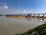 "+
"
"+
" "+
"
"+
" "+
"
"+
" "+
"
"+
" "+
"",
headingbengali : "উত্তরাখণ্ড",
headingenglish : "UTTARAKHAND",
};
"+
"",
headingbengali : "উত্তরাখণ্ড",
headingenglish : "UTTARAKHAND",
};