মুখবন্ধঃ-ভোরের আলোয় আলোকিত পাহাড়ের দেশ নামে পরিচিত অরুণাচল প্রদেশ হলো, ভারতের সবচেয়ে প্রত্যন্ত রাজ্য, এবং উদীয়মান সূর্যকে স্বাগত জানানোর প্রথম ভারতীয় ভূমি। এটা ভারতীয় ইউনিয়নের ২৪তম রাজ্য, যা পশ্চিমে ভুটান, পূর্বে মায়ানমার, উত্তর ও উত্তর-পূর্বে তিব্বত এবং দক্ষিণে আসামের সমভূমি দ্বারা বেষ্টিত। এই রাজ্য বিশ্বের সবচেয়ে জাঁকজমকপূর্ণ, বৈচিত্র্যময়, এবং বহুভাষিক উপজাতি অঞ্চলগুলোর মধ্যে একটা হিসেবে স্বীকৃত। আয়তন অনুসারে অরুণাচল উত্তর-পূর্ব অঞ্চলের বৃহত্তম রাজ্য। ১৮৭৩ সালে ব্রিটিশরা যখন অবাধ চলাচল বন্ধ করে দেয়, তখন থেকে সমগ্র অঞ্চলটা বিচ্ছিন্ন হয়ে যায়। ১৯৪৭ সালের পর, অরুণাচল প্রদেশ উত্তর-পূর্ব সীমান্ত সংস্থার বা নেফার অংশে পরিণত হয়। ১৯৬২ সালে চীনা আক্রমণের ফলে এর কৌশলগত তাৎপর্য প্রমাণিত হয়। পরবর্তীকালে ভারত সরকার আসামের আশেপাশের সমস্ত অঞ্চলকে রাজ্যের মর্যাদা প্রদান করে, নেফা সংস্থা ভেঙে দেয়। কালিকা পুরাণের মতো সাহিত্যে, এবং মহাভারত ও রামায়ণের মহাকাব্যগুলোতে, অরুণাচল প্রদেশের উল্লেখ পাওয়া যায়। বিশ্বাস করা হয় যে ঋষি ব্যাস এখানে ধ্যান করেছিলেন। রোয়িংয়ের উত্তরে, পাহাড়ের দুটো গ্রামের চারপাশে ছড়িয়ে ছিটিয়ে থাকা ইটের কাঠামোর ধ্বংসাবশেষ, ভগবান শ্রীকৃষ্ণের স্ত্রী রুক্মিণীর প্রাসাদ ছিল বলে স্থানীয় মানুষজন বিশ্বাস করে। ষষ্ঠ দলাইলামাও অরুণাচল প্রদেশের মাটিতেই জন্মগ্রহণ করেছিলেন।বিস্তৃত ভৌগোলিক বৈচিত্র্য এবং গ্রীষ্মমন্ডলীয় থেকে নাতিশীতোষ্ণ এবং অ্যালপাইন অঞ্চল পর্যন্ত বিভিন্ন জলবায়ু, জীববৈচিত্র্যের নানাত্ব, সাথে বিভিন্ন ধরণের বন্যপ্রাণী, উদ্ভিদ, এবং প্রাণীজগতের সমাহার, এই ভূমি এখন বিশ্ব জীববৈচিত্র্যের ঐতিহ্যবাহী স্থান হিসেবে, স্বীকৃতি পেতে শুরু করেছে। অরুণাচল প্রদেশ ঘন চিরসবুজ বনে সমৃদ্ধ। অসংখ্য স্রোতস্বিনী, জলধারা, গিরিখাত, শত শত প্রজাতির উদ্ভিদ, এবং প্রাণীজগৎ, রাজ্যক্ষেত্রের ষাট শতাংশেরও বেশি এলাকা জুড়ে বর্তমান। এখানকার নদীগুলো মাছ ধরা, নৌকো চালানো, এবং ভেলা চালানোর জন্য আদর্শ। এই শান্ত পরিবেশের ভূখণ্ড, ট্রেকিং, হাইকিং, বা শুধুমাত্র অলসভাবে সময় কাটানোর জন্যে যথার্থ। এখানে পাঁচশোটারও বেশি প্রজাতির পাখির দেখা মেলে, যার মধ্যে অনেকগুলো অত্যন্ত বিপন্ন, এবং শুধুমাত্র এই রাজ্যেই সীমাবদ্ধ। যেমন সাদা ডানাযুক্ত হাঁস, স্ক্লেটার, বাঙ্গাল ফ্লোরিক্যান ইত্যাদি। বিশাল আকারের গাছ, বেত, ও বাঁশের প্রাচুর্য, অরুণাচলকে চিরসবুজ করে তুলেছে। ভারতে প্রায় এক হাজার প্রজাতির অর্কিডের মধ্যে, পাঁচশোরও বেশি শুধুমাত্র অরুণাচল প্রদেশেই পাওয়া যায়। কিছু অর্কিড বিরল এবং বিপন্ন হিসেবে লিপিবদ্ধ। বন্যপ্রাণীও সমানভাবে সমৃদ্ধ এবং বৈচিত্র্যময়, যার মধ্যে রয়েছে হাতি, বাঘ, চিতাবাঘ, জঙ্গল বেড়াল, সাদা গিবন, লাল পাণ্ডা, কস্তূরী মৃগ এবং অন্যান্য বন্য, এবং আধা-পোষা প্রাণীকুল। রাজ্যের বেশিরভাগ অঞ্চলই পাহাড়ি, এবং উত্তর সীমানা বরাবর রয়েছে হিমালয় পর্বতমালা, যা উত্তর থেকে দক্ষিণে বিস্তৃত। এই অবস্থান রাজ্যকে পাঁচটা নদী উপত্যকায় বিভক্ত করে - কামেং, সুবানসিরি, সিয়াং, লোহিত এবং তিরাপ। এগুলো সবই হিমালয় থেকে আসা তুষারযুক্ত অগণিত নদী, স্রোতস্বিনী, ও ঝর্ণার মিলন। এই নদীগুলোর মধ্যে সবচেয়ে বড় হল সিয়াং, যা তিব্বতে সাংপো নামে পরিচিত, ও দিবাং-এর পরে ব্রহ্মপুত্রে পরিণত হয়।প্রকৃতি মানুষকে সৌন্দর্যের গভীর অনুভূতি দিয়েছে, যা তাদের মনোরম গান, নৃত্য এবং কারুশিল্পে প্রকাশ পায়। এই রাজ্যে ২৬টা প্রধান উপজাতি এবং বেশ কয়েকটা গোষ্টী উপজাতি বাস করে। এই সম্প্রদায়গুলোর বেশিরভাগই নীতিগতভাবে এক রকম, কারণ তারা একটা আদি সাধারণ সম্প্রদায় থেকে এসেছে। তবে ভৌগোলিক বিচ্ছিন্নতা তাদের মধ্যে ভাষা, পোশাক এবং রীতিনীতির কিছু স্বতন্ত্র বৈশিষ্ট্য নিয়ে এসেছে।প্রথম গোষ্ঠী হলো তাওয়াং এবং পশ্চিম কামেং জেলার মনপা এবং শেরদুকপেন। তারা মহাযান বৌদ্ধধর্মের লামা ঐতিহ্য অনুসরণ করে। সাংস্কৃতিকভাবে তাদের সাথে মেম্বা এবং খাম্বা উপজাতির মিল আছে, যারা উত্তর সীমান্ত বরাবর উঁচু পাহাড়ে বাস করে। রাজ্যের পূর্ব অংশে বসবাসকারী খাম্পটিস এবং সিংফোরা হলো হীনায়ণ বৌদ্ধধর্মের অনুগামী।দ্বিতীয় গোষ্ঠী হলো আদি, আকাশ, আপাতানি, বাংনি, নিশিং, মিশমি, মিজি, তাংসা ইত্যাদি, যারা সূর্য ও চাঁদের উপাসনা করে। এই উপজাতিগুলোর বেশিরভাগই, আদি পূর্বপুরুষের নিয়ম নীতি অনুসরণ করে। তাদের ধর্মীয় আচার-অনুষ্ঠান মূলত কৃষিচক্রের পর্যায়ের সাথে মিলে যায়। তৃতীয় গোষ্ঠী হলো নোক্টেস এবং ওয়াঞ্চোস, যারা তিরাপ জেলার নাগাল্যান্ড সংলগ্ন। তারা কঠোর পরিশ্রমী মানুষ, ও সুসংগঠিত গ্রাম সমাজের জন্যে পরিচিত, যেখানে বংশগত গ্রামপ্রধান এখনও গুরুত্বপূর্ণ ভূমিকা পালন করে। নোক্টেসরা খানিকটা বৈষ্ণব ধর্মের প্রথা অনুশীলন করে। অরুণাচলের সমগ্র জনগোষ্ঠীকে তাদের সামাজিক-রাজনৈতিক-ধর্মীয় সম্পর্কের ভিত্তিতে তিনটে সাংস্কৃতিক গোষ্ঠীতে ভাগ করা হয়। এখানে তিন ধরণের ধর্ম পালন করা হয়। কামেং এবং তাওয়াং জেলার মনপা এবং শেরদুকপেনরা, যাদের সাথে তিব্বতিদের সম্পর্ক ছিল, তারা বৌদ্ধ লামা ধর্ম গ্রহণ করেছিল। অন্যদিকে লোহিত জেলার খাম্প্তিরা মহাযান বৌদ্ধধর্ম গ্রহণ করেছিল। দ্বিতীয় দল, তিরাপ জেলার নক্টেস এবং ওয়াঞ্চোরা, যাদের দক্ষিণে আসামীদের সাথে দীর্ঘ সম্পর্ক ছিল, তারা হিন্দু ধর্মে রূপান্তরিত হয়েছিল। তারা একসময় মানুষের মাথা শিকার অনুশীলনের সাথে যুক্ত ছিল। তৃতীয় দলে আদি, আকাশ, আপাতানিস, নিশিংস ইত্যাদি রয়েছে, যারা মোট জনসংখ্যার সংখ্যাগরিষ্ঠ অংশ। এদের নিয়ম নীতি, প্রাচীন বিশ্বাস এবং সহজাত ধারণায় নিহিত। এরা প্রকৃতি এবং দোনি-পোলো অর্থাৎ সূর্য ও চাঁদের উপাসনা করে। বর্তমানে বিভিন্ন কারণে ব্যাপক সংখ্যার উপজাতি খ্রিস্টানধর্ম গ্রহণ করছে।অশান্ত সীমান্ত, ভারত ও চীনের মধ্যে কেন সংঘর্ষঃ-চীন কর্তৃক প্রকাশিত একটা নতুন স্ট্যান্ডার্ড জাতীয় মানচিত্রে অরুণাচল প্রদেশ, এবং আকসাই চিন মালভূমি সহ ভারতীয় ভূখণ্ডের কিছু অংশকে, চীনা ভূখণ্ড বলে দাবি করা হয়েছে। কিন্তু ১৯৫০ সালের শেষের দিকে ভারত কখনও চীনের সাথে সীমান্ত ভাগ করেনি। সীমান্ত বিরোধ কোথা থেকে শুরু হয়েছিল ? এর ইতিহাস এখানে। আন্তর্জাতিক সীমান্ত নিয়ে বিরোধের কারণে, ভারত ও চীনের মধ্যে সম্পর্ক হিমশীতল ছিল। কিন্তু মজার বিষয় হল, ১৯৫০ সালের আগে উভয় দেশ, কখনও সীমান্ত ভাগ করেনি। সমস্যা শুরু হয়েছিল সম্প্রসারণবাদী চীনের তিব্বত দখলের মাধ্যমে। উত্তেজনার মূল কারণ ভারত ও চীনের মধ্যে অনির্ধারিত বা ভুলভাবে সংজ্ঞায়িত ৩,৪৪০ কিলোমিটার দীর্ঘ সীমান্ত। এই সীমান্ত তিনটে সেক্টরে বিভক্ত: পশ্চিম, মধ্য এবং পূর্ব। হিমাচল প্রদেশ, লাদাখ, সিকিম এবং অরুণাচল প্রদেশ হল সেই ভারতীয় রাজ্যগুলো, যাদের সাথে এখন চীনের সীমান্ত রয়েছে। ভারত ও চীনের মধ্যে ঐতিহাসিক সম্পর্ক প্রায় দু সহস্রাব্দেরও বেশি সময় ধরে চলে আসছে। সিল্ক রুট তার প্রমাণ। দু দেশের সম্পর্কের নিরিখে, সীমান্ত নিয়ে মতবিরোধের ইতিহাস বেশ সাম্প্রতিক, যা সর্বোচ্চ উনবিংশ শতাব্দীর। ভারত ও চীনের মধ্যে সীমান্তের প্রথম উল্লেখ পাওয়া যায় ১৮৬৫ সালে, যখন সার্ভে অফ ইন্ডিয়ার একজন সরকারি কর্মচারী ডব্লিউ এইচ জনসন, জনসন লাইনের প্রস্তাব করেছিলেন, যেখানে আকসাই চিনকে, জম্মু ও কাশ্মীরের মধ্যে অন্তর্ভুক্ত করা হয়েছিল। তৎকালীন কুইং রাজবংশের অধীনে থাকা চীন তা গ্রহণ করেনি, ও দাবি করে যে এই অঞ্চলটা জিনজিয়াংয়ের একটা অংশ। আঞ্চলিক বিরোধ নিষ্পত্তি করতে, ভারত এবং তিব্বতের মধ্যে একটা স্পষ্ট সীমানারেখা প্রতিষ্ঠা করতে, ১৯১৩-১৪ সালে, ব্রিটিশ শাসনাধীন ভারত, তিব্বত, এবং চীনের প্রতিনিধিরা সিমলায় এক আলোচনায় বসেছিলেন। মনে রাখা যেতে পারে, ১৯১১ সালের বিদ্রোহের পর, চীনে সাম্রাজ্যবাদী শাসনের অবসান ঘটে। আলোচনার টেবিলে, নবপ্রতিষ্ঠিত চীন প্রজাতন্ত্র, তাদের দাবিগুলো স্থির করার মতো অবস্থায় ছিল না। তাছাড়া, ১৯১১ সালের বিপ্লবের আগে পর্যন্ত, তিব্বত চীনের আধিপত্য বা সীমিত স্বশাসন স্বীকার করেছিল। কিন্তু বিপ্লবের পর, তিব্বত কার্যত স্বাধীনতা ঘোষণা করেছিল, যা চীনারা মেনে নেয়নি। সিমলা বৈঠকে, ব্রিটিশ প্রতিনিধি স্যার হেনরি ম্যাকমোহন, ভুটানের পূর্ব সীমান্ত থেকে বার্মা বা বর্তমান মায়ানমারের উত্তর প্রান্ত পর্যন্ত, ৮৯০ কিলোমিটার দীর্ঘ একটা রেখা প্রস্তাব করেছিলেন। সীমানাটা ম্যাকমোহন লাইন নামে পরিচিতি পায়। এই সীমানা নির্ধারণে, ব্রিটিশদের সীমান্ত বিরোধ নিষ্পত্তির চেয়েও, তাদের নিজস্ব স্বার্থ ছিল অনেক বেশি। ব্রিটিশরা এমন একটা সীমানা নির্ধারণ করতে চেয়েছিল, যা এই অঞ্চলে তাদের স্বার্থ সুরক্ষিত করবে, এবং তিব্বতে রাশিয়ার সম্ভাব্য প্রভাব প্রতিরোধ করবে। ১৯১৪ সালের ২৭শে এপ্রিল, তিনপক্ষের আলোচনার ভিত্তিতে, একটা খসড়া চুক্তি তৈরি করা হয়েছিল। তবে, চূড়ান্ত খসড়াতে কেবল স্যার হেনরি ম্যাকমাহন, এবং দালাই লামা-নিযুক্ত তিব্বতের প্রতিনিধি, পালজোর দর্জে শাত্র স্বাক্ষর করেছিলেন। চীনা প্রতিনিধি চেন-ই-ফেন নতুন রেখার বিরোধিতা করে বলেছিলেন যে, তিব্বত একটা স্বাধীন দেশ নয়, এবং সীমানা নির্ধারণের ক্ষমতা তাদের নেই। চেন, চূড়ান্ত পর্যায়ে সম্মেলন থেকে বেরিয়ে যান। ম্যাকমাহন লাইন আঁকা সত্ত্বেও, ব্রিটিশরা তাওয়াংকে আলাদা করে রাখে, ও তা তিব্বতের রাজধানী লাসার নিয়ন্ত্রণে রেখে দেয়। ১৯৪৯ সালে মাও সেতুং কর্তৃক গণপ্রজাতন্ত্রী চীন প্রতিষ্ঠিত হয়, এবং ভারতের স্বাধীনতার পরপরই, ১৯৫০ সালে পিপলস লিবারেশন আর্মি তিব্বত অধিগ্রহণ করে, পরিস্থিতিকে আরও জটিল করে তোলে। চীন ম্যাকমোহন লাইন মেনে না নিলেও, তারা একটা নতুন সীমান্ত চুক্তির প্রস্তাব দেয়। ১৯৫৯ সালে প্রধানমন্ত্রী জওহরলাল নেহেরুর কাছে লেখা এক নোটে, চীনা প্রধানমন্ত্রী চৌ এন লাই প্রথমে প্রকৃত নিয়ন্ত্রণ রেখা বা এল এ সি শব্দটা উল্লেখ করেন, ও তাকে প্রত্যেক পক্ষের প্রকৃত নিয়ন্ত্রণ প্রয়োগের রেখা হিসেবে সংজ্ঞায়িত করেন। তবে, নেহেরু এই ধারণাকে অসঙ্গত বলে প্রত্যাখ্যান করেন। চীন, অরুণাচল প্রদেশের কিছু অংশকে চীনা ভূখণ্ড হিসেবে দেখিয়ে, একটা সরকারী মানচিত্র প্রকাশ করলে পরিস্থিতি আরও জটিল হয়। এই পদক্ষেপের ফলে ১৯৬২ সালে চীন-ভারত যুদ্ধ শুরু হয়। ১৯৬২ সালের আগস্ট মাসে, চীনা সৈন্যরা লাদাখ এবং নর্থ-ইস্ট ফ্রন্টিয়ার এজেন্সি, যা বর্তমানে অরুণাচল প্রদেশ নামে পরিচিত, তার চৌকিগুলো ঘিরে ফেলে। ২০ নভেম্বর চীন একতরফা ভাবে যুদ্ধবিরতি ঘোষণা করে, এবং এর পরপরই আকসাই চিনের প্রায় ১৪,৭০০ বর্গমাইল অঞ্চলের নিয়ন্ত্রণ ধরে রাখে। ১৯৬২ সালের যুদ্ধের পর, এল এ সি, ভারত ও চীনের মধ্যে একটা অনানুষ্ঠানিক যুদ্ধবিরতি রেখায় পরিণত হয়। তবে, এল এ সি একটা অস্পষ্ট সীমানা, যা উভয় দেশই তাদের নিজস্ব শর্তে রেখাটা ব্যাখ্যা করে, এবং প্রায় সবসময়ই একে অপরের সাথে দ্বিমত পোষণ করে। ভারত ম্যাকমোহন রেখাকে এল এ সির নিজস্ব সংস্করণ হিসাবে বিবেচনা করে, অন্যদিকে চীন আকসাই চিন এবং অরুণাচল প্রদেশ, যাকে তারা দক্ষিণ তিব্বত বলে উল্লেখ করে, তাদের অঞ্চল বলে দাবি করে। সাম্প্রতিক বছরগুলোতে, চীন কর্তৃক নতুন মানচিত্র প্রস্তাব করা হয়েছে, যা সীমান্ত বিরোধকে পুনরুজ্জীবিত করেছে। ২০২৪ সালের আগস্ট মাসে, চীনের প্রাকৃতিক সম্পদ মন্ত্রণালয় কর্তৃক প্রকাশিত একটা নতুন জাতীয় মানচিত্রতে, অরুণাচল প্রদেশ, এবং আকসাই চীন মালভূমি সহ, ভারতীয় ভূখণ্ডের বেশ কিছু অংশ, তাদের ভূখণ্ড বলে দাবি করেছে। কূটনৈতিক চ্যানেলের মাধ্যমে ভারত তার তীব্র প্রতিবাদ জানিয়েছে। তবে চলমান বিরোধ এবং উত্তেজনা সত্ত্বেও, চীন এবং ভারত উভয় পক্ষই, সীমান্ত ইস্যুতে বিশেষ প্রতিনিধি ব্যবস্থার মাধ্যমে, সংলাপ এবং যোগাযোগ চালিয়ে যেতে সম্মত হয়েছে। "+
"Read More..."+
"
"+
"শব্দঃ প্রতিবেদনঃ "+
""+
"ভিডিও "+
"স্লাইডশোর জন্যে নীচের ছবিতে ক্লিক করুন "+
"
West Arunachal Intro:-Arunachal Pradesh, known as the land of the dawn-lit Mountains, is the most remote state of India, and the first Indian land to welcome the rising sun. It is the 24th state of the Indian Union, is bordered by Bhutan to the west, Myanmar to the east, Tibet to the north and northeast, and the plains of Assam to the south. Arunachal Pradesh is recognized as one of the most magnificent, diverse, and multilingual tribal regions in the world. Arunachal is the largest state in the North-Eastern region by area. When the British stopped free movement in 1873, the entire region became isolated. After 1947, Arunachal Pradesh became part of the North-East Frontier Agency or NEFA. Its strategic significance was proven by the Chinese invasion in 1962. Later, the Indian government granted statehood to all the areas surrounding Assam, disbanding NEFA. Arunachal Pradesh is mentioned in literature such as the Kalika Purana, and in the epics of the Mahabharata and the Ramayana. It is believed that sage Vyasa meditated here. North of Roing, the ruins of brick structures scattered around two hill villages, are believed by locals to be the palace of Lord Krishna's wife Rukmini. The 6th Dalai Lama was also born in Arunachal Pradesh.With its vast geographical diversity and diverse climates ranging from tropical to temperate and alpine, its biodiversity, along with its diverse range of wildlife, flora and fauna, this land is now beginning to be recognized as a World Heritage Site. Arunachal Pradesh is rich in dense evergreen forests. Numerous streams, rivers, gorges, hundreds of species of flora and fauna are present in more than sixty percent of the state's area. The rivers here are ideal for fishing, boating, and rafting. This serene landscape is perfect for trekking, hiking, or just lazing around. More than five hundred species of birds are found here, many of which are critically endangered and restricted to this state only. Such as the white-winged duck, the slatter, the Bengal florican, etc. The abundance of giant trees, canes, and bamboos make Arunachal evergreen. Of the nearly one thousand species of orchids in India, more than five hundred are found only in Arunachal Pradesh. Some orchids are listed as rare and endangered. The wildlife is equally rich and diverse, including elephants, tigers, leopards, jungle cats, white gibbons, red pandas, musk deer, and other wild and semi-domestic animals. Most of the state is hilly, and along the northern border are the Himalayan ranges, which run from north to south. This position divides the state into five river valleys - the Kameng, Subansiri, Siang, Lohit and Tirap. All these are the confluence of countless rivers and streams and springs flowing from the Himalayas. The largest of these rivers is the Siang, known in Tibet as the Tsangpo, and after the Dibang it becomes the Brahmaputra.Nature has endowed the people with a deep sense of beauty, which is expressed in their beautiful songs, dances and crafts. The state is inhabited by 26 major tribes and several sub tribes. Most of these communities are essentially the same, as they have descended from a common ancestor. However, geographical isolation has brought with them some distinctive features in language, dress and customs.The first group is the Monpa and Sherdukpen of Tawang and West Kameng districts. They follow the Lama tradition of Mahayana Buddhism. Culturally, they are related to the Memba and Khamba tribes, who live in the high hills along the northern border. The Khampatis and Singphoras, who live in the eastern part of the state, are the followers of Hinayana Buddhism. The second group is the Adi, Akash, Apatani, Bangni, Nising, Mishmi, Miji, Tangsa, etc., who worship the sun and moon. Most of these tribes follow the rules and regulations of their ancestors. Their religious rituals mainly correspond to the stages of the agricultural cycle. The third group is the Noctes and Wanchos, who lives in the border Nagaland in Tirap district. They are known for their hardworking people and well-organized village society, where hereditary village headmen still play an important role. The Noctes practice some Vaishnavism. The entire population of Arunachal Pradesh is divided into three cultural groups based on their socio-political-religious affiliations. Three types of religions are practiced here. The Monpas and Sherdukpenas of Kameng and Tawang districts, with whom the Tibetans had contact, adopted the Buddhist Lamaism. On the other hand, the Khampatis of Lohit district adopted Mahayana Buddhism. The second group, the Noctes and Wanchoras of Tirap district, who had long contact with the Assamese in the south, converted to Hinduism. They were associated with the practice of head-hunting. The third group consists of the Adis, Akash, Apatanis, Nishings, etc., who form the majority of the total population. Their rules are rooted in ancient beliefs and instinctive ideas. They worship nature and the Doni-Polo i.e. the sun and the moon. Currently, a large number of tribes are converting to Christianity for various reasons.Restive border, why conflict between India and China:-A new standard national map released by China claims, parts of Indian territory, including Arunachal Pradesh, and the Aksai Chin Plateau, as Chinese territory. But India never shared a border with China until the late 1950s. Where did the border dispute start? Here is its history. Due to the dispute over the international border, relations between India and China were chilling. But interestingly, before 1950, the two countries never shared a border. The problem started with the occupation of Tibet by expansionist China. The main reason for the tension is the undermarketed or ill-defined 3,440 Km long border between India and China. This border is divided into three sectors: western, central and eastern. Himachal Pradesh, Ladakh, Sikkim and Arunachal Pradesh are the Indian states, that now share a border with China. The historical relationship between India and China has been going on for more than two millennia. The Silk Route is proof of that. In terms of the relationship between the two countries, the history of border disputes is quite recent, dating back to the 19th century at the latest. The first mention of a border between India and China can be found in 1865, when W. H. Johnson, a civil servant of the Survey of India, proposed the Johnson Line, which included Aksai Chin in Jammu and Kashmir. China, then under the Qing Dynasty, did not accept it, claiming that the region was part of Xinjiang. To resolve the territorial dispute, and to establish a clear boundary between India and Tibet, in 1913–14, representatives of British-ruled India, Tibet, and China met in Simla. It may be recalled that after the 1911 revolution, imperial rule in China came to an end. At the negotiating table, the newly established Republic of China was in no position to settle its claims. Moreover, until the 1911 revolution, Tibet had accepted Chinese suzerainty or limited autonomy. But after the revolution, Tibet effectively declared independence, which the Chinese did not accept. At the Simla Conference, the British representative, Sir Henry McMahon, proposed a line of 890 km long, from the eastern border of Bhutan, to the northern tip of Burma, or present-day Myanmar. The line came to be known as the McMahon Line. The British had more than just a border dispute to settle in this demarcation line. The British wanted to establish a boundary that would protect their interests in the region, and prevent possible Russian influence in Tibet. On 27 April 1914, a draft agreement was drawn up, based on tripartite negotiations. However, the final draft was signed only by Sir Henry McMahon and the Dalai Lama-appointed Tibetan representative, Paljo Dorje Shastra. The Chinese representative, Chen Yi-fen, opposed the new line, stating that Tibet was not an independent country, and that they had no authority to determine its borders. Chen walked out of the conference at the last moment. Despite the McMahon Line, the British kept Tawang separate, and placed it under the control of the Tibetan capital, Lhasa. The People's Republic of China was founded by Mao Tse Tung in 1949, and soon after India's independence, the People's Liberation Army annexed Tibet, further complicating the situation. Although China did not accept the McMahon Line, it proposed a new border agreement. In a note to Prime Minister Jawaharlal Nehru in 1959, Chinese Premier Chou En Lai first mentioned the term Line of Actual Control or LAC, defining it as the line of actual control exercised by each side. However, Nehru rejected the concept as inconsistent. The situation was further complicated when China published an official map showing parts of Arunachal Pradesh as Chinese territory. This move led to the Sino-Indian War in 1962. In August 1962, Chinese troops surrounded posts in Ladakh and the North-East Frontier Agency, now known as Arunachal Pradesh. On 20 November, China unilaterally declared a ceasefire, and soon thereafter regained control of about 14,700 square miles of Aksai Chin. After the 1962 war, the LAC became an unofficial ceasefire line between India and China. However, the LAC is an ambiguous border, which both countries interpret on their own terms, and almost always disagree with each other. India considers the McMahon Line to be its own version of the LAC, while China claims Aksai Chin and Arunachal Pradesh, which it refers to as southern Tibet, as its territory. In recent years, new maps have been proposed by China, which have revived the border dispute. In August 2024, a new national map released by China's Ministry of Natural Resources claimed parts of Indian territory, including Arunachal Pradesh and the Aksai Chin Plateau, as its territory. India has strongly protested through diplomatic channels. However, despite the ongoing dispute and tension, both China and India have agreed to continue dialogue and communication on border issues through the Special Representative Mechanism. "+
"Read More..."+
"
"+
"Sound Stream: "+
""+
"Video "+
"Click any Picture for Slide Show "+
"
"+
"Go To Page Menu",
photointro :
""+
""+
""+
""+
""+
""+
""+
""+
""+
"",
bhalukpongbengali : "ভালুকপংঃ-প্রকৃতি, মানুষের সাথে বিভিন্নভাবে যোগাযোগ করে, আর তা নির্ভর করে নিজের আবেগ, আকর্ষণ ও পছন্দের ওপর। কেউ প্রকৃতির নির্মলতায় সম্পূর্ণ শান্তি বোধ করে, আবার কেউ দুঃসাহসিক চ্যালেঞ্জে উত্তেজিত হয়। প্রকৃতির শান্ত সৌন্দর্য, ফুলের সুবাস, তটিনীর কলকল শব্দ, বাতাসের হালকা ফিসফিসানি, আর স্রোতস্বিনীর তরঙ্গের নিনাদে, মানুষ মুগ্ধ হয়ে যায়। আর এগুলো যাদের ভালো লাগে, অরুণাচল প্রদেশের ভালুকপং তাদের জন্যে সঠিক ছুটির গন্তব্যস্থল। প্রকৃতির বরদানে ভালুকপং নিজে নিজেই সেজে বসে আছে। অরুণাচল প্রদেশের পশ্চিম কামেং জেলার, হিমালয়ের দক্ষিণ প্রান্তে অবস্থিত মনোমুগ্ধকর ছোট শহরটা, পাখুই বন্যপ্রাণী অভয়ারণ্যের ঘন বনের সীমানায় এবং কামেং নদীর তীরে সমুদ্রপৃষ্ঠ থেকে ২১৩ মিটার ওপরে অবস্থিত।রঙ্গপাড়া উত্তর রেল স্টেশন থেকে ভালুকপঙের দূরত্ব মাত্র ৪৭ কিলোমিটার। রঙ্গপাড়া থেকে এখানে লোকাল ট্রেনও চলে। কামেং নদীর তীরে অবস্থিত ভালুকপং সার্কেলের সদর দপ্তর টিপি গ্রাম, এখান থেকে ৫ কিলোমিটার দূরে অবস্থিত। ভ্রমণার্থীদের জন্যে আসাম-অরুণাচল সীমান্তের ভালুকপঙে প্রথম চেকপোস্ট রয়েছে। এখানেই ইনার লাইন পারমিট পরীক্ষা করা হয়। ভালুকপং তাওয়াং, দিরাং এবং বমডিলার মতো জনপ্রিয় গন্তব্যস্থলের প্রবেশদ্বার হলেও, এর নিজস্ব বিশেষ আকর্ষণও রয়েছে। এটা একটা জনপ্রিয় পিকনিক স্পট, এবং প্রতি বছর আসাম ও অরুণাচল প্রদেশের কাছাকাছি অঞ্চল থেকে, মানুষ এখানে পিকনিক করতে ভিড় জমায়। মাছ ধরা এবং রিভার রাফ্টিং হলো ভালুকপংয়ের প্রধান পর্যটন কার্যকলাপ। ভালুকপঙের অন্যান্য পর্যটন আকর্ষণের মধ্যে রয়েছে পাখুই বন্যপ্রাণী অভয়ারণ্য এবং টিপি অর্কিড সেন্টার, যেখানে ৮০টা ভিন্ন প্রজাতির ও ২,৬০০টারও বেশি চাষ করা অর্কিড রয়েছে। ভালুকপং দুর্গটা দশম শতাব্দীর দিকে নির্মিত হয়েছিল। যদিও বর্তমানে এটা ধ্বংসস্তূপে পরিণত হয়েছে, ও প্রায় পুরোটাই বেদখল হয়ে গেছে, তবু এই স্থান ভালুকপঙের ঐতিহ্য এবং ঐতিহাসিক গৌরবের প্রতীক। রাজা ভালুকা ভারালি নদীর তীরে এটা নির্মাণ করেছিলেন। দুর্গ ছাড়াও, রাজা ভালুকার নাতি এবং মহাভারতের বীরত্বপূর্ণ চরিত্র বানারের বাসভবনের, কিছু অবশিষ্টাংশ এখানে সংরক্ষিত আছে। ভারালি নদীর তীরে অবস্থিত পাহাড়ের ঢালে, দুর্গের ধ্বংসাবশেষে কয়েকটা পাথরের খণ্ড এবং ইট রয়েছে। এখানে একটা পুকুর এবং একটা ইটের কুয়ো রয়েছে। জানুয়ারিতে ভালুকপঙের কাছে থ্রিজিনোতে, আকা উপজাতির বার্ষিক উৎসব, নেইথিডো পালিত হয়। ভালুকপঙে বসবাসকারী মানুষজন আকা উপজাতির। "+
"Read More..."+
"
"+
"শব্দঃ প্রতিবেদনঃ "+
""+
"ভিডিও "+
"স্লাইডশোর জন্যে নীচের ছবিতে ক্লিক করুন "+
"
"+
"পেজ মেনুতে যান",
bhalukpongenglish : "Bhalukpong:-Nature communicates with individuals in different ways, depending on one's emotions, attractions and preferences. Some feel completely at peace in the serenity of nature, while others are excited by adventurous challenges. People are mesmerized by the serene beauty of nature, the fragrance of flowers, the rustling of the trees, the gentle whisper of the wind, and the gurgling of the streams. And for those who like these, Bhalukpong in Arunachal Pradesh is the perfect holiday destination. Bhalukpong is adorned with nature's abundance. Located in the southern fringe of the Himalayas in West Kameng district of Arunachal Pradesh, this charming small town is located on the banks of the Kameng River, and is nestled outside the dense forests of the Pakhui Wildlife Sanctuary. The town is situated at an altitude of 213 meters above sea level. The distance from Rangpara North Railway Station to Bhalukpong is only 47 kilometres. Local trains also ply from Rangpara. Tipi village, the headquarters of Bhalukpong Circle, is located on the banks of the Kameng River, 5 km from here. For tourists, the first checkpoint is in the border of Assam and Arunachal at Bhalukpong. This is where the Inner Line Permit is checked. Although Bhalukpong is the gateway to popular destinations like Tawang, Dirang, and Bomdila, it also has its own special charm. It is a popular picnic spot, and people from nearby areas of Assam and Arunachal Pradesh, flock here every year for picnics. Fishing and river rafting are the major tourist activities in Bhalukpong. Other tourist attractions in Bhalukpong include the Pakhui Wildlife Sanctuary and the Tipi Orchid Centre, which houses 80 different species, and over 2,600 cultivated orchids. The Bhalukpong Fort was built around the 10th century. Although it is now in ruins, and almost entire land is unauthorisedly occupied, yet it is a symbol of Bhalukpong's heritage and historical glory. It was built by King Bhaluka on the banks of the Varali River. Apart from the fort, some remains of Banar, the grandson of King Bhaluka, and a heroic character in the Mahabharata epic, are preserved here. The ruins of the fort on the hillside, located on the banks of the Varali River, consist of a few stone blocks and bricks. Here there is a pond and a brick well. In January, at Thrizino near Bhalukpong, the annual festival of the Aka tribe, Neithido, is celebrated. The people living in Bhalukpong are of the Aka tribe. "+
"Read More..."+
"
"+
"Sound Stream: "+
""+
"Video "+
"Click any Picture for Slide Show "+
"
"+
"Go To Page Menu",
photobhalukpong :
""+
""+
""+
""+
""+
""+
""+
""+
""+
"",
bomdilabengali : "বমডিলাঃ-ভালুকপং থেকে ১০৯ কিমি দূরে অবস্থিত বমডিলা, অরুণাচল প্রদেশের পশ্চিম কামেং জেলার সদর দপ্তর। সমুদ্রপৃষ্ঠ থেকে প্রায় ২,২১৭ মিটার উচ্চতায় অবস্থিত বমডিলা, তার বৌদ্ধ মঠ এবং আপেল বাগানের জন্যে বিখ্যাত। এখানে কারুশিল্প কেন্দ্র, মঠ, নৃতাত্ত্বিক জাদুঘর, এবং এম্পোরিয়াম, ইত্যাদি দর্শনীয় স্থান রয়েছে। বমডিলা থেকে বিভিন্ন তুষারাবৃত পর্বতশৃঙ্গও দেখা যায়, যার মধ্যে রয়েছে রাজ্যের সর্বোচ্চ শৃঙ্গ কাংটো এবং গোরিচেন। তুষারাবৃত হিমালয় পর্বতমালা, সবুজের সমাহার, সমৃদ্ধ সংস্কৃতি এবং জীবনযাত্রা, এবং বিভিন্ন কারুশিল্পের কারণে, বমডিলা অরুণাচল প্রদেশের শীর্ষস্থানীয় পর্যটন কেন্দ্রগুলোর মধ্যে একটা।বমডিলা মঠ ১৯৬৫ সালে প্রতিষ্ঠিত হয়েছিল, এবং এটা বৌদ্ধধর্মের আধ্যাত্মিক মর্মকে প্রতিনিধিত্ব করে। মহাযান বৌদ্ধধর্মের অনুসারীরা এই স্থানকে পবিত্র বলে মনে করে। মঠটা দক্ষিণ তিব্বতের সোনা গোন্টসে মঠের মতো দেখতে। মঠে অবস্থিত বুদ্ধের মন্দির, প্রচুর সংখ্যক তীর্থযাত্রীদের আকর্ষণ করে। পাহাড়ের ওপর অবস্থিত, উচ্চ গোম্পাও প্রচুর সংখ্যক পর্যটককে আকর্ষণ করে, কারণ এটাও বৌদ্ধধর্মের সাথে সম্পর্কিত ঐতিহ্যের প্রতীক। এটাকে জেন্টসে গাদেন রাবগিয়েল লিং বা জি আর এল মঠও বলা হয়। উচ্চ গোম্পায় ভিক্ষু শিশুদের শিক্ষিত করার জন্যে একটা স্কুল আছে। এখানে একটা বুদ্ধ মন্দির এবং একটা প্রার্থনা কক্ষ রয়েছে। প্রার্থনা কক্ষের দেয়ালে ঝোলানো বিভিন্ন প্রতিবেদন, বৌদ্ধধর্মের সমৃদ্ধ সংস্কৃতির পরিচয়। নিম্ন গোম্পা বমডিলার কেন্দ্রে অবস্থিত। এখানে তিব্বতি স্থাপত্যের প্রভাব বিশেষভাবে লক্ষণীয়।। এখানে একটা বিশাল আকারের প্রার্থনা কক্ষও রয়েছে। বৌদ্ধ দর্শনের অনুসারীরা এই স্থান পবিত্র বলে মনে করেন। মধ্য গোম্পা বমডিলার প্রধান বাজারের কাছে অবস্থিত। এই গোম্পা প্রাচীনতম গোম্পাগুলোর মধ্যে একটা। অসুস্থ মানুষজনের কাছে এই গোম্পা খুবই জনপ্রিয়, কারণ গোম্পায় নীল মেডিসিন বুদ্ধের মূর্তি রয়েছে, ও অসুস্থ মানুষজন এখানে প্রার্থনা এবং ধ্যানের মাধ্যমে সুস্থ হন। বমডিলার সংস্কৃতি এবং জীবনযাত্রার সারাংশ অনুভব করতে চাইলে, অবশ্যই যেতে হবে ক্রাফট সেন্টার এবং ইথিনোগ্রাফিক মিউজিয়ামে। হাতে বোনা কার্পেট, ঐতিহ্যবাহী মুখোশ, এবং দেওয়ালে ঝুলোনো জিনিসপত্র, অনন্যভাবে ডিজাইন করা হয়েছে। ড্রাগনের নকশাযুক্ত কার্পেটগুলো এখানে খুবই বিখ্যাত। এটা সেই জায়গা, যেখান থেকে স্মৃতিচিহ্ন হিসেবে, হস্তশিল্পের জিনিসপত্র কেনা যেতে পারে। বমডিলা, আপেল বাগানের জন্যেও বিখ্যাত। বাগানগুলো বিশাল এলাকা জুড়ে ছড়িয়ে আছে। বাগানে, আপেল ভর্তি গাছ, পর্যটকদের কাছে দুর্দান্ত আকর্ষণ। এখানে আপেলের দামও বেশ কম। প্রকৃতিপ্রেমীদের কাছে বমডিলা ভিউ পয়েন্ট খুবই পছন্দের, কারণ এখান থেকে দেখা যায় এখানকার সর্বোচ্চ স্থান নেচিপু পাস সহ আশেপাশের প্রাকৃতিক দৃশ্য। এখান থেকে পশ্চিম কামেং ভ্যালির অনেকটাই দৃশ্যমান হয়। আর আর হিল, বমডিলার সর্বোচ্চ স্থান হিসেবে, আরেকটা গুরুত্বপূর্ণ পর্যটন আকর্ষণ। বমডিলার বিশেষত্ব হলো মনোরম ভূদৃশ্য ছাড়া, তাওয়াং এবং ভুটানের সীমান্তে যাওয়ার রাস্তাও দেখা যায়। এককথায়, এই ছোট শহরটা, বৌদ্ধ গোম্পা এবং কামেং উপত্যকার অপূর্ব দৃশ্যের জন্যে বিখ্যাত। নেচিপু গিরিপথের চূড়ায় মেঘ জড়ো হওয়ার দৃশ্যের সাথে, রাজ্যের সর্বোচ্চ শৃঙ্গ হিসেবে বিবেচনা করা, কাংটো এবং গোরিচেন শৃঙ্গও এখান থেকে দেখা যায়।মধ্যযুগীয় সময়ে, বমডিলা তিব্বত রাজ্যের একটা অংশ ছিল, ও ভুটানের স্থানীয় উপজাতিরা শাসন করতো। আসামের আহোম শাসকরা, প্রতিশোধমূলক অভিযান ছাড়া, কখনও এই স্থানীয় উপজাতিদের ওপর হস্তক্ষেপ করেনি। ১৮৭৩ সালে, ব্রিটিশরা অরুণাচল প্রদেশের এই অঞ্চলে প্রবেশ নিষিদ্ধ করে। ১৯৪৭ সালে ভারত স্বাধীনতা লাভের পর, ভারত ও চীনের মধ্যে এই অঞ্চল নিয়ে ক্রমাগত মতবিরোধ ছিল যা আজও বর্তমান। ১৯৬২ সালে, চীন বমডিলার আশেপাশের অঞ্চল আক্রমণ করে, কিন্তু পরে সেখান থেকে তাদের সৈন্য প্রত্যাহার করে নেয়। এখানকার বাসিন্দারা সাধারণত মনপা এবং শেরদুকপেন উপজাতির অন্তর্ভুক্ত। তবে মানুষজন মনপা, শেরদুকপেন, মিজি, আকা, হিন্দি, অসমিয়া এবং ইংরেজির মতো বিভিন্ন ভাষায় কথা বলে। বসন্তের আগমন ও চান্দ্র পুঞ্জিকার প্রথম দিনে শুরু হয় লোসার উৎসব, যেখানে উৎসবের অবিচ্ছেদ্য অংশ হিসেবে থাকে মনোরম মনপা লোকসঙ্গীত, এবং শ্রুতিমধুর গীতবাদ্য। থাংকা ওয়াল হ্যাঙ্গিং, মুখোশ, এবং ড্রাগন কার্পেট এই স্থানের কিছু বিশেষত্ব। "+
"Read More..."+
"
"+
"শব্দঃ প্রতিবেদনঃ "+
""+
"ভিডিও "+
"স্লাইডশোর জন্যে নীচের ছবিতে ক্লিক করুন "+
"
"+
"পেজ মেনুতে যান",
bomdilaenglish : "Bomdila:-Bomdila, located 109 km from Bhalukpong, is the headquarters of West Kameng district of Arunachal Pradesh. Situated at an altitude of about 2,217 m above sea level, Bomdila is famous for its Buddhist monasteries and apple orchards. It has a handicraft centre, monastery, ethnographic museum, and emporium, among other places of interest. Bomdila also offers a view of various snow-capped peaks, including the highest peaks of the state, Kangto and Gorichen. Owing to the snow-capped Himalayan mountains, lush greenery, rich culture and lifestyle, and various handicrafts, Bomdila is one of the top tourist destinations in Arunachal Pradesh.Bomdila Monastery was established in 1965 and represents the spiritual essence of Buddhism. The place is considered sacred by followers of Mahayana Buddhism. The monastery resembles the Sona Gontse Monastery in southern Tibet. The Buddha temple located in the monastery attracts a large number of pilgrims. Located on a hill, the upper gompa also attracts a large number of tourists, as it is also a symbol of the tradition, related to Buddhism. It is also called Gentse Gaden Rabgyel Ling or G R L Monastery. The upper gompa has a school for educating the children of monks. There is a Buddha temple and a prayer room. Various dictum hanging on the walls of the prayer room, an indication of the rich culture of Buddhism. The lower gompa is located in the centre of Bomdila. The influence of Tibetan architecture is particularly noticeable here. There is also a large prayer room here. Followers of Buddhist philosophy consider this place sacred. The middle gompa is located near the main market of Bomdila. This gompa is one of the oldest gompas. This gompa is very popular for sick people, because the gompa has a statue of the Blue Medicine Buddha, and sick people get cured here through prayer and meditation. If one wants to experience the essence of the culture and lifestyle of Bomdila, the person must visit the Craft Centre and Ethnographic Museum. The hand-woven carpets, traditional masks, and wall hangings are uniquely designed. The carpets with dragon designs are very famous here. This is the place from where you can buy handicrafts as souvenirs. Bomdila is also famous for its apple orchards. The orchards are spread over a vast area. In the vast orchards, the trees laden with apples is a great attraction for tourists. The price of apples here is also quite cheap. Bomdila View Point is a favourite among nature lovers, as it offers a view of the surrounding natural scenery including the highest point of the place, Nechipu Pass. From here, much of the West Kameng Valley is visible. R R Hill is another important tourist attraction as the highest point of Bomdila. The specialty of Bomdila is that apart from the picturesque landscape, the road leading to Tawang and the border with Bhutan can also be seen. In short, this small town is famous for its Buddhist monasteries and the beautiful view of the Kameng Valley. Along with the view of the clouds gathering at the top of the Nechipu Pass, one can also see the Kangto peak considered the highest peaks of the state and Gorichen peak.During the medieval period, Bomdila was a part of the Tibetan kingdom, and was ruled by local tribes from Bhutan. The Ahom rulers of Assam, except in vengeful raids, never interfered with these local tribes. In 1873, the British banned entry to this region of Arunachal Pradesh. After India gained independence in 1947, there was a continuous dispute between India and China over the region, which continues even to this day. In 1962, China invaded the area around Bomdila, but later withdrew its troops from there. The inhabitants here mainly belong to the Monpa and Sherdukpen tribes. The people here speak various languages like Monpa, Sherdukpen, Miji, Aka, Hindi, Assamese and English. The Losar festival begins on the arrival of spring, and the first day of the lunar calendar, where the melodious Monpa folk music, and harmonious singing are an integral part of the festival. Thangka wall hangings, masks, and dragon carpets are some of the specialties of this place. "+
"Read More..."+
"
"+
"Sound Stream: "+
""+
"Video"+
"Click any Picture for Slide Show "+
"
"+
"Go To Page Menu",
photobomdila : ""+
""+
""+
""+
""+
""+
""+
""+
""+
"",
bumlabengali : "বুমলা পাসঃ-অরুণাচল প্রদেশের ভারত-চীন সীমান্তে, ১৫,২০০ ফুট উচ্চতায় অবস্থিত বুমলা পাস, সবচেয়ে অদ্ভুত কৌশলগত গিরিপথগুলোর মধ্যে একটা হিসেবে কাজ করে। তাওয়াং শহর থেকে প্রায় ৩৪ কিলোমিটার দূরে অবস্থিত, এই গিরিপথটা কেবল একটা ভৌগোলিক সত্তা নয়, বরং একটা ঐতিহাসিক ও রাজনৈতিক বৈশিষ্ট্য, যা ভারত ও চীনের মধ্যে প্রকৃত নিয়ন্ত্রণ রেখার কাছে একটা গুরুত্বপূর্ণ অবস্থান চিহ্নিত করে। ১৯৬২ সালের চীন-ভারত যুদ্ধের সময় বুমলা গিরিপথ ছিল, অন্যতম গুরুত্বপূর্ণ স্থান। তখন থেকে এই গিরিপথ, দু দেশের মধ্যে দ্বিপাক্ষিক সম্পর্কের ক্ষেত্রে গুরুত্বপূর্ণ ভূমিকা পালন করেছে। এটা এখন ভারতীয় সেনাবাহিনী এবং চীনের পিপলস লিবারেশন আর্মির মধ্যে, আনুষ্ঠানিকভাবে সম্মত সীমান্ত কর্মীদের বৈঠকের স্থানগুলোর মধ্যে একটা, যেখানে সম্পর্ক উন্নত করতে, এবং শান্তি বজায় রাখার জন্যে বৈঠক অনুষ্ঠিত হয়। প্রায়শই কূটনৈতিক আলোচনা এবং কর্মকর্তাদের পরিদর্শনের আয়োজনও করে থাকে।বুমলা পাসের আকর্ষণ, তার শ্বাসরুদ্ধকর উচ্চ-উচ্চতার ভূদৃশ্য, এবং এর অনুর্বর পাহাড়ি ভূখণ্ডের অসম্ভব সুন্দর সৌন্দর্যের মধ্যে নিহিত। বছরের বেশিরভাগ সময় এই অঞ্চল তুষারে ঢাকা থাকে, যা এক মনোরম দৃশ্য প্রদান করে, ও তা বেশ রহস্যময় এবং সৌম্য উভয়ই। চ্যালেঞ্জিং আবহাওয়া বুমলার রহস্যকে আরও বাড়িয়ে তোলে, যা ভারতের প্রত্যন্ত কোণে অ্যাডভেঞ্চার খুঁজছেন এমন মানুষজনের জন্যে, একটা অবশ্য গন্তব্যস্থল। বুমলা পাস একটা গন্তব্যস্থলের চেয়েও বেশি কিছু। এটা ভারতীয় সেনাবাহিনীর সহিষ্ণু, উদ্দীপনা, এবং পূর্ব হিমালয়ের কঠোর কিন্তু বিস্ময়কর সৌন্দর্যের প্রমাণ। এটা পর্যটকদের, সীমান্ত সুরক্ষার চ্যালেঞ্জ, এবং এক সংবেদনশীল অঞ্চলে শান্তির জন্যে প্রচেষ্টা প্রত্যক্ষ করার, একটা অনন্য সুযোগ প্রদান করে। যারা উচ্চ-উচ্চতার প্রাকৃতিক দৃশ্যের রহস্য এবং ঐতিহাসিক ঘটনার প্রতিধ্বনির প্রতি আকৃষ্ট হন, তাদের জন্য বুমলা পাস, ভ্রমণের একটা সেরা ঠিকানা। বুমলা পাস পরিদর্শন দুঃসাহসিক ব্যক্তিদের জন্যে বিভিন্ন ধরণের কার্যকলাপ প্রদান করে। গিরিপথে ভ্রমণ নিজেই একটা আনন্দদায়ক অভিজ্ঞতা, যেখানে ফটোগ্রাফি এবং তুষার নিয়ে খেলার সুযোগ রয়েছে। অবস্থানের সংবেদনশীলতার কারণে, পর্যটকদের বিশেষ পারমিটের প্রয়োজন হয়, এবং তা সাধারণত তাওয়াং-এ নিবন্ধিত ট্যুর অপারেটরদের মাধ্যমে আয়োজন করা হয়। গিরিপথে পৌঁছোনোর পর, পর্যটকরা সেখানে অবস্থানরত ভারতীয় সেনাদের সাথে যোগাযোগ করতে পারেন, আর এত উঁচুতে থাকা সৈন্যদের জীবন এবং চ্যালেঞ্জ সম্পর্কে সম্যক জ্ঞান অর্জন করতে পারেন। চীন-ভারত যুদ্ধের এক সম্পূর্ণ ধারা বিবরণীর সাথে, ভারতীয় সৈন্যদের সাহস, প্রতিরোধ, ও আত্মত্যাগের এক বীরত্বপূর্ণ কাহিনী, স্বপ্নিল চলচ্চিত্রের মতো দেখতে পাবেন। বিভিন্ন স্মৃতিফলকে সেনাদের সাহসিকতার হৃদয়বিদারক ও আবেগ জাগানো বহু কথা লেখা আছে, যার মধ্যে উল্লেখযোগ্য হলো - আজ আমরা আমাদের প্রাণ উৎসর্গ করছি, তোমরা যাতে আগামীকাল ভালো থাকো। কোনো মানুষ যদি বলে যে সে মৃত্যুকে ভয় পায় না, তাহলে সে মিথ্যে কথা বলছে, আর যদি সে সত্যি কথা বলে, তবে সে একজন গোর্খা সৈনিক ইত্যাদি। "+
"Read More..."+
"
"+
"শব্দঃ প্রতিবেদনঃ "+
""+
"ভিডিও "+
"স্লাইডশোর জন্যে নীচের ছবিতে ক্লিক করুন "+
"
"+
"পেজ মেনুতে যান",
bumlaenglish : "Bumla Pass:-Bumla Pass, located at an altitude of 15,200 feet on the India-China border in Arunachal Pradesh, serves as one of the most unique strategic passes. Located about 34 kilometres from the town of Tawang, the pass is not just a geographical entity, but a historical and political feature that marks an important location near the Line of Actual Control between India and China.Bumla Pass was one of the key points during the 1962 Sino-Indian War. Since then, the pass has played an important role in the bilateral relations between the two countries. It is now one of the officially agreed border personnel meeting places between the Indian Army and the People's Liberation Army of China, where meetings are held to improve relations and maintain peace. It also often hosts diplomatic talks and official visits.The attraction of Bumla Pass lies in its breathtaking high-altitude landscape, and the absolute beauty of its barren mountainous terrain. The region is covered in snow most of the year, providing a picturesque view that is both mysterious and serene. The challenging weather adds inscrutability of Bumla, a must-see destination for those seeking adventure in remote corners of India.Bumla Pass is more than a destination. It is a testament to the enduring spirit of the Indian Army and the harsh yet stunning beauty of the Eastern Himalayas. It offers tourists a unique opportunity to witness the challenges of border security and the efforts for peace in a sensitive region. For those who are drawn to the mystery of high-altitude landscapes and the echoes of historical events, Bumla Pass is a great destination.A visit to Bumla Pass offers a variety of activities for the adventurous. Journey to the pass itself is an enjoyable experience, with opportunities for photography and snow play. Due to the sensitivity of the location, tourists require special permits, and these are usually arranged through registered tour operators in Tawang. After reaching the pass, tourists can interact with the Indian soldiers stationed there, and gain a proper understanding of the life and challenges of the soldiers at such a high altitude. With a complete narrative of the Sino-Indian war, one will see a dreamy heroic story of courage, resistance and sacrifice of the Indian soldiers like a movie. Various memorial plaques have many heartbreaking and emotional words, written about the bravery of the soldiers, among which the most notable are - Today we sacrifice our lives, so that you may be well tomorrow. If a man says that he is not afraid of death, then he is lying, and if he is telling the truth, then he is a Gurkha soldier, etc. "+
"Read More..."+
"
"+
"Sound Stream: "+
""+
"Video"+
"Click any Picture for Slide Show "+
"
"+
"Go To Page Menu",
photobumla : ""+
""+
""+
""+
""+
""+
""+
""+
""+
"",
chagzambengali : "চাকজাম সেতুঃ-চাকজাম সেতু হলো অরুণাচল প্রদেশের তাওয়াং-এ অবস্থিত একটা ঝুলন্ত সেতু। এটা ১৪২০ খ্রিস্টাব্দে একজন বৌদ্ধ সন্ন্যাসী, এবং তার সময়ের একজন বিখ্যাত স্থপতি লামা থাংটং গ্যালপো দ্বারা নির্মিত হয়েছিল। তাওয়াং চু নদীর ওপর অবস্থিত চাকজাম সেতু প্রায় ছশো বছরের পুরনো, যা এই অঞ্চলের সবচেয়ে প্রাচীন সেতু। তাওয়াংয়ের ইতিহাসে এই সেতু এক গুরুত্বপূর্ণ ভূমিকা পালন করেছিল। তাওয়াং নদীর উত্তরে কিটপি এবং দক্ষিণে মুক্তো নামে দুটো গুরুত্বপূর্ণ গ্রামকে সংযুক্ত করেছিল, ফলে যাতায়াত এবং বাণিজ্যিক যোগাযোগের ব্যবস্থাকে সহজতর করেছিল। এই সেতু দুটো গ্রামের দূরত্বকে অন্তত দশ কিলোমিটার কমিয়েছে। অসংখ্য প্রাকৃতিক দুর্যোগ, এবং রাজনৈতিক অস্থিরতার মুখোমুখি হওয়া সত্ত্বেও, সেতুটা স্থিতিস্থাপকতা এবং সহনশীলতার প্রতীক হিসেবে এখনও দৃঢ়ভাবে দাঁড়িয়ে আছে। এটা এখনও একটা বিস্ময়কর দৃশ্য, যা আমাদের মানবিক দক্ষতার শক্তি, এবং ইতিহাস সংরক্ষণের গুরুত্বের কথা মনে করিয়ে দেয়। তাওয়াং-এর চাকজাম সেতু, সবচেয়ে অত্যাশ্চর্য প্রাচীন প্রকৌশল বিস্ময়ের মধ্যে একটা। কেউ যদি প্রকৌশল এবং প্রাকৃতিক সৌন্দর্যের একটা প্রাচীন কিন্তু অত্যাশ্চর্য উদাহরণ খোঁজে, তাহলে উত্তর-পূর্ব ভারতের অরুণাচল প্রদেশের তাওয়াং জেলার চাকজাম সেতু সেইরকম এক বিস্ময়। এই সেতু তাওয়াং নদীর ওপর বিস্তৃত, যা দর্শনার্থীদের আশেপাশের ভূদৃশ্যেরও এক অনন্য রোমাঞ্চকর অভিজ্ঞতা প্রদান করে। সাম্প্রতিক বছরগুলোতে এই সেতু একটা জনপ্রিয় পর্যটন আকর্ষণ হয়ে উঠেছে। এটা কেবলমাত্র প্রকৌশলের কীর্তি নয়, স্থানীয় সম্প্রদায়ের জন্যে এটার উল্লেখযোগ্য সাংস্কৃতিক এবং ঐতিহাসিক গুরুত্বও রয়েছে। তিব্বতি ভাষায় চাকজাম কথার অর্থ লোহার সেতু। ভারত, তিব্বত, ভুটান, এবং নেপাল হিমালয় অঞ্চলের শত শত লোহার সেতুর যে কোনও একটাকে বোঝাতে পারে। তবে, তাওয়াং জেলার সেতুকে চাকজাম সেতু বলা হয়, কারণ এটা শতাব্দী প্রাচীন বিশেষ লোহার সেতু। চাকজাম সেতু নির্মাণের জন্যে অনন্য নকশা, এবং প্রকৌশলগত চ্যালেঞ্জ তৈরি হয়েছিল, যার জন্য উদ্ভাবনী সমাধান এবং দৃঢ় সংকল্পের প্রয়োজন ছিল। অর্থ এবং সম্পদের জন্যে, লামা থাংটং গ্যালপো, বিভিন্ন গ্রামে নৃত্য এবং সঙ্গীতের মাধ্যমে মানুষকে সেতুর উপযোগিতা সম্পর্কে শিক্ষিত করেছিলেন। এইভাবে সংগৃহীত অর্থ সেতুর জন্যে ব্যবহার করা হয়েছিল। আশেপাশের গ্রামের অনেক মানুষ চাকজাম সেতুতে কাজ করতে রাজি হয়েছিল। প্রতিকূল ভূখণ্ড, চরম আবহাওয়া এবং সীমিত প্রবেশাধিকার, এই সেতু নির্মাণকে একটা কঠিন কাজে পরিণত করে তুলেছিল। তবে, থাংটং গ্যালপো এবং প্রকল্পের সাথে জড়িত নির্মাতারা, তাদের অধ্যবসায়, দক্ষতা এবং বুদ্ধিমত্তার সাথে এই চ্যালেঞ্জগুলো অতিক্রম করেছেন। চাকজাম সেতুর সমাপ্তি আপাতদৃষ্টিতে অপ্রতিরোধ্য বাধাগুলো জয় করার জন্যে মানবিক চেতনা ও ক্ষমতার প্রমাণ হিসেবে দাঁড়িয়ে আছে। এটা তাদের সকলের জন্যে অনুপ্রেরণা হিসেবে কাজ করে, যারা তাদের জীবনে কঠিন চ্যালেঞ্জের মুখোমুখি হয়, ও আমাদের মনে করিয়ে দেয় যে কঠোর পরিশ্রম এবং নিষ্ঠার সাথে কাজ করলে সবকিছুই সম্ভব। চাকজাম সেতু একটা প্রকৌশল বিস্ময় যা সময়ের পরীক্ষায় এখনও টিকে আছে। তাওয়াং নদীর ওপর এই ঝুলন্ত সেতু, লোহার শেকল, বাঁশ, বেত, এবং খড় দিয়ে তৈরি। নীচে দুটো লোহার শেকল এবং উভয় পাশে এক জোড়া লোহার শেকল রয়েছে। এর ওপর বাঁশের মাদুরের স্তর স্থাপন করা হয়েছে যাতে সহজেই হাঁটতে পারে। সেতুটা ৬০ মিটার লম্বা এবং প্রায় ২ মিটার চওড়া। এটা তার সময়ের অনন্য ঝুলন্ত সেতুগুলোর মধ্যে একটা। তীব্র বাতাস, ভূমিকম্প ও অন্যান্য প্রাকৃতিক দুর্যোগ সহ্য করেও, শতাব্দীর পর শতাব্দী ধরে এটা দাঁড়িয়ে আছে। লামা থাংটং গ্যালপো সম্বন্ধে কিছু না বললে এই প্রতিবেদন অসম্পূর্ণ থেকে যায়। ব্রিজের নির্মাতা লামা থাংটং গ্যালপো, তিব্বত ও ভুটানের ইতিহাসের একজন কিংবদন্তি ব্যক্তিত্ব ছিলেন, এবং প্রথম দালাই লামার শিষ্য ছিলেন। তিনি পঞ্চদশ শতাব্দীতে তিব্বতে জন্মগ্রহণ করেছিলেন, এবং তাঁর জীবনের বেশিরভাগ সময় হিমালয় জুড়ে ভ্রমণ, সেতু ও মঠ নির্মাণ, এবং বৌদ্ধধর্ম প্রচারে কাটিয়েছিলেন। লামা থাংটং গ্যালপো কেবল একজন মহান স্থপতিই ছিলেন না, বরং একজন আধ্যাত্মিক নেতা, সমাজ সংস্কারক, চিকিৎসক, কামার এবং কবিও ছিলেন। তিব্বত এবং ভুটানে লোহার শেকল সেতু নির্মাণের শিল্প প্রবর্তনের জন্যে তাকে কৃতিত্ব দেওয়া হয়, যা এই অঞ্চলে পরিবহন ব্যবস্থায় বিপ্লব এনেছিল। তিনি একজন দক্ষ নির্মাতা ছিলেন ও তিব্বত, ভুটান এবং ভারত জুড়ে ৫৮টা লোহার শেকলের ঝুলন্ত সেতু নির্মাণের জন্যে পরিচিত। চাকজাম সেতু তার সবচেয়ে বিখ্যাত সৃষ্টিগুলোর মধ্যে একটা। এই কারণে তাকে ভালবেসে লোহার সেতু নির্মাতা বা চাকজাম্পা বলা হতো। ভুটানের পারোর জাংটসা দুমৎসেগ লাখাং সহ তিব্বতের অনেক গুরুত্বপূর্ণ স্তূপ নির্মাণের জন্যেও তাকে কৃতিত্ব দেওয়া হয়। লামা থাংটং গ্যালপো তিব্বতি অপেরা প্রতিষ্ঠার জন্যও পরিচিত, যা এক ধরণের মুখোশধারী চাম নৃত্য। সেতু নির্মাণের অর্থ ও সম্পদ সংগ্রহের জন্যে, এই কলা বিভিন্ন গ্রামে পরিবেশন করা হতো। তিনি অবশ্যই তাঁর যুগের সবচেয়ে উদ্যোগী ব্যক্তি ছিলেন। "+
"Read More..."+
"
"+
"শব্দঃ প্রতিবেদনঃ "+
""+
"ভিডিও "+
"স্লাইডশোর জন্যে নীচের ছবিতে ক্লিক করুন "+
"
"+
"পেজ মেনুতে যান",
chagzamenglish : "Chagzam Bridge:-Chagzam Bridge is a suspension bridge located in Tawang, Arunachal Pradesh. It was built in 1420 AD by Lama Thangtong Gyalpo, a Buddhist monk and a renowned architect of his time. The Chagzam Bridge, located over the Tawang Chu River, is about six hundred years old, making it the oldest bridge in the region. The bridge played an important role in the history of Tawang. It connected two important villages, Kitpi in the north and Mukto in the south, across the Tawang River, facilitating travel and trade. The bridge reduced the distance between the two villages by at least ten kilometres. Despite facing numerous natural disasters and political upheavals, the bridge still stands strong as a symbol of resilience and tolerance. It is still an awe-inspiring sight, reminding us of the power of human ingenuity, and the importance of preserving history. The Chagzam Bridge in Tawang is one of the most stunning ancient engineering marvels. If one is looking for an ancient yet stunning example of engineering and natural beauty, then the Chagzam Bridge in Tawang district of Arunachal Pradesh, northeastern India, is one such marvel. The bridge spans the Tawang River, offering visitors a unique and thrilling experience of the surrounding landscape. In recent years, the bridge has become a popular tourist attraction. It is not only a feat of engineering, but also has significant cultural and historical significance for the local community. The word Chagzam means iron bridge in Tibetan. It can refer to any one of the hundreds of iron bridges in the Himalayan region of India, Tibet, Bhutan, and Nepal. However, the bridge in Tawang district is called Chagzam Bridge because it is a centuries-old special iron bridge.The construction of the Chagzam Bridge posed unique design and engineering challenges, which required innovative solutions and determination. In search of money and resources, Lama Thangtong Gyalpo educated people in various villages about the benefits of bridges through dance and music. The money thus collected was used for the bridge. Many people from the surrounding villages agreed to work on the Chagzam Bridge. The harsh terrain, extreme weather conditions, and limited access made the construction of the bridge a daunting task. However, Thangtong Gyalpo and the builders involved in the project overcame these challenges with their perseverance, skill, and ingenuity. The completion of the Chagzam Bridge stands as a testament to the human spirit and ability to overcome seemingly insurmountable obstacles. It serves as an inspiration to all those who face difficult challenges in their lives, and reminds us that anything is possible with hard work and dedication.The Chagzam Bridge is an engineering marvel that has stood the test of time. This suspension bridge over the Tawang River is made of iron chains, bamboo, cane, and straw. There are two iron shackles at the bottom and a pair of iron shackles on either side. A layer of bamboo mats has been laid on it so that one can walk easily. The bridge is 60 meters long and about 2 meters wide. It is one of the unique suspension bridges of its time. Despite withstanding strong winds, earthquakes and other natural disasters, it has stood for centuries.This account would be incomplete without mentioning Lama Thangtong Gyalpo. The builder of the bridge, Lama Thangtong Gyalpo, was a legendary figure in the history of Tibet and Bhutan, and a disciple of the first Dalai Lama. He was born in Tibet in the 15th century, and spent most of his life traveling throughout the Himalayas, building bridges and monasteries, and preaching Buddhism. Lama Thangtong Gyalpo was not only a great architect, but also a spiritual leader, social reformer, physician, blacksmith and a poet. He is credited with introducing the art of iron shackle bridge construction in Tibet and Bhutan, which revolutionized the transportation system in the region. He was a skilled builder and is known for building 58 iron shackle suspension bridges across Tibet, Bhutan, and India. The Chagzam Bridge is one of his most famous creations. For this reason, he was affectionately called the Iron Bridge Builder or Chagzampa. He is also credited with building many important stupas in Tibet, including the Jangtsa Dumtseg Lakhang in Paro, Bhutan. Lama Thangtong Gyalpo is also known for founding Tibetan opera, a type of masked Cham dance. This art was performed in various villages to raise funds and resources for the construction of bridges. He was certainly one of the most enterprising men of his era. "+
"Read More..."+
"
"+
"Sound Stream: "+
""+
"Video"+
"Click any Picture for Slide Show "+
"
"+
"Go To Page Menu",
photochagzam : ""+
""+
""+
""+
""+
""+
""+
""+
""+
"",
chugbengali : "চুগ ভ্যালিঃ-কেউ যদি কখনও এমন একটা জায়গা দেখতে চায়, যেখানে রয়েছে শুধুমাত্র অকৃত্রিম চিত্তপ্রসাদ ও লাগামছাড়া সুখানুভবতা, তাহলে তাকে যেতে হবে দিরাং থেকে মাত্র আট কিলোমিটার দূরে অবস্থিত চুগ ভ্যালিতে। চুগ ভ্যালি অরুণাচল প্রদেশের এক লুকোনো রত্ন। এই উপত্যকায় রয়েছে বিস্তৃত সবুজ তৃণভূমি, এবং শ্বাসরুদ্ধকর দৃশ্যের মধ্যে অবস্থিত একটা ছোট্ট গ্রাম। এখানকার এক ঝলক যে দেখবে, সে তার আকর্ষণকে প্রতিহত করতে পারবে না। তাকে যেতেই হবে এর বিস্ময়কর অভিজ্ঞতা অন্বেষণ করতে। পর্যটকরা চুগ উপত্যকায় প্রবেশ করা মাত্র তার সৌন্দর্যে মুগ্ধ হয়ে যায়, আর মনে হবে ক্যানভাসে আঁকা কোনো ছবি দেখছে। পটভূমিতে রয়েছে মহিমান্বিত হিমালয় শৃঙ্গ, উপত্যকার মধ্য দিয়ে প্রবাহিত স্ফটিক-স্বচ্ছ পাহাড়ি নদী, আর দিগন্ত বিস্তৃত ঢেউ খেলানো সবুজ তৃণক্ষেত্র। তার মধ্যে বিরাজ করছে সাদা ও পিঙ্ক রং-এর কসমস ফুল। নিম্ন উপত্যকায় রডোডেনড্রনের বন থেকে উচ্চ উপত্যকার অ্যালপাইন জঙ্গল, পুরো অঞ্চলকে ঘিরে রেখেছে। সবুজ পাহাড়, উঁচু উঁচু পাইন গাছ, রাখালদের গরু-ভেড়া চরানো, ছবির মতো সাজানো হোমস্টে ও রেস্তোরা, নদীর ওপর ছোট্ট ব্রিজ, পাহাড়ের ওপরে ছোট্ট বৌদ্ধমঠ, পাহাড়ের কোলে জমে থাকা হালকা মেঘের চাদর, তৈরি করে এক রূপকথার গল্প। স্থানীয়দের উষ্ণ আপ্যায়ন, অবাক নয়নে পরদেশীকে পরখ করা গ্রামবাসী, ছোট ছোট শিশুদের চঞ্চল চপলতা ও দু-একটা চকলেট দিয়ে বন্ধুত্ব করে নেওয়া, মানুষের সরলতা, ও মনপা সংস্কৃতি, মনকে নিয়ে যাবে এক মহাজাগতিক উচ্চতায়, যেখানে থাকবে শুধুমাত্র আনন্দ ও সুখ। চুগ ভ্যালি এক মনোরম প্রশান্তির আশ্রয়স্থল প্রদান করে। স্থানীয় মানুষজন সবসময়ই আমন্ত্রণ জানায় তাদের ধর্ম, সংস্কৃতি, পুজো পার্বণের অনুষ্ঠান সম্বন্ধে অভিজ্ঞতা লাভ করার জন্যে। এখানে জীবন চলে ধীর গতিতে। ব্যস্ততার কোন জায়গা এখানে নেই। মোবাইল ও ইন্টারনেট পরিসেবা অত্যন্ত ধীর গতির, ফলে মানুষ অর্থপূর্ণ কথোপকথনের সুযোগ পায়, আর মানুষের সাথে মানুষের প্রকৃত সংযোগ গড়ে ওঠে। প্রায় বহির্বিশ্ব থেকে বিচ্ছিন্ন হওয়া প্রশান্তির এই পল্লীগ্রামে, নিজেকে খুঁজে পাওয়া যায়, আর প্রকৃতিকে পুরোপুরি অনুভব করা যায়। স্থানীয় গাইড নিয়ে এই স্বর্গীয় উপত্যকায় ছোট ছোট ট্রেকও করা যায়। একদিন থাকলে সেখান থেকে আর ফিরতে ইচ্ছে করবে না। "+
"Read More..."+
"
"+
"শব্দঃ প্রতিবেদনঃ "+
""+
"ভিডিও "+
"স্লাইডশোর জন্যে নীচের ছবিতে ক্লিক করুন "+
"
"+
"পেজ মেনুতে যান",
chugenglish : "Chug Valley:-If one ever wants to see a place where there is only genuine pleasure and unbridled bliss, then he must go to Chug Valley, located just eight kilometres from Dirang. Chug Valley is a hidden gem of Arunachal Pradesh. This valley has vast green meadow, and a small village, nestled in a breathtaking view. Whoever see a glimpse of this valley, will not be able to resist its charm. He must go to explore its wonderful experience. As soon as tourists enter Chug Valley, they are mesmerized by its beauty, and it feels like they are looking at a picture, painted on canvas. In the background are the majestic Himalayan peaks, crystal-clear mountain rivers flowing through the valley, and the green meadows stretching to the horizon. In between are white and pink cosmos flowers. From the Rhododendron forests in the lower valley to the alpine forests in the upper valley, the entire valley is surrounded by green hills, tall pine trees, shepherds grazing their cows and sheep, picturesque homestays and restaurants, small bridges over the river, little Buddhist monastery on the hills, light clouds gathering around the hills, create a fairy tale. The warm hospitality of the locals, the villagers who look at the stranger with surprised eyes, the playful agility of small children and making one friends with one or two chocolates, the simplicity of the people, and the Manpa culture, will take the mind to a cosmic height, where there will be only joy and happiness. Chug Valley provides a haven of pleasant tranquillity. The locals always invite you to experience their religion, culture, and puja festivals. Life here is slow. There is no place for bustle here. Mobile and internet services are very slow, which makes people to have meaningful conversations and develop real association with people. In this peaceful village, almost cut off from the outside world, one can find himself and experience nature to the fullest. One can also do small treks in this heavenly valley with a local guide. Once you stay there for a day, you will never want to leave. "+
"Read More..."+
"
"+
"Sound Stream: "+
""+
"Video"+
"Click any Picture for Slide Show "+
"
"+
"Go To Page Menu",
photochug : ""+
""+
""+
""+
""+
""+
""+
""+
""+
"",
dirangbengali : "দিরাংঃ-অনাঘ্রাত অরুণাচলের পশ্চিম প্রান্তে রয়েছে সুন্দরী বমডিলা ও দিরাং উপত্যকা। আসাম-অরুণাচল সীমান্তে অবস্থিত অপরূপ ভালুকপংই, এ রাজ্যের প্রবেশদ্বার। পশ্চিম কামেং জেলার, কামেং নদীর তীরে অবস্থিত দিরাং, একটা মনোরম শহর। সমুদ্রপৃষ্ঠ থেকে ৪,৯০০ ফুট উচ্চতায় অবস্থিত, সবুজ পাহাড় দ্বারা বেষ্টিত শহরের বেশিরভাগ জনসংখ্যা মনপা উপজাতির। দিরাং, সবুজ বন, তুষারাবৃত পাহাড়, উষ্ণ প্রস্রবণ, বিশাল আপেল বাগান, এবং বিরাম চিহ্নের মতো পথরোধ করা নদী তীরবর্তী বিভিন্ন নৈসর্গিক দৃশ্যের, এক অপরূপ মিশ্রণ।ঔপনিবেশিক আমলে, দ্বিতীয় বিশ্বযুদ্ধের সময়, সামরিক অভিযানে সহায়তা করার জন্যে, ব্রিটিশরা শহরের কৌশলগত অবস্থান ব্যবহার করেছিল। ১৯৪৭ সালে ভারত স্বাধীনতা লাভের পর, এটা উত্তর-পূর্ব সীমান্ত সংস্থা বা নেফার অংশ হয়ে ওঠে। দিরাং তখন থেকে একটা প্রধান শহর, এবং রাজ্যের একটা অত্যন্ত জনপ্রিয় পর্যটন কেন্দ্রে পরিণত হয়েছে। আজ এই শহর বিভিন্ন সংস্কৃতির মিশ্রণ, যেখানে মনপা, আকা, শেরদুকপেন উপজাতি, এবং তিব্বতিরা বাস করে। তাদের সংস্কৃতি, ঐতিহ্য, স্থাপত্য এবং রন্ধনপ্রণালী, বিভিন্ন স্থানীয় উৎসবে প্রতিফলিত হয়।মনপা উপজাতির তিনটে প্রধান উপগোষ্ঠীর মধ্যে দিরাং মনপা, যা সাঙলা মনপা নামেও পরিচিত, তাদের ভাষা পূর্ব ভুটানে ব্যবহৃত ভাষাগুলোর মতোই। এরা দিরাংয়ের বৃহত্তম উপজাতি, এবং বেশিরভাগই মহাযান বৌদ্ধ ধর্মাবলম্বী। দিরাং মনপারা পশুপালন এবং ব্যবসা করতো, কিন্তু পাহাড়ি ঢালের সাথে খাপ খাইয়ে নেওয়ার পর, এখন তারা দূরবর্তী জায়গায় গিয়ে চাষবাস এবং সোপান চাষ শুরু করেছে। দিরাং মনপারা কাছাকাছি বসতিতে বাস করে, ও ইয়াক, গরু, শুয়োর, এবং ভেড়ার মতো প্রাণীদের পোষ মানিয়ে নেয়। পাহাড়ের ঢালে, বাঁশ এবং কাঠের ঐতিহ্যবাহী ঘরগুলো উঁচু প্ল্যাটফর্মে তৈরি করা হয়, যাতে ঘরের মেঝে সমান করা যায়। এগুলো সাধারণত বৌদ্ধ ক্যালেন্ডারের নবম মাসে, তৈরি করা হয়, কারণ এই সময়কালে লোকেরা কৃষিকাজ থেকে মুক্ত থাকে। কার্পেট তৈরি, বাঁশের বুনন, কাঠ খোদাই, থাংকা চিত্রকর্ম, এবং কাঠের বাটি তৈরি হলো, দিরাং-এ প্রচলিত শিল্প, ও কারুশিল্পের কিছু গুরুত্বপূর্ণ রূপরেখা। দিরাং, দিরাং জং-এর জন্যে সর্বাধিক পরিচিত। এটা একটা ঐতিহাসিক দুর্গ, যা ১৮৩১ সালে নির্মিত বলে মনে করা হয়, এবং স্থানীয় মানুষজন এখনও এখানে বাস করে। এটা দিরাং চু নদীর তীরে একটা টিলার উপর নির্মিত, এবং বলা হয় যে এখানকার বাসিন্দাদের আক্রমণকারীদের হাত থেকে রক্ষা করার জন্যে নির্মিত হয়েছিল। প্রাচীনতম মনপা স্থাপনাগুলির মধ্যে একটা হওয়ায়, দিরাং জং, মনপা জনগণের ইতিহাসে একটা অত্যন্ত গুরুত্বপূর্ণ স্থান অধিকার করে। দিরাং বাজারের কাছে অবস্থিত থুপসুং ধারগে লিং গোম্পা, যা ভিক্ষু এবং সাধারণ মানুষের জন্যে, তিব্বতি বৌদ্ধধর্ম অধ্যয়নের জন্যে একটা উপাসনালয়। এটা ২০১৬ সালে প্রতিষ্ঠিত হয়েছিল, এবং ২০১৭ সালের ৫ এপ্রিল দালাই লামা পবিত্র করেছিলেন। মঠটার নামও দালাই লামা দিয়েছিলেন এবং তিব্বতি ভাষায় এর অর্থ - বুদ্ধের বক্তৃতার বিকাশের স্থান। ভারতীয় কৃষি গবেষণা পরিষদের তত্ত্বাবধানে ১৯৮৯ সালে প্রতিষ্ঠিত ইয়াক জাতীয় গবেষণা কেন্দ্রটাও দিরাং-এ অবস্থিত। এই কেন্দ্রটা দেশে চমরী গাই পালনের উন্নয়নের উপর গবেষণা কৌশল প্রণয়নের একমাত্র প্রতিষ্ঠান। মনপারা একটা পশুপালক সম্প্রদায়। তারা চমরী গাই, পরিবহন এবং খাদ্যের জন্যে ব্যবহার করে, তার দুধ স্থানীয় পনির সুর্পা তৈরিতে ব্যবহৃত হয়। এর পশম, চুল এবং ফেল্ট, ঐতিহ্যবাহী চমরী গাই পোশাক, এবং টুপি তৈরিতেও ব্যবহৃত হয়। মনোমুগ্ধকর প্রাকৃতিক সৌন্দর্য ছাড়াও, দিরাং-এর একটা সমৃদ্ধ এবং স্বতন্ত্র সংস্কৃতি রয়েছে যা এর প্রাচীন বিশ্বাস এবং ঐতিহ্যের প্রতীক। "+
"Read More..."+
"
"+
"শব্দঃ প্রতিবেদনঃ "+
""+
"ভিডিও "+
"স্লাইডশোর জন্যে নীচের ছবিতে ক্লিক করুন "+
"
"+
"পেজ মেনুতে যান",
dirangenglish : "Dirang:-The western edge of unspoiled Arunachal Pradesh is home to the beautiful Bomdila and Dirang valleys. The stunning Bhalukpong, located on the Assam-Arunachal border, is the gateway to the state. Dirang is a picturesque town located on the banks of the Kameng River in West Kameng district. Situated at an altitude of 4,900 feet above sea level, the town is surrounded by lush green hills, and is mostly populated by the Monpa tribe. Dirang is a beautiful blend of lush forests, snow-capped mountains, hot springs, vast apple orchards, and punctuated with beautiful valleys on the banks of rivers.During the colonial period, the British used the town's strategic location to aid military operations, during World War II. After India gained independence in 1947, it became part of the North East Frontier Agency or NEFA. Dirang has since become a major town, and a very popular tourist destination in the state. Today, the city is a melting pot of cultures, with the Monpa, Aka, Sherdukpen, and Tibetans living there. Their culture, traditions, architecture, and cuisine are reflected in the various local festivals.Of the three main subgroups of the Monpa tribe, the Dirang Monpa, also known as the Sangla Monpa, speak a language, similar to that spoken in eastern Bhutan. They are the largest tribe in the Dirang, and are mostly Mahayana Buddhists. The Dirang Monpas used to be pastoralists and traders, but after adapting to the mountain slopes, they have now moved to remote areas and started farming and terrace farming. The Dirang Monpas live in nearby settlements, and they also manage animals such as yaks, cows, pigs, and sheep. On the slopes of the mountains, traditional bamboo and wooden houses are built on raised platforms, so that the floors of the houses can be levelled. They are usually made in the ninth month of the Buddhist calendar, as this is the time when people are free from agricultural work. Carpet making, bamboo weaving, wood carving, thangka painting, and wooden bowl making, are some of the important forms of arts and crafts practiced in Dirang. Dirang is best known for Dirang Dzong. It is a historic fort, believed to have been built in 1831, and is still inhabited by the local people. It is built on a hillock on the banks of the Dirang Chu River, and is said to have been built to protect the inhabitants from invaders. Being one of the oldest Monpa structures, Dirang Dzong holds a very important place in the history of the Monpa people. Thupsung Dharge Ling Gompa, located near Dirang Bazaar, is a place of worship for monks and congregations to study Tibetan Buddhism. It was established in 2016 and consecrated by the Dalai Lama on 5 April 2017. The monastery was also named by the Dalai Lama and in Tibetan means - the place where the Buddha's discourse flourished. The National Yak Research Centre, established in 1989 under the auspices of the Indian Council of Agricultural Research, is also located in Dirang. This centre is the only institution in the country to formulate research strategies on the development of Yak. The Monpara are a herding community. They use Yak for transport and food, and their milk is used to make the local cheese Churpa. Its wool, hair, and felt are also used to make traditional Chamri cattle clothing, and hats. Apart from its enchanting natural beauty, Dirang has a rich and unique culture that is a symbol of its ancient beliefs and traditions. "+
"Read More..."+
"
"+
"Sound Stream: "+
""+
"Video"+
"Click any Picture for Slide Show "+
"
"+
"Go To Page Menu",
photodirang : ""+
""+
""+
""+
""+
""+
""+
""+
""+
"",
madhuribengali : "মাধুরী লেকঃ-হিমালয়ের মাঝখানে অবস্থিত অরুণাচল প্রদেশে অসংখ্য অত্যাশ্চর্য লেক রয়েছে, তবে কোনটাই মাধুরী লেকের মতো মনোমুগ্ধকর নয়, যা স্থানীয়ভাবে সংগেষ্টার সো নামেও পরিচিত। তাওয়াং থেকে প্রায় ৩০ কিলোমিটার উত্তর-পূর্বে বুমলা পাস যাওয়ার পথে, ভারত-চীন সীমান্তের কাছে অবস্থিত, এই প্রত্যন্ত লেক সমুদ্রপৃষ্ঠ থেকে ১২,১৬৫ ফুট উচ্চতায় অবস্থিত। পাথুরে পর্বতমালার মাঝখানে অবস্থিত এর অপূর্ব সৌন্দর্য, ১৯৯৭ সালে বলিউড সিনেমা কয়লা অভিনীত হওয়ার পর খ্যাতি অর্জন করে। চলচ্চিত্রের প্রধান অভিনেত্রী মাধুরী দীক্ষিতের নামানুসারে এর কথ্য নাম রাখা হয় মাধুরী লেক। ১৯৫০ সালে একটা বড় ভূমিকম্পের ফলে আকস্মিক বন্যা হয়েছিল, এবং পাথর ও গাছপালা ভেঙে পড়ে এর সৃষ্টি হয়। মাধুরী লেক, উঁচু হিমালয় শৃঙ্গ দ্বারা বেষ্টিত। হাওয়ায় মৃদু আন্দোলিত স্ফটিক-স্বচ্ছ জলরাশির সাথে, শান্ত পরিবেশ, লম্বা লম্বা গাছের সারি, সবুজের ঘেরাটোপ, একটা পরাবাস্তব অনুভব তৈরি করে। ভারতীয় এবং তিব্বতি বৌদ্ধ, উভয়ের জন্যেই এই লেক অত্যন্ত তাৎপর্যপূর্ণ, যারা প্রতি বছর প্রার্থনার উদ্দেশ্যে এখানে আসেন। এটা প্রকৃতির সত্যিকারের এক বিস্ময়। মাধুরী লেক দর্শনার্থীদের মোহিত করে, তাদের প্রাকৃতিক সৌন্দর্যে মুগ্ধ করে, এবং মানসিকভাবে পুনরুজ্জীবিত করে। এখানকার আশেপাশের বনভূমিও বেশ সুন্দর। বসন্তকালে এই অঞ্চল বিভিন্ন রঙের রডোডেনড্রন ও অন্যান্য ফুলে ভরে যায়। আশেপাশের রুক্ষ এবং দুর্গম ভূখণ্ড, প্রায়শই অ্যাডভেঞ্চার প্রেমীদের আকর্ষণ করে। লেকের থেকে বেশ কয়েকটা উত্তেজনাপূর্ণ ট্রেকিং-এর রাস্তা ও ক্যাম্পিং স্পট আছে। এই অঞ্চল পাখি দেখার জন্যেও উপযুক্ত। ভারত-চীন সীমান্তের কাছাকাছি হওয়ায় অঞ্চলটা সংবেদনশীল। তাই এখানে প্রবেশ করার জন্যে, তাওয়াং-এর ভারতীয় সেনানিবাস, অথবা তাওয়াং জেলার ডেপুটি কমিশনারের অফিস থেকে, একটা বিশেষ অনুমতিপত্র নিতে হয়। ভারতীয় সেনাবাহিনী লেকের কাছে একটা আরামদায়ক ক্যাফেটেরিয়া তৈরি করেছে, যেখানে পর্যটকরা সামান্য খরচায় চা, কফি, ম্যাগি নুডলস, মোমো, এবং পরোটার, মতো খাবার উপভোগ করতে পারেন। "+
"Read More..."+
"
"+
"শব্দঃ প্রতিবেদনঃ "+
""+
"ভিডিও "+
"স্লাইডশোর জন্যে নীচের ছবিতে ক্লিক করুন "+
"
"+
"পেজ মেনুতে যান",
madhurienglish : "Madhuri Lake:-Nestled in the heart of the Himalayas, Arunachal Pradesh has numerous stunning lakes, but none of them are as enchanting as Madhuri Lake, also known locally as Sanghestar Tso. Located about 30 kilometres northeast of Tawang, on the way to Bumla Pass near the India-China border, this remote lake is situated at an altitude of 12,165 feet above sea level. Its stunning beauty nestled amidst Rocky Mountains gained fame after it was featured in the 1997 Bollywood film Koyla. It was colloquially named Madhuri Lake after the film's lead actress Madhuri Dixit. A major earthquake in 1950 caused flash floods, and the lake was formed by the collapse of rocks and trees. Madhuri Lake, surrounded by towering Himalayan peaks. With the crystal-clear water gently swaying in the breeze, the serene atmosphere, tall trees, and lush greenery create a surreal feel. The lake is of great significance to both Indian and Tibetan Buddhists, who come here every year for prayers. It is a true wonder of nature. Madhuri Lake captivates visitors, mesmerizes them with its natural beauty, and rejuvenates them mentally. The surrounding forests are also quite beautiful. During spring, this area is filled with Rhododendrons and other flowers of various colours. The rugged and remote terrain around it often attracts adventure lovers. There are several exciting trekking routes and camping spots from the lake. The area is also suitable for bird watching. Being close to the India-China border, the area is sensitive. Therefore, to enter here, a special permit is required from the Indian Army Cantonment in Tawang, or from the office of the Deputy Commissioner of Tawang district. The Indian Army has set up a cozy cafeteria near the lake, where tourists can enjoy food and drinks like Tea, Coffee, Maggi Noodles, Momos, and Parantha, at a nominal cost. "+
"Read More..."+
"
"+
"Sound Stream: "+
""+
"Video"+
"Click any Picture for Slide Show "+
"
"+
"Go To Page Menu",
photomadhuri : ""+
""+
""+
""+
""+
""+
""+
""+
""+
"",
sangtibengali : "সাংতি উপত্যকাঃ-সাংতি উপত্যকা অরুণাচলের একটা সুপরিচিত পর্যটন কেন্দ্র, কিন্তু খুব বেশি পর্যটক এখানে আসে না। সাংতি উপত্যকায় পর্যটকদের সংখ্যা খুবই কম। কিন্তু সঙ্গিনীর সাথে জায়গাটা ভ্রমণের জন্যে খুবই উপযুক্ত। এই স্বর্গীয় জায়গাটা সুন্দর পাহাড়ি শৃঙ্গ দ্বারা বেষ্টিত, এবং মাঝে মাঝে হালকা তুষারপাত ছাড়া, সবসময়ই আবহাওয়া মনোরম থাকে। যদি কেউ সবুজ বনাঞ্চল, খরস্রোতা পাহাড়ি নদী, আকর্ষণীয় আদিবাসী সংস্কৃতি এবং ঐতিহ্য, এবং অ্যাডভেঞ্চারের এক নিখুঁত মিশ্রণ পছন্দ করে, যা এখনও পর্যটনের দ্বারা অস্পৃর্শিত, তাহলে অরুণাচল প্রদেশের একটা লুকনো রত্ন সাংতি উপত্যকা হচ্ছে সেই নির্ভুল ঠিকানা। দিরাং শহর থেকে প্রায় ১৫ কিলোমিটার দূরে সাংতি উপত্যকা হলো, অরুণাচল প্রদেশের পশ্চিম কামেং জেলায় অবস্থিত এক মনোরম অঞ্চল। এই উপত্যকা সবুজ তৃণভূমি, ঢালু পাহাড়, পাইন বন, তুষারাবৃত পাহাড় দ্বারা বেষ্টিত, আর অরুণাচল প্রদেশের প্রাচীনতম এবং সবচেয়ে রঙিন উপজাতি, মনপাদের আবাসস্থল। অঞ্চলটা পক্ষী প্রেমীদের জন্যেও একটা স্বর্গ, কারণ তিব্বত এবং চীন থেকে শীতকালীন অভিবাসনের সময় বিপন্ন কালো গলার সারসদের আবাসস্থল।সাংতি উপত্যকা কেবল একটা জায়গা নয়, এটা একটা অভিজ্ঞতা, যা মানুষের জ্ঞানকোষে সঞ্চিত হয়। এই উপত্যকা উদ্ভিদ এবং প্রাণীজগতে সমৃদ্ধ। এখানে বিভিন্ন ফলের বাগান, যেমন আপেল, আখরোট, পীচ, ইত্যাদি পাওয়া যায়। কাছাকাছি বনাঞ্চলে লাল পাণ্ডা, কালো হিমালয়ান ভালুক, উড়ন্ত কাঠবিড়ালি ইত্যাদির মতো কিছু বিরল প্রাণীও দেখা যায়। কিছু ঔষধি গাছ এবং ভেষজ উদ্ভিদও রয়েছে, যেমন অ্যাকোনাইট, জেন্টিয়ান ইত্যাদি, যা স্থানীয়রা রোগ নিরাময়ের উদ্দেশ্যে ব্যবহার করে।সাংতি উপত্যকা হাতে গোনা কয়েকটা স্থানের মধ্যে একটা, যা বহির্বিশ্বের দ্বারা অনাবিষ্কৃত এবং অস্পর্শিত রয়ে গেছে। উপত্যকার একটা অনন্য আকর্ষণ রয়েছে যা অন্য কোথাও খুঁজে পাওয়া কঠিন। এখানকার এক সমৃদ্ধ এবং বৈচিত্র্যময় সংস্কৃতি, ইতিহাস এবং ঐতিহ্য রয়েছে, যা এর স্থাপত্য, রন্ধনপ্রণালী, উৎসব, কারুশিল্প ও অন্যান্য সামাজিক রীতিনীতিতে প্রতিফলিত হয়। পরিবেশের সাথে সামঞ্জস্য রেখে মনপাদের তৈরি পাথর এবং কাঠের ঐতিহ্যবাহী ঘরগুলো, পাহাড়ি পটভূমিতে দেখতে ছবির মতো লাগে। যদি পছন্দ হয় তবে স্থানীয় সুস্বাদু খাবার যেমন মোমো, থুকপা ইত্যাদির স্বাদও নেওয়া যেতে পারে, যা তাজা এবং জৈব উপাদান দিয়ে তৈরি। স্থানীয় উৎসব যেমন লোসার, চোসকার ইত্যাদিও মনপা জীবনযাত্রার একটা দিক। স্থানীয় হস্তশিল্প, যেমন কার্পেট, মুখোশ, চিত্রকর্ম ইত্যাদি, মনপা মানুষজনের শৈল্পিক দক্ষতা প্রদর্শন করে।সাংতি উপত্যকা কেবল দেখার জায়গা নয়, বরং অনুভূতির জায়গাও। এই উপত্যকা স্থানীয়দের সাথে আলাপচারিতা এবং তাদের সংস্কৃতি, ঐতিহ্য এবং বিশ্বাস সম্পর্কে জানার, এক বিরল সুযোগ করে দেয়। মনপা মানুষ খুবই বন্ধুত্বপূর্ণ, অতিথিপরায়ণ এবং স্বাগতপূর্ণ। তারা সর্বদা দর্শনার্থীদের সাথে তাদের গল্প, জ্ঞান এবং প্রজ্ঞা ভাগ করে নিতে চায়।কোন এক হোমস্টেতে থেকে মনপা জীবনধারা সরাসরি অনুভব করা যায়। তাদের কৃষি অনুশীলন এবং কৌশল সম্পর্কে জ্ঞানার্জন করা যায়। কোনও সাংস্কৃতিক অনুষ্ঠানে তাদের সঙ্গীত, নৃত্য এবং নাটক উপভোগ করা যেতে পারে। আবার কোনও মঠ পরিদর্শন করে মনপাদের বৌদ্ধ দর্শন এবং শিক্ষা সম্পর্কে জ্ঞানলাভ করা যায়।সাংতি উপত্যকা সারা বছর ধরে ভ্রমণের জন্যে উপযুক্ত, তবে শীতের মাসগুলোতে জায়গাটা আরও জাদুকরী হয়ে ওঠে। তাপমাত্রা শূন্যের নিচে নেমে গেলে, উপত্যকাটা তুষারে ঢাকা পড়ে যায়, ও শীতকালীন আশ্চর্যভূমিতে রূপান্তরিত হয়। তুষার উপত্যকার সৌন্দর্য এবং মনোমুগ্ধতায় এক নতুন মাত্রা যোগ করে। এখান থেকে গোরিচেন, কাংটো ইত্যাদি তুষারাবৃত পাহাড়ের অত্যাশ্চর্য দৃশ্য উপভোগ করা যায়। আবার হিমায়িত সাংতি নদী, সবুজ তৃণভূমির সাথে এক মনোমুগ্ধকর বৈপরীত্য তৈরি করে।সাংতি উপত্যকা ভারতের হাতে গোনা কয়েকটা স্থানের মধ্যে একটা যেখানে বিপন্ন কালো গলাওয়ালা সারস দেখতে পাওয়া যায়। মনপা ভাষায় এরা ট্রুং-ট্রুং নামেও পরিচিত। এই সারসগুলো মনপা সংস্কৃতি এবং মহাযান বৌদ্ধধর্মে, শান্তি, সমৃদ্ধি এবং সুখের প্রতীক। স্থানীয়রা এগুলোকে অত্যন্ত শ্রদ্ধা করে, এবং সুরক্ষিত রাখে। কালো গলার সারসগুলো নভেম্বরের দিকে সাংতি উপত্যকায় আসে, এবং মার্চ মাস পর্যন্ত থাকে। এগুলো মাঠে, নদীর ধারে, বা আকাশে উড়তে দেখা যায়। এদের উপস্থিতি উপত্যকার মনোমুগ্ধকর দৃশ্যগুলোকে আরও বাড়িয়ে তোলে। "+
"Read More..."+
"
"+
"শব্দঃ প্রতিবেদনঃ "+
""+
"ভিডিও "+
"স্লাইডশোর জন্যে নীচের ছবিতে ক্লিক করুন "+
"
"+
"পেজ মেনুতে যান",
sangtienglish : "Sangti Valley:-Sangti Valley is a well-known tourist destination in Arunachal Pradesh, but not many tourists visit it. The number of tourists in Sangti Valley is very low. But the place is very suitable for traveling with a partner. This heavenly place is surrounded by beautiful mountain peaks, and except for occasional light snowfall, the weather is always pleasant. If one loves a perfect blend of lush green forests, rushing mountain rivers, fascinating tribal culture and traditions, and adventure, which is still untouched by tourism, then Sangti Valley, a hidden gem of Arunachal Pradesh, is the perfect destination. About 15 km from Dirang town, Sangti Valley is a picturesque valley located in the West Kameng district of Arunachal Pradesh. The valley is surrounded by green meadows, rolling hills, pine forests, snow-capped mountains, and is home to the oldest and most colourful tribe of Arunachal Pradesh, the Manpas. The region is also a paradise for bird lovers, as it is home to the endangered black-necked cranes during their winter migration from Tibet and China.The Sangti Valley is not just a place, it is an experience that is stored in the human remembrance. The valley is rich in flora and fauna. There are various fruit orchards here, such as apple, walnut, peach, etc. Some rare animals like Red Panda, Black Himalayan Bear, Flying Squirrel, etc. are also seen in the nearby forests. There are also some medicinal plants and herbs, such as Aconite, Gentian, etc., which are used by the locals for remedial purposes.The Sangti Valley is one of the few places that remains unexplored and untouched by the outside world. The valley has a unique charm that is hard to find anywhere else. It has a rich and diverse culture, history and heritage, which is reflected in its architecture, cuisine, festivals, crafts and other social customs. The traditional houses of the Manpas, made of stone and wood, in harmony with the environment, look picturesque against the hilly backdrop. If you like, you can also have a taste local delicacy like Momos, Thukpa etc., which are made with fresh and organic ingredients. Local festivals like Losar, Choskar etc. are also an aspect of the Manpa way of life. Local handicrafts, such as carpets, masks, paintings etc., showcase the artistic skills of the Manpa people. The Sangti Valley is not just a place to see, but a place to feel. This valley offers a rare opportunity to interact with the locals and learn about their culture, traditions and beliefs. The Monpa people are very friendly, hospitable and welcoming. They are always eager to share their stories, knowledge and wisdom with visitors. One can experience the Monpa way of life firsthand from a homestay, their agricultural practices and techniques, enjoy their music, dance and drama at a cultural event, Buddhist philosophy and teachings of the by visiting a monastery.The Sangti Valley is suitable for travel all year round, but the place becomes even more magical during the winter months. When the temperature drops below zero, the valley is covered in snow, transforming into a winter wonderland. The snow adds a new dimension to the beauty and charm of the valley. From here, one can enjoy stunning views of the snow-capped mountains like Gorichen, Kangto etc. The frozen Sangti River creates a mesmerizing contrast with the green meadows.The Sangti Valley is one of the few places in India where the endangered black-necked cranes can be seen. They are also known as Trung-Trung in the Monpa language. These cranes are a symbol of peace, prosperity and happiness in the Monpa culture and Mahayana Buddhism. The locals highly respect and protect them. The black-necked cranes arrive in the Sangti Valley around November and stay till March. They can be seen in the fields, along the river banks, or flying in the sky. Their presence enhances the picturesque scenery of the valley. "+
"Read More..."+
"
"+
"Sound Stream: "+
""+
"Video"+
"Click any Picture for Slide Show "+
"
"+
"Go To Page Menu",
photosangti : ""+
""+
""+
""+
""+
""+
""+
""+
""+
"",
selabengali : "সেলা পাসঃ-সেলা পাস হল অরুণাচল প্রদেশের তাওয়াং এবং পশ্চিম কামেং জেলার সীমান্তে অবস্থিত একটা উচ্চ-উচ্চতার গিরিপথ। সমুদ্রপৃষ্ঠ থেকে ১৩,৭০০ ফুট উচ্চতায় অবস্থিত এই গিরিপথ, বৌদ্ধ শহর তাওয়াংকে, দিরাং, বমডিলা, ভালুকপং সহ দেশের অন্যান্য অংশের সাথে সংযুক্ত করার একটা গুরুত্বপূর্ণ রাস্তা হিসেবে কাজ করে। এই গিরিপথ জাতীয় মহাসড়ক ১৩ বা ট্রান্স অরুণাচল হাইওয়ে বলেও পরিচিত। এটা হিমালয়ের সবচেয়ে প্রতীকী এবং কৌশলগতভাবে গুরুত্বপূর্ণ গিরিপথগুলোর মধ্যে একটা। এই গিরিপথ, পূর্ব হিমালয় পর্বতমালার অত্যাশ্চর্য প্যানোরামিক দৃশ্যের জন্যে বিখ্যাত। ভূদৃশ্য প্রায়শই নাটকীয়, যার মধ্যে রয়েছে রাজকীয় শৃঙ্গগুলো, যা বছরের বেশিরভাগ সময়ই তুষারাবৃত থাকে। সেলা পাসের প্রতিদ্বন্দ্বিহীন সৌন্দর্য, তার আদিম প্রাকৃতিক দৃশ্য, এবং সেলা হ্রদের অলৌকিক প্রশান্তি, মানুষকে সম্মোহিত করে তোলে। সেলা পাস এবং আশেপাশের লেকগুলোকে স্থানীয় মনপা জনগণ এবং তিব্বতি বৌদ্ধরা অত্যন্ত সম্মান করে। প্রায় প্রত্যেক লেকের কাছে তারা প্রার্থনা পতাকা লাগিয়ে, এই অঞ্চলের আধ্যাত্মিক গুরুত্বের দিক নির্দেশ করে।সেলা পাসের সবচেয়ে উল্লেখযোগ্য বৈশিষ্ট্য হল সুন্দর সেলা লেক, যা প্রায়শই প্যারাডাইস লেক নামে পরিচিত। এটা ১৩,৬৫০ ফুট উচ্চতায়, গিরিপথের উত্তর দিকে অবস্থিত একটা বিশাল লেক। তিব্বতি বৌদ্ধধর্মে পবিত্র বলে বিবেচিত এই এলাকার ১০১টা হ্রদের মধ্যে এটা একটা। এই পবিত্র লেক শীতকালে জমে গিয়ে এক বিশাল অলৌকিক রূপালী আয়না তৈরি করে। অতি উচ্চতা এবং চরম অবস্থার কারণে, এখানে গাছপালা খুবই কম, যা ভূদৃশ্যকে একটা রুক্ষ সৌন্দর্য দেয়। তবে বসন্তকালে এই অঞ্চল রডোডেনড্রন এবং অন্যান্য অ্যালপাইন উদ্ভিদে পরিপূর্ণ হয়ে যায়, যা ভূদৃশ্যকে রঙিন প্রাণবন্ত দৃশ্যে রূপান্তরিত করে। এখানকার কিছু উচ্চ এলাকা সারা বছরই তুষারাবৃত থাকে, ফলে গ্রীষ্মকাল খুব গরম নয়, তবে শীতকালে তাপমাত্রা মাইনাস দশ ডিগ্রি সেলসিয়াস পর্যন্ত নেমে যায়।যদিও বর্ডার রোডস অর্গানাইজেশন সারা বছর গিরিপথ খোলা রাখার জন্যে কাজ করে যায়, তবে ধ্বস বা ভারী তুষারপাতের কারণে, এটা কখনও কখনও সাময়িকভাবে বন্ধ হয়ে যায়। সেলা পাস একটা পাহাড়ি গিরিপথের চেয়েও অনেক বেশি কিছু। এটা শুধুমাত্র একটা গুরুত্বপূর্ণ সংযোগকারী গিরিপথই নয়, অপরিসীম প্রাকৃতিক সৌন্দর্যের স্থান, অরুণাচল প্রদেশের সামরিক কৌশলগত অবস্থান, আধ্যাত্মিক অনুভূতির চর্চা, এবং চ্যালেঞ্জিং ভূখণ্ডের মুখোমুখি মানুষের স্থিতিস্থাপকতার এক প্রতীক। এই গিরিপথ ভারতীয় সেনাবাহিনীর এক ধমনী, যা চীন ও অন্যান্য দেশের সীমান্তবর্তী অঞ্চলে, সৈন্য এবং সরবরাহের চলাচলকে সহজতর করে। সম্প্রতি উদ্বোধন করা সেলা টানেল, প্রায়শই ঝুঁকিপূর্ণ তুষারাবৃত সেলা পাসকে বাইপাস করে, একটা সর্ব-আবহাওয়ায় যোগাযোগের ব্যবস্থা প্রদান করেছে। এটা আরও দ্রুত এবং দক্ষ পরিবহন নিশ্চিত করেছে, যা জাতীয় নিরাপত্তার জন্যে অত্যন্ত গুরুত্বপূর্ণ।এই পাস ঐতিহাসিক গুরুত্বও বহন করে। ১৯৬২ সালের চীন-ভারত যুদ্ধের সময় উল্লেখযোগ্য ঘটনাবলীর একটা স্থান ছিল এই সেলা পাস। চীনা সৈন্যদের বিরুদ্ধে বীরত্বের সাথে লড়াই করে শহীদ হওয়া রাইফেলম্যান যশবন্ত সিং রাওয়াতের নামে উৎসর্গীকৃত, যশবন্ত গড় নামক যুদ্ধ স্মারক, এই গিরিপথের কাছেই অবস্থিত, এবং এটা ভারতীয় সেনাবাহিনীর সাহসিকতা এবং আত্মত্যাগের প্রমাণ। এখানে ভারতীয় সেনাবাহিনী দ্বারা রক্ষণাবেক্ষণ করা একটা ছোট ক্যাফেটেরিয়া রয়েছে, যেখানে চা, কফি, ম্যাগি ইত্যাদি সরবরাহ করা হয়। তবে তা বছরের সব সময় খোলা থাকে না। "+
"Read More..."+
"
"+
"শব্দঃ প্রতিবেদনঃ "+
""+
"ভিডিও "+
"স্লাইডশোর জন্যে নীচের ছবিতে ক্লিক করুন "+
"
"+
"পেজ মেনুতে যান",
selaenglish : "Sela Pass:-Sela Pass is a high-altitude pass located on the border of Tawang and West Kameng districts in Arunachal Pradesh. Situated at an altitude of 13,700 feet above sea level, the pass serves as an important road connecting the Buddhist town of Tawang, with other parts of the country, including Dirang, Bamdila, Bhalukpong. The pass is also known as National Highway 13 or Trans Arunachal Highway. It is one of the most iconic and strategically important passes in the Himalayas. The pass is famous for its stunning panoramic views of the Eastern Himalayas. The landscape is often dramatic, with majestic peaks that are snow-capped for most of the year. The unrivalled beauty of Sela Pass, its pristine natural scenery, and the magical tranquillity of Sela Lake, mesmerize people. Sela Pass and the surrounding lakes are highly revered by the local Monpa people and Tibetan Buddhists. They place prayer flags near almost every lake, indicating the spiritual significance of the area.The most notable feature of the Sela Pass is the beautiful Sela Lake, often known as Paradise Lake. It is a large lake located at an altitude of 13,650 feet, on the northern side of the pass. It is one of the 101 lakes in the area considered sacred by Tibetan Buddhism, and this sacred lake freezes in winter, creating a huge miraculous silver mirror. Due to the high altitude and extreme conditions, there is very little vegetation here, which gives the landscape a rugged beauty. However, in spring, the area is filled with rhododendrons and other alpine plants, which transform the landscape into a colourful and vibrant scene. Some of the higher areas here are snow-capped round the year, so summers are not too hot, but in winter the temperature can drop to minus ten degrees Celsius.Although the Border Roads Organisation works to keep the pass open throughout the year, it sometimes closes temporarily due to landslides or heavy snowfall. Sela Pass is much more than a mountain pass. It is not only an important connecting pass, but also a place of immense natural beauty, a military strategic location in Arunachal Pradesh, a place of spiritual practice, and a symbol of the resilience of people in the face of challenging terrain. The pass is an artery of the Indian Army, facilitating the movement of troops and supplies along the border with China and other countries. The recently inaugurated Sela Tunnel, bypassing the often-dangerous snow-covered Sela Pass, provides an all-weather communication system. It ensures faster and more efficient transportation, which is crucial for national security. The pass also holds historical significance. The Sela Pass was a site of significant events during the Sino-Indian War of 1962. The war memorial named Yashwant Garh, dedicated to the rifleman Yashwant Singh Rawat, who fought bravely against the Chinese troops, is located near this pass, and is a testament of the bravery and sacrifice of the Indian Army. There is a small cafeteria here maintained by the Indian Army, which serves tea, coffee, Maggi, etc. However, it is not open all the time of the year. "+
"Read More..."+
"
"+
"Sound Stream: "+
""+
"Video"+
"Click any Picture for Slide Show "+
"
"+
"Go To Page Menu",
photosela : ""+
""+
""+
""+
""+
""+
""+
""+
""+
"",
shergaonbengali : "শেরগাঁওঃ-শেরগাঁও হিমালয়ের বুকে লুকিয়ে থাকা এক রত্ন। অরুণাচল প্রদেশের এই গ্রাম, সম্প্রতি রূপালী শ্রেণীর মর্যাদার, ভারতের সেরা পর্যটন গ্রামের খেতাব অর্জন করেছে। এই পুরষ্কার শেরগাঁওয়ের ক্রমবর্ধমান খ্যাতির উপর আলোকপাত করে, যা তার নাতিশীতোষ্ণ জলবায়ু, অত্যাশ্চর্য প্রাকৃতিক সৌন্দর্য, এবং প্রাণবন্ত সাংস্কৃতিক ঐতিহ্যের জন্যে বিখ্যাত।প্রায় নব্বই শতাংশ ঘন বনে ঢাকা বিস্তৃত এলাকা নিয়ে, গ্রামটা প্রকৃতিপ্রেমীদের স্বর্গরাজ্য হয়ে দাঁড়িয়ে আছে। প্রাণবন্ত বন্যফুল, এবং প্রাচীন ওক গাছে সজ্জিত মনোরম দৃশ্যগুলো দেখে মনে হয়, নানা বর্ণে সজ্জিত কোনো এক রঙিন চাদর বেছানো রয়েছে, যা ঋতুর সাথে পরিবর্তনশীল। বাতাসে সুমধুর সুবাস, ফুল ফোটার ইঙ্গিত বহন করে। পদচারণার প্রতি পদক্ষেপের সাথে, পাতার মৃদু মর্মর শব্দ, প্রশান্তির এক সিম্ফনি তৈরি করে, যা মনের মণিকোঠায় স্থায়ী ঠিকানা করে নেয়। এখানকার নাতিশীতোষ্ণ জলবায়ু বছরের যে কোন সময় ঘোরার উপযুক্ত। ছোসখোরং জলপ্রপাতের মনোমুগ্ধকর ক্যাসকেডগুলো ভূদৃশ্যে যোগ করে এক নতুন সৌন্দর্য, অন্যদিকে শান্ত ট্রাউট হ্যাচারির পুকুরে আকাশের প্রতিবিম্বকে আয়নার মতো প্রতিফলিত করে। শেরগাঁও শুধুমাত্র প্রাকৃতিক সৌন্দর্যে পরিপূর্ণ তাই নয়, এখানে উদ্ভিদ, প্রাণী এবং ভূদৃশ্যের এক ঐকতান রয়েছে, যা প্রত্যক্ষ করলে মনে হবে, সময় এখানে স্থির হয়ে আছে।শেরগাঁওয়ের সাংস্কৃতিক উত্তরাধিকার হলো, কয়েক শতাব্দী আগে তিব্বত থেকে চলে আসা শেরদুকপেন উপজাতির ঐতিহ্য। শেরগাঁওয়ের দৈনন্দিন জীবনের সমস্ত দিক, প্রকৃতি এবং ঐতিহ্যের প্রতি গভীর শ্রদ্ধার সাথে অনুরণিত হয়। একটা শক্তিশালী সম্প্রদায়-চেতনায় আবদ্ধ গ্রামবাসীরা, ঐতিহ্যপূর্ণ ক্রো-ছেইকোরের মতো উৎসবে সবাই যোগদান করে। এখানে তরুণ প্রজন্ম পূর্বপুরুষদের নৃত্যের চালচলন এবং গান শেখে, যা প্রাচীন রীতিনীতিতে বোনা জীবনকে প্রবাহমান রাখে। এই উৎসবের সময় গ্রামটা জীবন্ত হয়ে ওঠে। ঐতিহ্যবাহী পোশাক, হাতে বোনা ব্যাগ, এবং পুঁতির গয়না, সমস্ত গ্রামবাসীকে সাজিয়ে তোলে। স্থানীয় অলাভজনক সংস্থা গারুং থুক, এই সাংস্কৃতিক ঐতিহ্য সংরক্ষণে গুরুত্বপূর্ণ ভূমিকা পালন করে। নেচার ইন্টারপ্রেটেশন সেন্টার এবং কালচারাল ইন্টারপ্রেটেশন সেন্টারগুলোর উদ্যোগে, শিশু এবং গ্রামবাসীদের আদি সংস্কৃতির সাথে সংযোগ স্থাপনের একটা মাধ্যম তৈরি করে। গ্রামের জাদুঘরে প্রাচীন বাসনপত্র এবং কৃষি সরঞ্জাম প্রদর্শন করা হয়েছে, যেখানে তাদের পূর্বপুরুষদের জীবনের এক ঝলক দেখা যায়।শেরগাঁও পরিবেশগত স্থায়িত্বের প্রতি অটল প্রতিশ্রুতির প্রতীক। প্রাচীন ঐতিহ্যের সাথে সামঞ্জস্য রেখে, শেরদুকপেন সম্প্রদায় বাণিজ্যিকভাবে গাছ কাটা, এবং পাখি ও প্রজাপতি শিকার, কঠোরভাবে নিষিদ্ধ করেছে। তারা চন্দ্র পঞ্জিকা অনুসরণ করে, প্রকৃতির ভারসাম্যের জন্যে নির্দিষ্ট দিনগুলো আলাদা করে রাখে। ক্ষতিকারক রাসায়নিক ছাড়াই, ঐতিহ্যবাহী মাছ ধরার পদ্ধতিগুলো অবলম্বন করে, জলজ সম্পদের বিকাশ নিশ্চিত করে।তাছাড়া, শেরগাঁও বার্ষিক রডোডেনড্রন উৎসবের মাধ্যমে তার অনন্য জীববৈচিত্র্য উদযাপন করে, যা উদ্ভিদ সংরক্ষণের গুরুত্বের ওপর জোর দেয়। গবেষকদের স্বাগত জানিয়ে, গ্রামটা গর্বের সাথে তার সংরক্ষণ প্রচেষ্টা প্রদর্শন করে। শেরগাঁও মানবতা এবং প্রকৃতির মধ্যে সুরেলা সহাবস্থানের প্রমাণ হিসেবে দাঁড়িয়ে আছে, যা দায়িত্বশীল পর্যটন এবং সবুজ জীবনযাত্রার এক উজ্জ্বল উদাহরণ। শেরগাঁও দ্রুত এক জনপ্রিয় গন্তব্যস্থল হিসেবে আত্মপ্রকাশ করছে, যা দেশী এবং আন্তর্জাতিক উভয় পর্যটককেই আকর্ষণ করে। এখানে থাকার জন্যে অনেক হোমস্টে আছে তবে তা সবই পরিবেশবান্ধব। কাছাকাছি অবস্থিত মোর্শিং, চিলিপাম, রূপা, জিগাঁও, তেনজিংগাঁও এবং মুচাকসিংয়ের মতো আকর্ষণীয় গ্রামগুলো, এর মনোহারিত্বকে আরও বাড়িয়ে তুলেছে। "+
"Read More..."+
"
"+
"শব্দঃ প্রতিবেদনঃ "+
""+
"ভিডিও "+
"স্লাইডশোর জন্যে নীচের ছবিতে ক্লিক করুন "+
"
"+
"পেজ মেনুতে যান",
shergaonenglish : "Shergaon:-Shergaon is a hidden gem in the Himalayas. This village in Arunachal Pradesh has recently been awarded the Silver category best tourist village in India. The award highlights the growing popularity of Shergaon, which is known for its temperate climate, stunning natural beauty, and vibrant cultural heritage. With an area of almost ninety percent covered in dense forests, the village stands as a paradise for nature lovers. The picturesque views, adorned with vibrant wildflowers and ancient oak trees, seem like a colourful quilt, decorated with various colours, which change with the seasons. The sweet fragrance in the air, carries the hint of flowers blooming. With every step, the soft rustling of leaves creates a symphony of tranquillity that makes a permanent address in the mind. The temperate climate here is suitable for visiting any time of the year. The mesmerizing cascades of the Choskhorong Falls add a new gorgeousness to the landscape, while the tranquil trout hatchery ponds reflect the sky like a mirror. Shergaon is not only full of natural beauty, but there is a harmony of flora, fauna and landscape that makes it seem as if time has stopped still here.The cultural heritage of Shergaon is the heritage of the Sherdukpen tribe, who migrated from Tibet centuries ago. Every aspect of daily life in Shergaon resonates with a deep respect for nature and tradition. The villagers, who are bound by a strong community spirit, participate in festivals like the traditional Kro-Cheikor. Here, the younger generation learns the dance moves and songs of their ancestors, which keeps the life woven in ancient customs alive. During these festivals, the village comes alive. Traditional costumes, hand-woven bags, and beaded jewellery adorn all the villagers. The local non-profitable organization Garung Thuk plays a key role in preserving this cultural heritage. The Nature Interpretation Centre and Cultural Interpretation Centres provide a means for children and villagers to connect with their ancestral culture. The village museum displays ancient utensils and agricultural tools, giving a glimpse into the lives of their ancestors.Shergaon is a symbol of its unwavering commitment to environmental sustainability. In keeping with ancient traditions, the Sherdukpen community strictly prohibits commercial logging, and hunting of birds and butterflies. They follow a lunar calendar, setting aside specific days to maintain the balance of nature. They adopt traditional fishing methods, without harmful chemicals, ensuring the flourishing of aquatic resources.Moreover, Shergaon celebrates its unique biodiversity through the annual Rhododendron Festival, which emphasizes the importance of plant conservation. Welcoming researchers, the village proudly showcases its conservation efforts. Shergaon stands as a testament to the harmonious coexistence between humanity and nature, a shining example of responsible tourism and green living. Shergaon is fast emerging as a popular destination, attracting both domestic and international tourists. There are many homestays to stay in, but all of them are eco-friendly. The nearby charming villages like Morshing, Chilipam, Rupa, Jigaon, Tenzinggaon and Muchaksingh, further enhance its charm. "+
"Read More..."+
"
"+
"Sound Stream: "+
""+
"Video"+
"Click any Picture for Slide Show "+
"
"+
"Go To Page Menu",
photoshergaon : ""+
""+
""+
""+
""+
""+
""+
""+
""+
"",
tawangbengali : "তাওয়াংঃ-পূর্ব হিমালয়ের কোলে অবস্থিত, অরুণাচল প্রদেশ, ভারতের উত্তর-পূর্বাঞ্চলের একটা লুকোনো রত্ন। এই মনোরম রাজ্যটা কেবলমাত্র তার মনোমুগ্ধকর প্রাকৃতিক দৃশ্যের জন্যেই নয়, তার সমৃদ্ধ সাংস্কৃতিক ঐতিহ্যের জন্যেও পরিচিত, যা এখানকার মঠগুলোতে স্পষ্টভাবে প্রতিফলিত হয়। অরুণাচল প্রদেশ বিভিন্ন উপজাতি এবং সম্প্রদায়ের আবাসস্থল, যাদের প্রত্যেকের নিজস্ব ও অনন্য, ঐতিহ্য এবং বিশ্বাস রয়েছে।মনপা সম্প্রদায়ের মাতৃভূমি পশ্চিম অরুণাচল প্রদেশের তাওয়াং, উত্তর হিমালয়ের চীন ও ভুটানের আন্তর্জাতিক সীমানায়, এবং সমুদ্রপৃষ্ঠ থেকে ৩,৫০০ মিটার উচ্চতায় অবস্থিত। এই জেলার আয়তন প্রায় ২,১৭২ বর্গকিলোমিটার, যার উত্তরে তিব্বত, দক্ষিণ-পশ্চিমে ভুটান, এবং পূর্বে পশ্চিম কামেং জেলা, যা সেলা রেঞ্জ দ্বারা বিচ্ছিন্ন হয়ে আছে। তুষারাবৃত শৃঙ্গ, মনোরম লেক, অনুকূল জলবায়ু, বন্ধুত্বপূর্ণ মানুষজন, অতিথিপরায়ণ আবেদন, ভ্রমণকারীদের মুগ্ধ করে। এই জাদুকারী ভূমি অসাধারণ পাহাড়ি দৃশ্য, প্রত্যন্ত গ্রাম, ঘুমন্ত পল্লী, পবিত্র গোম্পা, শান্ত লেক এবং মনোমুগ্ধকর পাহাড়ের চিত্র তুলে ধরে। তাওয়াং-এ, প্রকৃতির সাথে স্বর্গীয় সমাযোজন হয়েছে, আর এই জায়গা প্রাচীন ইতিহাস, বিভিন্ন ধর্ম, ও গৌরবময় কিংবদন্তির এক মনোরম মিশ্রণ।তাওয়াং জনপদের পশ্চিম অংশ বরাবর বিস্তৃত পাহাড়ের ধারে অবস্থিত, জমকালো তাওয়াং মঠ থেকে, তাওয়াং এর নামকরণ করা হয়েছে বলে বিশ্বাস করা হয়। তা মানে ঘোড়া এবং ওয়াং মানে মনোনীত। কিংবদন্তি অনুসারে, বর্তমান মঠের স্থানটা মেরা লামা লোদ্রে গ্যাটসোর মালিকানাধীন একটা ঘোড়া দ্বারা নির্বাচিত হয়েছিল বলে মনে করা হয়। উনি মঠ স্থাপনের জন্যে উপযুক্ত স্থান খুঁজছিলেন, কিন্তু কোনও উপযুক্ত স্থান খুঁজে পাননি। তাই অবশেষে তিনি ঐশ্বরিক নির্দেশনার জন্যে প্রার্থনায় বসার সিদ্ধান্ত নেন। প্রার্থনার পর যখন তিনি চোখ খুললেন, তখন তিনি দেখতে পান যে তার ঘোড়াটা নেই। ক্লান্ত হয়ে তিনি তার ঘোড়া খুঁজতে বেরিয়েছিলেন, এবং তানা মান্দেখাং নামে পরিচিত পাহাড়ের চূড়ায় তাকে দেখতে পান, যেখানে একসময় রাজা কালা ওয়াংপোর প্রাসাদ ছিল। এই জায়গাকে শুভ বলে বিশ্বাস করে, মেরা লামা লোদ্রে গ্যাটসো জনগণের সহায়তায়, মঠ নির্মাণের কাজ শুরু করার সিদ্ধান্ত নেন। ১৬৮১ সালের শেষের দিকে মেরা লামা লোদ্রে গ্যাটসো এই মঠ প্রতিষ্ঠা করেছিলেন।তাওয়াং প্রাকৃতিক সম্পদে সমৃদ্ধ, তবে এর একটা সমৃদ্ধ ইতিহাসও রয়েছে। ঐতিহাসিকভাবে, তাওয়াং তিব্বতের একটা অংশ ছিল। পঞ্চম দালাই লামার ইচ্ছা এবং সুপারিশের ফলে, ১৬৮১ সালে তাওয়াং মঠ নির্মাণ করা হয়, যা বর্তমানে লাসার পাটোলা মঠের পরে, বিশ্বের দ্বিতীয় বৃহত্তম মঠ। শিমলা চুক্তি অনুসারে, ১৯১৪ সালে তিব্বত ম্যাকমোহন লাইন নামে পরিচিত একটা সীমান্ত নির্ধারণ করে, যা ব্রিটিশ-অধিকৃত ভারতের কাছে অনেক বর্গকিলোমিটার জমি হারায়। এর মধ্যে তাওয়াং জেলা অন্তর্ভুক্ত এবং এর ফলে তাওয়াং এখন ভারতের একটা অংশ। ম্যাকমোহন লাইন, ভারত ও তিব্বতের মধ্যে একটা চুক্তি ছিল, তবে চীন তাতে সাক্ষর করেনি। তিব্বত দখলের সময় চীন এটাকে আন্তর্জাতিক সীমান্ত হিসেবে কখনও স্বীকৃতি দেয়নি, কারণ তাদের বিশ্বাস যে তিব্বত একটা সার্বভৌম সত্তা নয়, যা এই ধরনের চুক্তি স্বাক্ষর করতে সক্ষম। তবে ঐতিহাসিকভাবে তিব্বত একটা সার্বভৌম অঞ্চল, যা পুরনো ইতিহাস পর্যালোচনা করলে বোঝা যাবে। আর তিব্বতের সাথে ভারতের যোগাযোগ কয়েক হাজার বছরের পুরনো, ফলে চীনের দখলদারি একটা গাজোয়ারি ছাড়া আর কিছু নয়।তাওয়াং-এ ঘোরার জায়গা প্রচুর, তবে সাধারণ পর্যটকরা তাওয়াং মঠ, তাওয়াং ওয়ার মেমোরিয়াল, চাকজ্যাম ব্রিজ, টাকসাঙ্গ গোম্পা, গোরিচেন পর্বতশৃঙ্গ, মাধুরী লেক, নুরান্যাঙ্গ জলপ্রপাত, প্যাংক্যাঙ্গ টেং সো লেক, বুমলা পাস, বাপ টেন ক্যাঙ্গ জলপ্রপাত, ইত্যাদি জায়গায় ঘোরেন। "+
"Read More..."+
"
"+
"শব্দঃ প্রতিবেদনঃ "+
""+
"ভিডিও "+
"স্লাইডশোর জন্যে নীচের ছবিতে ক্লিক করুন "+
"
"+
"পেজ মেনুতে যান",
tawangenglish : "Tawang:-Nestled in the lap of the Eastern Himalayas, Arunachal Pradesh is a hidden gem in the North Eastern part of India. This picturesque state is known not only for its mesmerizing natural scenery, but also for its rich cultural heritage, which is visibly reflected in the monasteries here. Arunachal Pradesh is home to various tribes and communities, each with its own unique traditions and beliefs.The homeland of the Monpa community is located in western Arunachal Pradesh, on the international border of China and Bhutan in the Northern Himalayas, and at an altitude of 3,500 meters above sea level. The district covers an area of about 2,172 square kilometres and is bordered by Tibet to the north, Bhutan to the Southwest, and West Kameng district to the east, which is separated by the Sela Range. The snow-capped peaks, picturesque lakes, favourable climate, friendly people, and hospitable appeal fascinate travellers. This magical land offers breathtaking mountain views, remote villages, sleepy countryside, enchanting monasteries, serene lakes, and majestic mountains. In Tawang, nature meets heaven, and the place is a delightful blend of ancient history, diverse religions, and glorious legends. Tawang is believed to have been named after the magnificent Tawang Monastery, located on the slopes of a mountain range, stretching along the western side of Tawang township. Ta means horse and Wang means chosen. According to legend, the site of the present monastery is believed to have been chosen by a horse owned by Mera Lama Lodre Gyatso. He was searching for a suitable place to establish the monastery, but could not find any suitable place. So, he finally decided to sit in prayer for divine guidance. When he opened his eyes after praying, he found that his horse was missing. Tired Gyatso, went out to find his horse and found it on the top of a hill known as Tana Mandekhang, where King Kala Wangpo once had his palace. Believing the place to be auspicious, Mera Lama Lodre Gyatso decided to begin the construction of a monastery, with the help of the local people. Mera Lama Lodre Gyatso founded the monastery in late 1681. Tawang is rich in natural resources, but it also has a rich history. Historically, Tawang was a part of Tibet. The wish and recommendation of the Fifth Dalai Lama led to the construction of Tawang Monastery in 1681, which is now the second largest monastery in the world after Patola Monastery in Lhasa. In 1914, under the Shimla Agreement, Tibet established a border known as the McMahon Line, which lost many square kilometers of land to British-occupied India. This included the Tawang district and as a result, Tawang is now a part of India. The McMahon Line was an agreement between India and Tibet, but China did not sign it. China never recognized it as an international border during its occupation of Tibet, as it believed that Tibet was not a sovereign entity which is capable of signing such an agreement. However, historically Tibet is a sovereign territory, which can be understood by reviewing ancient history. And India's contact with Tibet is several thousand years old, so China's occupation is nothing more than an arm twisting.There are many places to visit in Tawang, but regular tourists visit Tawang Monastery, Tawang War Memorial, Chakjam Bridge, Taksang Gompa, Gorichen Peak, Madhuri Lake, Nuryang Falls, Pangkang Teng So Lake, Bumla Pass, Bap Ten Kang Falls, etc. "+
"Read More..."+
"
"+
"Sound Stream: "+
""+
"Video"+
"Click any Picture for Slide Show "+
"
"+
"Go To Page Menu",
phototawang : ""+
""+
""+
""+
""+
""+
""+
""+
""+
"",
tenzinggaonbengali : "তেনজিংগাঁওঃ-তেনজিং গাঁও হচ্ছে অরুণাচল প্রদেশের পাহাড়ে, তিব্বতের এক টুকরো। অরুণাচল প্রদেশের পশ্চিম কামেং জেলার সবুজের ঘেরাটোপের মাঝে অবস্থিত, তেনজিং গাঁও হল একটা শান্ত এবং মনোরম তিব্বতি শরণার্থী বসতি। ১৯৭২ সালে প্রতিষ্ঠিত, প্রায় ৬,০০০ থেকে ৬,৫০০ ফুট উচ্চতায় অবস্থিত এই গ্রাম, তিব্বতি সংস্কৃতি, মনোমুগ্ধকর প্রাকৃতিক দৃশ্য, এবং শান্ত পরিবেশের এক অনন্য মিশ্রণ। বসতি স্থাপনের জন্যে, স্থানীয় দোমখো জনগণ চোদ্দতম দালাই লামা তেনজিং গ্যাতসোকে জমিটা উপহার হিসেবে দিয়েছিল। যার নাম থেকে এই গ্রামের নাম এসেছে তেনজিং গাঁও। তেনজিং গাঁওয়ের ইতিহাস, তিব্বতি প্রবাসীদের সাথে অঙ্গাঙ্গীভাবে জড়িত। চীনা দখলের পর, অনেক তিব্বতি ভারতে আশ্রয় চেয়েছিলেন। এই আগমন প্রবাহকে সঠিকভাবে পরিচালনা ও নিয়ন্ত্রণ করার জন্যে, ভারত সরকার ও বিভিন্ন সংস্থার মিলিত প্রচেষ্টায়, সারা দেশে বেশ কয়েকটা বসতি স্থাপন করা হয়েছিল। তেনজিং গাঁও হল এমনই এক বসতি, যা তিব্বতি জনগণের স্থিতিস্থাপকতা এবং চেতনার প্রমাণ। এখানকার সম্প্রদায় কেবল তাদের সমৃদ্ধ সাংস্কৃতিক ঐতিহ্যই সংরক্ষণ করেনি, বরং স্থানীয় অরুণাচল উপজাতিদের সাথেও সুসংগতভাবে একীভূত হয়েছে। তেনজিং গাঁওয়ের বাসিন্দারা তিব্বতি বংশোদ্ভূত। তাদের জীবিকা মূলত কৃষিনির্ভর। এরা এই অঞ্চলের উর্বর ঢালগুলোতে আপেল এবং কিউই ফল চাষ করে। ফসল পরিণত হলে তা ভূদৃশ্যকে প্রাণবন্ত রঙে রাঙিয়ে দেয়। এখানকার অনেক বাসিন্দা ভারতীয় সেনার বিশেষ সীমান্ত বাহিনীতেও কাজ করেন।তেনজিং গাঁওয়ের জীবন তিব্বতি বৌদ্ধধর্মে গভীরভাবে নিমজ্জিত। গ্রামটা একটা গুরুত্বপূর্ণ ধর্মীয় প্রতিষ্ঠান গিউটো মঠের আবাসস্থল। যদিও গিউটো মঠের প্রধান কেন্দ্র, হিমাচল প্রদেশের ধর্মশালায় স্থানান্তরিত হয়েছে, তবুও স্থানের আধ্যাত্মিক পবিত্রতা বজায় রাখার জন্যে, সন্ন্যাসীদের একটা ছোট দল এখানে রয়ে গেছে। দর্শনার্থীরা মঠের শান্ত পরিবেশ অনুভব করতে পারেন, এবং ভিক্ষুদের দৈনন্দিন আচার-অনুষ্ঠান প্রত্যক্ষ করতে পারেন। সম্প্রদায়ের প্রার্থনা এবং ধর্মীয় অনুষ্ঠানের জন্যে, গ্রামে বৌদ্ধ প্রার্থনালয় ও অন্যান্য ভবন রয়েছে। তেনজিং গাঁওয়ের সাংস্কৃতিক সংরক্ষণের একটা গুরুত্বপূর্ণ দিক হলো তিব্বতি স্কুল। তিব্বতি ভাষা, সংস্কৃতি এবং ঐতিহ্য সংরক্ষণের পাশাপাশি, আধুনিক শিক্ষা প্রদানের জন্যে প্রতিষ্ঠিত এই স্কুল, সম্প্রদায়ের ভবিষ্যৎ প্রজন্মকে গড়ে তোলার ক্ষেত্রে গুরুত্বপূর্ণ ভূমিকা পালন করে। লোসার বা তিব্বতি নববর্ষ, সাগা দাওয়া এবং অন্যান্য প্রধান ঐতিহ্যবাহী তিব্বতি উৎসবগুলো, উৎসাহের সাথে এখানে পালন করা হয়, যা গ্রামের প্রাণবন্ত সংস্কৃতির এক ঝলক প্রদর্শন করে।তেনজিং গাঁওয়ের প্রাকৃতিক সৌন্দর্য,শান্তি ও নিস্তব্ধতা একটা উল্লেখযোগ্য আকর্ষণ। গ্রামটা নাতিশীতোষ্ণ বন দ্বারা বেষ্টিত, এবং বৃহত্তর শেরগাঁও-তেনজিংগাং-কালাকতাং-এর মূল জীববৈচিত্র্য এলাকার অংশ, যা তার সমৃদ্ধ উদ্ভিদ এবং প্রাণীজগতের জন্যে স্বীকৃত। এই অঞ্চল পক্ষী প্রেমীদের একটা স্বর্গরাজ্য। বনে রয়েছে অসংখ্য পাখি, যার মধ্যে বেশ কয়েকটা বিরল এবং স্থানীয় পাখিও রয়েছে। তেনজিং গাঁও শুধুমাত্র একটা গ্রাম নয়, আরও বেশি কিছু। এটা তিব্বতি সংস্কৃতির একটা জীবন্ত ভাণ্ডার, এবং হিমালয়ের কোলে শান্তির এক অভয়ারণ্য। যারা এমন একটা গন্তব্য খুঁজছেন, যেখানে সমৃদ্ধ সাংস্কৃতিক অভিজ্ঞতা, এবং প্রকৃতির সাথে সংযোগ স্থাপনের সুযোগ আছে, তাদের জন্য তেনজিং গাঁও সঠিক জায়গা। "+
"Read More..."+
"
"+
"শব্দঃ প্রতিবেদনঃ "+
""+
"ভিডিও "+
"স্লাইডশোর জন্যে নীচের ছবিতে ক্লিক করুন "+
"
"+
"পেজ মেনুতে যান",
tenzinggaonenglish : "Tenzinggaon:-Tenzing Gaon is a piece of Tibet in the hills of Arunachal Pradesh. Nestled amidst the lush greenery of West Kameng district of Arunachal Pradesh, Tenzing Gaon is a peaceful and picturesque Tibetan refugee settlement. Established in 1972, this village, located at an altitude of about 6,000 to 6,500 feet, is a unique blend of Tibetan culture, breathtaking scenery, and peaceful surroundings. For the settlement, the local Domkho people gifted the land to the 14th Dalai Lama Tenzing Gyatso, from whom the village derives its name. The history of Tenzing Gaon is inextricably linked with the Tibetan diaspora. After the Chinese occupation, many Tibetans sought refuge in India. In order to properly manage and control this influx, several settlements were established across the country with the combined efforts of the Indian government and various agencies. Tenzing Gaon is one such settlement that is a testament to the resilience and spirit of the Tibetan people. The community here has not only preserved its rich cultural heritage, but has also harmoniously integrated with the local Arunachal tribes. The residents of Tenzing Gaon are of Tibetan origin. Their livelihood is mainly based on agriculture. They grow apples and kiwi fruits on the fertile slopes of the region. When the crops ripen, they paint the landscape with vibrant colours. Many of the residents also serve in the Indian Army's Special Frontier Force. Life in Tenzing Gaon is deeply immersed in Tibetan Buddhism. The village is home to the Gyuto Monastery, an important religious institution. Although the main centre of Gyuto Monastery has been shifted to Dharamsala in Himachal Pradesh, a small group of monks still remain here to maintain the spiritual sanctity of the place. Visitors can experience the peaceful atmosphere of the monastery and witness the daily rituals of the monks. For community prayers and religious ceremonies, the village has Buddhist prayer halls and other buildings. An important aspect of the cultural heritage of Tenzing Gaon is the Tibetan School. It Established to provide modern education, in addition to preserving the Tibetan language, culture and traditions, the school plays an important role in educating the future generations of the community. Losar or Tibetan New Year, Saga Dawa, and other major traditional Tibetan festivals are celebrated here with enthusiasm, which gives a glimpse of the vibrant culture of the village. Tenzing Gaon’s natural beauty, peace and tranquillity are a significant attraction. The village is surrounded by temperate forests and is part of the greater Shergaon-Tenzinggang-Kalaktang core biodiversity area, which is recognized for its rich flora and fauna. The region is a paradise for bird lovers. The forest is home to a variety of birds, including several rare and endemic ones. Tenzing Gaon is more than just a village. It is a living repository of Tibetan culture, and a sanctuary of peace in the lap of the Himalayas. For those looking for a destination that offers a rich cultural experience, and the opportunity to connect with nature, Tenzing Village is the right place. "+
"Read More..."+
"
"+
"Sound Stream: "+
""+
"Video"+
"Click any Picture for Slide Show "+
"
"+
"Go To Page Menu",
phototenzinggaon : ""+
""+
""+
""+
""+
""+
""+
""+
""+
"",
thembangbengali : "থেমবাং হেরিটেজ ভিলেজঃ-থেমবাং জং বমডিলা শহর থেকে প্রায় পঞ্চান্ন কিলোমিটার উত্তর-পূর্বে অরুণাচল প্রদেশের পশ্চিম কামেং জেলার থেমবাং প্রশাসনিক বৃত্তের অধীনে বর্তমান। এই এলাকাটা তাওয়াং-বমডিলা সড়কের পূর্বে, এবং মুন্না ক্যাম্প থেকে প্রায় চোদ্দ কিলোমিটার দূরে অবস্থিত। থেমবাং, উত্তরে তিব্বত, এবং পশ্চিমে ভুটানের সাথে, সরাসরি সীমানা ভাগ করে, যা সেখানকার সামাজিক ও সাংস্কৃতিক ব্যবস্থার ওপর প্রভাব ফেলে, যার মধ্যে রয়েছে দুর্গ স্থাপত্য।মনপা উপজাতিদের বসতি থেমবাং হলো, প্রায় ১২,৯৫০ স্কোয়ার মিটার আয়তনের দুর্গম এলাকার মধ্যে অবস্থিত একটা গ্রাম। এটা বেশ কয়েকটা প্রাচীন ও ঐতিহাসিক স্থাপনার আবাসস্থল। তবে এই অঞ্চলের ঐতিহ্যবাহী প্রযুক্তি ব্যবহার করে নির্মিত সুরক্ষিত জং বা দুর্গের প্রতি, পর্যটকদের আকর্ষণ সর্বাধিক। গ্রামে পাওয়া ঐতিহ্যবাহী স্থাপনার সমৃদ্ধির কারণে, স্থানীয়রা পুরো থেমবাং গ্রামকেই একটা স্মৃতিস্তম্ভ হিসেবে বিবেচনা করে। জং-এর দুটো দরজা রয়েছে। একটা উত্তর দিকে এবং অন্যটা দক্ষিণ দিকে। উত্তর দিকের দরজাটা সাড়ে তিন মিটার চওড়া ও পাঁচ মিটার লম্বা। দক্ষিণ দিকের দরজাটা সংকটময় সময়ে পালানোর দরজার মতো। জং এবং দরজাগুলোর নির্মাণকাজ, মনপাদের ঐতিহ্যবাহী নির্মাণ পদ্ধতি অনুসরণ করে করা হয়েছে, যার মধ্যে রয়েছে যৌগিক পাথরের গাঁথুনি এবং কাঠের স্থাপত্য। ঘরবাড়ি এবং প্রাচীন ধ্বংসাবশেষের পাশে, ম্যুরাল এবং গ্রাফিতি হিসেবে অলংকরণের বৈশিষ্ট্যগুলোর মধ্যে রয়েছে খোদাই করা পাথরের ব্লক, প্রার্থনা মন্ত্র খোদাই করা পাথরের দেওয়াল, ঐতিহ্যবাহী কাঠের খোদাই, চিত্রকর্ম এবং পাণ্ডুলিপি। জং এলাকায় বহু প্রজন্ম ধরে মনপাদের দিরখিপা বংশ বাস করে। জনসংখ্যা বৃদ্ধির কারণে, দিরখিপা বংশের একটা অংশ পুরনো থেমবাং জং-এর বাইরেও বসতি স্থাপন করেছে। গ্রামে বিয়াল্লিশটা পরিবার রয়েছে, এবং মোট জনসংখ্যা আড়াইশো জন। বেশিরভাগ বাসস্থান, আদিবাসী মনপা স্থাপত্যের ঐতিহ্যবাহী পদ্ধতিতে তৈরি। থেমবাং জংও একই ঐতিহ্যবাহী স্থাপত্য ব্যবহার করে নির্মিত হয়েছিল, যা এখনও প্রচলিত রয়েছে। থেমবাং-এর প্রধান ধর্ম হল বৌদ্ধধর্ম, এবং সম্পত্তির মালিকানা ব্যক্তি ভিত্তিক নয়, বরং স্থানীয় পঞ্চায়েত দ্বারা নিয়ন্ত্রিত, এবং সম্প্রদায়ের মালিকানা হিসাবে বিবেচিত হয়।থেমবাং গ্রাম এবং জং সবুজ পাহাড়, খাড়া গিরিখাত, এবং তুষারাবৃত চূড়ার মহিমান্বিত সৌন্দর্যে আবৃত। দিরাং নদী দক্ষিণ-পূর্ব দিকে থেমবাং গিরিখাতের পশ্চিম দিক দিয়ে প্রবাহিত হয়। থেমবাং-এর সংলগ্ন এলাকা জীববৈচিত্র্যে সমৃদ্ধ, এবং রেড পান্ডার মতো বিরল প্রজাতির জীব সহ বিভিন্ন ধরণের বন্য প্রাণী এই বনাঞ্চলে পাওয়া যায়। থেমবাং-এর মানুষজন এই পরিবেশগত সমৃদ্ধিকে সম্মান করে, এবং তাদের সামাজিক ও ধর্মীয় অনুশীলনে এর দিকগুলোকে অন্তর্ভুক্ত করে। পরিবেশগত ভারসাম্য বজায় রাখা, মনপাদের সামাজিক ও সাংস্কৃতিক জীবনের একটা অংশ হিসেবে বিবেচিত হয়। এই অঞ্চল বিভিন্ন প্রজাতির ভেষজ এবং অর্কিডের আবাসস্থল, যার ঔষধি মূল্য অনেক। তাদের ঐতিহ্যবাহী জ্ঞানের অংশ হিসেবে, জাতিগত চিকিৎসা অনুশীলনে তাদের যথেষ্ট অভিজ্ঞতা আছে।অরুণাচল প্রদেশ সরকারের প্রত্নতাত্ত্বিক বিভাগের গবেষণা শাখা, থেমবাং-এর প্রাগৈতিহাসিক প্রত্নতাত্ত্বিক নিদর্শন খনন করেছে। উদ্ধার হওয়া কিছু জিনিসপত্রের মধ্যে রয়েছে নব্যপ্রস্তরযুগীয় যন্ত্রপাতি, হাতিয়ার, প্রস্তর যুগের কুঠার ইত্যাদি। যেহেতু থেমবাং জং ১,১০০ খ্রিস্টাব্দের আগে নির্মিত, তাই এটা ভুটানের রাজকীয় জং স্থাপত্যের পূর্বসূরী হতে পারে বলে মনে করা হয়। "+
"Read More..."+
"
"+
"শব্দঃ প্রতিবেদনঃ "+
""+
"ভিডিও "+
"স্লাইডশোর জন্যে নীচের ছবিতে ক্লিক করুন "+
"
"+
"পেজ মেনুতে যান",
thembangenglish : "Thembang Heritage Village:-Thembang Dzong is located about fifty-five kilometres northeast of Bomdila town, under Thembang administrative circle of West Kameng district of Arunachal Pradesh. The area is located east of the Tawang-Bomdila road, and about fourteen kilometres from Munna Camp. Thembang shares direct borders with Tibet to the north, and Bhutan to the west, which has influenced their socio-cultural system, including the fort architecture.Thembang, a settlement of Manpa tribe, is a village, located in a remote area of about 12,950 square meters. It is home to several ancient and historical structures. However, the main attraction for tourists is the fortified Dzong or fort built using the traditional techniques of the region. Due to the richness of the heritage structures found in the village, the locals consider the entire village of Thembang as a monument. The Dzong has two gates. One on the north side and the other on the south side. The north gate is three and a half meters wide, and five meters long. The south gate is like an escape door in the time of crisis. The construction of the Dzong and the gates is done by following the traditional construction methods of the Manpa, which include composite stone masonry and wooden architecture. Decorative features such as murals and graffiti on the sides of the houses and ancient ruins include carved stone blocks, stone walls engraved with prayer mantras, traditional wood carvings, paintings and manuscripts. The Dzong area has been inhabited by the Dirkhipa clan of the Manpa for many generations. Due to population growth, a section of the Dirkhipa clan has also settled outside the old Thembang Dzong. The village has forty-two families, and a total population of two hundred and fifty people. Most of the dwellings are built in the traditional style of indigenous Manpa architecture. Thembang Dzong was also built using the same traditional architecture, which is still in use today. The main religion of Thembang is Buddhism, and property ownership is not based on individuals, rather controlled by local panchayats, and is considered community property.Thembang village is surrounded by jungle by the majestic beauty of green hills, steep gorges, and snow-capped peaks. The Dirang River flows southeast through the western side of the Thembang Gorge. The area surrounding Thembang is rich in biodiversity, and a variety of wild animals, including rare species like red panda, are found in this forest. The people of Thembang respect this ecological richness, and incorporate the aspects into their social and religious practices. Maintaining ecological balance is considered an integral part of the social and cultural life of the Manpas. The region is home to a variety of herbs and orchids, which have a great medicinal value. As a part of their traditional knowledge, they have considerable experience in practicing ethnomedicine.The research wing of the Archaeological Department of the Government of Arunachal Pradesh, has excavated prehistoric archaeological remains at Thembang. Some of the artifacts recovered include Neolithic tools, weapons, Stone Age axes, etc. Since Thembang Dzong was built before 1,100 CE, it is believed to be a precursor to the royal Dzong architecture of Bhutan. "+
"Read More..."+
"
"+
"Sound Stream: "+
""+
"Video"+
"Click any Picture for Slide Show "+
"
পূর্ব অরুণাচল মুখবন্ধঃ-প্রশান্তির প্রবেশদ্বার অরুণাচল প্রদেশ, ভারতের সবচেয়ে প্রত্যন্ত রাজ্য হিসেবে দাঁড়িয়ে আছে, যেখানে প্রতিদিন সকালে প্রথম সূর্যের আলো এদেশের মাটিতে পড়ে। এই রাজ্য, মনোমুগ্ধকর প্রাকৃতিক দৃশ্য, অনন্য সংস্কৃতি, এবং অনাবিষ্কৃত দিগন্তের আবাসস্থল, যা চীন, ভুটান এবং মায়ানমারের সাথে সীমান্ত ভাগ করে নেয়, ও অত্যাশ্চর্য জীব-বৈচিত্র্যের পরিবেশ তৈরি করে। অরুণাচল প্রদেশ ভারতের লুকনো রত্ন হিসেবে আলাদা ভাবে চিহ্নিত। সু-সংরক্ষিত প্রাচীন রীতিনীতি, কুয়াশাচ্ছন্ন পাহাড়, আঁকাবাঁকা নদী এবং ঝর্ণাধারা, এই অসাধারণ ভূখণ্ডকে সংবেশিত করে রেখেছে। সেলা পাস, তাওয়াং-এর সমৃদ্ধ পৌরাণিক কাহিনী এবং ঐতিহ্য, কালিকা পুরাণ এবং মহাভারতের মতো প্রাচীন গ্রন্থে পাওয়া যায়। হিন্দু পৌরাণিক কাহিনী অনুসারে, অরুণাচল প্রদেশ প্রভু পর্বতের আবাসস্থল ছিল। এখানে ঋষি পরশুরাম পবিত্রতা অর্জন করেছিলেন, ঋষি ব্যাসদেব জ্ঞান লাভ করেছিলেন, রাজা ভীষ্মক তাঁর রাজ্য প্রতিষ্ঠা করেছিলেন, এবং ভগবান কৃষ্ণ রুক্মিণীর সাথে বিবাহ বন্ধনে আবদ্ধ হয়েছিলেন।ঐতিহ্য ভ্রমণের মাধ্যমে পর্যটকরা অরুণাচল প্রদেশের অভিজ্ঞতা অর্জন করে, এবং আইকনিক স্থানগুলোর মাধ্যমে এর গভীর ইতিহাস সম্পর্কে অবগত হয়। মালিনিথানের ভীষ্মক নগর প্রত্নতাত্ত্বিক স্থান, চুটিয়া রাজাদের স্থাপত্যের উজ্জ্বলতা, প্রাচীন হিন্দু ধ্বংসাবশেষ, ও তাদের শাসনের এক ঝলক প্রদান করে। প্রতি জানুয়ারিতে তীর্থযাত্রীদের পবিত্র স্নানের জন্যে পরশুরাম কুণ্ডে আধ্যাত্মিকতার অভিজ্ঞতা অর্জন করা যায়। তাওয়াং শহর প্রকৃতির বিস্ময়কে ঘিরে রয়েছে। বৌদ্ধধর্মের গভীর তাৎপর্যের জন্যে, তাওয়াং-এর মনোমুগ্ধকর প্রাকৃতিক পরিবেশের মধ্যে রয়েছে বহু মঠ, যার মধ্যে প্রাচীনতম, সর্ববৃহৎ, ও বিখ্যাত হচ্ছে তাওয়াং মঠ, যা এক গুরুত্বপূর্ণ বৌদ্ধ স্থান হিসেবে পরিচিত। নুরাং জলপ্রপাতের শ্বাসরুদ্ধকর রমণীয় দৃশ্য এক লুকোনো রত্ন। আবার তাওয়াং-এর সাথে রাজ্যের অন্যান্য অংশের যোগাযোগের একমাত্র পথ সেলা পাসের বিভাজনও, সৌন্দর্যের দিক থেকে তো বটেই, দৈনন্দিন জীবন, ঐতিহাসিক, ও সাংস্কৃতিক দিক থেকেও গুরুত্বপূর্ণ। তাওয়াং-এ গোরিচেন শৃঙ্গ অরুণাচল প্রদেশের সর্বোচ্চ বিন্দু। তাওয়াং এবং পশ্চিম কামেং জেলার মধ্যে অবস্থিত এই শৃঙ্গ, প্রকৃতির মহিমার এক প্রতীকী প্রতিনিধিত্বকারী দৃশ্য।অরুণাচল প্রদেশ বন্যপ্রাণী এবং প্রকৃতি-প্রেমীদের জন্যে একটা মরূদ্যান। এর ঘন জঙ্গলে পাঁচশোরও বেশি বিরল অর্কিড রয়েছে। আবার এই জঙ্গলেই রয়েছে প্রচুর পরিমাণে বন্যপ্রাণী, যেমন বাঘ, চিতাবাঘ, তুষার চিতা, ল্যাঙ্গুর এবং লাল পাণ্ডা ও ভাল্লুক। নামদাফা জাতীয় উদ্যান একটা অবিস্মরণীয় বন্যপ্রাণী এবং প্রাকৃতিক অ্যাডভেঞ্চার, যা উদ্ভিদ এবং প্রাণী উভয়েরই, বিরল এবং বিপন্ন প্রজাতির আশ্রয়স্থল হিসেবে কাজ করে। অরুণাচল প্রদেশের জীব-বৈচিত্র্যপূর্ণ রাজধানী ইটানগরের একটা উত্তাল ভূখণ্ডে রয়েছে, ইটানগর বন্যপ্রাণী অভয়ারণ্য, যেখানে পাওয়া যায় বিরল বন্যপ্রাণী প্রজাতির এক বিশাল সমাহার। প্রাকৃতিক বিস্ময়ের আর এক স্তরের জন্যে, দিবাং বন্যপ্রাণী অভয়ারণ্যও অনবদ্য। এখানে, অরুণাচল প্রদেশের অরুপান্তরিত সৌন্দর্য অবিরামভাবে বিকশিত হয়।ট্রেকারদের জন্যে রয়েছে বমডিলা ও তাওয়াং অঞ্চলে প্রচুর পরিমাণ ট্রেকিং রুট। বিস্তৃত পথগুলো মনোমুগ্ধকর দৃশ্যের সাথে মিলিত হয়ে তৈরি করে এক রমণীয় পরিবেশ, বিশেষত: তাওয়াং নদীর চারপাশের চ্যালেঞ্জিং ভূখণ্ড। মে থেকে অক্টোবরের মধ্যে এখানে ট্রেক করার সময় পর্যটকরা হিমালয়ের সৌন্দর্যে ডুবে যায়, ও নিয়ে যায় এই মনোমুগ্ধকর ভূমিতে পদচারণার একটা অবিস্মরণীয় অ্যাডভেঞ্চারের স্বাদ।অরুণাচল প্রদেশ ঐতিহ্যবাহী কারুশিল্পের এক ভাণ্ডার, যা প্রজন্মের পর প্রজন্ম ধরে চলে আসছে। স্থানীয় কারিগরদের মধ্যে রয়েছে বয়ন, কার্পেট তৈরি, কাঠ খোদাই, চিত্রকলা, মৃৎশিল্প, গয়না তৈরি, বেত ও বাঁশের কাজ, কামার, এবং ঝুড়ি তৈরির মতো বৈচিত্র্যময় দক্ষতা। নৃত্য এবং সঙ্গীত অরুণাচল প্রদেশের উপজাতি সংস্কৃতির অবিচ্ছেদ্য অংশ। এগুলো তাদের পরিচয় বহন করে এবং চারটে স্বতন্ত্র ধারাকে অন্তর্ভুক্ত করে - উৎসব নৃত্য, আচার নৃত্য, বিনোদনমূলক নৃত্য এবং নৃত্য নাটক। এর মধ্যে, আজি লামু, চলো, হিরিই খানিং, পোপির, পোনুং, পাসি কংকি, রেখাম পাদা, রোপি এবং সিংহ, ও ময়ূর নৃত্যের মতো মনোমুগ্ধকর পরিবেশনা অত্যন্ত জনপ্রিয়। এই নৃত্যগুলোর অনেকের সাথে সুরেলা কোরাস গানের আলিঙ্গন, অরুণাচল প্রদেশের সাংস্কৃতিক দিককে আরও আকর্ষণীয় করে তোলে। অরুণাচল প্রদেশ ছাব্বিশটা বিশিষ্ট উপজাতির আবাসস্থল, যেখানে প্রতিটা উপজাতি গর্বের সাথে তাদের অনন্য জীবনযাত্রা সংরক্ষণ করে। এই অঞ্চলের উৎসবগুলো সমৃদ্ধ বৈচিত্র্যকে প্রতিফলিত করে, যা মূলত কৃষি এবং প্রকৃতির ছন্দের সাথে ঘনিষ্ঠভাবে জড়িত। প্রাণবন্ত উদযাপনগুলোর মধ্যে রয়েছে মোপিন উৎসব, লোসার উৎসব, আপাতানির ড্রি উৎসব, নক্টের চালাও-লোকু, আদিসের সোলুং, জিরো সঙ্গীত উৎসব, পাংসাউ পাস শীতকালীন উৎসব, এবং সিয়াং নদী উৎসব। এই উৎসবগুলো অরুণাচল প্রদেশের সংস্কৃতির প্রাণবন্ত অভিব্যক্তি হিসেবে দাঁড়িয়ে আছে। প্রতিটা উৎসবই এখানকার জনগণের ঐতিহ্যের একটা অনন্য দিক প্রদর্শন করে।অরুণাচল প্রদেশের বৈচিত্র্যময় এবং সমৃদ্ধ খাবারের সম্ভার এর উপজাতি সম্প্রদায়ের জীবনধারাকে প্রতিফলিত করে। এই খাবারের মূলে রয়েছে ভাত, মাছ, মাংস এবং প্রচুর শাকসবজি। এখানে খাবারের স্বাদগুলো ফুটে ওঠে, ভেষজ, জৈব পণ্য, এবং বাঁশের অঙ্কুরের অনন্য সংযোজনকে কাজে লাগিয়ে। অবশ্যই মোমো এবং থুকপার স্বাদ নিতে কোনও পর্যটকই ভোলে না। অরুণাচল প্রদেশ জুড়ে সুস্বাদু খাবার হিসেবে পাসা, ঐতিহ্যের স্বাদ প্রদান করে। সুগন্ধি মাছের স্যুপ, এবং নোয়াটাক নামে এক মাছের তরকারি, স্থানীয় রন্ধন-সম্পর্কীয় খাবারের অপরিহার্য উপাদান হিসেবে দাঁড়িয়ে আছে। তাদের স্বাদ এই অঞ্চলের ঐতিহ্যের সাথে গভীরভাবে মিশে আছে।হিমালয়ের আলিঙ্গনের মাঝে যদি কেউ পুনর্জীবন এবং প্রশান্তি খোঁজে, তাহলে অরুণাচল প্রদেশ তার জন্যে একটা আদর্শ গন্তব্যস্থল। এর বিস্ময়কর প্রাকৃতিক সৌন্দর্যের বাইরে, এখানকার প্রাণবন্ত এবং অনন্য সংস্কৃতি, তাকে সত্যিই মুগ্ধ করবে। "+
"Read More..."+
"
"+
"শব্দঃ প্রতিবেদনঃ "+
""+
"ভিডিও "+
"স্লাইডশোর জন্যে নীচের ছবিতে ক্লিক করুন "+
"
East Arunachal Intro:-Arunachal Pradesh, the gateway to tranquillity, stands as the most remote state of India, where the first rays of the sun hit the country's soil every morning. This state is the home to breathtaking landscapes, unique culture, and unexplored horizons, which shares borders with China, Bhutan, and Myanmar, creates an environment of stunning biodiversity. Arunachal Pradesh is uniquely identified as the hidden gem of India. Well-preserved ancient customs, mist-shrouded mountains, winding rivers, and waterfalls, permeate this extraordinary landscape.Sela Pass, Tawang's rich mythology and heritage can be found in ancient texts like the Kalika Purana and the Mahabharata. According to Hindu mythology, Arunachal Pradesh was the abode of Prabhu Parvat. Here, sage Parashurama attained sanctity, sage Vyasadeva attained enlightenment, king Bhishmak established his kingdom, and Lord Krishna married Rukmini.Tourists experience Arunachal Pradesh through heritage tours, and learn about its deep history through iconic sites. The Bhishmak Nagar archaeological site in Malinithan offers a glimpse into the architectural brilliance of the Chutia kings, ancient Hindu ruins, and their rule. Every January, pilgrims take a holy dip at the Parashuram Kund to experience spirituality. Tawang town is surrounded by natural wonders. Owing to its deep significance to Buddhism, Tawang is home to many monasteries amidst its enchanting natural surroundings, the oldest, largest, and most famous of which is the Tawang Monastery, and is known as an important Buddhist site. The breathtaking view of the Nurang Falls is a hidden gem. The only way to connect Tawang with the rest of the state is through the Sela Pass, which is also important not only in terms of beauty, but also in terms of daily life, history and culture. Gorichen Peak in Tawang is the highest point in Arunachal Pradesh. Located between Tawang and West Kameng districts, this peak is a symbolic representation of the majesty of nature.Arunachal Pradesh is an oasis for wildlife and nature lovers. Its dense forests are home to more than five hundred rare orchids. These forests are also home to a large number of wildlife, such as tigers, leopards, snow leopards, langurs, red pandas, and bears. Namdapha National Park is an unforgettable wildlife and nature adventure, which serves as a haven for rare and endangered species of both flora and fauna. Nestled in the rugged terrain of Itanagar, the biodiverse capital of Arunachal Pradesh, lies the Itanagar Wildlife Sanctuary, home to a vast array of rare wildlife species. For another layer of natural wonder, the Dibang Wildlife Sanctuary is also a landmark. Here, the unspoiled beauty of Arunachal Pradesh reveals untouched.Trekkers have a lot of trekking routes in the Bomdila-Tawang region. The expansive trails combine with the mesmerizing scenery to create an enthralling environment, especially the challenging terrain around the Tawang River. Trekking here between May and October immerses tourists in the beauty of the Himalayas, and takes them on an unforgettable adventure of trekking in this enchanting land.Arunachal Pradesh is a treasure trove of traditional crafts, which have been passed down from generation to generation. Local artisans have skills as diverse as weaving, carpet making, wood carving, painting, pottery, jewellery making, cane and bamboo work, blacksmithing, and basket making. Dance and music are an integral part of the tribal culture of Arunachal Pradesh. They carry their identity and include four distinct categories - festival dance, ritual dance, entertainment dance, and dance drama. Out of these, the hypnotic performances like Aji Lamu, Chalo, Hiriy Khaning, Popir, Ponung, Pasi Kanki, Rekham Pada, Ropi and Singha, and Peacock Dance are extremely popular. The melodious chorus songs that accompany many of these dances, add to the cultural appeal of Arunachal Pradesh. Arunachal Pradesh is home to twenty-six distinct tribes, each of which proudly preserves its unique way of life. The festivals of the region reflect the rich diversity, which is closely linked to agriculture and the rhythms of nature. Some of the vibrant celebrations include the Mopin Festival, Losar Festival, Apatani Dry Festival, Chalao-Loku of Nokter, Solung of Adiser, Ziro Music Festival, Pangsau Pass Winter Festival, and Siang River Festival. These festivals stand as a vibrant expression of the culture of Arunachal Pradesh. Each festival showcases a unique aspect of the heritage of the people here.The diverse and rich cuisine of Arunachal Pradesh reflects the lifestyle of its tribal communities. The cuisine is based on rice, fish, meat, and a plethora of vegetables. The flavours of the food here are brought to life, utilizing the unique addition of herbs, organic produce, and bamboo shoots. Of course, no tourist forgets to try Momos and Thukpas. As a delicious dish across Arunachal Pradesh, Pasa offers a taste of tradition. Fragrant fish soup, and a fish curry called Noatak, stand as essential elements of the local cuisine. Their flavours are deeply ingrained in the region's heritage.If one is looking for rejuvenation and tranquillity amidst the embrace of the Himalayas, then Arunachal Pradesh is an ideal destination for him. Beyond its stunning natural beauty, the vibrant and unique culture here, will truly captivate him. "+
"Read More..."+
"
"+
"Sound Stream: "+
""+
"Video"+
"Click any Picture for Slide Show "+
"
"+
"Go To Page Menu",
photoeastarunachalintro : ""+
""+
""+
""+
""+
""+
""+
""+
""+
"",
itanagarbengali : "ইটানগরঃ-পাপুম পারে জেলায় অবস্থিত, উত্তর-পূর্ব রাজ্য অরুণাচল প্রদেশের রাজধানী হলো ইটানগর। শহরটা হিমালয় পর্বতমালার ছায়ায় অবস্থিত, যার উত্তর-পূর্ব দিকে রয়েছে তুষারাবৃত শৃঙ্গ, আর দক্ষিণ দিকে ব্রহ্মপুত্র নদীর বিস্তৃত সমভূমি। রহস্যময় আবেদন এবং আধুনিক মনোভাবের কারণে, শহরটা বিশ্বজুড়ে পর্যটকদের দৃষ্টি আকর্ষণ করে। এই স্থানের সবচেয়ে আদিম চিত্র, রামায়ণ এবং মহাভারতের মতো প্রাচীন মহাকাব্য থেকেও পাওয়া যায়। ঐতিহাসিক যুগে, আদি, নিশি, গালো, মিরি এবং আপাতানিদের মতো বেশ কয়েকটা উপজাতি এই প্রদেশে বাস করতো ও ইটানগর শাসন করতো। শহরটা একাদশ শতাব্দীতে প্রতিষ্ঠিত জিত্রি রাজবংশের পূর্বতন রাজধানী মায়াপুর হিসেবেও বর্ণনা করা হয়। এই অঞ্চলের প্রধান ঐতিহাসিক প্রমাণ সেই যুগের ইটা দুর্গ, যা চতুর্দশ বা পঞ্চদশ শতাব্দীতে রাজা রামচন্দ্র দ্বারা নির্মিত হয়েছিল। ষোড়শ শতাব্দীতে, অহোম রাজবংশ ইটানগর শাসন করেছিল। উপজাতিরা ইটানগরের কাছাকাছি স্থানগুলো ও দুর্গ দখল করে। ইটা দুর্গ সংস্কার অহোম রাজবংশের সেরা উন্নয়নগুলোর মধ্যে একটা। মনপা প্রধানরা রাজ্যের উত্তর-পশ্চিম অংশ শাসন করতেন। যখন এখানকার পর্যটন স্থানগুলো খুব বিখ্যাত হয়ে উঠেছিল, তখন ব্রিটিশরা ইটানগরে প্রবেশ করে, এবং স্থানীয় জনগণের ওপর নির্যাতন চালিয়ে শাসন করে। স্বাধীনতার পর, কুড়ি এপ্রিল ১৯৭৪ সালে, ইটানগরকে আনুষ্ঠানিকভাবে অরুণাচল প্রদেশের অস্থায়ী রাজধানী ঘোষণা করা হয়। ইটানগর নামটা এসেছে ইটা দুর্গের নাম অনুসারে। ইটানগর, ভোরের আলোয় আলোকিত পাহাড়ের ভূমি বলে বর্ণনা করা দুটো দেশাংশের মধ্যে একটা, অন্যটা হলো নাহারলাগুন। আবার ইটানগরকে প্রায়শই অর্কিড রাজধানীও বলা হয়। সমৃদ্ধ সংস্কৃতি, উপজাতি ঐতিহ্য, এবং কয়েক শতাব্দী ধরে প্রচলিত মূল্যবোধ হলো, সাক্ষ্য দেওয়ার মতো কিছু অসাধারণ জিনিস। আঞ্চলিক ঐতিহ্য এবং সংস্কৃতি রক্ষার লক্ষ্যে, কয়েক বছর আগে পর্যন্ত এই প্রদেশ পর্যটনের জন্যে সীমাবদ্ধ ছিল। এই অঞ্চল ইংরেজি, আপ্তানি, হিন্দি, অসমিয়া, নিশি এবং বিভিন্ন আদি ভাষাভাষী সম্প্রদায়ের আবাসস্থল। ইটানগরের জাদুঘরগুলো ভাস্কর্যের সাহায্যে রাজ্যের জাতিগত গোষ্ঠীর বিভিন্ন ধরণের চিত্র তুলে ধরে। রাজ্যের কোণা-কোণা না দেখেই, পর্যটকরা সমগ্র ইটানগরের সাংস্কৃতিক উত্তরাধিকারের সংক্ষিপ্তসার উপভোগ করতে পারে। ইটানগরে বিক্রি এবং কেনা সমস্ত সবজি জৈব। অরুণাচল প্রদেশের রাজধানী শহর উপক্রান্তীয় আবহাওয়ায় অবস্থিত, সেইজন্যে শীতকালে এখানে প্রচণ্ড ঠাণ্ডা বা গ্রীষ্মকালে প্রচণ্ড গরম থাকে না অর্থাৎ কখনই চরম আবহাওয়া থাকে না। "+
"Read More..."+
"
"+
"শব্দঃ প্রতিবেদনঃ "+
""+
"ভিডিও "+
"স্লাইডশোর জন্যে নীচের ছবিতে ক্লিক করুন "+
"
"+
"পেজ মেনুতে যান",
itanagarenglish : "Itanagar:-Located in Papum Pare district, Itanagar is the capital of the northeastern state of Arunachal Pradesh. It is situated in the shadow of the Himalayan mountains, with snow-capped peaks to the northeast, and the vast plains of the Brahmaputra River to the south. Due to its mystical appeal and modern attitude, the city attracts tourists from all over the world. The most primitive images of this place can be found in ancient epics like the Ramayana and the Mahabharata. In historical times, several tribes like the Adi, Nishi, Galo, Miri and Apatani inhabited and ruled the state. The city is also described as Mayapur, the former capital of the Jitri dynasty, founded in the 11th century. The main historical evidence of the region is the Ita Fort of that era, which was built by King Ramachandra in the 14th or 15th century. In the 16th century, the Ahom dynasty ruled Itanagar. The tribes occupied the places and forts near Itanagar. The renovation of Itanagar fort was one of the best developments of the Ahom dynasty. The Manpa chiefs ruled the northwestern part of the state. When the tourist spots here were becoming very famous, the British entered Itanagar and ruled by oppressing the local people. After independence, on 20 April 1974, Itanagar was officially declared the provisional capital of Arunachal Pradesh. The name Itanagar comes from the name of the Ita fort. Itanagar is one of the two parts of the state described as the land of hills illuminated by the dawn, the other being Naharlagun. Itanagar is also often called the Orchid Capital. The rich culture, tribal heritage and centuries-old values are some of the remarkable things to witness. In order to preserve the regional heritage and culture, the state was off-limits to tourism till a few years ago. The region is home to English, Aptani, Hindi, Assamese, Nishi and various indigenous language speaking communities. The museums in Itanagar depict the diverse ethnic groups of the state through sculptures. Without visiting every corner of the state, tourists can enjoy a glimpse of the cultural heritage of the entire Itanagar. All the vegetables sold and bought in Itanagar are organic. The capital city of Arunachal Pradesh is located in a subtropical climate; hence it does not experience extreme cold in winters or extreme heat in summers, meaning there are no extreme weather conditions. "+
"Read More..."+
"
"+
"Sound Stream: "+
""+
"Video"+
"Click any Picture for Slide Show "+
"
"+
"Go To Page Menu",
photoitanagar : ""+
""+
""+
""+
""+
""+
""+
""+
""+
"",
zirobengali : "জিরোঃ-জিরো একটা মনোমুগ্ধকর সুন্দর মালভূমি এবং অরুণাচল প্রদেশের নিম্ন সুবানসিরি জেলার সদর দপ্তর। বিস্তৃত ধানক্ষেত এবং রাজকীয় পাইন-আচ্ছাদিত পাহাড়ের কারণে, প্রায়শই এই অঞ্চলকে সবুজ স্বর্গ হিসেবে বর্ণনা করা হয়। প্রায় ১,৫০০ মিটার উচ্চতায় অবস্থিত এই অদ্ভুত পাহাড়ি এলাকা, মূলত আপাতানি উপজাতিদের বাসস্থল। অরুণাচলের আপাতানি উপজাতি একটা অনন্য বিরল উপজাতি, যারা যাযাবর প্রকৃতির নয়। তারা জলাভূমিতে চাষ করে এবং তাদের মুখের ট্যাটুর জন্যে বিখ্যাত। সম্প্রতি এই প্রথা বন্ধ হয়ে গেছে। আপাতানি উপজাতি, জানুয়ারি মাসে মুরুং উৎসব, আর মার্চ মাসে মায়োকো উৎসব পালন করে। আবার প্রতি বছর চার থেকে সাত জুলাই পর্যন্ত ড্রি উৎসব অনুষ্ঠিত হয়, যেখানে আপাতানি উপজাতির মানুষজন ঈশ্বরের উদ্দেশ্যে পশু বলি দেন। তাদের বিশ্বাস যে এই দানে দেবতারা সন্তুষ্ট হবেন, এবং এই অঞ্চল দুর্ভিক্ষের সম্মুখীন হবে না। ফেব্রুয়ারি থেকে অক্টোবর পর্যন্ত এই অঞ্চলে কৃষিকার্য হয়। জিরো শহর থেকে কয়েক কিলোমিটার দূরে একটা বিখ্যাত শিবলিঙ্গ রয়েছে, যা প্রতিদিন বিপুল সংখ্যক ভক্তকে আকর্ষণ করে। জিরোপুতু, পেচিপুতু, কিলেপাখো, ইত্যাদি স্থানগুলো হল এক একটা সুন্দর পাহাড়ি অবস্থান, যেখান থেকে পুরো জিরো উপত্যকা দেখা যায়। এখানকার উদ্ভিদ ও প্রাণীজগৎ উপ-গ্রীষ্মমন্ডলীয় বন থেকে শুরু করে রূপালী দেবদারু গাছ, সেইসাথে বিভিন্ন ধরণের ফার্ন, বাঁশ, অর্কিড এবং রডোডেনড্রন পর্যন্ত বিস্তৃত। জিরোর স্বতন্ত্র সাংস্কৃতিক ভূদৃশ্য, প্রকৃতির সাথে আপাতানিদের সুরেলা সহাবস্থান, আর ড্রি এবং মায়োকোর মতো প্রাণবন্ত উৎসবগুলো জিরোকে, ইউনেস্কোর বিশ্ব ঐতিহ্যবাহী স্থান ঘোষণা করার জন্যে নির্বাচিত করেছে। জিরোতে বিভিন্ন হোটেল, রিসর্ট ও হোমস্টে রয়েছে, যা থাকার ব্যবস্থা এবং কার্যকলাপের দিক থেকে দর্শনার্থীদের আকর্ষণ করে। জিরোর জলবায়ু সারা বছরই কোমল থাকে, যার ফলে ভ্রমণ করা সহজ হয়। "+
"Read More..."+
"
"+
"শব্দঃ প্রতিবেদনঃ "+
""+
"ভিডিও "+
"স্লাইডশোর জন্যে নীচের ছবিতে ক্লিক করুন "+
"
"+
"পেজ মেনুতে যান",
ziroenglish : "Ziro:-Ziro is a picturesque plateau and the headquarters of the Lower Subansiri district of Arunachal Pradesh. With its vast paddy fields and majestic pine-clad hills, the region is often described as a Green Paradise. Situated at an altitude of about 1,500 meters, this quaint hilly area is primarily home to the Apatani tribe. The Apatani tribe of Arunachal is a unique and rare tribe, who are not nomadic in nature. They cultivate in the wetlands and are famous for their facial tattoos. This practice has recently ceased. The Apatani tribe celebrates the Murung festival in January, and the Mayoko festival in March. The Dree festival is also held every year from July 4 to 7, where the Apatani people sacrifice animals to the Gods. They believe that with this offering, Gods will be pleased, and the region will not face famine. Agriculture is carried out in the region from February to October. A few kilometres from the town of Ziro, there is a famous Shivalinga, which attracts a large number of devotees every day. Places like Ziroputu, Pechiputu, Kilepakho, etc. are beautiful hill stations from which the entire Ziro valley can be seen. The flora and fauna here ranges from subtropical forests to silver cedar trees, as well as various types of ferns, bamboos, orchids and rhododendrons. Ziro's unique cultural landscape, the harmonious coexistence of the Apatanis with nature, and vibrant festivals like Dree and Mayoko, have selected Ziro for declaration as a UNESCO World Heritage Site. Ziro has various hotels, resorts and homestays, which attract visitors in terms of accommodation and activities. Ziro's climate remains mild throughout the year, making it easy to travel. "+
"Read More..."+
"
"+
"Sound Stream: "+
""+
"Video"+
"Click any Picture for Slide Show "+
"
"+
"Go To Page Menu",
photoziro : ""+
""+
""+
""+
""+
""+
""+
""+
""+
"",
daporijobengali : "দাপরিজোঃ-নৈসর্গিক শহর দাপোরিজো, উত্তর-পূর্ব রাজ্য অরুণাচল প্রদেশের উচ্চ সুবানসিরি জেলায় অবস্থিত। সমুদ্রপৃষ্ঠ থেকে প্রায় ছশো মিটার উচ্চতায় অবস্থিত এই শহর, তার সমৃদ্ধ উদ্ভিদ, প্রাণীজগৎ, এবং জাতিগত বৈচিত্র্যের জন্যে পরিচিত। দাপোরিজো এই অঞ্চলের বিভিন্ন উপজাতি সম্প্রদায়ের আবাসস্থল, এবং এখানকার সংস্কৃতি, বিভিন্ন উপজাতি গোষ্ঠীর নিজস্ব সংস্কৃতি এবং ঐতিহ্যের এক অনন্য মিশ্রণ। স্থানীয় মানুষজনের তৈরি আদিবাসী হস্তশিল্প, এবং শিল্পকর্মগুলো বেশ রঙিন এবং অনন্য, যা এই জায়গার নিজস্ব পরিচয় দেয়। বাঁশের হস্তশিল্প, ও রঙিন পোশাক, উপহার হিসেবে বাড়িতে নিয়ে যাওয়ার জন্যে চমৎকার স্মৃতিচিহ্ন, এবং এগুলো স্থানীয় বাজারে সহজেই পাওয়া যায়। শহরের মানুষের, বিশেষ করে মহিলাদের মধ্যে, প্রধান জীবিকা হল বুনন, হস্তশিল্প, পশুপালন, এবং অল্প কিছুটা কৃষিকাজ। শহরটা ট্রেকিং এবং প্রকৃতিতে হাঁটার জন্যে এক আদর্শ স্থান হিসেবে পরিচিত। বেশ কয়েকটা সুন্দর ট্রেকিংয়ের পথ রয়েছে, যা ট্রেকিং অভিযানের জন্যে জনপ্রিয়, ও শহরের প্রাকৃতিক মহিমা এবং আশেপাশের ভূদৃশ্য অন্বেষণ করার সেরা উপায়। শহরের কাছাকাছি অবস্থিত সুবানসিরি নদী রাফটিং এবং মাছ ধরার মতো অ্যাডভেঞ্চারের জন্যে উপযুক্ত। ভগবান শিবের উদ্দেশ্যে নিবেদিত সুন্দর মেঘনা গুহা মন্দির, একটা জনপ্রিয় দর্শনীয় স্থান। শহরের কাছে বেশ কয়েকটা মনোরম স্থান, কয়েকটা পাহাড়ি গুহা এবং সুন্দর গ্রাম রয়েছে, যা দাপোরিজো থেকে দিনে দিনে ভ্রমণের জন্যে উপযুক্ত। শহরের আশেপাশে রাগা, তামিন, এবং মোরির মতো বেশ কয়েকটা সুন্দর আদিবাসী গ্রাম, এই অঞ্চলের আদিবাসী জীবন প্রত্যক্ষ করা ও অভিজ্ঞতা লাভের জন্য উপযুক্ত। দাপোরিজো সবুজ গাছপালা এবং বিভিন্ন ধরণের উদ্ভিদ এবং প্রাণীজগতের সৌন্দর্যে ভরা। শীতের মাসগুলো, বিশেষ করে অক্টোবর এবং নভেম্বর, এই জায়গা দেখার আদর্শ সময় হিসেবে বিবেচিত হয়, কারণ এই সময়ের আবহাওয়া মনোরম থাকে আর ঘুরে বেড়ানো এবং ট্রেকিংয়ের জন্যে উপযুক্ত। "+
"Read More..."+
"
"+
"শব্দঃ প্রতিবেদনঃ "+
""+
"ভিডিও "+
"স্লাইডশোর জন্যে নীচের ছবিতে ক্লিক করুন "+
"
"+
"পেজ মেনুতে যান",
daporijoenglish : "Daporijo:-The scenic town of Daporijo is located in the Upper Subansiri district of the northeastern state of Arunachal Pradesh. Situated at an altitude of about six hundred meters above sea level, the town is known for its rich flora, fauna, and ethnic diversity. Daporijo is home to various tribal communities in the region, and the culture here is a unique blend of the own cultures and traditions of different tribal groups. The tribal handicrafts and artefacts made by the local people are quite colourful and unique, giving the place its own identity. Bamboo handicrafts, and colourful clothes, make great souvenirs to take home as gifts, and are easily available in the local markets. The main occupations of the people of the town, especially the women, are weaving, handicrafts, animal husbandry, and to a lesser extent, agriculture. The town is known as an ideal place for trekking and nature walks. There are several beautiful trekking routes, which are popular for trekking expeditions, and are the best way to explore the natural splendour of the town and the surrounding landscape. The Subansiri River, located near the city, is suitable for adventures like rafting and fishing. The beautiful Meghna Cave Temple, dedicated to Lord Shiva, is a popular tourist attraction. There are several scenic spots near the city, a few hill caves, and beautiful villages, which are suitable for day trips from Daporijo. The tribal villages around the city, such as Raga, Tamin, and Mori, are suitable for witnessing and experiencing the tribal life of the region. Daporijo is full of lush greenery and a variety of flora and fauna. The winter months, especially October and November, are considered the ideal time to visit this place, as the weather during this time is pleasant and suitable for sightseeing and trekking. "+
"Read More..."+
"
"+
"Sound Stream: "+
""+
"Video"+
"Click any Picture for Slide Show "+
"
"+
"Go To Page Menu",
photodaporijo : ""+
""+
""+
""+
""+
""+
""+
""+
""+
"",
aalobengali : "আলোঃ-আলো, যা আগে অ্যালং নামে পরিচিত ছিল, একটা মনোমুগ্ধকর শহর এবং অরুণাচল প্রদেশের পশ্চিম সিয়াং জেলার প্রশাসনিক সদর দপ্তর। এই অঞ্চল সিপু এবং সিওম নদীর সঙ্গমস্থলে অবস্থিত। সবুজ পাহাড়, কমলালেবুর বাগান, এবং বিস্তৃত বাজরা বাগান সহ মনোমুগ্ধকর প্রাকৃতিক দৃশ্যের মাঝে অবস্থিত, আলো একটা শান্ত এবং প্রাণবন্ত অবকাশ প্রদান করে। এখানে মূলত অতিথিপরায়ণ গালো উপজাতি বাস করে, যাদের প্রাণবন্ত সংস্কৃতি, দোনি-পোলো বা সূর্য ও চাঁদের উপাসনায় বিশ্বাস, এবং মোপিনের মতো গুরুত্বপূর্ণ উৎসবগুলো এই শহরের পরিচয় বহন করে। সাংস্কৃতিক সমৃদ্ধির বাইরে, আলো একটা অ্যাডভেঞ্চার হাব, যা সিওম নদীতে রোমাঞ্চকর নদী রাফটিং, আশেপাশের প্রাকৃতিক দৃশ্যের মধ্যে দিয়ে ট্রেকিং, এবং চিত্তাকর্ষক পাটুম সেতুর মতো ঐতিহ্যবাহী বেত এবং বাঁশের ঝুলন্ত সেতুগুলো অন্বেষণের সুযোগ প্রদান করে। প্রধান আকর্ষণগুলোর মধ্যে রয়েছে রামকৃষ্ণ মিশন ক্যাম্পাস, দোনি পোলো মন্দির, দারকা এবং বাগড়ার মতো কাছাকাছি গ্রামগুলো, যা স্থানীয় জীবনযাত্রায় একটা অন্তর্দৃষ্টি প্রদান করে। "+
"Read More..."+
"
"+
"শব্দঃ প্রতিবেদনঃ "+
""+
"ভিডিও "+
"স্লাইডশোর জন্যে নীচের ছবিতে ক্লিক করুন "+
"
"+
"পেজ মেনুতে যান",
aaloenglish : "Aalo:-formerly known as Aalong, is a charming town and the administrative headquarters of West Siang District in Arunachal Pradesh. The area is located at the confluence of the Sipu and Siom rivers. Nestled amidst a mesmerizing landscape of green hills, orange groves, and sprawling millet fields, Aalo offers a tranquil and vibrant getaway. It is primarily inhabited by the hospitable Galo tribe, whose vibrant culture, belief in Doni-Polo or sun and moon worship, and important festivals like Mopin, define the town. Beyond its cultural richness, Aalo is an adventure hub, offering opportunities for thrilling river rafting on the Siom River, trekking through the surrounding natural scenery, and exploring traditional cane and bamboo suspension bridges like the impressive Patum Bridge. Major attractions include the Ramakrishna Mission campus, the Doni Polo Temple, and nearby villages like Darka and Bagra, which provide an insight into local life. "+
"Read More..."+
"
"+
"Sound Stream: "+
""+
"Video"+
"Click any Picture for Slide Show "+
"
"+
"Go To Page Menu",
photoaalo : ""+
""+
""+
""+
""+
""+
""+
""+
""+
"",
mechukabengali : "মেচুকাঃ-সময়ের নিরিখে অস্পর্শিত এক পৃথিবী হলো মেচুকা উপত্যকা। মেচুকা নামটা নিজেই এই দেশের গল্প বলে। ইন্দো-তিব্বত সীমান্তের কাছে, অরুণাচল প্রদেশের নবগঠিত শি-ইয়োমি জেলায়, ছ হাজার ফুট উচ্চতায় অবস্থিত মেচুকা, এক অপূর্ব শান্ত গ্রাম। এই গ্রামকে প্রায়শই মিনি সুইজারল্যান্ড বলা হয়। এই মনোমুগ্ধকর গ্রাম, তার অসাধারণ প্রাকৃতিক সৌন্দর্য দ্বারা চিহ্নিত, যেখানে অ্যালপাইন তৃণভূমি, বিস্তীর্ণ সবুজ প্রান্তর, সুউচ্চ তুষারাবৃত পাহাড়, এবং কুমারী বনের এক নাটকীয় অ্যাম্ফিথিয়েটার রয়েছে। উপত্যকার মধ্য দিয়ে প্রবাহিত নির্মল সিওম নদী, এর সৌন্দর্যের বিন্যাসে আর এক রত্ন যোগ করেছে। মেচুকা বিভিন্ন আদিবাসী উপজাতির আবাসস্থল, প্রধানত মেম্বাস। এ ছাড়াও রামোস, বোকার এবং লিবোস, যাদের স্বতন্ত্র বৌদ্ধ সংস্কৃতি, রঙিন কাঠের ঘর, উড়ন্ত প্রার্থনা পতাকা, এবং প্রাচীন ঐতিহ্য, ভূদৃশ্যে অপরিসীম আকর্ষণ যোগ করে। মনোমুগ্ধকর দৃশ্যের বাইরেও, মেচুকার আধ্যাত্মিক ও ঐতিহাসিক গুরুত্বও উল্লেখযোগ্য। পাহাড়ের চূড়ায় অবস্থিত চারশো বছরের পুরনো সামতেন ইয়ংচা মঠ, গুরুদোয়ারা গুরু নানক তপোস্থান, সিকো ডিডো জলপ্রপাত, এবং হনুমান পয়েন্ট শিলা বিন্যাসের মতো প্রাকৃতিক বিস্ময় রয়েছে, যা এই অঞ্চলকে অস্পর্শিত হিমালয়ের মহিমার মধ্যে এক অপ্রচলিত অ্যাডভেঞ্চার, সাংস্কৃতিক নিমজ্জন এবং গভীর প্রশান্তির আদর্শ গন্তব্যস্থল করে তুলেছে। "+
"Read More..."+
"
"+
"শব্দঃ প্রতিবেদনঃ "+
""+
"ভিডিও "+
"স্লাইডশোর জন্যে নীচের ছবিতে ক্লিক করুন "+
"
"+
"পেজ মেনুতে যান",
mechukaenglish : "Mechuka:-A world untouched by time is the Mechuka Valley. The name Mechuka itself tells the stories of this land. Located at an altitude of 6,000 feet, near the Indo-Tibetan border, in the newly formed Shi-Yomi district of Arunachal Pradesh, Mechuka is ideally a peaceful village. The village is often called Mini Switzerland. This charming village is characterized by its enchanting natural beauty, which includes alpine meadows, vast green plains, towering snow-capped mountains, and a dramatic amphitheatre of virgin forests. The serene Siom River flowing through the valley adds another gem to its beauty. Mechuka is home to various indigenous tribes, mainly the Membas. Apart from this, the Ramos, Bokars, and Libos, whose distinct Buddhist culture, colourful wooden houses, flying prayer flags, and ancient traditions, add immense charm to the landscape. Apart from the mesmerizing scenery, Mechuka also holds momentous spiritual and historical significance. Natural wonders like the four-hundred-year-old Samten Yongcha Monastery perched atop a hill, Gurudwara Guru Nanak Tapasthan, Siko Dido Waterfalls, and the Hanuman Point rock formations, make this region an ideal destination for unconventional adventure, cultural immersion, and deep tranquillity amidst the untouched Himalayan majesty. "+
"Read More..."+
"
"+
"Sound Stream: "+
""+
"Video"+
"Click any Picture for Slide Show "+
"
"+
"Go To Page Menu",
photomechuka : ""+
""+
""+
""+
""+
""+
""+
""+
""+
"",
pasighatbengali : "পাসিঘাটঃ-১৯১১ সালে প্রতিষ্ঠিত পাসিঘাট হলো অরুণাচল প্রদেশের প্রাচীনতম শহর এবং পূর্ব সিয়াং জেলার সদর দপ্তর। শহরটা সমুদ্রপৃষ্ঠ থেকে ১৫৫ মিটার উচ্চতায় অবস্থিত এবং একে অরুণাচল প্রদেশের প্রবেশদ্বার বলা হয়ে থাকে। শহরের নামকরণ হয়েছে পাসি নামক উপজাতিদের নামানুসারে।পাসিঘাট একটা ছোট্ট শহর, যেখানে গ্রীষ্মকাল উষ্ণ এবং আর্দ্র, আবার শীতকালে নাতিশীতোষ্ণ জলবায়ু থাকে, ফলে শীতকাল এই স্থান ভ্রমণের জন্যে সেরা সময়। তিব্বত থেকে বিশাল ব্রহ্মপুত্র নদী, যাকে অরুণাচল প্রদেশে সিয়াং নদীও বলা হয়, এই শহরে নেমে আসে। প্রাকৃতিক দৃশ্যের প্রাচুর্যের জন্যে এই জায়গা আলোকচিত্রীদের কাছেও আকর্ষণীয়। ব্রিটিশরা পাসিঘাটের ভিত্তিস্থাপন করে, বৃহত্তর আবোর পাহাড়ের প্রশাসনিক সুবিধার জন্যে। এই অঞ্চল ১৯১১ সালে একটা প্রশাসনিক কেন্দ্র হিসেবে প্রতিষ্ঠিত হয়, এবং ঔপনিবেশিক যুগে, এটা অরুণাচলে প্রবেশ, ও বাণিজ্যের একটা গুরুত্বপূর্ণ স্থান হিসেবে তাৎপর্যপূর্ণ ভূমিকা পালন করে। এটা পাসি এবং মিনিয়ং সম্প্রদায়ের বসতিস্থলও হয়ে ওঠে, যারা এখনও এর গ্রামে বাস করে। ২০১১ সালে এই ছোট শহরের অস্তিত্বের ১০০ বছর পূর্ণ হয়। ১৯১২ সালে সংঘটিত অ্যাংলো-আবর যুদ্ধের মাধ্যমে পাসিঘাটের অধিক্ষেত্র তৈরি হয়। পাসিঘাট প্রতিষ্ঠার ফলে এই স্থানে প্রথম প্রশাসনিক সদর দপ্তর তৈরি হয়। ১৯৪৬ সালে পাগলেকের কাছে পাসিঘাটে একটা বিমানঘাঁটি স্থাপন করা হয়। স্বাধীনতার পর, ১৯৫০ সালে পাসিঘাটে অরুণাচল প্রদেশের প্রথম কৃষি ইনস্টিটিউট প্রতিষ্ঠিত হয়।পাসিঘাটের স্থানীয় জনগণের প্রধান পেশা কৃষি এবং এখানে উৎপাদিত প্রধান খাদ্যশস্য হল ধান। শহরের প্রাঙ্গণে বেশ কয়েকটা বড় চা বাগানও রয়েছে, যা সমগ্র অঞ্চলের শ্রমিকদের জীবিকা নির্বাহ করতে সাহায্য করে। নব্বইয়ের দশকে কাঠ কাটাও এই শহরের একটা বড় শিল্প ছিল। কৃষি, হর্টিকালচার এবং পর্যটন, এই শহরের অর্থনীতির প্রধান অংশ। বর্তমানে, এই শহরে মূলত আদি উপজাতিরা বাস করে, যাদের প্রাণবন্ত সংস্কৃতি, ঐতিহ্যবাহী বাঁশ এবং বেতের ঘর, আর সোলুং এবং ইটোরের মতো অনন্য উৎসবগুলো এখানকার আকর্ষণের অবিচ্ছেদ্য অংশ। আদিদের আবার অনেক ভাগ আছে যেমন, মিনিয়ং, কারকোস, বোমডা, জানবস ও পাগ্গিস। পাসিঘাট অ্যাডভেঞ্চারের জন্যে একটা প্রধান গন্তব্যস্থল হিসেবে কাজ করে, যা সিয়াং নদীর সাদা জলে রাফটিং, মাছ ধরা, এবং নৌকো চালানোর পাশাপাশি কাছাকাছি পাহাড়ে ট্রেকিং এবং হাইকিংয়ের মতো রোমাঞ্চকর ক্রীড়ার সুযোগ প্রদান করে। প্রধান আকর্ষণগুলোর মধ্যে রয়েছে ডেইং এরিং বন্যপ্রাণী অভয়ারণ্য, পাসিঘাট বৌদ্ধ মন্দির, সিয়াং নদীর সেতু এবং উদ্যানতত্ত্ব ও বনবিদ্যা কলেজ, যা পাসিঘাটকে প্রাকৃতিক সৌন্দর্য, সাংস্কৃতিক ঐতিহ্য, এবং শিক্ষাগত সাধনার মিশ্রণ করে তোলে। পুনর্উল্লেখ্য যে, ডেইং এরিং বন্যপ্রাণী অভয়ারণ্য এবং পানগিন হলো শহরের সবচেয়ে জনপ্রিয় ভ্রমণ স্থান। ডেইং এরিং বন্যপ্রাণী অভয়ারণ্য হলো ব্রহ্মপুত্রের সাথে দিহাং এবং লোহিত নদীর মিলনস্থল। পাঙ্গিন, পাসিঘাট থেকে ৬০ কিলোমিটার দূরে অবস্থিত, এবং সিওম ও সিয়াং নদীর মিলনস্থল। পাসিঘাট ভারতের অন্যান্য রাজ্যের সাথে রেল, সড়ক এবং বিমানের মাধ্যমে সংযুক্ত। "+
"Read More..."+
"
"+
"শব্দঃ প্রতিবেদনঃ "+
""+
"ভিডিও "+
"স্লাইডশোর জন্যে নীচের ছবিতে ক্লিক করুন "+
"
"+
"পেজ মেনুতে যান",
pasighatenglish : "Pasighat:-Established in 1911, Pasighat is the oldest city in Arunachal Pradesh, and the headquarters of East Siang district. The city is situated at an altitude of 155 metres above sea level, and is known as the gateway to Arunachal Pradesh. The city is named after the Pasi tribe.Pasighat is a small town with hot and humid summers and mild winters, making winter, the best time to visit. The mighty Brahmaputra River, also known as the Siang River in Arunachal Pradesh, flows through the city from Tibet. The place is also attractive to photographers due to its abundance of natural scenery.The British founded Pasighat to facilitate the administration of the greater Abor Hills. The area was established as an administrative centre in 1911, and during the colonial era, it played a significant role as an entry point to Arunachal Pradesh, and an important point of trade. It also became a settlement for the Pasi and Miniang communities, who still live in its villages. The small town celebrated its 100th anniversary in 2011. The Anglo-Abar War of 1912 created the jurisdiction of Pasighat. The creation of Pasighat resulted in the establishment of the first administrative headquarters at this place. An air base was established at Pasighat near Paglek in 1946. After independence, the first agricultural institute of Arunachal Pradesh was established at Pasighat in 1950.The main occupation of the local people of Pasighat is agriculture, and the main food crop grown here is paddy. There are also several large tea gardens in the city limits, which help in the livelihood of the workers of the entire region. Timber cutting was also a major industry of the city in the 1990s. Agriculture, horticulture, and tourism are the main parts of the economy of the city. Today, the town is mainly inhabited by Adi tribes, whose vibrant culture, traditional bamboo and thatch houses, and unique festivals like Solung and Itore are an integral part of its charm. The Adi also has many divisions, such as Miniong, Karkos, Bomda, Janbas, and Paggis. Pasighat serves as a major destination for adventure, offering opportunities for white water rafting, fishing, and boating on the Siang River, as well as thrilling sports like trekking and hiking in the nearby hills. Major attractions include the Deing Ering Wildlife Sanctuary, the Pasighat Buddhist Temple, the Siang River Bridge, and the College of Horticulture and Forestry, making Pasighat a blend of natural beauty, cultural heritage, and educational pursuits. It is worth mentioning that the Deing Ering Wildlife Sanctuary and Pangin are the most popular tourist destinations in the town. The Deing Ering Wildlife Sanctuary is the confluence of the Brahmaputra with the Dihang and Lohit rivers. Pangin is located 60 km from Pasighat, and is the confluence of the Siom and Siang rivers. Pasighat is connected to other states of India by rail, road and air. "+
"Read More..."+
"
"+
"Sound Stream: "+
""+
"Video"+
"Click any Picture for Slide Show "+
"
"+
"Go To Page Menu",
photopasighat : ""+
""+
""+
""+
""+
""+
""+
""+
""+
"",
roingbengali : "রোয়িংঃ-অরুণাচল প্রদেশের নিম্ন দিবাং উপত্যকার জেলা সদর দপ্তর রোয়িং, ভারতের উত্তর-পূর্ব সীমান্তের শেষ গুরুত্বপূর্ণ শহর হিসেবে কাজ করে। রাজ্যের পনেরোটা জেলার মধ্যে রোয়িং সবচেয়ে ছোট। ১৯১৪ সালের আগে, এই জেলা লক্ষ্মীপুর জেলার অন্তর্ভুক্ত ছিল। ১৯১৯ সালে মধ্য ও পূর্ব অংশের নামকরণ করা হয় সাদিয়া ফ্রন্টিয়ার ট্র্যাক্ট। পরবর্তীকালে ১৯৪৮ সালে, উত্তর-পূর্ব ফ্রন্টিয়ার ট্র্যাক্টসের নিয়ন্ত্রণাধীন, সাদিয়া ফ্রন্টিয়ার ট্র্যাক্টের অবশিষ্ট অঞ্চলগুলোকে আবোর পাহাড় এবং মিশমি পাহাড় এই দু জেলায় বিভক্ত করা হয়। সময়ের সাথে সাথে, ১৯৫১ সালে মিশমি পাহাড় জেলার সমতল অংশ, আসাম সরকারের প্রশাসনিক এক্তিয়ারে চলে যায়। ১৯৫৪ সালে উত্তর-পূর্ব ফ্রন্টিয়ার ট্র্যাক্ট নিয়ন্ত্রণাধীন মিশমি পাহাড় জেলার নামকরণ করা হয়, লোহিত ফ্রন্টিয়ার বিভাগ। ১৯৮০ সালের জুন মাসে, অরুণাচল প্রদেশ আইনের অধীনে, লোহিত জেলাকে দুভাগে ভাগ করা হয়। একটা লোহিত জেলা এবং অপরটা দিবাং উপত্যকা জেলা। রোয়িং শহর প্রাকৃতিক সৌন্দর্য, প্রাচীন ইতিহাস, এবং প্রাণবন্ত আদিবাসী সংস্কৃতির এক অনন্য মিশ্রণ। মিশমি পাহাড়ের পাদদেশে অবস্থিত, রোয়িং বিভিন্ন অসাধারণ প্রাকৃতিক দৃশ্যের অধিকারী, যার মধ্যে রয়েছে কৃষিকাজের জন্যে উপযুক্ত সবুজ সমভূমি থেকে শুরু করে নাটকীয় তুষারাবৃত পাহাড়, আর তার বুক চিরে চলে গেছে খরস্রোতা কলপ্রবাহিণী দিবাং নদী। শহরটা সমগ্র দিবাং উপত্যকা অঞ্চলের জন্যে একটা বাণিজ্যিক কেন্দ্র এবং প্রধানত আদি এবং ইদু মিশমি উপজাতিরা এখানে বাস করে। তাদের সমৃদ্ধ সাংস্কৃতিক ঐতিহ্য সোলুং এবং রেহ এর মতো উৎসবের মাধ্যমে প্রতিফলিত হয়, যা তাদের স্বতন্ত্র ঐতিহ্য, এবং রঙিন পোশাকে প্রদর্শিত হয়। সাংস্কৃতিক আকর্ষণের বাইরেও, রোয়িং প্রকৃতিপ্রেমী এবং ইতিহাস প্রেমীদের জন্যে এক অমূল্য সম্পদ, যেখানে রয়েছে মেহাও বন্যপ্রাণী অভয়ারণ্য। অভয়ারণ্যের নির্মল মেহাও হ্রদ এবং স্যালি হ্রদ, পোড়া মাটি নির্মিত দ্বাদশ শতাব্দীর প্রত্নতাত্ত্বিক বিস্ময় ভীষ্মকনগর দুর্গ, শীতকালে মনোমুগ্ধকর তুষারাবৃত মায়ুদিয়া গিরিপথ, এবং দিবাং নদীর ওপর শান্ত ইফি পানি ঘাট, যা মাছ ধরা এবং অন্যান্য জলক্রীড়ার জন্যে এক উপযুক্ত স্থান। "+
"Read More..."+
"
"+
"শব্দঃ প্রতিবেদনঃ "+
""+
"ভিডিও "+
"স্লাইডশোর জন্যে নীচের ছবিতে ক্লিক করুন "+
"
"+
"পেজ মেনুতে যান",
roingenglish : "Roing:-Roing, the district headquarters of the Lower Dibang Valley of Arunachal Pradesh, serves as the last major town on the northeastern border of India. Roing is the smallest of the fifteen districts of the state. Before 1914, the district was part of Lakshmipur district. In 1919, the central and eastern parts were renamed the Sadia Frontier Tract. Later, in 1948, the remaining areas of the Sadia Frontier Tract, under the control of the North-East Frontier Tracts, were divided into two districts, Abor Pahar and Mishmi Pahar. Over time, in 1951, the plains of Mishmi Pahar district, under the control of the North-East Frontier Tract, were transferred to the administrative jurisdiction of the Government of Assam. In 1954, the Mishmi Pahar district, under the control of the North-East Frontier Tract, was renamed the Lohit Frontier Division. In June 1980, under the Arunachal Pradesh Act, Lohit district was divided into two parts, one Lohit district and the other Dibang Valley district. The town of Roing is a unique blend of natural beauty, ancient history, and vibrant tribal culture. Situated at the foothills of the Mishmi Hills, Roing boasts a diverse range of scenic beauty, from lush green plains suitable for farming to dramatic snow-capped mountains, and is traversed by the mighty Dibang River. The town is a commercial hub for the entire Dibang Valley region, and is home to the Adi and Idu Mishmi tribes. Their rich cultural heritage is reflected in festivals like Solung and Reh, which showcase their unique traditions and colourful costumes. Beyond its cultural attractions, Roing is a treasure trove for nature lovers and history buffs, with the Mehao Wildlife Sanctuary. The sanctuary's serene Mehao Lake and Sally Lake, the 12th-century archaeological marvel of Bhishmoknagar Fort, built of burnt earth, the snow-capped Mayudiya Pass, which is enchanting in winter, and the tranquil Ifi Pani Ghat on the Dibang River, which is a perfect spot for fishing and other water sports. "+
"Read More..."+
"
"+
"Sound Stream: "+
""+
"Video"+
"Click any Picture for Slide Show "+
"
"+
"Go To Page Menu",
photoroing : ""+
""+
""+
""+
""+
""+
""+
""+
""+
"",
hunlibengali : "হুনলিঃ-হুনলি, ভারতের অরুণাচল প্রদেশের নিম্ন দিবাং উপত্যকা জেলার একটা ছোট শহর। শহরটা ব্রহ্মপুত্র নদীর তীরে অবস্থিত এবং সুন্দর পাহাড় এবং ঘন বন দ্বারা বেষ্টিত। হুনলি তার প্রাকৃতিক সৌন্দর্য, সাংস্কৃতিক সমৃদ্ধি, এবং দুঃসাহসিক কার্যকলাপের জন্যে পরিচিত। হুনলির অন্যতম প্রধান আকর্ষণ হলো শহরের মধ্য দিয়ে প্রবাহিত সুন্দর ব্রহ্মপুত্র নদী, যা দর্শনার্থীদের নৌকো ভ্রমণ, ভেলা ভ্রমণ এবং মাছ ধরার সুযোগ করে দেয়। এই নদী স্থানীয় মানুষজনের, বেশিরভাগই জেলেদের, জীবিকার একটা গুরুত্বপূর্ণ উৎস। হুনলি তার সমৃদ্ধ সাংস্কৃতিক ঐতিহ্যের জন্যেও পরিচিত। শহরে বেশ কয়েকটা উপজাতি সম্প্রদায় বাস করে ও তাদের অনন্য রীতিনীতি, ঐতিহ্য, এবং উৎসব ভ্রমণার্থীদের আকর্ষণ করে । দর্শনার্থীরা স্থানীয় বাজার ঘুরে, স্থানীয়দের সাথে যোগাযোগ করে, এই অঞ্চলের সমৃদ্ধ সাংস্কৃতিক ঐতিহ্য সম্পর্কে জানতে পারেন। হুনলি ট্রেকিং, হাইকিং এবং ক্যাম্পিংয়ের জন্যেও পরিচিত। আশেপাশের পাহাড় এবং বনে, বিভিন্ন উদ্ভিদ এবং প্রাণীর আবাসস্থল, যা এই অঞ্চলকে করে তুলেছে প্রকৃতি প্রেমীদের এক আদর্শ গন্তব্যস্থল। শহরের কাছাকাছি মেহাও বন্যপ্রাণী অভয়ারণ্য ঘুরে দেখার জন্যে হুনলি একটা জনপ্রিয় বেস ক্যাম্প। অভয়ারণ্যে হাতি, বাঘ এবং চিতাবাঘ সহ বিভিন্ন বন্যপ্রাণী রয়েছে। হুনলির আর একটা প্রধান আকর্ষণ হল কুপুলির পবিত্র গুহা মন্দির, যা স্থানীয় উপজাতিদের জন্যে একটা গুরুত্বপূর্ণ উপাসনালয়। অন্যান্য জনপ্রিয় আকর্ষণ হলো মায়ুদিয়া পাস, যা সমুদ্রপৃষ্ঠ থেকে ২,৬৫৫ মিটার উঁচুতে অবস্থিত। এই পাস থেকে আশেপাশের পাহাড় এবং উপত্যকার মনোমুগ্ধকর দৃশ্য দেখা যায়, এবং ট্রেকিং ও হাইকিং উৎসাহীদের জন্যে একটা জনপ্রিয় গন্তব্যস্থল। "+
"Read More..."+
"
"+
"শব্দঃ প্রতিবেদনঃ "+
""+
"ভিডিও "+
"স্লাইডশোর জন্যে নীচের ছবিতে ক্লিক করুন "+
"
"+
"পেজ মেনুতে যান",
hunlienglish : "Hunli:-Hunli is a small town in the Lower Dibang Valley district of Arunachal Pradesh, India. The town is located on the banks of the Brahmaputra River and is surrounded by beautiful hills and dense forests. Hunli is known for its natural beauty, cultural richness, and adventurous activities. One of the main attractions of Hunli is the beautiful Brahmaputra River that flows through the town, which offers visitors the opportunity to go on boating, rafting, and fishing. The river is an important source of livelihood for the local people, mainly fishermen. Hunli is also known for its rich cultural heritage. Several tribal communities live in the town and their unique customs, traditions, and festivals attract tourists. Visitors can visit the local markets, interact with the locals people, and learn about the rich cultural heritage of the region. Hunli is also known for trekking, hiking, and camping. The surrounding hills and forests are home to a variety of flora and fauna, making this area an ideal destination of nature lovers. Hunli is a popular base camp for exploring the Mehao Wildlife Sanctuary near the city. The sanctuary is home to a variety of wildlife, including elephants, tigers, and leopards. Another major attraction in Hunli is the sacred cave temple of Kupuli, which is an important place of worship for the local tribes. Among other popular attractions is the Mayudiya Pass, which is located at an altitude of 2,655 meters above sea level. The pass offers breathtaking views of the surrounding mountains and valleys, and is a popular destination for trekking and hiking enthusiasts. "+
"Read More..."+
"
"+
"Sound Stream: "+
""+
"Video"+
"Click any Picture for Slide Show "+
"
"+
"Go To Page Menu",
photohunli : ""+
""+
""+
""+
""+
""+
""+
""+
""+
"",
tejubengali : "তেজুঃ-অরুণাচল প্রদেশের লোহিত জেলার প্রশাসনিক সদর দপ্তর তেজু, প্রায় ছশো ফুট উচ্চতায় মনোমুগ্ধকর মিশমি পাহাড়ের মাঝখানে, এবং ব্রহ্মপুত্রের অন্যতম প্রধান উপনদী, লোহিত নদীর তীরে অবস্থিত একটা প্রাণবন্ত, এবং ঐতিহাসিকভাবে গুরুত্বপূর্ণ শহর। বৈচিত্র্যময় সাংস্কৃতিক সুরেলার মিশ্রণের জন্যে পরিচিত তেজু, মিশমি, খামতি, দিগারু এবং মিজুর মতো উপজাতিদের আবাসস্থল। মিশমিদের প্রাচীন ঐতিহ্য মহাভারত যুগের বলে বিশ্বাস করা হয়, এমনকি ভগবান শ্রীকৃষ্ণের প্রথম রানী রুক্মিণীকেও তাদের বংশের বলে দাবী করা হয়। তেজুতে মিশমি উপজাতিদের এখনও একজন রাজা এবং রানী বাস করেন। শহরটা বেশ কয়েকটা প্রাকৃতিক এবং আধ্যাত্মিক বিস্ময়ের প্রবেশদ্বার হিসেবে কাজ করে, যার মধ্যে রয়েছে পবিত্র পরশুরাম কুণ্ড, যা একটা গুরুত্বপূর্ণ হিন্দু তীর্থস্থান ও যেখানে ভক্তরা পাপ মুক্ত হবার জন্যে স্নান করেন, বিশেষ করে মকর সংক্রান্তির সময়, এবং শান্ত গ্লো হ্রদ, যেখানে হিমালয়ের উদ্ভিদ ও প্রাণীজগৎ পরখ করা এবং ট্রেকিং-এর জন্যে একটা আদর্শ স্থান। তেজুর কৌশলগত অবস্থান এটাকে নিকটবর্তী আঞ্জাও জেলার জন্যে একটা লজিস্টিক হাব করে তুলেছে, এবং লোহিত নদীতে পর্যটকদের জন্যে ট্রেকিং, হাইকিং, রিভার রাফটিং, এবং মাছ ধরার মতো অ্যাডভেঞ্চার করার সুযোগ প্রদান করে। আবার দূরবর্তী ডং গ্রামে ভারতের প্রথম সূর্যোদয় প্রত্যক্ষ করার অনন্য অভিজ্ঞতা লাভ করা যেতে পারে। "+
"Read More..."+
"
"+
"শব্দঃ প্রতিবেদনঃ "+
""+
"ভিডিও "+
"স্লাইডশোর জন্যে নীচের ছবিতে ক্লিক করুন "+
"
"+
"পেজ মেনুতে যান",
tejuenglish : "Teju:-Teju, the administrative headquarters of Lohit district in Arunachal Pradesh, is a vibrant and historically significant town, nestled amidst the majestic Mishmi Hills, rising to a height of about six hundred feet, and on the banks of the Lohit River, one of the major tributaries of the Brahmaputra. Known for its diverse cultural blend, Teju is home to tribes like the Mishmi, Khamati, Digaru and Mizu. The ancient heritage of the Mishmi is believed to date back to the Mahabharata era, and even Lord Krishna's first queen, Rukmini, is claimed to be their descendant. Teju is still inhabited by a king and queen of the Mishmi tribes. The city serves as a gateway to several natural and spiritual wonders, including the holy Parashuram Kund, an important Hindu pilgrimage site where devotees bathe to cleanse themselves, especially during Makar Sankranti, and the serene Glo Lake, an ideal place for trekking and exploring the Himalayan flora and fauna. Tezu's strategic location makes it a logistical hub for the nearby Anjaw district, and offers tourists the opportunity to enjoy adventures such as trekking, hiking, river rafting and fishing on the Lohit River. The remote distant village Dong, offers the unique experience of witnessing India's first sunrise. "+
"Read More..."+
"
"+
"Sound Stream: "+
""+
"Video"+
"Click any Picture for Slide Show "+
"
"+
"Go To Page Menu",
phototeju : ""+
""+
""+
""+
""+
""+
""+
""+
""+
"",
namsaibengali : "নামসাইঃ-অরুণাচল প্রদেশের নামসাই, স্বর্ণরাঙা এক শান্তির প্রদেশ, যেন পূর্ব দিগন্তের আলো নিজের বুকের মধ্যে ধরে রাখা এক স্বপ্নভূমি। প্রকৃতি এখানে কথা বলে নরম কণ্ঠে, বাতাস বইলে মনে হয় যেন অদৃশ্য কোনো সুরকার বাঁশির সুর তুলেছে। লোহিত নদীর ধীরে বয়ে চলা জলরেখা এই ভূমির সৌন্দর্যকে আরও গভীর করে তুলেছে, যেন সময়ও এখানে একটু ধীরে হাঁটে। নামসাইয়ের সকাল যেন রঙিন কোনো চিত্রশালার দরজা খুলে যাওয়ার মুহূর্ত। কুয়াশা ধীরে ধীরে পাতলা হয়ে এলে দেখা যায় সোনালি ধানের খেত, বাঁশঝাড়ের ফাঁকে ফাঁকে ছায়াময় সবুজ, আর দূরের পাহাড়ে সকালের রোদ লেগে থাকা মেঘের টুকরো। গ্রামের পথ ধরে চললে শুনতে পাওয়া যায় পাখির কিচিরমিচির, আর মাটির গন্ধে ভেসে ওঠে এক সরল অথচ প্রশান্ত দিনের আমন্ত্রণ।এ অঞ্চলের হৃদয় নিঃসন্দেহে বৈভবশালী কন্সাই শ্রীমাইতোদ প্যাগোডা, ভারতের মধ্যে সবচেয়ে বড় বৌদ্ধ প্যাগোডাগুলোর মধ্যে একটা। সোনালি গম্বুজ রোদের আলোয় ঝলমল করে ওঠে, যেন শান্তির এক মন্দির আকাশ ছুঁতে চায়। ভিক্ষুদের মন্ত্রোচ্চারণ, প্রজ্বালিত প্রদীপের মৃদু আলো, আর সুগন্ধি ধূপের ধোঁয়া মিলেমিশে সৃষ্টি করে এক গভীর আধ্যাত্মিক পরিবেশ, যেখানে দাঁড়ালেই মনে হয় মনটা স্বচ্ছ হয়ে যাচ্ছে।নামসাইয়ের মানুষও এই ভূমির মতোই নরম, হাসিমুখে অতিথিকে বরণ করে নেয়। তাই খামতি জনগোষ্ঠীর ঐতিহ্য, রঙিন পোশাক, কাঠের খোদাই, আর লোককথার গল্প, এই অঞ্চলের জীবনকে রাঙিয়ে তোলে। উৎসবের দিনে ঢোলের আওয়াজ, নৃত্যের ছন্দ, আর আকাশে ভেসে ওঠা লণ্ঠনের সারি নামসাইকে করে তোলে এক জীবন্ত কাব্য। সন্ধ্যে নেমে এলে লোহিত নদীর দু পাড়ে ছড়িয়ে পড়ে সোনালি অন্ধকার। নদীর জলে চাঁদের প্রতিচ্ছবি কাঁপতে থাকে, দূরের ঝিঁঝিঁ পোকার ডাক রাতকে আরও নীরব করে তোলে। সেই নীরবতা হৃদয় ছুঁয়ে যায়। এখানে দাঁড়িয়ে মনে হয়, পৃথিবী এখনও সুন্দর, এখনও শান্ত, এখনও সত্য। নামসাই তাই কেবল একটা শহর নয়, এ এক শান্ত স্বপ্ন, প্রকৃতির গায়ে লেখা কোমল কবিতা, যেখানে ভ্রমণকারী ফিরে এসে দীর্ঘদিন মনে বহন করে তার আলো, তার নীরবতা, তার সৌন্দর্য। "+
"Read More..."+
"
"+
"শব্দঃ প্রতিবেদনঃ "+
""+
"ভিডিও "+
"স্লাইডশোর জন্যে নীচের ছবিতে ক্লিক করুন "+
"
"+
"পেজ মেনুতে যান",
namsaienglish : "Namsai:-Namsai in Arunachal Pradesh, a golden province of peace, is like a dreamland holding the light of the eastern horizon in its hutch. Nature speaks here in a soft voice, and when the wind blows, it seems as if an invisible musician has played the tune of a flute. The slow-moving water of the Lohit River deepens the beauty of this land, as if time also moves a little slower here. Mornings in Namsai are like the moment when the doors of a colourful painting open. When the fog gradually thins, golden rice fields are visible, shady greenery in the gaps between bamboo groves, and fragments of clouds on the distant mountains with the morning sun. Walking along the village paths, one can hear the chirping of birds, and the smell of the earth invites someone to a simple yet peaceful day. The heart of this region is undoubtedly the magnificent Kansai Srimaitod Pagoda, one of the largest Buddhist pagodas in India. The golden domes shimmer in the sunlight, as if a temple of peace wants to touch the sky. The chanting of monks, the soft light of lit lamps, and the smoke of fragrant incense combine to create a deep spiritual atmosphere, where just standing there feels like one’s mind is becoming clear. The people of Namsai are as soft as this land, welcoming guests with a smile. Therefore, the traditions of the Khamati people, colourful clothes, wood carvings, and folk tales, colour the life of this region. On festival days, the sound of drums, the rhythm of dance, and the rows of lanterns floating in the sky make Namsai a living poem. When evening falls, golden darkness spreads on both banks of the Lohit River. The reflection of the moon trembles in the river water, the call of distant crickets makes the night even more silent. That silence touches the heart. Standing here, it seems that the world is still beautiful, still peaceful, still true. Namsai is not just a city, it is a peaceful dream, a gentle poem written on nature, where the traveller returns and carries its light, its silence, its beauty in his mind for a long time. "+
"Read More..."+
"
"+
"Sound Stream: "+
""+
"Video"+
"Click any Picture for Slide Show "+
"
 "+
"
"+
"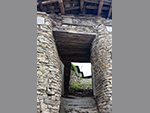 "+
"
"+
" "+
"
"+
" "+
"
"+
" "+
"
"+
" "+
"
"+
" "+
"
"+
" "+
"
"+
" "+
"
"+
" "+
"
"+
" "+
"
"+
" "+
"
"+
" "+
"
"+
" "+
"
"+
" "+
"
"+
" "+
"",
bomdilabengali : "বমডিলাঃ-ভালুকপং থেকে ১০৯ কিমি দূরে অবস্থিত বমডিলা, অরুণাচল প্রদেশের পশ্চিম কামেং জেলার সদর দপ্তর। সমুদ্রপৃষ্ঠ থেকে প্রায় ২,২১৭ মিটার উচ্চতায় অবস্থিত বমডিলা, তার বৌদ্ধ মঠ এবং আপেল বাগানের জন্যে বিখ্যাত। এখানে কারুশিল্প কেন্দ্র, মঠ, নৃতাত্ত্বিক জাদুঘর, এবং এম্পোরিয়াম, ইত্যাদি দর্শনীয় স্থান রয়েছে। বমডিলা থেকে বিভিন্ন তুষারাবৃত পর্বতশৃঙ্গও দেখা যায়, যার মধ্যে রয়েছে রাজ্যের সর্বোচ্চ শৃঙ্গ কাংটো এবং গোরিচেন। তুষারাবৃত হিমালয় পর্বতমালা, সবুজের সমাহার, সমৃদ্ধ সংস্কৃতি এবং জীবনযাত্রা, এবং বিভিন্ন কারুশিল্পের কারণে, বমডিলা অরুণাচল প্রদেশের শীর্ষস্থানীয় পর্যটন কেন্দ্রগুলোর মধ্যে একটা।বমডিলা মঠ ১৯৬৫ সালে প্রতিষ্ঠিত হয়েছিল, এবং এটা বৌদ্ধধর্মের আধ্যাত্মিক মর্মকে প্রতিনিধিত্ব করে। মহাযান বৌদ্ধধর্মের অনুসারীরা এই স্থানকে পবিত্র বলে মনে করে। মঠটা দক্ষিণ তিব্বতের সোনা গোন্টসে মঠের মতো দেখতে। মঠে অবস্থিত বুদ্ধের মন্দির, প্রচুর সংখ্যক তীর্থযাত্রীদের আকর্ষণ করে। পাহাড়ের ওপর অবস্থিত, উচ্চ গোম্পাও প্রচুর সংখ্যক পর্যটককে আকর্ষণ করে, কারণ এটাও বৌদ্ধধর্মের সাথে সম্পর্কিত ঐতিহ্যের প্রতীক। এটাকে জেন্টসে গাদেন রাবগিয়েল লিং বা জি আর এল মঠও বলা হয়। উচ্চ গোম্পায় ভিক্ষু শিশুদের শিক্ষিত করার জন্যে একটা স্কুল আছে। এখানে একটা বুদ্ধ মন্দির এবং একটা প্রার্থনা কক্ষ রয়েছে। প্রার্থনা কক্ষের দেয়ালে ঝোলানো বিভিন্ন প্রতিবেদন, বৌদ্ধধর্মের সমৃদ্ধ সংস্কৃতির পরিচয়। নিম্ন গোম্পা বমডিলার কেন্দ্রে অবস্থিত। এখানে তিব্বতি স্থাপত্যের প্রভাব বিশেষভাবে লক্ষণীয়।। এখানে একটা বিশাল আকারের প্রার্থনা কক্ষও রয়েছে। বৌদ্ধ দর্শনের অনুসারীরা এই স্থান পবিত্র বলে মনে করেন। মধ্য গোম্পা বমডিলার প্রধান বাজারের কাছে অবস্থিত। এই গোম্পা প্রাচীনতম গোম্পাগুলোর মধ্যে একটা। অসুস্থ মানুষজনের কাছে এই গোম্পা খুবই জনপ্রিয়, কারণ গোম্পায় নীল মেডিসিন বুদ্ধের মূর্তি রয়েছে, ও অসুস্থ মানুষজন এখানে প্রার্থনা এবং ধ্যানের মাধ্যমে সুস্থ হন। বমডিলার সংস্কৃতি এবং জীবনযাত্রার সারাংশ অনুভব করতে চাইলে, অবশ্যই যেতে হবে ক্রাফট সেন্টার এবং ইথিনোগ্রাফিক মিউজিয়ামে। হাতে বোনা কার্পেট, ঐতিহ্যবাহী মুখোশ, এবং দেওয়ালে ঝুলোনো জিনিসপত্র, অনন্যভাবে ডিজাইন করা হয়েছে। ড্রাগনের নকশাযুক্ত কার্পেটগুলো এখানে খুবই বিখ্যাত। এটা সেই জায়গা, যেখান থেকে স্মৃতিচিহ্ন হিসেবে, হস্তশিল্পের জিনিসপত্র কেনা যেতে পারে। বমডিলা, আপেল বাগানের জন্যেও বিখ্যাত। বাগানগুলো বিশাল এলাকা জুড়ে ছড়িয়ে আছে। বাগানে, আপেল ভর্তি গাছ, পর্যটকদের কাছে দুর্দান্ত আকর্ষণ। এখানে আপেলের দামও বেশ কম। প্রকৃতিপ্রেমীদের কাছে বমডিলা ভিউ পয়েন্ট খুবই পছন্দের, কারণ এখান থেকে দেখা যায় এখানকার সর্বোচ্চ স্থান নেচিপু পাস সহ আশেপাশের প্রাকৃতিক দৃশ্য। এখান থেকে পশ্চিম কামেং ভ্যালির অনেকটাই দৃশ্যমান হয়। আর আর হিল, বমডিলার সর্বোচ্চ স্থান হিসেবে, আরেকটা গুরুত্বপূর্ণ পর্যটন আকর্ষণ। বমডিলার বিশেষত্ব হলো মনোরম ভূদৃশ্য ছাড়া, তাওয়াং এবং ভুটানের সীমান্তে যাওয়ার রাস্তাও দেখা যায়। এককথায়, এই ছোট শহরটা, বৌদ্ধ গোম্পা এবং কামেং উপত্যকার অপূর্ব দৃশ্যের জন্যে বিখ্যাত। নেচিপু গিরিপথের চূড়ায় মেঘ জড়ো হওয়ার দৃশ্যের সাথে, রাজ্যের সর্বোচ্চ শৃঙ্গ হিসেবে বিবেচনা করা, কাংটো এবং গোরিচেন শৃঙ্গও এখান থেকে দেখা যায়।মধ্যযুগীয় সময়ে, বমডিলা তিব্বত রাজ্যের একটা অংশ ছিল, ও ভুটানের স্থানীয় উপজাতিরা শাসন করতো। আসামের আহোম শাসকরা, প্রতিশোধমূলক অভিযান ছাড়া, কখনও এই স্থানীয় উপজাতিদের ওপর হস্তক্ষেপ করেনি। ১৮৭৩ সালে, ব্রিটিশরা অরুণাচল প্রদেশের এই অঞ্চলে প্রবেশ নিষিদ্ধ করে। ১৯৪৭ সালে ভারত স্বাধীনতা লাভের পর, ভারত ও চীনের মধ্যে এই অঞ্চল নিয়ে ক্রমাগত মতবিরোধ ছিল যা আজও বর্তমান। ১৯৬২ সালে, চীন বমডিলার আশেপাশের অঞ্চল আক্রমণ করে, কিন্তু পরে সেখান থেকে তাদের সৈন্য প্রত্যাহার করে নেয়। এখানকার বাসিন্দারা সাধারণত মনপা এবং শেরদুকপেন উপজাতির অন্তর্ভুক্ত। তবে মানুষজন মনপা, শেরদুকপেন, মিজি, আকা, হিন্দি, অসমিয়া এবং ইংরেজির মতো বিভিন্ন ভাষায় কথা বলে। বসন্তের আগমন ও চান্দ্র পুঞ্জিকার প্রথম দিনে শুরু হয় লোসার উৎসব, যেখানে উৎসবের অবিচ্ছেদ্য অংশ হিসেবে থাকে মনোরম মনপা লোকসঙ্গীত, এবং শ্রুতিমধুর গীতবাদ্য। থাংকা ওয়াল হ্যাঙ্গিং, মুখোশ, এবং ড্রাগন কার্পেট এই স্থানের কিছু বিশেষত্ব। "+
"Read More..."+
"
"+
"",
bomdilabengali : "বমডিলাঃ-ভালুকপং থেকে ১০৯ কিমি দূরে অবস্থিত বমডিলা, অরুণাচল প্রদেশের পশ্চিম কামেং জেলার সদর দপ্তর। সমুদ্রপৃষ্ঠ থেকে প্রায় ২,২১৭ মিটার উচ্চতায় অবস্থিত বমডিলা, তার বৌদ্ধ মঠ এবং আপেল বাগানের জন্যে বিখ্যাত। এখানে কারুশিল্প কেন্দ্র, মঠ, নৃতাত্ত্বিক জাদুঘর, এবং এম্পোরিয়াম, ইত্যাদি দর্শনীয় স্থান রয়েছে। বমডিলা থেকে বিভিন্ন তুষারাবৃত পর্বতশৃঙ্গও দেখা যায়, যার মধ্যে রয়েছে রাজ্যের সর্বোচ্চ শৃঙ্গ কাংটো এবং গোরিচেন। তুষারাবৃত হিমালয় পর্বতমালা, সবুজের সমাহার, সমৃদ্ধ সংস্কৃতি এবং জীবনযাত্রা, এবং বিভিন্ন কারুশিল্পের কারণে, বমডিলা অরুণাচল প্রদেশের শীর্ষস্থানীয় পর্যটন কেন্দ্রগুলোর মধ্যে একটা।বমডিলা মঠ ১৯৬৫ সালে প্রতিষ্ঠিত হয়েছিল, এবং এটা বৌদ্ধধর্মের আধ্যাত্মিক মর্মকে প্রতিনিধিত্ব করে। মহাযান বৌদ্ধধর্মের অনুসারীরা এই স্থানকে পবিত্র বলে মনে করে। মঠটা দক্ষিণ তিব্বতের সোনা গোন্টসে মঠের মতো দেখতে। মঠে অবস্থিত বুদ্ধের মন্দির, প্রচুর সংখ্যক তীর্থযাত্রীদের আকর্ষণ করে। পাহাড়ের ওপর অবস্থিত, উচ্চ গোম্পাও প্রচুর সংখ্যক পর্যটককে আকর্ষণ করে, কারণ এটাও বৌদ্ধধর্মের সাথে সম্পর্কিত ঐতিহ্যের প্রতীক। এটাকে জেন্টসে গাদেন রাবগিয়েল লিং বা জি আর এল মঠও বলা হয়। উচ্চ গোম্পায় ভিক্ষু শিশুদের শিক্ষিত করার জন্যে একটা স্কুল আছে। এখানে একটা বুদ্ধ মন্দির এবং একটা প্রার্থনা কক্ষ রয়েছে। প্রার্থনা কক্ষের দেয়ালে ঝোলানো বিভিন্ন প্রতিবেদন, বৌদ্ধধর্মের সমৃদ্ধ সংস্কৃতির পরিচয়। নিম্ন গোম্পা বমডিলার কেন্দ্রে অবস্থিত। এখানে তিব্বতি স্থাপত্যের প্রভাব বিশেষভাবে লক্ষণীয়।। এখানে একটা বিশাল আকারের প্রার্থনা কক্ষও রয়েছে। বৌদ্ধ দর্শনের অনুসারীরা এই স্থান পবিত্র বলে মনে করেন। মধ্য গোম্পা বমডিলার প্রধান বাজারের কাছে অবস্থিত। এই গোম্পা প্রাচীনতম গোম্পাগুলোর মধ্যে একটা। অসুস্থ মানুষজনের কাছে এই গোম্পা খুবই জনপ্রিয়, কারণ গোম্পায় নীল মেডিসিন বুদ্ধের মূর্তি রয়েছে, ও অসুস্থ মানুষজন এখানে প্রার্থনা এবং ধ্যানের মাধ্যমে সুস্থ হন। বমডিলার সংস্কৃতি এবং জীবনযাত্রার সারাংশ অনুভব করতে চাইলে, অবশ্যই যেতে হবে ক্রাফট সেন্টার এবং ইথিনোগ্রাফিক মিউজিয়ামে। হাতে বোনা কার্পেট, ঐতিহ্যবাহী মুখোশ, এবং দেওয়ালে ঝুলোনো জিনিসপত্র, অনন্যভাবে ডিজাইন করা হয়েছে। ড্রাগনের নকশাযুক্ত কার্পেটগুলো এখানে খুবই বিখ্যাত। এটা সেই জায়গা, যেখান থেকে স্মৃতিচিহ্ন হিসেবে, হস্তশিল্পের জিনিসপত্র কেনা যেতে পারে। বমডিলা, আপেল বাগানের জন্যেও বিখ্যাত। বাগানগুলো বিশাল এলাকা জুড়ে ছড়িয়ে আছে। বাগানে, আপেল ভর্তি গাছ, পর্যটকদের কাছে দুর্দান্ত আকর্ষণ। এখানে আপেলের দামও বেশ কম। প্রকৃতিপ্রেমীদের কাছে বমডিলা ভিউ পয়েন্ট খুবই পছন্দের, কারণ এখান থেকে দেখা যায় এখানকার সর্বোচ্চ স্থান নেচিপু পাস সহ আশেপাশের প্রাকৃতিক দৃশ্য। এখান থেকে পশ্চিম কামেং ভ্যালির অনেকটাই দৃশ্যমান হয়। আর আর হিল, বমডিলার সর্বোচ্চ স্থান হিসেবে, আরেকটা গুরুত্বপূর্ণ পর্যটন আকর্ষণ। বমডিলার বিশেষত্ব হলো মনোরম ভূদৃশ্য ছাড়া, তাওয়াং এবং ভুটানের সীমান্তে যাওয়ার রাস্তাও দেখা যায়। এককথায়, এই ছোট শহরটা, বৌদ্ধ গোম্পা এবং কামেং উপত্যকার অপূর্ব দৃশ্যের জন্যে বিখ্যাত। নেচিপু গিরিপথের চূড়ায় মেঘ জড়ো হওয়ার দৃশ্যের সাথে, রাজ্যের সর্বোচ্চ শৃঙ্গ হিসেবে বিবেচনা করা, কাংটো এবং গোরিচেন শৃঙ্গও এখান থেকে দেখা যায়।মধ্যযুগীয় সময়ে, বমডিলা তিব্বত রাজ্যের একটা অংশ ছিল, ও ভুটানের স্থানীয় উপজাতিরা শাসন করতো। আসামের আহোম শাসকরা, প্রতিশোধমূলক অভিযান ছাড়া, কখনও এই স্থানীয় উপজাতিদের ওপর হস্তক্ষেপ করেনি। ১৮৭৩ সালে, ব্রিটিশরা অরুণাচল প্রদেশের এই অঞ্চলে প্রবেশ নিষিদ্ধ করে। ১৯৪৭ সালে ভারত স্বাধীনতা লাভের পর, ভারত ও চীনের মধ্যে এই অঞ্চল নিয়ে ক্রমাগত মতবিরোধ ছিল যা আজও বর্তমান। ১৯৬২ সালে, চীন বমডিলার আশেপাশের অঞ্চল আক্রমণ করে, কিন্তু পরে সেখান থেকে তাদের সৈন্য প্রত্যাহার করে নেয়। এখানকার বাসিন্দারা সাধারণত মনপা এবং শেরদুকপেন উপজাতির অন্তর্ভুক্ত। তবে মানুষজন মনপা, শেরদুকপেন, মিজি, আকা, হিন্দি, অসমিয়া এবং ইংরেজির মতো বিভিন্ন ভাষায় কথা বলে। বসন্তের আগমন ও চান্দ্র পুঞ্জিকার প্রথম দিনে শুরু হয় লোসার উৎসব, যেখানে উৎসবের অবিচ্ছেদ্য অংশ হিসেবে থাকে মনোরম মনপা লোকসঙ্গীত, এবং শ্রুতিমধুর গীতবাদ্য। থাংকা ওয়াল হ্যাঙ্গিং, মুখোশ, এবং ড্রাগন কার্পেট এই স্থানের কিছু বিশেষত্ব। "+
"Read More..."+
" "+
"
"+
" "+
"
"+
" "+
"
"+
" "+
"
"+
" "+
"
"+
" "+
"
"+
" "+
"
"+
" "+
"",
bumlabengali : "বুমলা পাসঃ-অরুণাচল প্রদেশের ভারত-চীন সীমান্তে, ১৫,২০০ ফুট উচ্চতায় অবস্থিত বুমলা পাস, সবচেয়ে অদ্ভুত কৌশলগত গিরিপথগুলোর মধ্যে একটা হিসেবে কাজ করে। তাওয়াং শহর থেকে প্রায় ৩৪ কিলোমিটার দূরে অবস্থিত, এই গিরিপথটা কেবল একটা ভৌগোলিক সত্তা নয়, বরং একটা ঐতিহাসিক ও রাজনৈতিক বৈশিষ্ট্য, যা ভারত ও চীনের মধ্যে প্রকৃত নিয়ন্ত্রণ রেখার কাছে একটা গুরুত্বপূর্ণ অবস্থান চিহ্নিত করে। ১৯৬২ সালের চীন-ভারত যুদ্ধের সময় বুমলা গিরিপথ ছিল, অন্যতম গুরুত্বপূর্ণ স্থান। তখন থেকে এই গিরিপথ, দু দেশের মধ্যে দ্বিপাক্ষিক সম্পর্কের ক্ষেত্রে গুরুত্বপূর্ণ ভূমিকা পালন করেছে। এটা এখন ভারতীয় সেনাবাহিনী এবং চীনের পিপলস লিবারেশন আর্মির মধ্যে, আনুষ্ঠানিকভাবে সম্মত সীমান্ত কর্মীদের বৈঠকের স্থানগুলোর মধ্যে একটা, যেখানে সম্পর্ক উন্নত করতে, এবং শান্তি বজায় রাখার জন্যে বৈঠক অনুষ্ঠিত হয়। প্রায়শই কূটনৈতিক আলোচনা এবং কর্মকর্তাদের পরিদর্শনের আয়োজনও করে থাকে।বুমলা পাসের আকর্ষণ, তার শ্বাসরুদ্ধকর উচ্চ-উচ্চতার ভূদৃশ্য, এবং এর অনুর্বর পাহাড়ি ভূখণ্ডের অসম্ভব সুন্দর সৌন্দর্যের মধ্যে নিহিত। বছরের বেশিরভাগ সময় এই অঞ্চল তুষারে ঢাকা থাকে, যা এক মনোরম দৃশ্য প্রদান করে, ও তা বেশ রহস্যময় এবং সৌম্য উভয়ই। চ্যালেঞ্জিং আবহাওয়া বুমলার রহস্যকে আরও বাড়িয়ে তোলে, যা ভারতের প্রত্যন্ত কোণে অ্যাডভেঞ্চার খুঁজছেন এমন মানুষজনের জন্যে, একটা অবশ্য গন্তব্যস্থল। বুমলা পাস একটা গন্তব্যস্থলের চেয়েও বেশি কিছু। এটা ভারতীয় সেনাবাহিনীর সহিষ্ণু, উদ্দীপনা, এবং পূর্ব হিমালয়ের কঠোর কিন্তু বিস্ময়কর সৌন্দর্যের প্রমাণ। এটা পর্যটকদের, সীমান্ত সুরক্ষার চ্যালেঞ্জ, এবং এক সংবেদনশীল অঞ্চলে শান্তির জন্যে প্রচেষ্টা প্রত্যক্ষ করার, একটা অনন্য সুযোগ প্রদান করে। যারা উচ্চ-উচ্চতার প্রাকৃতিক দৃশ্যের রহস্য এবং ঐতিহাসিক ঘটনার প্রতিধ্বনির প্রতি আকৃষ্ট হন, তাদের জন্য বুমলা পাস, ভ্রমণের একটা সেরা ঠিকানা। বুমলা পাস পরিদর্শন দুঃসাহসিক ব্যক্তিদের জন্যে বিভিন্ন ধরণের কার্যকলাপ প্রদান করে। গিরিপথে ভ্রমণ নিজেই একটা আনন্দদায়ক অভিজ্ঞতা, যেখানে ফটোগ্রাফি এবং তুষার নিয়ে খেলার সুযোগ রয়েছে। অবস্থানের সংবেদনশীলতার কারণে, পর্যটকদের বিশেষ পারমিটের প্রয়োজন হয়, এবং তা সাধারণত তাওয়াং-এ নিবন্ধিত ট্যুর অপারেটরদের মাধ্যমে আয়োজন করা হয়। গিরিপথে পৌঁছোনোর পর, পর্যটকরা সেখানে অবস্থানরত ভারতীয় সেনাদের সাথে যোগাযোগ করতে পারেন, আর এত উঁচুতে থাকা সৈন্যদের জীবন এবং চ্যালেঞ্জ সম্পর্কে সম্যক জ্ঞান অর্জন করতে পারেন। চীন-ভারত যুদ্ধের এক সম্পূর্ণ ধারা বিবরণীর সাথে, ভারতীয় সৈন্যদের সাহস, প্রতিরোধ, ও আত্মত্যাগের এক বীরত্বপূর্ণ কাহিনী, স্বপ্নিল চলচ্চিত্রের মতো দেখতে পাবেন। বিভিন্ন স্মৃতিফলকে সেনাদের সাহসিকতার হৃদয়বিদারক ও আবেগ জাগানো বহু কথা লেখা আছে, যার মধ্যে উল্লেখযোগ্য হলো - আজ আমরা আমাদের প্রাণ উৎসর্গ করছি, তোমরা যাতে আগামীকাল ভালো থাকো। কোনো মানুষ যদি বলে যে সে মৃত্যুকে ভয় পায় না, তাহলে সে মিথ্যে কথা বলছে, আর যদি সে সত্যি কথা বলে, তবে সে একজন গোর্খা সৈনিক ইত্যাদি। "+
"Read More..."+
"
"+
"",
bumlabengali : "বুমলা পাসঃ-অরুণাচল প্রদেশের ভারত-চীন সীমান্তে, ১৫,২০০ ফুট উচ্চতায় অবস্থিত বুমলা পাস, সবচেয়ে অদ্ভুত কৌশলগত গিরিপথগুলোর মধ্যে একটা হিসেবে কাজ করে। তাওয়াং শহর থেকে প্রায় ৩৪ কিলোমিটার দূরে অবস্থিত, এই গিরিপথটা কেবল একটা ভৌগোলিক সত্তা নয়, বরং একটা ঐতিহাসিক ও রাজনৈতিক বৈশিষ্ট্য, যা ভারত ও চীনের মধ্যে প্রকৃত নিয়ন্ত্রণ রেখার কাছে একটা গুরুত্বপূর্ণ অবস্থান চিহ্নিত করে। ১৯৬২ সালের চীন-ভারত যুদ্ধের সময় বুমলা গিরিপথ ছিল, অন্যতম গুরুত্বপূর্ণ স্থান। তখন থেকে এই গিরিপথ, দু দেশের মধ্যে দ্বিপাক্ষিক সম্পর্কের ক্ষেত্রে গুরুত্বপূর্ণ ভূমিকা পালন করেছে। এটা এখন ভারতীয় সেনাবাহিনী এবং চীনের পিপলস লিবারেশন আর্মির মধ্যে, আনুষ্ঠানিকভাবে সম্মত সীমান্ত কর্মীদের বৈঠকের স্থানগুলোর মধ্যে একটা, যেখানে সম্পর্ক উন্নত করতে, এবং শান্তি বজায় রাখার জন্যে বৈঠক অনুষ্ঠিত হয়। প্রায়শই কূটনৈতিক আলোচনা এবং কর্মকর্তাদের পরিদর্শনের আয়োজনও করে থাকে।বুমলা পাসের আকর্ষণ, তার শ্বাসরুদ্ধকর উচ্চ-উচ্চতার ভূদৃশ্য, এবং এর অনুর্বর পাহাড়ি ভূখণ্ডের অসম্ভব সুন্দর সৌন্দর্যের মধ্যে নিহিত। বছরের বেশিরভাগ সময় এই অঞ্চল তুষারে ঢাকা থাকে, যা এক মনোরম দৃশ্য প্রদান করে, ও তা বেশ রহস্যময় এবং সৌম্য উভয়ই। চ্যালেঞ্জিং আবহাওয়া বুমলার রহস্যকে আরও বাড়িয়ে তোলে, যা ভারতের প্রত্যন্ত কোণে অ্যাডভেঞ্চার খুঁজছেন এমন মানুষজনের জন্যে, একটা অবশ্য গন্তব্যস্থল। বুমলা পাস একটা গন্তব্যস্থলের চেয়েও বেশি কিছু। এটা ভারতীয় সেনাবাহিনীর সহিষ্ণু, উদ্দীপনা, এবং পূর্ব হিমালয়ের কঠোর কিন্তু বিস্ময়কর সৌন্দর্যের প্রমাণ। এটা পর্যটকদের, সীমান্ত সুরক্ষার চ্যালেঞ্জ, এবং এক সংবেদনশীল অঞ্চলে শান্তির জন্যে প্রচেষ্টা প্রত্যক্ষ করার, একটা অনন্য সুযোগ প্রদান করে। যারা উচ্চ-উচ্চতার প্রাকৃতিক দৃশ্যের রহস্য এবং ঐতিহাসিক ঘটনার প্রতিধ্বনির প্রতি আকৃষ্ট হন, তাদের জন্য বুমলা পাস, ভ্রমণের একটা সেরা ঠিকানা। বুমলা পাস পরিদর্শন দুঃসাহসিক ব্যক্তিদের জন্যে বিভিন্ন ধরণের কার্যকলাপ প্রদান করে। গিরিপথে ভ্রমণ নিজেই একটা আনন্দদায়ক অভিজ্ঞতা, যেখানে ফটোগ্রাফি এবং তুষার নিয়ে খেলার সুযোগ রয়েছে। অবস্থানের সংবেদনশীলতার কারণে, পর্যটকদের বিশেষ পারমিটের প্রয়োজন হয়, এবং তা সাধারণত তাওয়াং-এ নিবন্ধিত ট্যুর অপারেটরদের মাধ্যমে আয়োজন করা হয়। গিরিপথে পৌঁছোনোর পর, পর্যটকরা সেখানে অবস্থানরত ভারতীয় সেনাদের সাথে যোগাযোগ করতে পারেন, আর এত উঁচুতে থাকা সৈন্যদের জীবন এবং চ্যালেঞ্জ সম্পর্কে সম্যক জ্ঞান অর্জন করতে পারেন। চীন-ভারত যুদ্ধের এক সম্পূর্ণ ধারা বিবরণীর সাথে, ভারতীয় সৈন্যদের সাহস, প্রতিরোধ, ও আত্মত্যাগের এক বীরত্বপূর্ণ কাহিনী, স্বপ্নিল চলচ্চিত্রের মতো দেখতে পাবেন। বিভিন্ন স্মৃতিফলকে সেনাদের সাহসিকতার হৃদয়বিদারক ও আবেগ জাগানো বহু কথা লেখা আছে, যার মধ্যে উল্লেখযোগ্য হলো - আজ আমরা আমাদের প্রাণ উৎসর্গ করছি, তোমরা যাতে আগামীকাল ভালো থাকো। কোনো মানুষ যদি বলে যে সে মৃত্যুকে ভয় পায় না, তাহলে সে মিথ্যে কথা বলছে, আর যদি সে সত্যি কথা বলে, তবে সে একজন গোর্খা সৈনিক ইত্যাদি। "+
"Read More..."+
" "+
"
"+
" "+
"
"+
" "+
"
"+
" "+
"
"+
" "+
"
"+
" "+
"
"+
" "+
"
"+
" "+
"",
chagzambengali : "চাকজাম সেতুঃ-চাকজাম সেতু হলো অরুণাচল প্রদেশের তাওয়াং-এ অবস্থিত একটা ঝুলন্ত সেতু। এটা ১৪২০ খ্রিস্টাব্দে একজন বৌদ্ধ সন্ন্যাসী, এবং তার সময়ের একজন বিখ্যাত স্থপতি লামা থাংটং গ্যালপো দ্বারা নির্মিত হয়েছিল। তাওয়াং চু নদীর ওপর অবস্থিত চাকজাম সেতু প্রায় ছশো বছরের পুরনো, যা এই অঞ্চলের সবচেয়ে প্রাচীন সেতু। তাওয়াংয়ের ইতিহাসে এই সেতু এক গুরুত্বপূর্ণ ভূমিকা পালন করেছিল। তাওয়াং নদীর উত্তরে কিটপি এবং দক্ষিণে মুক্তো নামে দুটো গুরুত্বপূর্ণ গ্রামকে সংযুক্ত করেছিল, ফলে যাতায়াত এবং বাণিজ্যিক যোগাযোগের ব্যবস্থাকে সহজতর করেছিল। এই সেতু দুটো গ্রামের দূরত্বকে অন্তত দশ কিলোমিটার কমিয়েছে। অসংখ্য প্রাকৃতিক দুর্যোগ, এবং রাজনৈতিক অস্থিরতার মুখোমুখি হওয়া সত্ত্বেও, সেতুটা স্থিতিস্থাপকতা এবং সহনশীলতার প্রতীক হিসেবে এখনও দৃঢ়ভাবে দাঁড়িয়ে আছে। এটা এখনও একটা বিস্ময়কর দৃশ্য, যা আমাদের মানবিক দক্ষতার শক্তি, এবং ইতিহাস সংরক্ষণের গুরুত্বের কথা মনে করিয়ে দেয়। তাওয়াং-এর চাকজাম সেতু, সবচেয়ে অত্যাশ্চর্য প্রাচীন প্রকৌশল বিস্ময়ের মধ্যে একটা। কেউ যদি প্রকৌশল এবং প্রাকৃতিক সৌন্দর্যের একটা প্রাচীন কিন্তু অত্যাশ্চর্য উদাহরণ খোঁজে, তাহলে উত্তর-পূর্ব ভারতের অরুণাচল প্রদেশের তাওয়াং জেলার চাকজাম সেতু সেইরকম এক বিস্ময়। এই সেতু তাওয়াং নদীর ওপর বিস্তৃত, যা দর্শনার্থীদের আশেপাশের ভূদৃশ্যেরও এক অনন্য রোমাঞ্চকর অভিজ্ঞতা প্রদান করে। সাম্প্রতিক বছরগুলোতে এই সেতু একটা জনপ্রিয় পর্যটন আকর্ষণ হয়ে উঠেছে। এটা কেবলমাত্র প্রকৌশলের কীর্তি নয়, স্থানীয় সম্প্রদায়ের জন্যে এটার উল্লেখযোগ্য সাংস্কৃতিক এবং ঐতিহাসিক গুরুত্বও রয়েছে। তিব্বতি ভাষায় চাকজাম কথার অর্থ লোহার সেতু। ভারত, তিব্বত, ভুটান, এবং নেপাল হিমালয় অঞ্চলের শত শত লোহার সেতুর যে কোনও একটাকে বোঝাতে পারে। তবে, তাওয়াং জেলার সেতুকে চাকজাম সেতু বলা হয়, কারণ এটা শতাব্দী প্রাচীন বিশেষ লোহার সেতু। চাকজাম সেতু নির্মাণের জন্যে অনন্য নকশা, এবং প্রকৌশলগত চ্যালেঞ্জ তৈরি হয়েছিল, যার জন্য উদ্ভাবনী সমাধান এবং দৃঢ় সংকল্পের প্রয়োজন ছিল। অর্থ এবং সম্পদের জন্যে, লামা থাংটং গ্যালপো, বিভিন্ন গ্রামে নৃত্য এবং সঙ্গীতের মাধ্যমে মানুষকে সেতুর উপযোগিতা সম্পর্কে শিক্ষিত করেছিলেন। এইভাবে সংগৃহীত অর্থ সেতুর জন্যে ব্যবহার করা হয়েছিল। আশেপাশের গ্রামের অনেক মানুষ চাকজাম সেতুতে কাজ করতে রাজি হয়েছিল। প্রতিকূল ভূখণ্ড, চরম আবহাওয়া এবং সীমিত প্রবেশাধিকার, এই সেতু নির্মাণকে একটা কঠিন কাজে পরিণত করে তুলেছিল। তবে, থাংটং গ্যালপো এবং প্রকল্পের সাথে জড়িত নির্মাতারা, তাদের অধ্যবসায়, দক্ষতা এবং বুদ্ধিমত্তার সাথে এই চ্যালেঞ্জগুলো অতিক্রম করেছেন। চাকজাম সেতুর সমাপ্তি আপাতদৃষ্টিতে অপ্রতিরোধ্য বাধাগুলো জয় করার জন্যে মানবিক চেতনা ও ক্ষমতার প্রমাণ হিসেবে দাঁড়িয়ে আছে। এটা তাদের সকলের জন্যে অনুপ্রেরণা হিসেবে কাজ করে, যারা তাদের জীবনে কঠিন চ্যালেঞ্জের মুখোমুখি হয়, ও আমাদের মনে করিয়ে দেয় যে কঠোর পরিশ্রম এবং নিষ্ঠার সাথে কাজ করলে সবকিছুই সম্ভব। চাকজাম সেতু একটা প্রকৌশল বিস্ময় যা সময়ের পরীক্ষায় এখনও টিকে আছে। তাওয়াং নদীর ওপর এই ঝুলন্ত সেতু, লোহার শেকল, বাঁশ, বেত, এবং খড় দিয়ে তৈরি। নীচে দুটো লোহার শেকল এবং উভয় পাশে এক জোড়া লোহার শেকল রয়েছে। এর ওপর বাঁশের মাদুরের স্তর স্থাপন করা হয়েছে যাতে সহজেই হাঁটতে পারে। সেতুটা ৬০ মিটার লম্বা এবং প্রায় ২ মিটার চওড়া। এটা তার সময়ের অনন্য ঝুলন্ত সেতুগুলোর মধ্যে একটা। তীব্র বাতাস, ভূমিকম্প ও অন্যান্য প্রাকৃতিক দুর্যোগ সহ্য করেও, শতাব্দীর পর শতাব্দী ধরে এটা দাঁড়িয়ে আছে। লামা থাংটং গ্যালপো সম্বন্ধে কিছু না বললে এই প্রতিবেদন অসম্পূর্ণ থেকে যায়। ব্রিজের নির্মাতা লামা থাংটং গ্যালপো, তিব্বত ও ভুটানের ইতিহাসের একজন কিংবদন্তি ব্যক্তিত্ব ছিলেন, এবং প্রথম দালাই লামার শিষ্য ছিলেন। তিনি পঞ্চদশ শতাব্দীতে তিব্বতে জন্মগ্রহণ করেছিলেন, এবং তাঁর জীবনের বেশিরভাগ সময় হিমালয় জুড়ে ভ্রমণ, সেতু ও মঠ নির্মাণ, এবং বৌদ্ধধর্ম প্রচারে কাটিয়েছিলেন। লামা থাংটং গ্যালপো কেবল একজন মহান স্থপতিই ছিলেন না, বরং একজন আধ্যাত্মিক নেতা, সমাজ সংস্কারক, চিকিৎসক, কামার এবং কবিও ছিলেন। তিব্বত এবং ভুটানে লোহার শেকল সেতু নির্মাণের শিল্প প্রবর্তনের জন্যে তাকে কৃতিত্ব দেওয়া হয়, যা এই অঞ্চলে পরিবহন ব্যবস্থায় বিপ্লব এনেছিল। তিনি একজন দক্ষ নির্মাতা ছিলেন ও তিব্বত, ভুটান এবং ভারত জুড়ে ৫৮টা লোহার শেকলের ঝুলন্ত সেতু নির্মাণের জন্যে পরিচিত। চাকজাম সেতু তার সবচেয়ে বিখ্যাত সৃষ্টিগুলোর মধ্যে একটা। এই কারণে তাকে ভালবেসে লোহার সেতু নির্মাতা বা চাকজাম্পা বলা হতো। ভুটানের পারোর জাংটসা দুমৎসেগ লাখাং সহ তিব্বতের অনেক গুরুত্বপূর্ণ স্তূপ নির্মাণের জন্যেও তাকে কৃতিত্ব দেওয়া হয়। লামা থাংটং গ্যালপো তিব্বতি অপেরা প্রতিষ্ঠার জন্যও পরিচিত, যা এক ধরণের মুখোশধারী চাম নৃত্য। সেতু নির্মাণের অর্থ ও সম্পদ সংগ্রহের জন্যে, এই কলা বিভিন্ন গ্রামে পরিবেশন করা হতো। তিনি অবশ্যই তাঁর যুগের সবচেয়ে উদ্যোগী ব্যক্তি ছিলেন। "+
"Read More..."+
"
"+
"",
chagzambengali : "চাকজাম সেতুঃ-চাকজাম সেতু হলো অরুণাচল প্রদেশের তাওয়াং-এ অবস্থিত একটা ঝুলন্ত সেতু। এটা ১৪২০ খ্রিস্টাব্দে একজন বৌদ্ধ সন্ন্যাসী, এবং তার সময়ের একজন বিখ্যাত স্থপতি লামা থাংটং গ্যালপো দ্বারা নির্মিত হয়েছিল। তাওয়াং চু নদীর ওপর অবস্থিত চাকজাম সেতু প্রায় ছশো বছরের পুরনো, যা এই অঞ্চলের সবচেয়ে প্রাচীন সেতু। তাওয়াংয়ের ইতিহাসে এই সেতু এক গুরুত্বপূর্ণ ভূমিকা পালন করেছিল। তাওয়াং নদীর উত্তরে কিটপি এবং দক্ষিণে মুক্তো নামে দুটো গুরুত্বপূর্ণ গ্রামকে সংযুক্ত করেছিল, ফলে যাতায়াত এবং বাণিজ্যিক যোগাযোগের ব্যবস্থাকে সহজতর করেছিল। এই সেতু দুটো গ্রামের দূরত্বকে অন্তত দশ কিলোমিটার কমিয়েছে। অসংখ্য প্রাকৃতিক দুর্যোগ, এবং রাজনৈতিক অস্থিরতার মুখোমুখি হওয়া সত্ত্বেও, সেতুটা স্থিতিস্থাপকতা এবং সহনশীলতার প্রতীক হিসেবে এখনও দৃঢ়ভাবে দাঁড়িয়ে আছে। এটা এখনও একটা বিস্ময়কর দৃশ্য, যা আমাদের মানবিক দক্ষতার শক্তি, এবং ইতিহাস সংরক্ষণের গুরুত্বের কথা মনে করিয়ে দেয়। তাওয়াং-এর চাকজাম সেতু, সবচেয়ে অত্যাশ্চর্য প্রাচীন প্রকৌশল বিস্ময়ের মধ্যে একটা। কেউ যদি প্রকৌশল এবং প্রাকৃতিক সৌন্দর্যের একটা প্রাচীন কিন্তু অত্যাশ্চর্য উদাহরণ খোঁজে, তাহলে উত্তর-পূর্ব ভারতের অরুণাচল প্রদেশের তাওয়াং জেলার চাকজাম সেতু সেইরকম এক বিস্ময়। এই সেতু তাওয়াং নদীর ওপর বিস্তৃত, যা দর্শনার্থীদের আশেপাশের ভূদৃশ্যেরও এক অনন্য রোমাঞ্চকর অভিজ্ঞতা প্রদান করে। সাম্প্রতিক বছরগুলোতে এই সেতু একটা জনপ্রিয় পর্যটন আকর্ষণ হয়ে উঠেছে। এটা কেবলমাত্র প্রকৌশলের কীর্তি নয়, স্থানীয় সম্প্রদায়ের জন্যে এটার উল্লেখযোগ্য সাংস্কৃতিক এবং ঐতিহাসিক গুরুত্বও রয়েছে। তিব্বতি ভাষায় চাকজাম কথার অর্থ লোহার সেতু। ভারত, তিব্বত, ভুটান, এবং নেপাল হিমালয় অঞ্চলের শত শত লোহার সেতুর যে কোনও একটাকে বোঝাতে পারে। তবে, তাওয়াং জেলার সেতুকে চাকজাম সেতু বলা হয়, কারণ এটা শতাব্দী প্রাচীন বিশেষ লোহার সেতু। চাকজাম সেতু নির্মাণের জন্যে অনন্য নকশা, এবং প্রকৌশলগত চ্যালেঞ্জ তৈরি হয়েছিল, যার জন্য উদ্ভাবনী সমাধান এবং দৃঢ় সংকল্পের প্রয়োজন ছিল। অর্থ এবং সম্পদের জন্যে, লামা থাংটং গ্যালপো, বিভিন্ন গ্রামে নৃত্য এবং সঙ্গীতের মাধ্যমে মানুষকে সেতুর উপযোগিতা সম্পর্কে শিক্ষিত করেছিলেন। এইভাবে সংগৃহীত অর্থ সেতুর জন্যে ব্যবহার করা হয়েছিল। আশেপাশের গ্রামের অনেক মানুষ চাকজাম সেতুতে কাজ করতে রাজি হয়েছিল। প্রতিকূল ভূখণ্ড, চরম আবহাওয়া এবং সীমিত প্রবেশাধিকার, এই সেতু নির্মাণকে একটা কঠিন কাজে পরিণত করে তুলেছিল। তবে, থাংটং গ্যালপো এবং প্রকল্পের সাথে জড়িত নির্মাতারা, তাদের অধ্যবসায়, দক্ষতা এবং বুদ্ধিমত্তার সাথে এই চ্যালেঞ্জগুলো অতিক্রম করেছেন। চাকজাম সেতুর সমাপ্তি আপাতদৃষ্টিতে অপ্রতিরোধ্য বাধাগুলো জয় করার জন্যে মানবিক চেতনা ও ক্ষমতার প্রমাণ হিসেবে দাঁড়িয়ে আছে। এটা তাদের সকলের জন্যে অনুপ্রেরণা হিসেবে কাজ করে, যারা তাদের জীবনে কঠিন চ্যালেঞ্জের মুখোমুখি হয়, ও আমাদের মনে করিয়ে দেয় যে কঠোর পরিশ্রম এবং নিষ্ঠার সাথে কাজ করলে সবকিছুই সম্ভব। চাকজাম সেতু একটা প্রকৌশল বিস্ময় যা সময়ের পরীক্ষায় এখনও টিকে আছে। তাওয়াং নদীর ওপর এই ঝুলন্ত সেতু, লোহার শেকল, বাঁশ, বেত, এবং খড় দিয়ে তৈরি। নীচে দুটো লোহার শেকল এবং উভয় পাশে এক জোড়া লোহার শেকল রয়েছে। এর ওপর বাঁশের মাদুরের স্তর স্থাপন করা হয়েছে যাতে সহজেই হাঁটতে পারে। সেতুটা ৬০ মিটার লম্বা এবং প্রায় ২ মিটার চওড়া। এটা তার সময়ের অনন্য ঝুলন্ত সেতুগুলোর মধ্যে একটা। তীব্র বাতাস, ভূমিকম্প ও অন্যান্য প্রাকৃতিক দুর্যোগ সহ্য করেও, শতাব্দীর পর শতাব্দী ধরে এটা দাঁড়িয়ে আছে। লামা থাংটং গ্যালপো সম্বন্ধে কিছু না বললে এই প্রতিবেদন অসম্পূর্ণ থেকে যায়। ব্রিজের নির্মাতা লামা থাংটং গ্যালপো, তিব্বত ও ভুটানের ইতিহাসের একজন কিংবদন্তি ব্যক্তিত্ব ছিলেন, এবং প্রথম দালাই লামার শিষ্য ছিলেন। তিনি পঞ্চদশ শতাব্দীতে তিব্বতে জন্মগ্রহণ করেছিলেন, এবং তাঁর জীবনের বেশিরভাগ সময় হিমালয় জুড়ে ভ্রমণ, সেতু ও মঠ নির্মাণ, এবং বৌদ্ধধর্ম প্রচারে কাটিয়েছিলেন। লামা থাংটং গ্যালপো কেবল একজন মহান স্থপতিই ছিলেন না, বরং একজন আধ্যাত্মিক নেতা, সমাজ সংস্কারক, চিকিৎসক, কামার এবং কবিও ছিলেন। তিব্বত এবং ভুটানে লোহার শেকল সেতু নির্মাণের শিল্প প্রবর্তনের জন্যে তাকে কৃতিত্ব দেওয়া হয়, যা এই অঞ্চলে পরিবহন ব্যবস্থায় বিপ্লব এনেছিল। তিনি একজন দক্ষ নির্মাতা ছিলেন ও তিব্বত, ভুটান এবং ভারত জুড়ে ৫৮টা লোহার শেকলের ঝুলন্ত সেতু নির্মাণের জন্যে পরিচিত। চাকজাম সেতু তার সবচেয়ে বিখ্যাত সৃষ্টিগুলোর মধ্যে একটা। এই কারণে তাকে ভালবেসে লোহার সেতু নির্মাতা বা চাকজাম্পা বলা হতো। ভুটানের পারোর জাংটসা দুমৎসেগ লাখাং সহ তিব্বতের অনেক গুরুত্বপূর্ণ স্তূপ নির্মাণের জন্যেও তাকে কৃতিত্ব দেওয়া হয়। লামা থাংটং গ্যালপো তিব্বতি অপেরা প্রতিষ্ঠার জন্যও পরিচিত, যা এক ধরণের মুখোশধারী চাম নৃত্য। সেতু নির্মাণের অর্থ ও সম্পদ সংগ্রহের জন্যে, এই কলা বিভিন্ন গ্রামে পরিবেশন করা হতো। তিনি অবশ্যই তাঁর যুগের সবচেয়ে উদ্যোগী ব্যক্তি ছিলেন। "+
"Read More..."+
" "+
"
"+
" "+
"
"+
" "+
"
"+
" "+
"
"+
" "+
"
"+
" "+
"
"+
" "+
"
"+
" "+
"",
chugbengali : "চুগ ভ্যালিঃ-কেউ যদি কখনও এমন একটা জায়গা দেখতে চায়, যেখানে রয়েছে শুধুমাত্র অকৃত্রিম চিত্তপ্রসাদ ও লাগামছাড়া সুখানুভবতা, তাহলে তাকে যেতে হবে দিরাং থেকে মাত্র আট কিলোমিটার দূরে অবস্থিত চুগ ভ্যালিতে। চুগ ভ্যালি অরুণাচল প্রদেশের এক লুকোনো রত্ন। এই উপত্যকায় রয়েছে বিস্তৃত সবুজ তৃণভূমি, এবং শ্বাসরুদ্ধকর দৃশ্যের মধ্যে অবস্থিত একটা ছোট্ট গ্রাম। এখানকার এক ঝলক যে দেখবে, সে তার আকর্ষণকে প্রতিহত করতে পারবে না। তাকে যেতেই হবে এর বিস্ময়কর অভিজ্ঞতা অন্বেষণ করতে। পর্যটকরা চুগ উপত্যকায় প্রবেশ করা মাত্র তার সৌন্দর্যে মুগ্ধ হয়ে যায়, আর মনে হবে ক্যানভাসে আঁকা কোনো ছবি দেখছে। পটভূমিতে রয়েছে মহিমান্বিত হিমালয় শৃঙ্গ, উপত্যকার মধ্য দিয়ে প্রবাহিত স্ফটিক-স্বচ্ছ পাহাড়ি নদী, আর দিগন্ত বিস্তৃত ঢেউ খেলানো সবুজ তৃণক্ষেত্র। তার মধ্যে বিরাজ করছে সাদা ও পিঙ্ক রং-এর কসমস ফুল। নিম্ন উপত্যকায় রডোডেনড্রনের বন থেকে উচ্চ উপত্যকার অ্যালপাইন জঙ্গল, পুরো অঞ্চলকে ঘিরে রেখেছে। সবুজ পাহাড়, উঁচু উঁচু পাইন গাছ, রাখালদের গরু-ভেড়া চরানো, ছবির মতো সাজানো হোমস্টে ও রেস্তোরা, নদীর ওপর ছোট্ট ব্রিজ, পাহাড়ের ওপরে ছোট্ট বৌদ্ধমঠ, পাহাড়ের কোলে জমে থাকা হালকা মেঘের চাদর, তৈরি করে এক রূপকথার গল্প। স্থানীয়দের উষ্ণ আপ্যায়ন, অবাক নয়নে পরদেশীকে পরখ করা গ্রামবাসী, ছোট ছোট শিশুদের চঞ্চল চপলতা ও দু-একটা চকলেট দিয়ে বন্ধুত্ব করে নেওয়া, মানুষের সরলতা, ও মনপা সংস্কৃতি, মনকে নিয়ে যাবে এক মহাজাগতিক উচ্চতায়, যেখানে থাকবে শুধুমাত্র আনন্দ ও সুখ। চুগ ভ্যালি এক মনোরম প্রশান্তির আশ্রয়স্থল প্রদান করে। স্থানীয় মানুষজন সবসময়ই আমন্ত্রণ জানায় তাদের ধর্ম, সংস্কৃতি, পুজো পার্বণের অনুষ্ঠান সম্বন্ধে অভিজ্ঞতা লাভ করার জন্যে। এখানে জীবন চলে ধীর গতিতে। ব্যস্ততার কোন জায়গা এখানে নেই। মোবাইল ও ইন্টারনেট পরিসেবা অত্যন্ত ধীর গতির, ফলে মানুষ অর্থপূর্ণ কথোপকথনের সুযোগ পায়, আর মানুষের সাথে মানুষের প্রকৃত সংযোগ গড়ে ওঠে। প্রায় বহির্বিশ্ব থেকে বিচ্ছিন্ন হওয়া প্রশান্তির এই পল্লীগ্রামে, নিজেকে খুঁজে পাওয়া যায়, আর প্রকৃতিকে পুরোপুরি অনুভব করা যায়। স্থানীয় গাইড নিয়ে এই স্বর্গীয় উপত্যকায় ছোট ছোট ট্রেকও করা যায়। একদিন থাকলে সেখান থেকে আর ফিরতে ইচ্ছে করবে না। "+
"Read More..."+
"
"+
"",
chugbengali : "চুগ ভ্যালিঃ-কেউ যদি কখনও এমন একটা জায়গা দেখতে চায়, যেখানে রয়েছে শুধুমাত্র অকৃত্রিম চিত্তপ্রসাদ ও লাগামছাড়া সুখানুভবতা, তাহলে তাকে যেতে হবে দিরাং থেকে মাত্র আট কিলোমিটার দূরে অবস্থিত চুগ ভ্যালিতে। চুগ ভ্যালি অরুণাচল প্রদেশের এক লুকোনো রত্ন। এই উপত্যকায় রয়েছে বিস্তৃত সবুজ তৃণভূমি, এবং শ্বাসরুদ্ধকর দৃশ্যের মধ্যে অবস্থিত একটা ছোট্ট গ্রাম। এখানকার এক ঝলক যে দেখবে, সে তার আকর্ষণকে প্রতিহত করতে পারবে না। তাকে যেতেই হবে এর বিস্ময়কর অভিজ্ঞতা অন্বেষণ করতে। পর্যটকরা চুগ উপত্যকায় প্রবেশ করা মাত্র তার সৌন্দর্যে মুগ্ধ হয়ে যায়, আর মনে হবে ক্যানভাসে আঁকা কোনো ছবি দেখছে। পটভূমিতে রয়েছে মহিমান্বিত হিমালয় শৃঙ্গ, উপত্যকার মধ্য দিয়ে প্রবাহিত স্ফটিক-স্বচ্ছ পাহাড়ি নদী, আর দিগন্ত বিস্তৃত ঢেউ খেলানো সবুজ তৃণক্ষেত্র। তার মধ্যে বিরাজ করছে সাদা ও পিঙ্ক রং-এর কসমস ফুল। নিম্ন উপত্যকায় রডোডেনড্রনের বন থেকে উচ্চ উপত্যকার অ্যালপাইন জঙ্গল, পুরো অঞ্চলকে ঘিরে রেখেছে। সবুজ পাহাড়, উঁচু উঁচু পাইন গাছ, রাখালদের গরু-ভেড়া চরানো, ছবির মতো সাজানো হোমস্টে ও রেস্তোরা, নদীর ওপর ছোট্ট ব্রিজ, পাহাড়ের ওপরে ছোট্ট বৌদ্ধমঠ, পাহাড়ের কোলে জমে থাকা হালকা মেঘের চাদর, তৈরি করে এক রূপকথার গল্প। স্থানীয়দের উষ্ণ আপ্যায়ন, অবাক নয়নে পরদেশীকে পরখ করা গ্রামবাসী, ছোট ছোট শিশুদের চঞ্চল চপলতা ও দু-একটা চকলেট দিয়ে বন্ধুত্ব করে নেওয়া, মানুষের সরলতা, ও মনপা সংস্কৃতি, মনকে নিয়ে যাবে এক মহাজাগতিক উচ্চতায়, যেখানে থাকবে শুধুমাত্র আনন্দ ও সুখ। চুগ ভ্যালি এক মনোরম প্রশান্তির আশ্রয়স্থল প্রদান করে। স্থানীয় মানুষজন সবসময়ই আমন্ত্রণ জানায় তাদের ধর্ম, সংস্কৃতি, পুজো পার্বণের অনুষ্ঠান সম্বন্ধে অভিজ্ঞতা লাভ করার জন্যে। এখানে জীবন চলে ধীর গতিতে। ব্যস্ততার কোন জায়গা এখানে নেই। মোবাইল ও ইন্টারনেট পরিসেবা অত্যন্ত ধীর গতির, ফলে মানুষ অর্থপূর্ণ কথোপকথনের সুযোগ পায়, আর মানুষের সাথে মানুষের প্রকৃত সংযোগ গড়ে ওঠে। প্রায় বহির্বিশ্ব থেকে বিচ্ছিন্ন হওয়া প্রশান্তির এই পল্লীগ্রামে, নিজেকে খুঁজে পাওয়া যায়, আর প্রকৃতিকে পুরোপুরি অনুভব করা যায়। স্থানীয় গাইড নিয়ে এই স্বর্গীয় উপত্যকায় ছোট ছোট ট্রেকও করা যায়। একদিন থাকলে সেখান থেকে আর ফিরতে ইচ্ছে করবে না। "+
"Read More..."+
" "+
"
"+
" "+
"
"+
" "+
"
"+
" "+
"
"+
" "+
"
"+
" "+
"
"+
" "+
"
"+
" "+
"",
dirangbengali : "দিরাংঃ-অনাঘ্রাত অরুণাচলের পশ্চিম প্রান্তে রয়েছে সুন্দরী বমডিলা ও দিরাং উপত্যকা। আসাম-অরুণাচল সীমান্তে অবস্থিত অপরূপ ভালুকপংই, এ রাজ্যের প্রবেশদ্বার। পশ্চিম কামেং জেলার, কামেং নদীর তীরে অবস্থিত দিরাং, একটা মনোরম শহর। সমুদ্রপৃষ্ঠ থেকে ৪,৯০০ ফুট উচ্চতায় অবস্থিত, সবুজ পাহাড় দ্বারা বেষ্টিত শহরের বেশিরভাগ জনসংখ্যা মনপা উপজাতির। দিরাং, সবুজ বন, তুষারাবৃত পাহাড়, উষ্ণ প্রস্রবণ, বিশাল আপেল বাগান, এবং বিরাম চিহ্নের মতো পথরোধ করা নদী তীরবর্তী বিভিন্ন নৈসর্গিক দৃশ্যের, এক অপরূপ মিশ্রণ।ঔপনিবেশিক আমলে, দ্বিতীয় বিশ্বযুদ্ধের সময়, সামরিক অভিযানে সহায়তা করার জন্যে, ব্রিটিশরা শহরের কৌশলগত অবস্থান ব্যবহার করেছিল। ১৯৪৭ সালে ভারত স্বাধীনতা লাভের পর, এটা উত্তর-পূর্ব সীমান্ত সংস্থা বা নেফার অংশ হয়ে ওঠে। দিরাং তখন থেকে একটা প্রধান শহর, এবং রাজ্যের একটা অত্যন্ত জনপ্রিয় পর্যটন কেন্দ্রে পরিণত হয়েছে। আজ এই শহর বিভিন্ন সংস্কৃতির মিশ্রণ, যেখানে মনপা, আকা, শেরদুকপেন উপজাতি, এবং তিব্বতিরা বাস করে। তাদের সংস্কৃতি, ঐতিহ্য, স্থাপত্য এবং রন্ধনপ্রণালী, বিভিন্ন স্থানীয় উৎসবে প্রতিফলিত হয়।মনপা উপজাতির তিনটে প্রধান উপগোষ্ঠীর মধ্যে দিরাং মনপা, যা সাঙলা মনপা নামেও পরিচিত, তাদের ভাষা পূর্ব ভুটানে ব্যবহৃত ভাষাগুলোর মতোই। এরা দিরাংয়ের বৃহত্তম উপজাতি, এবং বেশিরভাগই মহাযান বৌদ্ধ ধর্মাবলম্বী। দিরাং মনপারা পশুপালন এবং ব্যবসা করতো, কিন্তু পাহাড়ি ঢালের সাথে খাপ খাইয়ে নেওয়ার পর, এখন তারা দূরবর্তী জায়গায় গিয়ে চাষবাস এবং সোপান চাষ শুরু করেছে। দিরাং মনপারা কাছাকাছি বসতিতে বাস করে, ও ইয়াক, গরু, শুয়োর, এবং ভেড়ার মতো প্রাণীদের পোষ মানিয়ে নেয়। পাহাড়ের ঢালে, বাঁশ এবং কাঠের ঐতিহ্যবাহী ঘরগুলো উঁচু প্ল্যাটফর্মে তৈরি করা হয়, যাতে ঘরের মেঝে সমান করা যায়। এগুলো সাধারণত বৌদ্ধ ক্যালেন্ডারের নবম মাসে, তৈরি করা হয়, কারণ এই সময়কালে লোকেরা কৃষিকাজ থেকে মুক্ত থাকে। কার্পেট তৈরি, বাঁশের বুনন, কাঠ খোদাই, থাংকা চিত্রকর্ম, এবং কাঠের বাটি তৈরি হলো, দিরাং-এ প্রচলিত শিল্প, ও কারুশিল্পের কিছু গুরুত্বপূর্ণ রূপরেখা। দিরাং, দিরাং জং-এর জন্যে সর্বাধিক পরিচিত। এটা একটা ঐতিহাসিক দুর্গ, যা ১৮৩১ সালে নির্মিত বলে মনে করা হয়, এবং স্থানীয় মানুষজন এখনও এখানে বাস করে। এটা দিরাং চু নদীর তীরে একটা টিলার উপর নির্মিত, এবং বলা হয় যে এখানকার বাসিন্দাদের আক্রমণকারীদের হাত থেকে রক্ষা করার জন্যে নির্মিত হয়েছিল। প্রাচীনতম মনপা স্থাপনাগুলির মধ্যে একটা হওয়ায়, দিরাং জং, মনপা জনগণের ইতিহাসে একটা অত্যন্ত গুরুত্বপূর্ণ স্থান অধিকার করে। দিরাং বাজারের কাছে অবস্থিত থুপসুং ধারগে লিং গোম্পা, যা ভিক্ষু এবং সাধারণ মানুষের জন্যে, তিব্বতি বৌদ্ধধর্ম অধ্যয়নের জন্যে একটা উপাসনালয়। এটা ২০১৬ সালে প্রতিষ্ঠিত হয়েছিল, এবং ২০১৭ সালের ৫ এপ্রিল দালাই লামা পবিত্র করেছিলেন। মঠটার নামও দালাই লামা দিয়েছিলেন এবং তিব্বতি ভাষায় এর অর্থ - বুদ্ধের বক্তৃতার বিকাশের স্থান। ভারতীয় কৃষি গবেষণা পরিষদের তত্ত্বাবধানে ১৯৮৯ সালে প্রতিষ্ঠিত ইয়াক জাতীয় গবেষণা কেন্দ্রটাও দিরাং-এ অবস্থিত। এই কেন্দ্রটা দেশে চমরী গাই পালনের উন্নয়নের উপর গবেষণা কৌশল প্রণয়নের একমাত্র প্রতিষ্ঠান। মনপারা একটা পশুপালক সম্প্রদায়। তারা চমরী গাই, পরিবহন এবং খাদ্যের জন্যে ব্যবহার করে, তার দুধ স্থানীয় পনির সুর্পা তৈরিতে ব্যবহৃত হয়। এর পশম, চুল এবং ফেল্ট, ঐতিহ্যবাহী চমরী গাই পোশাক, এবং টুপি তৈরিতেও ব্যবহৃত হয়। মনোমুগ্ধকর প্রাকৃতিক সৌন্দর্য ছাড়াও, দিরাং-এর একটা সমৃদ্ধ এবং স্বতন্ত্র সংস্কৃতি রয়েছে যা এর প্রাচীন বিশ্বাস এবং ঐতিহ্যের প্রতীক। "+
"Read More..."+
"
"+
"",
dirangbengali : "দিরাংঃ-অনাঘ্রাত অরুণাচলের পশ্চিম প্রান্তে রয়েছে সুন্দরী বমডিলা ও দিরাং উপত্যকা। আসাম-অরুণাচল সীমান্তে অবস্থিত অপরূপ ভালুকপংই, এ রাজ্যের প্রবেশদ্বার। পশ্চিম কামেং জেলার, কামেং নদীর তীরে অবস্থিত দিরাং, একটা মনোরম শহর। সমুদ্রপৃষ্ঠ থেকে ৪,৯০০ ফুট উচ্চতায় অবস্থিত, সবুজ পাহাড় দ্বারা বেষ্টিত শহরের বেশিরভাগ জনসংখ্যা মনপা উপজাতির। দিরাং, সবুজ বন, তুষারাবৃত পাহাড়, উষ্ণ প্রস্রবণ, বিশাল আপেল বাগান, এবং বিরাম চিহ্নের মতো পথরোধ করা নদী তীরবর্তী বিভিন্ন নৈসর্গিক দৃশ্যের, এক অপরূপ মিশ্রণ।ঔপনিবেশিক আমলে, দ্বিতীয় বিশ্বযুদ্ধের সময়, সামরিক অভিযানে সহায়তা করার জন্যে, ব্রিটিশরা শহরের কৌশলগত অবস্থান ব্যবহার করেছিল। ১৯৪৭ সালে ভারত স্বাধীনতা লাভের পর, এটা উত্তর-পূর্ব সীমান্ত সংস্থা বা নেফার অংশ হয়ে ওঠে। দিরাং তখন থেকে একটা প্রধান শহর, এবং রাজ্যের একটা অত্যন্ত জনপ্রিয় পর্যটন কেন্দ্রে পরিণত হয়েছে। আজ এই শহর বিভিন্ন সংস্কৃতির মিশ্রণ, যেখানে মনপা, আকা, শেরদুকপেন উপজাতি, এবং তিব্বতিরা বাস করে। তাদের সংস্কৃতি, ঐতিহ্য, স্থাপত্য এবং রন্ধনপ্রণালী, বিভিন্ন স্থানীয় উৎসবে প্রতিফলিত হয়।মনপা উপজাতির তিনটে প্রধান উপগোষ্ঠীর মধ্যে দিরাং মনপা, যা সাঙলা মনপা নামেও পরিচিত, তাদের ভাষা পূর্ব ভুটানে ব্যবহৃত ভাষাগুলোর মতোই। এরা দিরাংয়ের বৃহত্তম উপজাতি, এবং বেশিরভাগই মহাযান বৌদ্ধ ধর্মাবলম্বী। দিরাং মনপারা পশুপালন এবং ব্যবসা করতো, কিন্তু পাহাড়ি ঢালের সাথে খাপ খাইয়ে নেওয়ার পর, এখন তারা দূরবর্তী জায়গায় গিয়ে চাষবাস এবং সোপান চাষ শুরু করেছে। দিরাং মনপারা কাছাকাছি বসতিতে বাস করে, ও ইয়াক, গরু, শুয়োর, এবং ভেড়ার মতো প্রাণীদের পোষ মানিয়ে নেয়। পাহাড়ের ঢালে, বাঁশ এবং কাঠের ঐতিহ্যবাহী ঘরগুলো উঁচু প্ল্যাটফর্মে তৈরি করা হয়, যাতে ঘরের মেঝে সমান করা যায়। এগুলো সাধারণত বৌদ্ধ ক্যালেন্ডারের নবম মাসে, তৈরি করা হয়, কারণ এই সময়কালে লোকেরা কৃষিকাজ থেকে মুক্ত থাকে। কার্পেট তৈরি, বাঁশের বুনন, কাঠ খোদাই, থাংকা চিত্রকর্ম, এবং কাঠের বাটি তৈরি হলো, দিরাং-এ প্রচলিত শিল্প, ও কারুশিল্পের কিছু গুরুত্বপূর্ণ রূপরেখা। দিরাং, দিরাং জং-এর জন্যে সর্বাধিক পরিচিত। এটা একটা ঐতিহাসিক দুর্গ, যা ১৮৩১ সালে নির্মিত বলে মনে করা হয়, এবং স্থানীয় মানুষজন এখনও এখানে বাস করে। এটা দিরাং চু নদীর তীরে একটা টিলার উপর নির্মিত, এবং বলা হয় যে এখানকার বাসিন্দাদের আক্রমণকারীদের হাত থেকে রক্ষা করার জন্যে নির্মিত হয়েছিল। প্রাচীনতম মনপা স্থাপনাগুলির মধ্যে একটা হওয়ায়, দিরাং জং, মনপা জনগণের ইতিহাসে একটা অত্যন্ত গুরুত্বপূর্ণ স্থান অধিকার করে। দিরাং বাজারের কাছে অবস্থিত থুপসুং ধারগে লিং গোম্পা, যা ভিক্ষু এবং সাধারণ মানুষের জন্যে, তিব্বতি বৌদ্ধধর্ম অধ্যয়নের জন্যে একটা উপাসনালয়। এটা ২০১৬ সালে প্রতিষ্ঠিত হয়েছিল, এবং ২০১৭ সালের ৫ এপ্রিল দালাই লামা পবিত্র করেছিলেন। মঠটার নামও দালাই লামা দিয়েছিলেন এবং তিব্বতি ভাষায় এর অর্থ - বুদ্ধের বক্তৃতার বিকাশের স্থান। ভারতীয় কৃষি গবেষণা পরিষদের তত্ত্বাবধানে ১৯৮৯ সালে প্রতিষ্ঠিত ইয়াক জাতীয় গবেষণা কেন্দ্রটাও দিরাং-এ অবস্থিত। এই কেন্দ্রটা দেশে চমরী গাই পালনের উন্নয়নের উপর গবেষণা কৌশল প্রণয়নের একমাত্র প্রতিষ্ঠান। মনপারা একটা পশুপালক সম্প্রদায়। তারা চমরী গাই, পরিবহন এবং খাদ্যের জন্যে ব্যবহার করে, তার দুধ স্থানীয় পনির সুর্পা তৈরিতে ব্যবহৃত হয়। এর পশম, চুল এবং ফেল্ট, ঐতিহ্যবাহী চমরী গাই পোশাক, এবং টুপি তৈরিতেও ব্যবহৃত হয়। মনোমুগ্ধকর প্রাকৃতিক সৌন্দর্য ছাড়াও, দিরাং-এর একটা সমৃদ্ধ এবং স্বতন্ত্র সংস্কৃতি রয়েছে যা এর প্রাচীন বিশ্বাস এবং ঐতিহ্যের প্রতীক। "+
"Read More..."+
" "+
"
"+
" "+
"
"+
"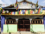 "+
"
"+
" "+
"
"+
" "+
"
"+
" "+
"
"+
"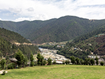 "+
"
"+
" "+
"",
madhuribengali : "মাধুরী লেকঃ-হিমালয়ের মাঝখানে অবস্থিত অরুণাচল প্রদেশে অসংখ্য অত্যাশ্চর্য লেক রয়েছে, তবে কোনটাই মাধুরী লেকের মতো মনোমুগ্ধকর নয়, যা স্থানীয়ভাবে সংগেষ্টার সো নামেও পরিচিত। তাওয়াং থেকে প্রায় ৩০ কিলোমিটার উত্তর-পূর্বে বুমলা পাস যাওয়ার পথে, ভারত-চীন সীমান্তের কাছে অবস্থিত, এই প্রত্যন্ত লেক সমুদ্রপৃষ্ঠ থেকে ১২,১৬৫ ফুট উচ্চতায় অবস্থিত। পাথুরে পর্বতমালার মাঝখানে অবস্থিত এর অপূর্ব সৌন্দর্য, ১৯৯৭ সালে বলিউড সিনেমা কয়লা অভিনীত হওয়ার পর খ্যাতি অর্জন করে। চলচ্চিত্রের প্রধান অভিনেত্রী মাধুরী দীক্ষিতের নামানুসারে এর কথ্য নাম রাখা হয় মাধুরী লেক। ১৯৫০ সালে একটা বড় ভূমিকম্পের ফলে আকস্মিক বন্যা হয়েছিল, এবং পাথর ও গাছপালা ভেঙে পড়ে এর সৃষ্টি হয়। মাধুরী লেক, উঁচু হিমালয় শৃঙ্গ দ্বারা বেষ্টিত। হাওয়ায় মৃদু আন্দোলিত স্ফটিক-স্বচ্ছ জলরাশির সাথে, শান্ত পরিবেশ, লম্বা লম্বা গাছের সারি, সবুজের ঘেরাটোপ, একটা পরাবাস্তব অনুভব তৈরি করে। ভারতীয় এবং তিব্বতি বৌদ্ধ, উভয়ের জন্যেই এই লেক অত্যন্ত তাৎপর্যপূর্ণ, যারা প্রতি বছর প্রার্থনার উদ্দেশ্যে এখানে আসেন। এটা প্রকৃতির সত্যিকারের এক বিস্ময়। মাধুরী লেক দর্শনার্থীদের মোহিত করে, তাদের প্রাকৃতিক সৌন্দর্যে মুগ্ধ করে, এবং মানসিকভাবে পুনরুজ্জীবিত করে। এখানকার আশেপাশের বনভূমিও বেশ সুন্দর। বসন্তকালে এই অঞ্চল বিভিন্ন রঙের রডোডেনড্রন ও অন্যান্য ফুলে ভরে যায়। আশেপাশের রুক্ষ এবং দুর্গম ভূখণ্ড, প্রায়শই অ্যাডভেঞ্চার প্রেমীদের আকর্ষণ করে। লেকের থেকে বেশ কয়েকটা উত্তেজনাপূর্ণ ট্রেকিং-এর রাস্তা ও ক্যাম্পিং স্পট আছে। এই অঞ্চল পাখি দেখার জন্যেও উপযুক্ত। ভারত-চীন সীমান্তের কাছাকাছি হওয়ায় অঞ্চলটা সংবেদনশীল। তাই এখানে প্রবেশ করার জন্যে, তাওয়াং-এর ভারতীয় সেনানিবাস, অথবা তাওয়াং জেলার ডেপুটি কমিশনারের অফিস থেকে, একটা বিশেষ অনুমতিপত্র নিতে হয়। ভারতীয় সেনাবাহিনী লেকের কাছে একটা আরামদায়ক ক্যাফেটেরিয়া তৈরি করেছে, যেখানে পর্যটকরা সামান্য খরচায় চা, কফি, ম্যাগি নুডলস, মোমো, এবং পরোটার, মতো খাবার উপভোগ করতে পারেন। "+
"Read More..."+
"
"+
"",
madhuribengali : "মাধুরী লেকঃ-হিমালয়ের মাঝখানে অবস্থিত অরুণাচল প্রদেশে অসংখ্য অত্যাশ্চর্য লেক রয়েছে, তবে কোনটাই মাধুরী লেকের মতো মনোমুগ্ধকর নয়, যা স্থানীয়ভাবে সংগেষ্টার সো নামেও পরিচিত। তাওয়াং থেকে প্রায় ৩০ কিলোমিটার উত্তর-পূর্বে বুমলা পাস যাওয়ার পথে, ভারত-চীন সীমান্তের কাছে অবস্থিত, এই প্রত্যন্ত লেক সমুদ্রপৃষ্ঠ থেকে ১২,১৬৫ ফুট উচ্চতায় অবস্থিত। পাথুরে পর্বতমালার মাঝখানে অবস্থিত এর অপূর্ব সৌন্দর্য, ১৯৯৭ সালে বলিউড সিনেমা কয়লা অভিনীত হওয়ার পর খ্যাতি অর্জন করে। চলচ্চিত্রের প্রধান অভিনেত্রী মাধুরী দীক্ষিতের নামানুসারে এর কথ্য নাম রাখা হয় মাধুরী লেক। ১৯৫০ সালে একটা বড় ভূমিকম্পের ফলে আকস্মিক বন্যা হয়েছিল, এবং পাথর ও গাছপালা ভেঙে পড়ে এর সৃষ্টি হয়। মাধুরী লেক, উঁচু হিমালয় শৃঙ্গ দ্বারা বেষ্টিত। হাওয়ায় মৃদু আন্দোলিত স্ফটিক-স্বচ্ছ জলরাশির সাথে, শান্ত পরিবেশ, লম্বা লম্বা গাছের সারি, সবুজের ঘেরাটোপ, একটা পরাবাস্তব অনুভব তৈরি করে। ভারতীয় এবং তিব্বতি বৌদ্ধ, উভয়ের জন্যেই এই লেক অত্যন্ত তাৎপর্যপূর্ণ, যারা প্রতি বছর প্রার্থনার উদ্দেশ্যে এখানে আসেন। এটা প্রকৃতির সত্যিকারের এক বিস্ময়। মাধুরী লেক দর্শনার্থীদের মোহিত করে, তাদের প্রাকৃতিক সৌন্দর্যে মুগ্ধ করে, এবং মানসিকভাবে পুনরুজ্জীবিত করে। এখানকার আশেপাশের বনভূমিও বেশ সুন্দর। বসন্তকালে এই অঞ্চল বিভিন্ন রঙের রডোডেনড্রন ও অন্যান্য ফুলে ভরে যায়। আশেপাশের রুক্ষ এবং দুর্গম ভূখণ্ড, প্রায়শই অ্যাডভেঞ্চার প্রেমীদের আকর্ষণ করে। লেকের থেকে বেশ কয়েকটা উত্তেজনাপূর্ণ ট্রেকিং-এর রাস্তা ও ক্যাম্পিং স্পট আছে। এই অঞ্চল পাখি দেখার জন্যেও উপযুক্ত। ভারত-চীন সীমান্তের কাছাকাছি হওয়ায় অঞ্চলটা সংবেদনশীল। তাই এখানে প্রবেশ করার জন্যে, তাওয়াং-এর ভারতীয় সেনানিবাস, অথবা তাওয়াং জেলার ডেপুটি কমিশনারের অফিস থেকে, একটা বিশেষ অনুমতিপত্র নিতে হয়। ভারতীয় সেনাবাহিনী লেকের কাছে একটা আরামদায়ক ক্যাফেটেরিয়া তৈরি করেছে, যেখানে পর্যটকরা সামান্য খরচায় চা, কফি, ম্যাগি নুডলস, মোমো, এবং পরোটার, মতো খাবার উপভোগ করতে পারেন। "+
"Read More..."+
" "+
"
"+
"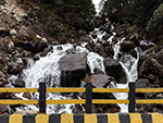 "+
"
"+
" "+
"
"+
" "+
"
"+
" "+
"
"+
" "+
"
"+
" "+
"
"+
" "+
"",
sangtibengali : "সাংতি উপত্যকাঃ-সাংতি উপত্যকা অরুণাচলের একটা সুপরিচিত পর্যটন কেন্দ্র, কিন্তু খুব বেশি পর্যটক এখানে আসে না। সাংতি উপত্যকায় পর্যটকদের সংখ্যা খুবই কম। কিন্তু সঙ্গিনীর সাথে জায়গাটা ভ্রমণের জন্যে খুবই উপযুক্ত। এই স্বর্গীয় জায়গাটা সুন্দর পাহাড়ি শৃঙ্গ দ্বারা বেষ্টিত, এবং মাঝে মাঝে হালকা তুষারপাত ছাড়া, সবসময়ই আবহাওয়া মনোরম থাকে। যদি কেউ সবুজ বনাঞ্চল, খরস্রোতা পাহাড়ি নদী, আকর্ষণীয় আদিবাসী সংস্কৃতি এবং ঐতিহ্য, এবং অ্যাডভেঞ্চারের এক নিখুঁত মিশ্রণ পছন্দ করে, যা এখনও পর্যটনের দ্বারা অস্পৃর্শিত, তাহলে অরুণাচল প্রদেশের একটা লুকনো রত্ন সাংতি উপত্যকা হচ্ছে সেই নির্ভুল ঠিকানা। দিরাং শহর থেকে প্রায় ১৫ কিলোমিটার দূরে সাংতি উপত্যকা হলো, অরুণাচল প্রদেশের পশ্চিম কামেং জেলায় অবস্থিত এক মনোরম অঞ্চল। এই উপত্যকা সবুজ তৃণভূমি, ঢালু পাহাড়, পাইন বন, তুষারাবৃত পাহাড় দ্বারা বেষ্টিত, আর অরুণাচল প্রদেশের প্রাচীনতম এবং সবচেয়ে রঙিন উপজাতি, মনপাদের আবাসস্থল। অঞ্চলটা পক্ষী প্রেমীদের জন্যেও একটা স্বর্গ, কারণ তিব্বত এবং চীন থেকে শীতকালীন অভিবাসনের সময় বিপন্ন কালো গলার সারসদের আবাসস্থল।সাংতি উপত্যকা কেবল একটা জায়গা নয়, এটা একটা অভিজ্ঞতা, যা মানুষের জ্ঞানকোষে সঞ্চিত হয়। এই উপত্যকা উদ্ভিদ এবং প্রাণীজগতে সমৃদ্ধ। এখানে বিভিন্ন ফলের বাগান, যেমন আপেল, আখরোট, পীচ, ইত্যাদি পাওয়া যায়। কাছাকাছি বনাঞ্চলে লাল পাণ্ডা, কালো হিমালয়ান ভালুক, উড়ন্ত কাঠবিড়ালি ইত্যাদির মতো কিছু বিরল প্রাণীও দেখা যায়। কিছু ঔষধি গাছ এবং ভেষজ উদ্ভিদও রয়েছে, যেমন অ্যাকোনাইট, জেন্টিয়ান ইত্যাদি, যা স্থানীয়রা রোগ নিরাময়ের উদ্দেশ্যে ব্যবহার করে।সাংতি উপত্যকা হাতে গোনা কয়েকটা স্থানের মধ্যে একটা, যা বহির্বিশ্বের দ্বারা অনাবিষ্কৃত এবং অস্পর্শিত রয়ে গেছে। উপত্যকার একটা অনন্য আকর্ষণ রয়েছে যা অন্য কোথাও খুঁজে পাওয়া কঠিন। এখানকার এক সমৃদ্ধ এবং বৈচিত্র্যময় সংস্কৃতি, ইতিহাস এবং ঐতিহ্য রয়েছে, যা এর স্থাপত্য, রন্ধনপ্রণালী, উৎসব, কারুশিল্প ও অন্যান্য সামাজিক রীতিনীতিতে প্রতিফলিত হয়। পরিবেশের সাথে সামঞ্জস্য রেখে মনপাদের তৈরি পাথর এবং কাঠের ঐতিহ্যবাহী ঘরগুলো, পাহাড়ি পটভূমিতে দেখতে ছবির মতো লাগে। যদি পছন্দ হয় তবে স্থানীয় সুস্বাদু খাবার যেমন মোমো, থুকপা ইত্যাদির স্বাদও নেওয়া যেতে পারে, যা তাজা এবং জৈব উপাদান দিয়ে তৈরি। স্থানীয় উৎসব যেমন লোসার, চোসকার ইত্যাদিও মনপা জীবনযাত্রার একটা দিক। স্থানীয় হস্তশিল্প, যেমন কার্পেট, মুখোশ, চিত্রকর্ম ইত্যাদি, মনপা মানুষজনের শৈল্পিক দক্ষতা প্রদর্শন করে।সাংতি উপত্যকা কেবল দেখার জায়গা নয়, বরং অনুভূতির জায়গাও। এই উপত্যকা স্থানীয়দের সাথে আলাপচারিতা এবং তাদের সংস্কৃতি, ঐতিহ্য এবং বিশ্বাস সম্পর্কে জানার, এক বিরল সুযোগ করে দেয়। মনপা মানুষ খুবই বন্ধুত্বপূর্ণ, অতিথিপরায়ণ এবং স্বাগতপূর্ণ। তারা সর্বদা দর্শনার্থীদের সাথে তাদের গল্প, জ্ঞান এবং প্রজ্ঞা ভাগ করে নিতে চায়।কোন এক হোমস্টেতে থেকে মনপা জীবনধারা সরাসরি অনুভব করা যায়। তাদের কৃষি অনুশীলন এবং কৌশল সম্পর্কে জ্ঞানার্জন করা যায়। কোনও সাংস্কৃতিক অনুষ্ঠানে তাদের সঙ্গীত, নৃত্য এবং নাটক উপভোগ করা যেতে পারে। আবার কোনও মঠ পরিদর্শন করে মনপাদের বৌদ্ধ দর্শন এবং শিক্ষা সম্পর্কে জ্ঞানলাভ করা যায়।সাংতি উপত্যকা সারা বছর ধরে ভ্রমণের জন্যে উপযুক্ত, তবে শীতের মাসগুলোতে জায়গাটা আরও জাদুকরী হয়ে ওঠে। তাপমাত্রা শূন্যের নিচে নেমে গেলে, উপত্যকাটা তুষারে ঢাকা পড়ে যায়, ও শীতকালীন আশ্চর্যভূমিতে রূপান্তরিত হয়। তুষার উপত্যকার সৌন্দর্য এবং মনোমুগ্ধতায় এক নতুন মাত্রা যোগ করে। এখান থেকে গোরিচেন, কাংটো ইত্যাদি তুষারাবৃত পাহাড়ের অত্যাশ্চর্য দৃশ্য উপভোগ করা যায়। আবার হিমায়িত সাংতি নদী, সবুজ তৃণভূমির সাথে এক মনোমুগ্ধকর বৈপরীত্য তৈরি করে।সাংতি উপত্যকা ভারতের হাতে গোনা কয়েকটা স্থানের মধ্যে একটা যেখানে বিপন্ন কালো গলাওয়ালা সারস দেখতে পাওয়া যায়। মনপা ভাষায় এরা ট্রুং-ট্রুং নামেও পরিচিত। এই সারসগুলো মনপা সংস্কৃতি এবং মহাযান বৌদ্ধধর্মে, শান্তি, সমৃদ্ধি এবং সুখের প্রতীক। স্থানীয়রা এগুলোকে অত্যন্ত শ্রদ্ধা করে, এবং সুরক্ষিত রাখে। কালো গলার সারসগুলো নভেম্বরের দিকে সাংতি উপত্যকায় আসে, এবং মার্চ মাস পর্যন্ত থাকে। এগুলো মাঠে, নদীর ধারে, বা আকাশে উড়তে দেখা যায়। এদের উপস্থিতি উপত্যকার মনোমুগ্ধকর দৃশ্যগুলোকে আরও বাড়িয়ে তোলে। "+
"Read More..."+
"
"+
"",
sangtibengali : "সাংতি উপত্যকাঃ-সাংতি উপত্যকা অরুণাচলের একটা সুপরিচিত পর্যটন কেন্দ্র, কিন্তু খুব বেশি পর্যটক এখানে আসে না। সাংতি উপত্যকায় পর্যটকদের সংখ্যা খুবই কম। কিন্তু সঙ্গিনীর সাথে জায়গাটা ভ্রমণের জন্যে খুবই উপযুক্ত। এই স্বর্গীয় জায়গাটা সুন্দর পাহাড়ি শৃঙ্গ দ্বারা বেষ্টিত, এবং মাঝে মাঝে হালকা তুষারপাত ছাড়া, সবসময়ই আবহাওয়া মনোরম থাকে। যদি কেউ সবুজ বনাঞ্চল, খরস্রোতা পাহাড়ি নদী, আকর্ষণীয় আদিবাসী সংস্কৃতি এবং ঐতিহ্য, এবং অ্যাডভেঞ্চারের এক নিখুঁত মিশ্রণ পছন্দ করে, যা এখনও পর্যটনের দ্বারা অস্পৃর্শিত, তাহলে অরুণাচল প্রদেশের একটা লুকনো রত্ন সাংতি উপত্যকা হচ্ছে সেই নির্ভুল ঠিকানা। দিরাং শহর থেকে প্রায় ১৫ কিলোমিটার দূরে সাংতি উপত্যকা হলো, অরুণাচল প্রদেশের পশ্চিম কামেং জেলায় অবস্থিত এক মনোরম অঞ্চল। এই উপত্যকা সবুজ তৃণভূমি, ঢালু পাহাড়, পাইন বন, তুষারাবৃত পাহাড় দ্বারা বেষ্টিত, আর অরুণাচল প্রদেশের প্রাচীনতম এবং সবচেয়ে রঙিন উপজাতি, মনপাদের আবাসস্থল। অঞ্চলটা পক্ষী প্রেমীদের জন্যেও একটা স্বর্গ, কারণ তিব্বত এবং চীন থেকে শীতকালীন অভিবাসনের সময় বিপন্ন কালো গলার সারসদের আবাসস্থল।সাংতি উপত্যকা কেবল একটা জায়গা নয়, এটা একটা অভিজ্ঞতা, যা মানুষের জ্ঞানকোষে সঞ্চিত হয়। এই উপত্যকা উদ্ভিদ এবং প্রাণীজগতে সমৃদ্ধ। এখানে বিভিন্ন ফলের বাগান, যেমন আপেল, আখরোট, পীচ, ইত্যাদি পাওয়া যায়। কাছাকাছি বনাঞ্চলে লাল পাণ্ডা, কালো হিমালয়ান ভালুক, উড়ন্ত কাঠবিড়ালি ইত্যাদির মতো কিছু বিরল প্রাণীও দেখা যায়। কিছু ঔষধি গাছ এবং ভেষজ উদ্ভিদও রয়েছে, যেমন অ্যাকোনাইট, জেন্টিয়ান ইত্যাদি, যা স্থানীয়রা রোগ নিরাময়ের উদ্দেশ্যে ব্যবহার করে।সাংতি উপত্যকা হাতে গোনা কয়েকটা স্থানের মধ্যে একটা, যা বহির্বিশ্বের দ্বারা অনাবিষ্কৃত এবং অস্পর্শিত রয়ে গেছে। উপত্যকার একটা অনন্য আকর্ষণ রয়েছে যা অন্য কোথাও খুঁজে পাওয়া কঠিন। এখানকার এক সমৃদ্ধ এবং বৈচিত্র্যময় সংস্কৃতি, ইতিহাস এবং ঐতিহ্য রয়েছে, যা এর স্থাপত্য, রন্ধনপ্রণালী, উৎসব, কারুশিল্প ও অন্যান্য সামাজিক রীতিনীতিতে প্রতিফলিত হয়। পরিবেশের সাথে সামঞ্জস্য রেখে মনপাদের তৈরি পাথর এবং কাঠের ঐতিহ্যবাহী ঘরগুলো, পাহাড়ি পটভূমিতে দেখতে ছবির মতো লাগে। যদি পছন্দ হয় তবে স্থানীয় সুস্বাদু খাবার যেমন মোমো, থুকপা ইত্যাদির স্বাদও নেওয়া যেতে পারে, যা তাজা এবং জৈব উপাদান দিয়ে তৈরি। স্থানীয় উৎসব যেমন লোসার, চোসকার ইত্যাদিও মনপা জীবনযাত্রার একটা দিক। স্থানীয় হস্তশিল্প, যেমন কার্পেট, মুখোশ, চিত্রকর্ম ইত্যাদি, মনপা মানুষজনের শৈল্পিক দক্ষতা প্রদর্শন করে।সাংতি উপত্যকা কেবল দেখার জায়গা নয়, বরং অনুভূতির জায়গাও। এই উপত্যকা স্থানীয়দের সাথে আলাপচারিতা এবং তাদের সংস্কৃতি, ঐতিহ্য এবং বিশ্বাস সম্পর্কে জানার, এক বিরল সুযোগ করে দেয়। মনপা মানুষ খুবই বন্ধুত্বপূর্ণ, অতিথিপরায়ণ এবং স্বাগতপূর্ণ। তারা সর্বদা দর্শনার্থীদের সাথে তাদের গল্প, জ্ঞান এবং প্রজ্ঞা ভাগ করে নিতে চায়।কোন এক হোমস্টেতে থেকে মনপা জীবনধারা সরাসরি অনুভব করা যায়। তাদের কৃষি অনুশীলন এবং কৌশল সম্পর্কে জ্ঞানার্জন করা যায়। কোনও সাংস্কৃতিক অনুষ্ঠানে তাদের সঙ্গীত, নৃত্য এবং নাটক উপভোগ করা যেতে পারে। আবার কোনও মঠ পরিদর্শন করে মনপাদের বৌদ্ধ দর্শন এবং শিক্ষা সম্পর্কে জ্ঞানলাভ করা যায়।সাংতি উপত্যকা সারা বছর ধরে ভ্রমণের জন্যে উপযুক্ত, তবে শীতের মাসগুলোতে জায়গাটা আরও জাদুকরী হয়ে ওঠে। তাপমাত্রা শূন্যের নিচে নেমে গেলে, উপত্যকাটা তুষারে ঢাকা পড়ে যায়, ও শীতকালীন আশ্চর্যভূমিতে রূপান্তরিত হয়। তুষার উপত্যকার সৌন্দর্য এবং মনোমুগ্ধতায় এক নতুন মাত্রা যোগ করে। এখান থেকে গোরিচেন, কাংটো ইত্যাদি তুষারাবৃত পাহাড়ের অত্যাশ্চর্য দৃশ্য উপভোগ করা যায়। আবার হিমায়িত সাংতি নদী, সবুজ তৃণভূমির সাথে এক মনোমুগ্ধকর বৈপরীত্য তৈরি করে।সাংতি উপত্যকা ভারতের হাতে গোনা কয়েকটা স্থানের মধ্যে একটা যেখানে বিপন্ন কালো গলাওয়ালা সারস দেখতে পাওয়া যায়। মনপা ভাষায় এরা ট্রুং-ট্রুং নামেও পরিচিত। এই সারসগুলো মনপা সংস্কৃতি এবং মহাযান বৌদ্ধধর্মে, শান্তি, সমৃদ্ধি এবং সুখের প্রতীক। স্থানীয়রা এগুলোকে অত্যন্ত শ্রদ্ধা করে, এবং সুরক্ষিত রাখে। কালো গলার সারসগুলো নভেম্বরের দিকে সাংতি উপত্যকায় আসে, এবং মার্চ মাস পর্যন্ত থাকে। এগুলো মাঠে, নদীর ধারে, বা আকাশে উড়তে দেখা যায়। এদের উপস্থিতি উপত্যকার মনোমুগ্ধকর দৃশ্যগুলোকে আরও বাড়িয়ে তোলে। "+
"Read More..."+
" "+
"
"+
" "+
"
"+
" "+
"
"+
" "+
"
"+
" "+
"
"+
" "+
"
"+
" "+
"
"+
" "+
"",
selabengali : "সেলা পাসঃ-সেলা পাস হল অরুণাচল প্রদেশের তাওয়াং এবং পশ্চিম কামেং জেলার সীমান্তে অবস্থিত একটা উচ্চ-উচ্চতার গিরিপথ। সমুদ্রপৃষ্ঠ থেকে ১৩,৭০০ ফুট উচ্চতায় অবস্থিত এই গিরিপথ, বৌদ্ধ শহর তাওয়াংকে, দিরাং, বমডিলা, ভালুকপং সহ দেশের অন্যান্য অংশের সাথে সংযুক্ত করার একটা গুরুত্বপূর্ণ রাস্তা হিসেবে কাজ করে। এই গিরিপথ জাতীয় মহাসড়ক ১৩ বা ট্রান্স অরুণাচল হাইওয়ে বলেও পরিচিত। এটা হিমালয়ের সবচেয়ে প্রতীকী এবং কৌশলগতভাবে গুরুত্বপূর্ণ গিরিপথগুলোর মধ্যে একটা। এই গিরিপথ, পূর্ব হিমালয় পর্বতমালার অত্যাশ্চর্য প্যানোরামিক দৃশ্যের জন্যে বিখ্যাত। ভূদৃশ্য প্রায়শই নাটকীয়, যার মধ্যে রয়েছে রাজকীয় শৃঙ্গগুলো, যা বছরের বেশিরভাগ সময়ই তুষারাবৃত থাকে। সেলা পাসের প্রতিদ্বন্দ্বিহীন সৌন্দর্য, তার আদিম প্রাকৃতিক দৃশ্য, এবং সেলা হ্রদের অলৌকিক প্রশান্তি, মানুষকে সম্মোহিত করে তোলে। সেলা পাস এবং আশেপাশের লেকগুলোকে স্থানীয় মনপা জনগণ এবং তিব্বতি বৌদ্ধরা অত্যন্ত সম্মান করে। প্রায় প্রত্যেক লেকের কাছে তারা প্রার্থনা পতাকা লাগিয়ে, এই অঞ্চলের আধ্যাত্মিক গুরুত্বের দিক নির্দেশ করে।সেলা পাসের সবচেয়ে উল্লেখযোগ্য বৈশিষ্ট্য হল সুন্দর সেলা লেক, যা প্রায়শই প্যারাডাইস লেক নামে পরিচিত। এটা ১৩,৬৫০ ফুট উচ্চতায়, গিরিপথের উত্তর দিকে অবস্থিত একটা বিশাল লেক। তিব্বতি বৌদ্ধধর্মে পবিত্র বলে বিবেচিত এই এলাকার ১০১টা হ্রদের মধ্যে এটা একটা। এই পবিত্র লেক শীতকালে জমে গিয়ে এক বিশাল অলৌকিক রূপালী আয়না তৈরি করে। অতি উচ্চতা এবং চরম অবস্থার কারণে, এখানে গাছপালা খুবই কম, যা ভূদৃশ্যকে একটা রুক্ষ সৌন্দর্য দেয়। তবে বসন্তকালে এই অঞ্চল রডোডেনড্রন এবং অন্যান্য অ্যালপাইন উদ্ভিদে পরিপূর্ণ হয়ে যায়, যা ভূদৃশ্যকে রঙিন প্রাণবন্ত দৃশ্যে রূপান্তরিত করে। এখানকার কিছু উচ্চ এলাকা সারা বছরই তুষারাবৃত থাকে, ফলে গ্রীষ্মকাল খুব গরম নয়, তবে শীতকালে তাপমাত্রা মাইনাস দশ ডিগ্রি সেলসিয়াস পর্যন্ত নেমে যায়।যদিও বর্ডার রোডস অর্গানাইজেশন সারা বছর গিরিপথ খোলা রাখার জন্যে কাজ করে যায়, তবে ধ্বস বা ভারী তুষারপাতের কারণে, এটা কখনও কখনও সাময়িকভাবে বন্ধ হয়ে যায়। সেলা পাস একটা পাহাড়ি গিরিপথের চেয়েও অনেক বেশি কিছু। এটা শুধুমাত্র একটা গুরুত্বপূর্ণ সংযোগকারী গিরিপথই নয়, অপরিসীম প্রাকৃতিক সৌন্দর্যের স্থান, অরুণাচল প্রদেশের সামরিক কৌশলগত অবস্থান, আধ্যাত্মিক অনুভূতির চর্চা, এবং চ্যালেঞ্জিং ভূখণ্ডের মুখোমুখি মানুষের স্থিতিস্থাপকতার এক প্রতীক। এই গিরিপথ ভারতীয় সেনাবাহিনীর এক ধমনী, যা চীন ও অন্যান্য দেশের সীমান্তবর্তী অঞ্চলে, সৈন্য এবং সরবরাহের চলাচলকে সহজতর করে। সম্প্রতি উদ্বোধন করা সেলা টানেল, প্রায়শই ঝুঁকিপূর্ণ তুষারাবৃত সেলা পাসকে বাইপাস করে, একটা সর্ব-আবহাওয়ায় যোগাযোগের ব্যবস্থা প্রদান করেছে। এটা আরও দ্রুত এবং দক্ষ পরিবহন নিশ্চিত করেছে, যা জাতীয় নিরাপত্তার জন্যে অত্যন্ত গুরুত্বপূর্ণ।এই পাস ঐতিহাসিক গুরুত্বও বহন করে। ১৯৬২ সালের চীন-ভারত যুদ্ধের সময় উল্লেখযোগ্য ঘটনাবলীর একটা স্থান ছিল এই সেলা পাস। চীনা সৈন্যদের বিরুদ্ধে বীরত্বের সাথে লড়াই করে শহীদ হওয়া রাইফেলম্যান যশবন্ত সিং রাওয়াতের নামে উৎসর্গীকৃত, যশবন্ত গড় নামক যুদ্ধ স্মারক, এই গিরিপথের কাছেই অবস্থিত, এবং এটা ভারতীয় সেনাবাহিনীর সাহসিকতা এবং আত্মত্যাগের প্রমাণ। এখানে ভারতীয় সেনাবাহিনী দ্বারা রক্ষণাবেক্ষণ করা একটা ছোট ক্যাফেটেরিয়া রয়েছে, যেখানে চা, কফি, ম্যাগি ইত্যাদি সরবরাহ করা হয়। তবে তা বছরের সব সময় খোলা থাকে না। "+
"Read More..."+
"
"+
"",
selabengali : "সেলা পাসঃ-সেলা পাস হল অরুণাচল প্রদেশের তাওয়াং এবং পশ্চিম কামেং জেলার সীমান্তে অবস্থিত একটা উচ্চ-উচ্চতার গিরিপথ। সমুদ্রপৃষ্ঠ থেকে ১৩,৭০০ ফুট উচ্চতায় অবস্থিত এই গিরিপথ, বৌদ্ধ শহর তাওয়াংকে, দিরাং, বমডিলা, ভালুকপং সহ দেশের অন্যান্য অংশের সাথে সংযুক্ত করার একটা গুরুত্বপূর্ণ রাস্তা হিসেবে কাজ করে। এই গিরিপথ জাতীয় মহাসড়ক ১৩ বা ট্রান্স অরুণাচল হাইওয়ে বলেও পরিচিত। এটা হিমালয়ের সবচেয়ে প্রতীকী এবং কৌশলগতভাবে গুরুত্বপূর্ণ গিরিপথগুলোর মধ্যে একটা। এই গিরিপথ, পূর্ব হিমালয় পর্বতমালার অত্যাশ্চর্য প্যানোরামিক দৃশ্যের জন্যে বিখ্যাত। ভূদৃশ্য প্রায়শই নাটকীয়, যার মধ্যে রয়েছে রাজকীয় শৃঙ্গগুলো, যা বছরের বেশিরভাগ সময়ই তুষারাবৃত থাকে। সেলা পাসের প্রতিদ্বন্দ্বিহীন সৌন্দর্য, তার আদিম প্রাকৃতিক দৃশ্য, এবং সেলা হ্রদের অলৌকিক প্রশান্তি, মানুষকে সম্মোহিত করে তোলে। সেলা পাস এবং আশেপাশের লেকগুলোকে স্থানীয় মনপা জনগণ এবং তিব্বতি বৌদ্ধরা অত্যন্ত সম্মান করে। প্রায় প্রত্যেক লেকের কাছে তারা প্রার্থনা পতাকা লাগিয়ে, এই অঞ্চলের আধ্যাত্মিক গুরুত্বের দিক নির্দেশ করে।সেলা পাসের সবচেয়ে উল্লেখযোগ্য বৈশিষ্ট্য হল সুন্দর সেলা লেক, যা প্রায়শই প্যারাডাইস লেক নামে পরিচিত। এটা ১৩,৬৫০ ফুট উচ্চতায়, গিরিপথের উত্তর দিকে অবস্থিত একটা বিশাল লেক। তিব্বতি বৌদ্ধধর্মে পবিত্র বলে বিবেচিত এই এলাকার ১০১টা হ্রদের মধ্যে এটা একটা। এই পবিত্র লেক শীতকালে জমে গিয়ে এক বিশাল অলৌকিক রূপালী আয়না তৈরি করে। অতি উচ্চতা এবং চরম অবস্থার কারণে, এখানে গাছপালা খুবই কম, যা ভূদৃশ্যকে একটা রুক্ষ সৌন্দর্য দেয়। তবে বসন্তকালে এই অঞ্চল রডোডেনড্রন এবং অন্যান্য অ্যালপাইন উদ্ভিদে পরিপূর্ণ হয়ে যায়, যা ভূদৃশ্যকে রঙিন প্রাণবন্ত দৃশ্যে রূপান্তরিত করে। এখানকার কিছু উচ্চ এলাকা সারা বছরই তুষারাবৃত থাকে, ফলে গ্রীষ্মকাল খুব গরম নয়, তবে শীতকালে তাপমাত্রা মাইনাস দশ ডিগ্রি সেলসিয়াস পর্যন্ত নেমে যায়।যদিও বর্ডার রোডস অর্গানাইজেশন সারা বছর গিরিপথ খোলা রাখার জন্যে কাজ করে যায়, তবে ধ্বস বা ভারী তুষারপাতের কারণে, এটা কখনও কখনও সাময়িকভাবে বন্ধ হয়ে যায়। সেলা পাস একটা পাহাড়ি গিরিপথের চেয়েও অনেক বেশি কিছু। এটা শুধুমাত্র একটা গুরুত্বপূর্ণ সংযোগকারী গিরিপথই নয়, অপরিসীম প্রাকৃতিক সৌন্দর্যের স্থান, অরুণাচল প্রদেশের সামরিক কৌশলগত অবস্থান, আধ্যাত্মিক অনুভূতির চর্চা, এবং চ্যালেঞ্জিং ভূখণ্ডের মুখোমুখি মানুষের স্থিতিস্থাপকতার এক প্রতীক। এই গিরিপথ ভারতীয় সেনাবাহিনীর এক ধমনী, যা চীন ও অন্যান্য দেশের সীমান্তবর্তী অঞ্চলে, সৈন্য এবং সরবরাহের চলাচলকে সহজতর করে। সম্প্রতি উদ্বোধন করা সেলা টানেল, প্রায়শই ঝুঁকিপূর্ণ তুষারাবৃত সেলা পাসকে বাইপাস করে, একটা সর্ব-আবহাওয়ায় যোগাযোগের ব্যবস্থা প্রদান করেছে। এটা আরও দ্রুত এবং দক্ষ পরিবহন নিশ্চিত করেছে, যা জাতীয় নিরাপত্তার জন্যে অত্যন্ত গুরুত্বপূর্ণ।এই পাস ঐতিহাসিক গুরুত্বও বহন করে। ১৯৬২ সালের চীন-ভারত যুদ্ধের সময় উল্লেখযোগ্য ঘটনাবলীর একটা স্থান ছিল এই সেলা পাস। চীনা সৈন্যদের বিরুদ্ধে বীরত্বের সাথে লড়াই করে শহীদ হওয়া রাইফেলম্যান যশবন্ত সিং রাওয়াতের নামে উৎসর্গীকৃত, যশবন্ত গড় নামক যুদ্ধ স্মারক, এই গিরিপথের কাছেই অবস্থিত, এবং এটা ভারতীয় সেনাবাহিনীর সাহসিকতা এবং আত্মত্যাগের প্রমাণ। এখানে ভারতীয় সেনাবাহিনী দ্বারা রক্ষণাবেক্ষণ করা একটা ছোট ক্যাফেটেরিয়া রয়েছে, যেখানে চা, কফি, ম্যাগি ইত্যাদি সরবরাহ করা হয়। তবে তা বছরের সব সময় খোলা থাকে না। "+
"Read More..."+
" "+
"
"+
" "+
"
"+
" "+
"
"+
" "+
"
"+
" "+
"
"+
" "+
"
"+
" "+
"
"+
" "+
"",
shergaonbengali : "শেরগাঁওঃ-শেরগাঁও হিমালয়ের বুকে লুকিয়ে থাকা এক রত্ন। অরুণাচল প্রদেশের এই গ্রাম, সম্প্রতি রূপালী শ্রেণীর মর্যাদার, ভারতের সেরা পর্যটন গ্রামের খেতাব অর্জন করেছে। এই পুরষ্কার শেরগাঁওয়ের ক্রমবর্ধমান খ্যাতির উপর আলোকপাত করে, যা তার নাতিশীতোষ্ণ জলবায়ু, অত্যাশ্চর্য প্রাকৃতিক সৌন্দর্য, এবং প্রাণবন্ত সাংস্কৃতিক ঐতিহ্যের জন্যে বিখ্যাত।প্রায় নব্বই শতাংশ ঘন বনে ঢাকা বিস্তৃত এলাকা নিয়ে, গ্রামটা প্রকৃতিপ্রেমীদের স্বর্গরাজ্য হয়ে দাঁড়িয়ে আছে। প্রাণবন্ত বন্যফুল, এবং প্রাচীন ওক গাছে সজ্জিত মনোরম দৃশ্যগুলো দেখে মনে হয়, নানা বর্ণে সজ্জিত কোনো এক রঙিন চাদর বেছানো রয়েছে, যা ঋতুর সাথে পরিবর্তনশীল। বাতাসে সুমধুর সুবাস, ফুল ফোটার ইঙ্গিত বহন করে। পদচারণার প্রতি পদক্ষেপের সাথে, পাতার মৃদু মর্মর শব্দ, প্রশান্তির এক সিম্ফনি তৈরি করে, যা মনের মণিকোঠায় স্থায়ী ঠিকানা করে নেয়। এখানকার নাতিশীতোষ্ণ জলবায়ু বছরের যে কোন সময় ঘোরার উপযুক্ত। ছোসখোরং জলপ্রপাতের মনোমুগ্ধকর ক্যাসকেডগুলো ভূদৃশ্যে যোগ করে এক নতুন সৌন্দর্য, অন্যদিকে শান্ত ট্রাউট হ্যাচারির পুকুরে আকাশের প্রতিবিম্বকে আয়নার মতো প্রতিফলিত করে। শেরগাঁও শুধুমাত্র প্রাকৃতিক সৌন্দর্যে পরিপূর্ণ তাই নয়, এখানে উদ্ভিদ, প্রাণী এবং ভূদৃশ্যের এক ঐকতান রয়েছে, যা প্রত্যক্ষ করলে মনে হবে, সময় এখানে স্থির হয়ে আছে।শেরগাঁওয়ের সাংস্কৃতিক উত্তরাধিকার হলো, কয়েক শতাব্দী আগে তিব্বত থেকে চলে আসা শেরদুকপেন উপজাতির ঐতিহ্য। শেরগাঁওয়ের দৈনন্দিন জীবনের সমস্ত দিক, প্রকৃতি এবং ঐতিহ্যের প্রতি গভীর শ্রদ্ধার সাথে অনুরণিত হয়। একটা শক্তিশালী সম্প্রদায়-চেতনায় আবদ্ধ গ্রামবাসীরা, ঐতিহ্যপূর্ণ ক্রো-ছেইকোরের মতো উৎসবে সবাই যোগদান করে। এখানে তরুণ প্রজন্ম পূর্বপুরুষদের নৃত্যের চালচলন এবং গান শেখে, যা প্রাচীন রীতিনীতিতে বোনা জীবনকে প্রবাহমান রাখে। এই উৎসবের সময় গ্রামটা জীবন্ত হয়ে ওঠে। ঐতিহ্যবাহী পোশাক, হাতে বোনা ব্যাগ, এবং পুঁতির গয়না, সমস্ত গ্রামবাসীকে সাজিয়ে তোলে। স্থানীয় অলাভজনক সংস্থা গারুং থুক, এই সাংস্কৃতিক ঐতিহ্য সংরক্ষণে গুরুত্বপূর্ণ ভূমিকা পালন করে। নেচার ইন্টারপ্রেটেশন সেন্টার এবং কালচারাল ইন্টারপ্রেটেশন সেন্টারগুলোর উদ্যোগে, শিশু এবং গ্রামবাসীদের আদি সংস্কৃতির সাথে সংযোগ স্থাপনের একটা মাধ্যম তৈরি করে। গ্রামের জাদুঘরে প্রাচীন বাসনপত্র এবং কৃষি সরঞ্জাম প্রদর্শন করা হয়েছে, যেখানে তাদের পূর্বপুরুষদের জীবনের এক ঝলক দেখা যায়।শেরগাঁও পরিবেশগত স্থায়িত্বের প্রতি অটল প্রতিশ্রুতির প্রতীক। প্রাচীন ঐতিহ্যের সাথে সামঞ্জস্য রেখে, শেরদুকপেন সম্প্রদায় বাণিজ্যিকভাবে গাছ কাটা, এবং পাখি ও প্রজাপতি শিকার, কঠোরভাবে নিষিদ্ধ করেছে। তারা চন্দ্র পঞ্জিকা অনুসরণ করে, প্রকৃতির ভারসাম্যের জন্যে নির্দিষ্ট দিনগুলো আলাদা করে রাখে। ক্ষতিকারক রাসায়নিক ছাড়াই, ঐতিহ্যবাহী মাছ ধরার পদ্ধতিগুলো অবলম্বন করে, জলজ সম্পদের বিকাশ নিশ্চিত করে।তাছাড়া, শেরগাঁও বার্ষিক রডোডেনড্রন উৎসবের মাধ্যমে তার অনন্য জীববৈচিত্র্য উদযাপন করে, যা উদ্ভিদ সংরক্ষণের গুরুত্বের ওপর জোর দেয়। গবেষকদের স্বাগত জানিয়ে, গ্রামটা গর্বের সাথে তার সংরক্ষণ প্রচেষ্টা প্রদর্শন করে। শেরগাঁও মানবতা এবং প্রকৃতির মধ্যে সুরেলা সহাবস্থানের প্রমাণ হিসেবে দাঁড়িয়ে আছে, যা দায়িত্বশীল পর্যটন এবং সবুজ জীবনযাত্রার এক উজ্জ্বল উদাহরণ। শেরগাঁও দ্রুত এক জনপ্রিয় গন্তব্যস্থল হিসেবে আত্মপ্রকাশ করছে, যা দেশী এবং আন্তর্জাতিক উভয় পর্যটককেই আকর্ষণ করে। এখানে থাকার জন্যে অনেক হোমস্টে আছে তবে তা সবই পরিবেশবান্ধব। কাছাকাছি অবস্থিত মোর্শিং, চিলিপাম, রূপা, জিগাঁও, তেনজিংগাঁও এবং মুচাকসিংয়ের মতো আকর্ষণীয় গ্রামগুলো, এর মনোহারিত্বকে আরও বাড়িয়ে তুলেছে। "+
"Read More..."+
"
"+
"",
shergaonbengali : "শেরগাঁওঃ-শেরগাঁও হিমালয়ের বুকে লুকিয়ে থাকা এক রত্ন। অরুণাচল প্রদেশের এই গ্রাম, সম্প্রতি রূপালী শ্রেণীর মর্যাদার, ভারতের সেরা পর্যটন গ্রামের খেতাব অর্জন করেছে। এই পুরষ্কার শেরগাঁওয়ের ক্রমবর্ধমান খ্যাতির উপর আলোকপাত করে, যা তার নাতিশীতোষ্ণ জলবায়ু, অত্যাশ্চর্য প্রাকৃতিক সৌন্দর্য, এবং প্রাণবন্ত সাংস্কৃতিক ঐতিহ্যের জন্যে বিখ্যাত।প্রায় নব্বই শতাংশ ঘন বনে ঢাকা বিস্তৃত এলাকা নিয়ে, গ্রামটা প্রকৃতিপ্রেমীদের স্বর্গরাজ্য হয়ে দাঁড়িয়ে আছে। প্রাণবন্ত বন্যফুল, এবং প্রাচীন ওক গাছে সজ্জিত মনোরম দৃশ্যগুলো দেখে মনে হয়, নানা বর্ণে সজ্জিত কোনো এক রঙিন চাদর বেছানো রয়েছে, যা ঋতুর সাথে পরিবর্তনশীল। বাতাসে সুমধুর সুবাস, ফুল ফোটার ইঙ্গিত বহন করে। পদচারণার প্রতি পদক্ষেপের সাথে, পাতার মৃদু মর্মর শব্দ, প্রশান্তির এক সিম্ফনি তৈরি করে, যা মনের মণিকোঠায় স্থায়ী ঠিকানা করে নেয়। এখানকার নাতিশীতোষ্ণ জলবায়ু বছরের যে কোন সময় ঘোরার উপযুক্ত। ছোসখোরং জলপ্রপাতের মনোমুগ্ধকর ক্যাসকেডগুলো ভূদৃশ্যে যোগ করে এক নতুন সৌন্দর্য, অন্যদিকে শান্ত ট্রাউট হ্যাচারির পুকুরে আকাশের প্রতিবিম্বকে আয়নার মতো প্রতিফলিত করে। শেরগাঁও শুধুমাত্র প্রাকৃতিক সৌন্দর্যে পরিপূর্ণ তাই নয়, এখানে উদ্ভিদ, প্রাণী এবং ভূদৃশ্যের এক ঐকতান রয়েছে, যা প্রত্যক্ষ করলে মনে হবে, সময় এখানে স্থির হয়ে আছে।শেরগাঁওয়ের সাংস্কৃতিক উত্তরাধিকার হলো, কয়েক শতাব্দী আগে তিব্বত থেকে চলে আসা শেরদুকপেন উপজাতির ঐতিহ্য। শেরগাঁওয়ের দৈনন্দিন জীবনের সমস্ত দিক, প্রকৃতি এবং ঐতিহ্যের প্রতি গভীর শ্রদ্ধার সাথে অনুরণিত হয়। একটা শক্তিশালী সম্প্রদায়-চেতনায় আবদ্ধ গ্রামবাসীরা, ঐতিহ্যপূর্ণ ক্রো-ছেইকোরের মতো উৎসবে সবাই যোগদান করে। এখানে তরুণ প্রজন্ম পূর্বপুরুষদের নৃত্যের চালচলন এবং গান শেখে, যা প্রাচীন রীতিনীতিতে বোনা জীবনকে প্রবাহমান রাখে। এই উৎসবের সময় গ্রামটা জীবন্ত হয়ে ওঠে। ঐতিহ্যবাহী পোশাক, হাতে বোনা ব্যাগ, এবং পুঁতির গয়না, সমস্ত গ্রামবাসীকে সাজিয়ে তোলে। স্থানীয় অলাভজনক সংস্থা গারুং থুক, এই সাংস্কৃতিক ঐতিহ্য সংরক্ষণে গুরুত্বপূর্ণ ভূমিকা পালন করে। নেচার ইন্টারপ্রেটেশন সেন্টার এবং কালচারাল ইন্টারপ্রেটেশন সেন্টারগুলোর উদ্যোগে, শিশু এবং গ্রামবাসীদের আদি সংস্কৃতির সাথে সংযোগ স্থাপনের একটা মাধ্যম তৈরি করে। গ্রামের জাদুঘরে প্রাচীন বাসনপত্র এবং কৃষি সরঞ্জাম প্রদর্শন করা হয়েছে, যেখানে তাদের পূর্বপুরুষদের জীবনের এক ঝলক দেখা যায়।শেরগাঁও পরিবেশগত স্থায়িত্বের প্রতি অটল প্রতিশ্রুতির প্রতীক। প্রাচীন ঐতিহ্যের সাথে সামঞ্জস্য রেখে, শেরদুকপেন সম্প্রদায় বাণিজ্যিকভাবে গাছ কাটা, এবং পাখি ও প্রজাপতি শিকার, কঠোরভাবে নিষিদ্ধ করেছে। তারা চন্দ্র পঞ্জিকা অনুসরণ করে, প্রকৃতির ভারসাম্যের জন্যে নির্দিষ্ট দিনগুলো আলাদা করে রাখে। ক্ষতিকারক রাসায়নিক ছাড়াই, ঐতিহ্যবাহী মাছ ধরার পদ্ধতিগুলো অবলম্বন করে, জলজ সম্পদের বিকাশ নিশ্চিত করে।তাছাড়া, শেরগাঁও বার্ষিক রডোডেনড্রন উৎসবের মাধ্যমে তার অনন্য জীববৈচিত্র্য উদযাপন করে, যা উদ্ভিদ সংরক্ষণের গুরুত্বের ওপর জোর দেয়। গবেষকদের স্বাগত জানিয়ে, গ্রামটা গর্বের সাথে তার সংরক্ষণ প্রচেষ্টা প্রদর্শন করে। শেরগাঁও মানবতা এবং প্রকৃতির মধ্যে সুরেলা সহাবস্থানের প্রমাণ হিসেবে দাঁড়িয়ে আছে, যা দায়িত্বশীল পর্যটন এবং সবুজ জীবনযাত্রার এক উজ্জ্বল উদাহরণ। শেরগাঁও দ্রুত এক জনপ্রিয় গন্তব্যস্থল হিসেবে আত্মপ্রকাশ করছে, যা দেশী এবং আন্তর্জাতিক উভয় পর্যটককেই আকর্ষণ করে। এখানে থাকার জন্যে অনেক হোমস্টে আছে তবে তা সবই পরিবেশবান্ধব। কাছাকাছি অবস্থিত মোর্শিং, চিলিপাম, রূপা, জিগাঁও, তেনজিংগাঁও এবং মুচাকসিংয়ের মতো আকর্ষণীয় গ্রামগুলো, এর মনোহারিত্বকে আরও বাড়িয়ে তুলেছে। "+
"Read More..."+
" "+
"
"+
" "+
"
"+
" "+
"
"+
" "+
"
"+
" "+
"
"+
" "+
"
"+
" "+
"
"+
"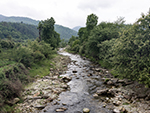 "+
"",
tawangbengali : "তাওয়াংঃ-পূর্ব হিমালয়ের কোলে অবস্থিত, অরুণাচল প্রদেশ, ভারতের উত্তর-পূর্বাঞ্চলের একটা লুকোনো রত্ন। এই মনোরম রাজ্যটা কেবলমাত্র তার মনোমুগ্ধকর প্রাকৃতিক দৃশ্যের জন্যেই নয়, তার সমৃদ্ধ সাংস্কৃতিক ঐতিহ্যের জন্যেও পরিচিত, যা এখানকার মঠগুলোতে স্পষ্টভাবে প্রতিফলিত হয়। অরুণাচল প্রদেশ বিভিন্ন উপজাতি এবং সম্প্রদায়ের আবাসস্থল, যাদের প্রত্যেকের নিজস্ব ও অনন্য, ঐতিহ্য এবং বিশ্বাস রয়েছে।মনপা সম্প্রদায়ের মাতৃভূমি পশ্চিম অরুণাচল প্রদেশের তাওয়াং, উত্তর হিমালয়ের চীন ও ভুটানের আন্তর্জাতিক সীমানায়, এবং সমুদ্রপৃষ্ঠ থেকে ৩,৫০০ মিটার উচ্চতায় অবস্থিত। এই জেলার আয়তন প্রায় ২,১৭২ বর্গকিলোমিটার, যার উত্তরে তিব্বত, দক্ষিণ-পশ্চিমে ভুটান, এবং পূর্বে পশ্চিম কামেং জেলা, যা সেলা রেঞ্জ দ্বারা বিচ্ছিন্ন হয়ে আছে। তুষারাবৃত শৃঙ্গ, মনোরম লেক, অনুকূল জলবায়ু, বন্ধুত্বপূর্ণ মানুষজন, অতিথিপরায়ণ আবেদন, ভ্রমণকারীদের মুগ্ধ করে। এই জাদুকারী ভূমি অসাধারণ পাহাড়ি দৃশ্য, প্রত্যন্ত গ্রাম, ঘুমন্ত পল্লী, পবিত্র গোম্পা, শান্ত লেক এবং মনোমুগ্ধকর পাহাড়ের চিত্র তুলে ধরে। তাওয়াং-এ, প্রকৃতির সাথে স্বর্গীয় সমাযোজন হয়েছে, আর এই জায়গা প্রাচীন ইতিহাস, বিভিন্ন ধর্ম, ও গৌরবময় কিংবদন্তির এক মনোরম মিশ্রণ।তাওয়াং জনপদের পশ্চিম অংশ বরাবর বিস্তৃত পাহাড়ের ধারে অবস্থিত, জমকালো তাওয়াং মঠ থেকে, তাওয়াং এর নামকরণ করা হয়েছে বলে বিশ্বাস করা হয়। তা মানে ঘোড়া এবং ওয়াং মানে মনোনীত। কিংবদন্তি অনুসারে, বর্তমান মঠের স্থানটা মেরা লামা লোদ্রে গ্যাটসোর মালিকানাধীন একটা ঘোড়া দ্বারা নির্বাচিত হয়েছিল বলে মনে করা হয়। উনি মঠ স্থাপনের জন্যে উপযুক্ত স্থান খুঁজছিলেন, কিন্তু কোনও উপযুক্ত স্থান খুঁজে পাননি। তাই অবশেষে তিনি ঐশ্বরিক নির্দেশনার জন্যে প্রার্থনায় বসার সিদ্ধান্ত নেন। প্রার্থনার পর যখন তিনি চোখ খুললেন, তখন তিনি দেখতে পান যে তার ঘোড়াটা নেই। ক্লান্ত হয়ে তিনি তার ঘোড়া খুঁজতে বেরিয়েছিলেন, এবং তানা মান্দেখাং নামে পরিচিত পাহাড়ের চূড়ায় তাকে দেখতে পান, যেখানে একসময় রাজা কালা ওয়াংপোর প্রাসাদ ছিল। এই জায়গাকে শুভ বলে বিশ্বাস করে, মেরা লামা লোদ্রে গ্যাটসো জনগণের সহায়তায়, মঠ নির্মাণের কাজ শুরু করার সিদ্ধান্ত নেন। ১৬৮১ সালের শেষের দিকে মেরা লামা লোদ্রে গ্যাটসো এই মঠ প্রতিষ্ঠা করেছিলেন।তাওয়াং প্রাকৃতিক সম্পদে সমৃদ্ধ, তবে এর একটা সমৃদ্ধ ইতিহাসও রয়েছে। ঐতিহাসিকভাবে, তাওয়াং তিব্বতের একটা অংশ ছিল। পঞ্চম দালাই লামার ইচ্ছা এবং সুপারিশের ফলে, ১৬৮১ সালে তাওয়াং মঠ নির্মাণ করা হয়, যা বর্তমানে লাসার পাটোলা মঠের পরে, বিশ্বের দ্বিতীয় বৃহত্তম মঠ। শিমলা চুক্তি অনুসারে, ১৯১৪ সালে তিব্বত ম্যাকমোহন লাইন নামে পরিচিত একটা সীমান্ত নির্ধারণ করে, যা ব্রিটিশ-অধিকৃত ভারতের কাছে অনেক বর্গকিলোমিটার জমি হারায়। এর মধ্যে তাওয়াং জেলা অন্তর্ভুক্ত এবং এর ফলে তাওয়াং এখন ভারতের একটা অংশ। ম্যাকমোহন লাইন, ভারত ও তিব্বতের মধ্যে একটা চুক্তি ছিল, তবে চীন তাতে সাক্ষর করেনি। তিব্বত দখলের সময় চীন এটাকে আন্তর্জাতিক সীমান্ত হিসেবে কখনও স্বীকৃতি দেয়নি, কারণ তাদের বিশ্বাস যে তিব্বত একটা সার্বভৌম সত্তা নয়, যা এই ধরনের চুক্তি স্বাক্ষর করতে সক্ষম। তবে ঐতিহাসিকভাবে তিব্বত একটা সার্বভৌম অঞ্চল, যা পুরনো ইতিহাস পর্যালোচনা করলে বোঝা যাবে। আর তিব্বতের সাথে ভারতের যোগাযোগ কয়েক হাজার বছরের পুরনো, ফলে চীনের দখলদারি একটা গাজোয়ারি ছাড়া আর কিছু নয়।তাওয়াং-এ ঘোরার জায়গা প্রচুর, তবে সাধারণ পর্যটকরা তাওয়াং মঠ, তাওয়াং ওয়ার মেমোরিয়াল, চাকজ্যাম ব্রিজ, টাকসাঙ্গ গোম্পা, গোরিচেন পর্বতশৃঙ্গ, মাধুরী লেক, নুরান্যাঙ্গ জলপ্রপাত, প্যাংক্যাঙ্গ টেং সো লেক, বুমলা পাস, বাপ টেন ক্যাঙ্গ জলপ্রপাত, ইত্যাদি জায়গায় ঘোরেন। "+
"Read More..."+
"
"+
"",
tawangbengali : "তাওয়াংঃ-পূর্ব হিমালয়ের কোলে অবস্থিত, অরুণাচল প্রদেশ, ভারতের উত্তর-পূর্বাঞ্চলের একটা লুকোনো রত্ন। এই মনোরম রাজ্যটা কেবলমাত্র তার মনোমুগ্ধকর প্রাকৃতিক দৃশ্যের জন্যেই নয়, তার সমৃদ্ধ সাংস্কৃতিক ঐতিহ্যের জন্যেও পরিচিত, যা এখানকার মঠগুলোতে স্পষ্টভাবে প্রতিফলিত হয়। অরুণাচল প্রদেশ বিভিন্ন উপজাতি এবং সম্প্রদায়ের আবাসস্থল, যাদের প্রত্যেকের নিজস্ব ও অনন্য, ঐতিহ্য এবং বিশ্বাস রয়েছে।মনপা সম্প্রদায়ের মাতৃভূমি পশ্চিম অরুণাচল প্রদেশের তাওয়াং, উত্তর হিমালয়ের চীন ও ভুটানের আন্তর্জাতিক সীমানায়, এবং সমুদ্রপৃষ্ঠ থেকে ৩,৫০০ মিটার উচ্চতায় অবস্থিত। এই জেলার আয়তন প্রায় ২,১৭২ বর্গকিলোমিটার, যার উত্তরে তিব্বত, দক্ষিণ-পশ্চিমে ভুটান, এবং পূর্বে পশ্চিম কামেং জেলা, যা সেলা রেঞ্জ দ্বারা বিচ্ছিন্ন হয়ে আছে। তুষারাবৃত শৃঙ্গ, মনোরম লেক, অনুকূল জলবায়ু, বন্ধুত্বপূর্ণ মানুষজন, অতিথিপরায়ণ আবেদন, ভ্রমণকারীদের মুগ্ধ করে। এই জাদুকারী ভূমি অসাধারণ পাহাড়ি দৃশ্য, প্রত্যন্ত গ্রাম, ঘুমন্ত পল্লী, পবিত্র গোম্পা, শান্ত লেক এবং মনোমুগ্ধকর পাহাড়ের চিত্র তুলে ধরে। তাওয়াং-এ, প্রকৃতির সাথে স্বর্গীয় সমাযোজন হয়েছে, আর এই জায়গা প্রাচীন ইতিহাস, বিভিন্ন ধর্ম, ও গৌরবময় কিংবদন্তির এক মনোরম মিশ্রণ।তাওয়াং জনপদের পশ্চিম অংশ বরাবর বিস্তৃত পাহাড়ের ধারে অবস্থিত, জমকালো তাওয়াং মঠ থেকে, তাওয়াং এর নামকরণ করা হয়েছে বলে বিশ্বাস করা হয়। তা মানে ঘোড়া এবং ওয়াং মানে মনোনীত। কিংবদন্তি অনুসারে, বর্তমান মঠের স্থানটা মেরা লামা লোদ্রে গ্যাটসোর মালিকানাধীন একটা ঘোড়া দ্বারা নির্বাচিত হয়েছিল বলে মনে করা হয়। উনি মঠ স্থাপনের জন্যে উপযুক্ত স্থান খুঁজছিলেন, কিন্তু কোনও উপযুক্ত স্থান খুঁজে পাননি। তাই অবশেষে তিনি ঐশ্বরিক নির্দেশনার জন্যে প্রার্থনায় বসার সিদ্ধান্ত নেন। প্রার্থনার পর যখন তিনি চোখ খুললেন, তখন তিনি দেখতে পান যে তার ঘোড়াটা নেই। ক্লান্ত হয়ে তিনি তার ঘোড়া খুঁজতে বেরিয়েছিলেন, এবং তানা মান্দেখাং নামে পরিচিত পাহাড়ের চূড়ায় তাকে দেখতে পান, যেখানে একসময় রাজা কালা ওয়াংপোর প্রাসাদ ছিল। এই জায়গাকে শুভ বলে বিশ্বাস করে, মেরা লামা লোদ্রে গ্যাটসো জনগণের সহায়তায়, মঠ নির্মাণের কাজ শুরু করার সিদ্ধান্ত নেন। ১৬৮১ সালের শেষের দিকে মেরা লামা লোদ্রে গ্যাটসো এই মঠ প্রতিষ্ঠা করেছিলেন।তাওয়াং প্রাকৃতিক সম্পদে সমৃদ্ধ, তবে এর একটা সমৃদ্ধ ইতিহাসও রয়েছে। ঐতিহাসিকভাবে, তাওয়াং তিব্বতের একটা অংশ ছিল। পঞ্চম দালাই লামার ইচ্ছা এবং সুপারিশের ফলে, ১৬৮১ সালে তাওয়াং মঠ নির্মাণ করা হয়, যা বর্তমানে লাসার পাটোলা মঠের পরে, বিশ্বের দ্বিতীয় বৃহত্তম মঠ। শিমলা চুক্তি অনুসারে, ১৯১৪ সালে তিব্বত ম্যাকমোহন লাইন নামে পরিচিত একটা সীমান্ত নির্ধারণ করে, যা ব্রিটিশ-অধিকৃত ভারতের কাছে অনেক বর্গকিলোমিটার জমি হারায়। এর মধ্যে তাওয়াং জেলা অন্তর্ভুক্ত এবং এর ফলে তাওয়াং এখন ভারতের একটা অংশ। ম্যাকমোহন লাইন, ভারত ও তিব্বতের মধ্যে একটা চুক্তি ছিল, তবে চীন তাতে সাক্ষর করেনি। তিব্বত দখলের সময় চীন এটাকে আন্তর্জাতিক সীমান্ত হিসেবে কখনও স্বীকৃতি দেয়নি, কারণ তাদের বিশ্বাস যে তিব্বত একটা সার্বভৌম সত্তা নয়, যা এই ধরনের চুক্তি স্বাক্ষর করতে সক্ষম। তবে ঐতিহাসিকভাবে তিব্বত একটা সার্বভৌম অঞ্চল, যা পুরনো ইতিহাস পর্যালোচনা করলে বোঝা যাবে। আর তিব্বতের সাথে ভারতের যোগাযোগ কয়েক হাজার বছরের পুরনো, ফলে চীনের দখলদারি একটা গাজোয়ারি ছাড়া আর কিছু নয়।তাওয়াং-এ ঘোরার জায়গা প্রচুর, তবে সাধারণ পর্যটকরা তাওয়াং মঠ, তাওয়াং ওয়ার মেমোরিয়াল, চাকজ্যাম ব্রিজ, টাকসাঙ্গ গোম্পা, গোরিচেন পর্বতশৃঙ্গ, মাধুরী লেক, নুরান্যাঙ্গ জলপ্রপাত, প্যাংক্যাঙ্গ টেং সো লেক, বুমলা পাস, বাপ টেন ক্যাঙ্গ জলপ্রপাত, ইত্যাদি জায়গায় ঘোরেন। "+
"Read More..."+
" "+
"
"+
" "+
"
"+
" "+
"
"+
" "+
"
"+
" "+
"
"+
" "+
"
"+
" "+
"
"+
" "+
"",
tenzinggaonbengali : "তেনজিংগাঁওঃ-তেনজিং গাঁও হচ্ছে অরুণাচল প্রদেশের পাহাড়ে, তিব্বতের এক টুকরো। অরুণাচল প্রদেশের পশ্চিম কামেং জেলার সবুজের ঘেরাটোপের মাঝে অবস্থিত, তেনজিং গাঁও হল একটা শান্ত এবং মনোরম তিব্বতি শরণার্থী বসতি। ১৯৭২ সালে প্রতিষ্ঠিত, প্রায় ৬,০০০ থেকে ৬,৫০০ ফুট উচ্চতায় অবস্থিত এই গ্রাম, তিব্বতি সংস্কৃতি, মনোমুগ্ধকর প্রাকৃতিক দৃশ্য, এবং শান্ত পরিবেশের এক অনন্য মিশ্রণ। বসতি স্থাপনের জন্যে, স্থানীয় দোমখো জনগণ চোদ্দতম দালাই লামা তেনজিং গ্যাতসোকে জমিটা উপহার হিসেবে দিয়েছিল। যার নাম থেকে এই গ্রামের নাম এসেছে তেনজিং গাঁও। তেনজিং গাঁওয়ের ইতিহাস, তিব্বতি প্রবাসীদের সাথে অঙ্গাঙ্গীভাবে জড়িত। চীনা দখলের পর, অনেক তিব্বতি ভারতে আশ্রয় চেয়েছিলেন। এই আগমন প্রবাহকে সঠিকভাবে পরিচালনা ও নিয়ন্ত্রণ করার জন্যে, ভারত সরকার ও বিভিন্ন সংস্থার মিলিত প্রচেষ্টায়, সারা দেশে বেশ কয়েকটা বসতি স্থাপন করা হয়েছিল। তেনজিং গাঁও হল এমনই এক বসতি, যা তিব্বতি জনগণের স্থিতিস্থাপকতা এবং চেতনার প্রমাণ। এখানকার সম্প্রদায় কেবল তাদের সমৃদ্ধ সাংস্কৃতিক ঐতিহ্যই সংরক্ষণ করেনি, বরং স্থানীয় অরুণাচল উপজাতিদের সাথেও সুসংগতভাবে একীভূত হয়েছে। তেনজিং গাঁওয়ের বাসিন্দারা তিব্বতি বংশোদ্ভূত। তাদের জীবিকা মূলত কৃষিনির্ভর। এরা এই অঞ্চলের উর্বর ঢালগুলোতে আপেল এবং কিউই ফল চাষ করে। ফসল পরিণত হলে তা ভূদৃশ্যকে প্রাণবন্ত রঙে রাঙিয়ে দেয়। এখানকার অনেক বাসিন্দা ভারতীয় সেনার বিশেষ সীমান্ত বাহিনীতেও কাজ করেন।তেনজিং গাঁওয়ের জীবন তিব্বতি বৌদ্ধধর্মে গভীরভাবে নিমজ্জিত। গ্রামটা একটা গুরুত্বপূর্ণ ধর্মীয় প্রতিষ্ঠান গিউটো মঠের আবাসস্থল। যদিও গিউটো মঠের প্রধান কেন্দ্র, হিমাচল প্রদেশের ধর্মশালায় স্থানান্তরিত হয়েছে, তবুও স্থানের আধ্যাত্মিক পবিত্রতা বজায় রাখার জন্যে, সন্ন্যাসীদের একটা ছোট দল এখানে রয়ে গেছে। দর্শনার্থীরা মঠের শান্ত পরিবেশ অনুভব করতে পারেন, এবং ভিক্ষুদের দৈনন্দিন আচার-অনুষ্ঠান প্রত্যক্ষ করতে পারেন। সম্প্রদায়ের প্রার্থনা এবং ধর্মীয় অনুষ্ঠানের জন্যে, গ্রামে বৌদ্ধ প্রার্থনালয় ও অন্যান্য ভবন রয়েছে। তেনজিং গাঁওয়ের সাংস্কৃতিক সংরক্ষণের একটা গুরুত্বপূর্ণ দিক হলো তিব্বতি স্কুল। তিব্বতি ভাষা, সংস্কৃতি এবং ঐতিহ্য সংরক্ষণের পাশাপাশি, আধুনিক শিক্ষা প্রদানের জন্যে প্রতিষ্ঠিত এই স্কুল, সম্প্রদায়ের ভবিষ্যৎ প্রজন্মকে গড়ে তোলার ক্ষেত্রে গুরুত্বপূর্ণ ভূমিকা পালন করে। লোসার বা তিব্বতি নববর্ষ, সাগা দাওয়া এবং অন্যান্য প্রধান ঐতিহ্যবাহী তিব্বতি উৎসবগুলো, উৎসাহের সাথে এখানে পালন করা হয়, যা গ্রামের প্রাণবন্ত সংস্কৃতির এক ঝলক প্রদর্শন করে।তেনজিং গাঁওয়ের প্রাকৃতিক সৌন্দর্য,শান্তি ও নিস্তব্ধতা একটা উল্লেখযোগ্য আকর্ষণ। গ্রামটা নাতিশীতোষ্ণ বন দ্বারা বেষ্টিত, এবং বৃহত্তর শেরগাঁও-তেনজিংগাং-কালাকতাং-এর মূল জীববৈচিত্র্য এলাকার অংশ, যা তার সমৃদ্ধ উদ্ভিদ এবং প্রাণীজগতের জন্যে স্বীকৃত। এই অঞ্চল পক্ষী প্রেমীদের একটা স্বর্গরাজ্য। বনে রয়েছে অসংখ্য পাখি, যার মধ্যে বেশ কয়েকটা বিরল এবং স্থানীয় পাখিও রয়েছে। তেনজিং গাঁও শুধুমাত্র একটা গ্রাম নয়, আরও বেশি কিছু। এটা তিব্বতি সংস্কৃতির একটা জীবন্ত ভাণ্ডার, এবং হিমালয়ের কোলে শান্তির এক অভয়ারণ্য। যারা এমন একটা গন্তব্য খুঁজছেন, যেখানে সমৃদ্ধ সাংস্কৃতিক অভিজ্ঞতা, এবং প্রকৃতির সাথে সংযোগ স্থাপনের সুযোগ আছে, তাদের জন্য তেনজিং গাঁও সঠিক জায়গা। "+
"Read More..."+
"
"+
"",
tenzinggaonbengali : "তেনজিংগাঁওঃ-তেনজিং গাঁও হচ্ছে অরুণাচল প্রদেশের পাহাড়ে, তিব্বতের এক টুকরো। অরুণাচল প্রদেশের পশ্চিম কামেং জেলার সবুজের ঘেরাটোপের মাঝে অবস্থিত, তেনজিং গাঁও হল একটা শান্ত এবং মনোরম তিব্বতি শরণার্থী বসতি। ১৯৭২ সালে প্রতিষ্ঠিত, প্রায় ৬,০০০ থেকে ৬,৫০০ ফুট উচ্চতায় অবস্থিত এই গ্রাম, তিব্বতি সংস্কৃতি, মনোমুগ্ধকর প্রাকৃতিক দৃশ্য, এবং শান্ত পরিবেশের এক অনন্য মিশ্রণ। বসতি স্থাপনের জন্যে, স্থানীয় দোমখো জনগণ চোদ্দতম দালাই লামা তেনজিং গ্যাতসোকে জমিটা উপহার হিসেবে দিয়েছিল। যার নাম থেকে এই গ্রামের নাম এসেছে তেনজিং গাঁও। তেনজিং গাঁওয়ের ইতিহাস, তিব্বতি প্রবাসীদের সাথে অঙ্গাঙ্গীভাবে জড়িত। চীনা দখলের পর, অনেক তিব্বতি ভারতে আশ্রয় চেয়েছিলেন। এই আগমন প্রবাহকে সঠিকভাবে পরিচালনা ও নিয়ন্ত্রণ করার জন্যে, ভারত সরকার ও বিভিন্ন সংস্থার মিলিত প্রচেষ্টায়, সারা দেশে বেশ কয়েকটা বসতি স্থাপন করা হয়েছিল। তেনজিং গাঁও হল এমনই এক বসতি, যা তিব্বতি জনগণের স্থিতিস্থাপকতা এবং চেতনার প্রমাণ। এখানকার সম্প্রদায় কেবল তাদের সমৃদ্ধ সাংস্কৃতিক ঐতিহ্যই সংরক্ষণ করেনি, বরং স্থানীয় অরুণাচল উপজাতিদের সাথেও সুসংগতভাবে একীভূত হয়েছে। তেনজিং গাঁওয়ের বাসিন্দারা তিব্বতি বংশোদ্ভূত। তাদের জীবিকা মূলত কৃষিনির্ভর। এরা এই অঞ্চলের উর্বর ঢালগুলোতে আপেল এবং কিউই ফল চাষ করে। ফসল পরিণত হলে তা ভূদৃশ্যকে প্রাণবন্ত রঙে রাঙিয়ে দেয়। এখানকার অনেক বাসিন্দা ভারতীয় সেনার বিশেষ সীমান্ত বাহিনীতেও কাজ করেন।তেনজিং গাঁওয়ের জীবন তিব্বতি বৌদ্ধধর্মে গভীরভাবে নিমজ্জিত। গ্রামটা একটা গুরুত্বপূর্ণ ধর্মীয় প্রতিষ্ঠান গিউটো মঠের আবাসস্থল। যদিও গিউটো মঠের প্রধান কেন্দ্র, হিমাচল প্রদেশের ধর্মশালায় স্থানান্তরিত হয়েছে, তবুও স্থানের আধ্যাত্মিক পবিত্রতা বজায় রাখার জন্যে, সন্ন্যাসীদের একটা ছোট দল এখানে রয়ে গেছে। দর্শনার্থীরা মঠের শান্ত পরিবেশ অনুভব করতে পারেন, এবং ভিক্ষুদের দৈনন্দিন আচার-অনুষ্ঠান প্রত্যক্ষ করতে পারেন। সম্প্রদায়ের প্রার্থনা এবং ধর্মীয় অনুষ্ঠানের জন্যে, গ্রামে বৌদ্ধ প্রার্থনালয় ও অন্যান্য ভবন রয়েছে। তেনজিং গাঁওয়ের সাংস্কৃতিক সংরক্ষণের একটা গুরুত্বপূর্ণ দিক হলো তিব্বতি স্কুল। তিব্বতি ভাষা, সংস্কৃতি এবং ঐতিহ্য সংরক্ষণের পাশাপাশি, আধুনিক শিক্ষা প্রদানের জন্যে প্রতিষ্ঠিত এই স্কুল, সম্প্রদায়ের ভবিষ্যৎ প্রজন্মকে গড়ে তোলার ক্ষেত্রে গুরুত্বপূর্ণ ভূমিকা পালন করে। লোসার বা তিব্বতি নববর্ষ, সাগা দাওয়া এবং অন্যান্য প্রধান ঐতিহ্যবাহী তিব্বতি উৎসবগুলো, উৎসাহের সাথে এখানে পালন করা হয়, যা গ্রামের প্রাণবন্ত সংস্কৃতির এক ঝলক প্রদর্শন করে।তেনজিং গাঁওয়ের প্রাকৃতিক সৌন্দর্য,শান্তি ও নিস্তব্ধতা একটা উল্লেখযোগ্য আকর্ষণ। গ্রামটা নাতিশীতোষ্ণ বন দ্বারা বেষ্টিত, এবং বৃহত্তর শেরগাঁও-তেনজিংগাং-কালাকতাং-এর মূল জীববৈচিত্র্য এলাকার অংশ, যা তার সমৃদ্ধ উদ্ভিদ এবং প্রাণীজগতের জন্যে স্বীকৃত। এই অঞ্চল পক্ষী প্রেমীদের একটা স্বর্গরাজ্য। বনে রয়েছে অসংখ্য পাখি, যার মধ্যে বেশ কয়েকটা বিরল এবং স্থানীয় পাখিও রয়েছে। তেনজিং গাঁও শুধুমাত্র একটা গ্রাম নয়, আরও বেশি কিছু। এটা তিব্বতি সংস্কৃতির একটা জীবন্ত ভাণ্ডার, এবং হিমালয়ের কোলে শান্তির এক অভয়ারণ্য। যারা এমন একটা গন্তব্য খুঁজছেন, যেখানে সমৃদ্ধ সাংস্কৃতিক অভিজ্ঞতা, এবং প্রকৃতির সাথে সংযোগ স্থাপনের সুযোগ আছে, তাদের জন্য তেনজিং গাঁও সঠিক জায়গা। "+
"Read More..."+
" "+
"
"+
" "+
"
"+
" "+
"
"+
"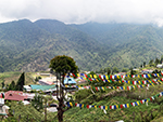 "+
"
"+
" "+
"
"+
" "+
"
"+
" "+
"
"+
" "+
"",
thembangbengali : "থেমবাং হেরিটেজ ভিলেজঃ-থেমবাং জং বমডিলা শহর থেকে প্রায় পঞ্চান্ন কিলোমিটার উত্তর-পূর্বে অরুণাচল প্রদেশের পশ্চিম কামেং জেলার থেমবাং প্রশাসনিক বৃত্তের অধীনে বর্তমান। এই এলাকাটা তাওয়াং-বমডিলা সড়কের পূর্বে, এবং মুন্না ক্যাম্প থেকে প্রায় চোদ্দ কিলোমিটার দূরে অবস্থিত। থেমবাং, উত্তরে তিব্বত, এবং পশ্চিমে ভুটানের সাথে, সরাসরি সীমানা ভাগ করে, যা সেখানকার সামাজিক ও সাংস্কৃতিক ব্যবস্থার ওপর প্রভাব ফেলে, যার মধ্যে রয়েছে দুর্গ স্থাপত্য।মনপা উপজাতিদের বসতি থেমবাং হলো, প্রায় ১২,৯৫০ স্কোয়ার মিটার আয়তনের দুর্গম এলাকার মধ্যে অবস্থিত একটা গ্রাম। এটা বেশ কয়েকটা প্রাচীন ও ঐতিহাসিক স্থাপনার আবাসস্থল। তবে এই অঞ্চলের ঐতিহ্যবাহী প্রযুক্তি ব্যবহার করে নির্মিত সুরক্ষিত জং বা দুর্গের প্রতি, পর্যটকদের আকর্ষণ সর্বাধিক। গ্রামে পাওয়া ঐতিহ্যবাহী স্থাপনার সমৃদ্ধির কারণে, স্থানীয়রা পুরো থেমবাং গ্রামকেই একটা স্মৃতিস্তম্ভ হিসেবে বিবেচনা করে। জং-এর দুটো দরজা রয়েছে। একটা উত্তর দিকে এবং অন্যটা দক্ষিণ দিকে। উত্তর দিকের দরজাটা সাড়ে তিন মিটার চওড়া ও পাঁচ মিটার লম্বা। দক্ষিণ দিকের দরজাটা সংকটময় সময়ে পালানোর দরজার মতো। জং এবং দরজাগুলোর নির্মাণকাজ, মনপাদের ঐতিহ্যবাহী নির্মাণ পদ্ধতি অনুসরণ করে করা হয়েছে, যার মধ্যে রয়েছে যৌগিক পাথরের গাঁথুনি এবং কাঠের স্থাপত্য। ঘরবাড়ি এবং প্রাচীন ধ্বংসাবশেষের পাশে, ম্যুরাল এবং গ্রাফিতি হিসেবে অলংকরণের বৈশিষ্ট্যগুলোর মধ্যে রয়েছে খোদাই করা পাথরের ব্লক, প্রার্থনা মন্ত্র খোদাই করা পাথরের দেওয়াল, ঐতিহ্যবাহী কাঠের খোদাই, চিত্রকর্ম এবং পাণ্ডুলিপি। জং এলাকায় বহু প্রজন্ম ধরে মনপাদের দিরখিপা বংশ বাস করে। জনসংখ্যা বৃদ্ধির কারণে, দিরখিপা বংশের একটা অংশ পুরনো থেমবাং জং-এর বাইরেও বসতি স্থাপন করেছে। গ্রামে বিয়াল্লিশটা পরিবার রয়েছে, এবং মোট জনসংখ্যা আড়াইশো জন। বেশিরভাগ বাসস্থান, আদিবাসী মনপা স্থাপত্যের ঐতিহ্যবাহী পদ্ধতিতে তৈরি। থেমবাং জংও একই ঐতিহ্যবাহী স্থাপত্য ব্যবহার করে নির্মিত হয়েছিল, যা এখনও প্রচলিত রয়েছে। থেমবাং-এর প্রধান ধর্ম হল বৌদ্ধধর্ম, এবং সম্পত্তির মালিকানা ব্যক্তি ভিত্তিক নয়, বরং স্থানীয় পঞ্চায়েত দ্বারা নিয়ন্ত্রিত, এবং সম্প্রদায়ের মালিকানা হিসাবে বিবেচিত হয়।থেমবাং গ্রাম এবং জং সবুজ পাহাড়, খাড়া গিরিখাত, এবং তুষারাবৃত চূড়ার মহিমান্বিত সৌন্দর্যে আবৃত। দিরাং নদী দক্ষিণ-পূর্ব দিকে থেমবাং গিরিখাতের পশ্চিম দিক দিয়ে প্রবাহিত হয়। থেমবাং-এর সংলগ্ন এলাকা জীববৈচিত্র্যে সমৃদ্ধ, এবং রেড পান্ডার মতো বিরল প্রজাতির জীব সহ বিভিন্ন ধরণের বন্য প্রাণী এই বনাঞ্চলে পাওয়া যায়। থেমবাং-এর মানুষজন এই পরিবেশগত সমৃদ্ধিকে সম্মান করে, এবং তাদের সামাজিক ও ধর্মীয় অনুশীলনে এর দিকগুলোকে অন্তর্ভুক্ত করে। পরিবেশগত ভারসাম্য বজায় রাখা, মনপাদের সামাজিক ও সাংস্কৃতিক জীবনের একটা অংশ হিসেবে বিবেচিত হয়। এই অঞ্চল বিভিন্ন প্রজাতির ভেষজ এবং অর্কিডের আবাসস্থল, যার ঔষধি মূল্য অনেক। তাদের ঐতিহ্যবাহী জ্ঞানের অংশ হিসেবে, জাতিগত চিকিৎসা অনুশীলনে তাদের যথেষ্ট অভিজ্ঞতা আছে।অরুণাচল প্রদেশ সরকারের প্রত্নতাত্ত্বিক বিভাগের গবেষণা শাখা, থেমবাং-এর প্রাগৈতিহাসিক প্রত্নতাত্ত্বিক নিদর্শন খনন করেছে। উদ্ধার হওয়া কিছু জিনিসপত্রের মধ্যে রয়েছে নব্যপ্রস্তরযুগীয় যন্ত্রপাতি, হাতিয়ার, প্রস্তর যুগের কুঠার ইত্যাদি। যেহেতু থেমবাং জং ১,১০০ খ্রিস্টাব্দের আগে নির্মিত, তাই এটা ভুটানের রাজকীয় জং স্থাপত্যের পূর্বসূরী হতে পারে বলে মনে করা হয়। "+
"Read More..."+
"
"+
"",
thembangbengali : "থেমবাং হেরিটেজ ভিলেজঃ-থেমবাং জং বমডিলা শহর থেকে প্রায় পঞ্চান্ন কিলোমিটার উত্তর-পূর্বে অরুণাচল প্রদেশের পশ্চিম কামেং জেলার থেমবাং প্রশাসনিক বৃত্তের অধীনে বর্তমান। এই এলাকাটা তাওয়াং-বমডিলা সড়কের পূর্বে, এবং মুন্না ক্যাম্প থেকে প্রায় চোদ্দ কিলোমিটার দূরে অবস্থিত। থেমবাং, উত্তরে তিব্বত, এবং পশ্চিমে ভুটানের সাথে, সরাসরি সীমানা ভাগ করে, যা সেখানকার সামাজিক ও সাংস্কৃতিক ব্যবস্থার ওপর প্রভাব ফেলে, যার মধ্যে রয়েছে দুর্গ স্থাপত্য।মনপা উপজাতিদের বসতি থেমবাং হলো, প্রায় ১২,৯৫০ স্কোয়ার মিটার আয়তনের দুর্গম এলাকার মধ্যে অবস্থিত একটা গ্রাম। এটা বেশ কয়েকটা প্রাচীন ও ঐতিহাসিক স্থাপনার আবাসস্থল। তবে এই অঞ্চলের ঐতিহ্যবাহী প্রযুক্তি ব্যবহার করে নির্মিত সুরক্ষিত জং বা দুর্গের প্রতি, পর্যটকদের আকর্ষণ সর্বাধিক। গ্রামে পাওয়া ঐতিহ্যবাহী স্থাপনার সমৃদ্ধির কারণে, স্থানীয়রা পুরো থেমবাং গ্রামকেই একটা স্মৃতিস্তম্ভ হিসেবে বিবেচনা করে। জং-এর দুটো দরজা রয়েছে। একটা উত্তর দিকে এবং অন্যটা দক্ষিণ দিকে। উত্তর দিকের দরজাটা সাড়ে তিন মিটার চওড়া ও পাঁচ মিটার লম্বা। দক্ষিণ দিকের দরজাটা সংকটময় সময়ে পালানোর দরজার মতো। জং এবং দরজাগুলোর নির্মাণকাজ, মনপাদের ঐতিহ্যবাহী নির্মাণ পদ্ধতি অনুসরণ করে করা হয়েছে, যার মধ্যে রয়েছে যৌগিক পাথরের গাঁথুনি এবং কাঠের স্থাপত্য। ঘরবাড়ি এবং প্রাচীন ধ্বংসাবশেষের পাশে, ম্যুরাল এবং গ্রাফিতি হিসেবে অলংকরণের বৈশিষ্ট্যগুলোর মধ্যে রয়েছে খোদাই করা পাথরের ব্লক, প্রার্থনা মন্ত্র খোদাই করা পাথরের দেওয়াল, ঐতিহ্যবাহী কাঠের খোদাই, চিত্রকর্ম এবং পাণ্ডুলিপি। জং এলাকায় বহু প্রজন্ম ধরে মনপাদের দিরখিপা বংশ বাস করে। জনসংখ্যা বৃদ্ধির কারণে, দিরখিপা বংশের একটা অংশ পুরনো থেমবাং জং-এর বাইরেও বসতি স্থাপন করেছে। গ্রামে বিয়াল্লিশটা পরিবার রয়েছে, এবং মোট জনসংখ্যা আড়াইশো জন। বেশিরভাগ বাসস্থান, আদিবাসী মনপা স্থাপত্যের ঐতিহ্যবাহী পদ্ধতিতে তৈরি। থেমবাং জংও একই ঐতিহ্যবাহী স্থাপত্য ব্যবহার করে নির্মিত হয়েছিল, যা এখনও প্রচলিত রয়েছে। থেমবাং-এর প্রধান ধর্ম হল বৌদ্ধধর্ম, এবং সম্পত্তির মালিকানা ব্যক্তি ভিত্তিক নয়, বরং স্থানীয় পঞ্চায়েত দ্বারা নিয়ন্ত্রিত, এবং সম্প্রদায়ের মালিকানা হিসাবে বিবেচিত হয়।থেমবাং গ্রাম এবং জং সবুজ পাহাড়, খাড়া গিরিখাত, এবং তুষারাবৃত চূড়ার মহিমান্বিত সৌন্দর্যে আবৃত। দিরাং নদী দক্ষিণ-পূর্ব দিকে থেমবাং গিরিখাতের পশ্চিম দিক দিয়ে প্রবাহিত হয়। থেমবাং-এর সংলগ্ন এলাকা জীববৈচিত্র্যে সমৃদ্ধ, এবং রেড পান্ডার মতো বিরল প্রজাতির জীব সহ বিভিন্ন ধরণের বন্য প্রাণী এই বনাঞ্চলে পাওয়া যায়। থেমবাং-এর মানুষজন এই পরিবেশগত সমৃদ্ধিকে সম্মান করে, এবং তাদের সামাজিক ও ধর্মীয় অনুশীলনে এর দিকগুলোকে অন্তর্ভুক্ত করে। পরিবেশগত ভারসাম্য বজায় রাখা, মনপাদের সামাজিক ও সাংস্কৃতিক জীবনের একটা অংশ হিসেবে বিবেচিত হয়। এই অঞ্চল বিভিন্ন প্রজাতির ভেষজ এবং অর্কিডের আবাসস্থল, যার ঔষধি মূল্য অনেক। তাদের ঐতিহ্যবাহী জ্ঞানের অংশ হিসেবে, জাতিগত চিকিৎসা অনুশীলনে তাদের যথেষ্ট অভিজ্ঞতা আছে।অরুণাচল প্রদেশ সরকারের প্রত্নতাত্ত্বিক বিভাগের গবেষণা শাখা, থেমবাং-এর প্রাগৈতিহাসিক প্রত্নতাত্ত্বিক নিদর্শন খনন করেছে। উদ্ধার হওয়া কিছু জিনিসপত্রের মধ্যে রয়েছে নব্যপ্রস্তরযুগীয় যন্ত্রপাতি, হাতিয়ার, প্রস্তর যুগের কুঠার ইত্যাদি। যেহেতু থেমবাং জং ১,১০০ খ্রিস্টাব্দের আগে নির্মিত, তাই এটা ভুটানের রাজকীয় জং স্থাপত্যের পূর্বসূরী হতে পারে বলে মনে করা হয়। "+
"Read More..."+
" "+
"
"+
" "+
"
"+
" "+
"
"+
" "+
"
"+
" "+
"
"+
"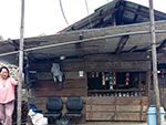 "+
"
"+
" "+
"
"+
" "+
"",
eastarunachalintrobengali : "
"+
"",
eastarunachalintrobengali : " "+
"
"+
" "+
"
"+
" "+
"
"+
" "+
"
"+
" "+
"
"+
" "+
"
"+
" "+
"
"+
" "+
"",
itanagarbengali : "ইটানগরঃ-পাপুম পারে জেলায় অবস্থিত, উত্তর-পূর্ব রাজ্য অরুণাচল প্রদেশের রাজধানী হলো ইটানগর। শহরটা হিমালয় পর্বতমালার ছায়ায় অবস্থিত, যার উত্তর-পূর্ব দিকে রয়েছে তুষারাবৃত শৃঙ্গ, আর দক্ষিণ দিকে ব্রহ্মপুত্র নদীর বিস্তৃত সমভূমি। রহস্যময় আবেদন এবং আধুনিক মনোভাবের কারণে, শহরটা বিশ্বজুড়ে পর্যটকদের দৃষ্টি আকর্ষণ করে। এই স্থানের সবচেয়ে আদিম চিত্র, রামায়ণ এবং মহাভারতের মতো প্রাচীন মহাকাব্য থেকেও পাওয়া যায়। ঐতিহাসিক যুগে, আদি, নিশি, গালো, মিরি এবং আপাতানিদের মতো বেশ কয়েকটা উপজাতি এই প্রদেশে বাস করতো ও ইটানগর শাসন করতো। শহরটা একাদশ শতাব্দীতে প্রতিষ্ঠিত জিত্রি রাজবংশের পূর্বতন রাজধানী মায়াপুর হিসেবেও বর্ণনা করা হয়। এই অঞ্চলের প্রধান ঐতিহাসিক প্রমাণ সেই যুগের ইটা দুর্গ, যা চতুর্দশ বা পঞ্চদশ শতাব্দীতে রাজা রামচন্দ্র দ্বারা নির্মিত হয়েছিল। ষোড়শ শতাব্দীতে, অহোম রাজবংশ ইটানগর শাসন করেছিল। উপজাতিরা ইটানগরের কাছাকাছি স্থানগুলো ও দুর্গ দখল করে। ইটা দুর্গ সংস্কার অহোম রাজবংশের সেরা উন্নয়নগুলোর মধ্যে একটা। মনপা প্রধানরা রাজ্যের উত্তর-পশ্চিম অংশ শাসন করতেন। যখন এখানকার পর্যটন স্থানগুলো খুব বিখ্যাত হয়ে উঠেছিল, তখন ব্রিটিশরা ইটানগরে প্রবেশ করে, এবং স্থানীয় জনগণের ওপর নির্যাতন চালিয়ে শাসন করে। স্বাধীনতার পর, কুড়ি এপ্রিল ১৯৭৪ সালে, ইটানগরকে আনুষ্ঠানিকভাবে অরুণাচল প্রদেশের অস্থায়ী রাজধানী ঘোষণা করা হয়। ইটানগর নামটা এসেছে ইটা দুর্গের নাম অনুসারে। ইটানগর, ভোরের আলোয় আলোকিত পাহাড়ের ভূমি বলে বর্ণনা করা দুটো দেশাংশের মধ্যে একটা, অন্যটা হলো নাহারলাগুন। আবার ইটানগরকে প্রায়শই অর্কিড রাজধানীও বলা হয়। সমৃদ্ধ সংস্কৃতি, উপজাতি ঐতিহ্য, এবং কয়েক শতাব্দী ধরে প্রচলিত মূল্যবোধ হলো, সাক্ষ্য দেওয়ার মতো কিছু অসাধারণ জিনিস। আঞ্চলিক ঐতিহ্য এবং সংস্কৃতি রক্ষার লক্ষ্যে, কয়েক বছর আগে পর্যন্ত এই প্রদেশ পর্যটনের জন্যে সীমাবদ্ধ ছিল। এই অঞ্চল ইংরেজি, আপ্তানি, হিন্দি, অসমিয়া, নিশি এবং বিভিন্ন আদি ভাষাভাষী সম্প্রদায়ের আবাসস্থল। ইটানগরের জাদুঘরগুলো ভাস্কর্যের সাহায্যে রাজ্যের জাতিগত গোষ্ঠীর বিভিন্ন ধরণের চিত্র তুলে ধরে। রাজ্যের কোণা-কোণা না দেখেই, পর্যটকরা সমগ্র ইটানগরের সাংস্কৃতিক উত্তরাধিকারের সংক্ষিপ্তসার উপভোগ করতে পারে। ইটানগরে বিক্রি এবং কেনা সমস্ত সবজি জৈব। অরুণাচল প্রদেশের রাজধানী শহর উপক্রান্তীয় আবহাওয়ায় অবস্থিত, সেইজন্যে শীতকালে এখানে প্রচণ্ড ঠাণ্ডা বা গ্রীষ্মকালে প্রচণ্ড গরম থাকে না অর্থাৎ কখনই চরম আবহাওয়া থাকে না। "+
"Read More..."+
"
"+
"",
itanagarbengali : "ইটানগরঃ-পাপুম পারে জেলায় অবস্থিত, উত্তর-পূর্ব রাজ্য অরুণাচল প্রদেশের রাজধানী হলো ইটানগর। শহরটা হিমালয় পর্বতমালার ছায়ায় অবস্থিত, যার উত্তর-পূর্ব দিকে রয়েছে তুষারাবৃত শৃঙ্গ, আর দক্ষিণ দিকে ব্রহ্মপুত্র নদীর বিস্তৃত সমভূমি। রহস্যময় আবেদন এবং আধুনিক মনোভাবের কারণে, শহরটা বিশ্বজুড়ে পর্যটকদের দৃষ্টি আকর্ষণ করে। এই স্থানের সবচেয়ে আদিম চিত্র, রামায়ণ এবং মহাভারতের মতো প্রাচীন মহাকাব্য থেকেও পাওয়া যায়। ঐতিহাসিক যুগে, আদি, নিশি, গালো, মিরি এবং আপাতানিদের মতো বেশ কয়েকটা উপজাতি এই প্রদেশে বাস করতো ও ইটানগর শাসন করতো। শহরটা একাদশ শতাব্দীতে প্রতিষ্ঠিত জিত্রি রাজবংশের পূর্বতন রাজধানী মায়াপুর হিসেবেও বর্ণনা করা হয়। এই অঞ্চলের প্রধান ঐতিহাসিক প্রমাণ সেই যুগের ইটা দুর্গ, যা চতুর্দশ বা পঞ্চদশ শতাব্দীতে রাজা রামচন্দ্র দ্বারা নির্মিত হয়েছিল। ষোড়শ শতাব্দীতে, অহোম রাজবংশ ইটানগর শাসন করেছিল। উপজাতিরা ইটানগরের কাছাকাছি স্থানগুলো ও দুর্গ দখল করে। ইটা দুর্গ সংস্কার অহোম রাজবংশের সেরা উন্নয়নগুলোর মধ্যে একটা। মনপা প্রধানরা রাজ্যের উত্তর-পশ্চিম অংশ শাসন করতেন। যখন এখানকার পর্যটন স্থানগুলো খুব বিখ্যাত হয়ে উঠেছিল, তখন ব্রিটিশরা ইটানগরে প্রবেশ করে, এবং স্থানীয় জনগণের ওপর নির্যাতন চালিয়ে শাসন করে। স্বাধীনতার পর, কুড়ি এপ্রিল ১৯৭৪ সালে, ইটানগরকে আনুষ্ঠানিকভাবে অরুণাচল প্রদেশের অস্থায়ী রাজধানী ঘোষণা করা হয়। ইটানগর নামটা এসেছে ইটা দুর্গের নাম অনুসারে। ইটানগর, ভোরের আলোয় আলোকিত পাহাড়ের ভূমি বলে বর্ণনা করা দুটো দেশাংশের মধ্যে একটা, অন্যটা হলো নাহারলাগুন। আবার ইটানগরকে প্রায়শই অর্কিড রাজধানীও বলা হয়। সমৃদ্ধ সংস্কৃতি, উপজাতি ঐতিহ্য, এবং কয়েক শতাব্দী ধরে প্রচলিত মূল্যবোধ হলো, সাক্ষ্য দেওয়ার মতো কিছু অসাধারণ জিনিস। আঞ্চলিক ঐতিহ্য এবং সংস্কৃতি রক্ষার লক্ষ্যে, কয়েক বছর আগে পর্যন্ত এই প্রদেশ পর্যটনের জন্যে সীমাবদ্ধ ছিল। এই অঞ্চল ইংরেজি, আপ্তানি, হিন্দি, অসমিয়া, নিশি এবং বিভিন্ন আদি ভাষাভাষী সম্প্রদায়ের আবাসস্থল। ইটানগরের জাদুঘরগুলো ভাস্কর্যের সাহায্যে রাজ্যের জাতিগত গোষ্ঠীর বিভিন্ন ধরণের চিত্র তুলে ধরে। রাজ্যের কোণা-কোণা না দেখেই, পর্যটকরা সমগ্র ইটানগরের সাংস্কৃতিক উত্তরাধিকারের সংক্ষিপ্তসার উপভোগ করতে পারে। ইটানগরে বিক্রি এবং কেনা সমস্ত সবজি জৈব। অরুণাচল প্রদেশের রাজধানী শহর উপক্রান্তীয় আবহাওয়ায় অবস্থিত, সেইজন্যে শীতকালে এখানে প্রচণ্ড ঠাণ্ডা বা গ্রীষ্মকালে প্রচণ্ড গরম থাকে না অর্থাৎ কখনই চরম আবহাওয়া থাকে না। "+
"Read More..."+
" "+
"
"+
" "+
"
"+
" "+
"
"+
" "+
"
"+
" "+
"
"+
" "+
"
"+
" "+
"
"+
" "+
"",
zirobengali : "জিরোঃ-জিরো একটা মনোমুগ্ধকর সুন্দর মালভূমি এবং অরুণাচল প্রদেশের নিম্ন সুবানসিরি জেলার সদর দপ্তর। বিস্তৃত ধানক্ষেত এবং রাজকীয় পাইন-আচ্ছাদিত পাহাড়ের কারণে, প্রায়শই এই অঞ্চলকে সবুজ স্বর্গ হিসেবে বর্ণনা করা হয়। প্রায় ১,৫০০ মিটার উচ্চতায় অবস্থিত এই অদ্ভুত পাহাড়ি এলাকা, মূলত আপাতানি উপজাতিদের বাসস্থল। অরুণাচলের আপাতানি উপজাতি একটা অনন্য বিরল উপজাতি, যারা যাযাবর প্রকৃতির নয়। তারা জলাভূমিতে চাষ করে এবং তাদের মুখের ট্যাটুর জন্যে বিখ্যাত। সম্প্রতি এই প্রথা বন্ধ হয়ে গেছে। আপাতানি উপজাতি, জানুয়ারি মাসে মুরুং উৎসব, আর মার্চ মাসে মায়োকো উৎসব পালন করে। আবার প্রতি বছর চার থেকে সাত জুলাই পর্যন্ত ড্রি উৎসব অনুষ্ঠিত হয়, যেখানে আপাতানি উপজাতির মানুষজন ঈশ্বরের উদ্দেশ্যে পশু বলি দেন। তাদের বিশ্বাস যে এই দানে দেবতারা সন্তুষ্ট হবেন, এবং এই অঞ্চল দুর্ভিক্ষের সম্মুখীন হবে না। ফেব্রুয়ারি থেকে অক্টোবর পর্যন্ত এই অঞ্চলে কৃষিকার্য হয়। জিরো শহর থেকে কয়েক কিলোমিটার দূরে একটা বিখ্যাত শিবলিঙ্গ রয়েছে, যা প্রতিদিন বিপুল সংখ্যক ভক্তকে আকর্ষণ করে। জিরোপুতু, পেচিপুতু, কিলেপাখো, ইত্যাদি স্থানগুলো হল এক একটা সুন্দর পাহাড়ি অবস্থান, যেখান থেকে পুরো জিরো উপত্যকা দেখা যায়। এখানকার উদ্ভিদ ও প্রাণীজগৎ উপ-গ্রীষ্মমন্ডলীয় বন থেকে শুরু করে রূপালী দেবদারু গাছ, সেইসাথে বিভিন্ন ধরণের ফার্ন, বাঁশ, অর্কিড এবং রডোডেনড্রন পর্যন্ত বিস্তৃত। জিরোর স্বতন্ত্র সাংস্কৃতিক ভূদৃশ্য, প্রকৃতির সাথে আপাতানিদের সুরেলা সহাবস্থান, আর ড্রি এবং মায়োকোর মতো প্রাণবন্ত উৎসবগুলো জিরোকে, ইউনেস্কোর বিশ্ব ঐতিহ্যবাহী স্থান ঘোষণা করার জন্যে নির্বাচিত করেছে। জিরোতে বিভিন্ন হোটেল, রিসর্ট ও হোমস্টে রয়েছে, যা থাকার ব্যবস্থা এবং কার্যকলাপের দিক থেকে দর্শনার্থীদের আকর্ষণ করে। জিরোর জলবায়ু সারা বছরই কোমল থাকে, যার ফলে ভ্রমণ করা সহজ হয়। "+
"Read More..."+
"
"+
"",
zirobengali : "জিরোঃ-জিরো একটা মনোমুগ্ধকর সুন্দর মালভূমি এবং অরুণাচল প্রদেশের নিম্ন সুবানসিরি জেলার সদর দপ্তর। বিস্তৃত ধানক্ষেত এবং রাজকীয় পাইন-আচ্ছাদিত পাহাড়ের কারণে, প্রায়শই এই অঞ্চলকে সবুজ স্বর্গ হিসেবে বর্ণনা করা হয়। প্রায় ১,৫০০ মিটার উচ্চতায় অবস্থিত এই অদ্ভুত পাহাড়ি এলাকা, মূলত আপাতানি উপজাতিদের বাসস্থল। অরুণাচলের আপাতানি উপজাতি একটা অনন্য বিরল উপজাতি, যারা যাযাবর প্রকৃতির নয়। তারা জলাভূমিতে চাষ করে এবং তাদের মুখের ট্যাটুর জন্যে বিখ্যাত। সম্প্রতি এই প্রথা বন্ধ হয়ে গেছে। আপাতানি উপজাতি, জানুয়ারি মাসে মুরুং উৎসব, আর মার্চ মাসে মায়োকো উৎসব পালন করে। আবার প্রতি বছর চার থেকে সাত জুলাই পর্যন্ত ড্রি উৎসব অনুষ্ঠিত হয়, যেখানে আপাতানি উপজাতির মানুষজন ঈশ্বরের উদ্দেশ্যে পশু বলি দেন। তাদের বিশ্বাস যে এই দানে দেবতারা সন্তুষ্ট হবেন, এবং এই অঞ্চল দুর্ভিক্ষের সম্মুখীন হবে না। ফেব্রুয়ারি থেকে অক্টোবর পর্যন্ত এই অঞ্চলে কৃষিকার্য হয়। জিরো শহর থেকে কয়েক কিলোমিটার দূরে একটা বিখ্যাত শিবলিঙ্গ রয়েছে, যা প্রতিদিন বিপুল সংখ্যক ভক্তকে আকর্ষণ করে। জিরোপুতু, পেচিপুতু, কিলেপাখো, ইত্যাদি স্থানগুলো হল এক একটা সুন্দর পাহাড়ি অবস্থান, যেখান থেকে পুরো জিরো উপত্যকা দেখা যায়। এখানকার উদ্ভিদ ও প্রাণীজগৎ উপ-গ্রীষ্মমন্ডলীয় বন থেকে শুরু করে রূপালী দেবদারু গাছ, সেইসাথে বিভিন্ন ধরণের ফার্ন, বাঁশ, অর্কিড এবং রডোডেনড্রন পর্যন্ত বিস্তৃত। জিরোর স্বতন্ত্র সাংস্কৃতিক ভূদৃশ্য, প্রকৃতির সাথে আপাতানিদের সুরেলা সহাবস্থান, আর ড্রি এবং মায়োকোর মতো প্রাণবন্ত উৎসবগুলো জিরোকে, ইউনেস্কোর বিশ্ব ঐতিহ্যবাহী স্থান ঘোষণা করার জন্যে নির্বাচিত করেছে। জিরোতে বিভিন্ন হোটেল, রিসর্ট ও হোমস্টে রয়েছে, যা থাকার ব্যবস্থা এবং কার্যকলাপের দিক থেকে দর্শনার্থীদের আকর্ষণ করে। জিরোর জলবায়ু সারা বছরই কোমল থাকে, যার ফলে ভ্রমণ করা সহজ হয়। "+
"Read More..."+
" "+
"
"+
" "+
"
"+
" "+
"
"+
" "+
"
"+
" "+
"
"+
" "+
"
"+
" "+
"
"+
" "+
"",
daporijobengali : "দাপরিজোঃ-নৈসর্গিক শহর দাপোরিজো, উত্তর-পূর্ব রাজ্য অরুণাচল প্রদেশের উচ্চ সুবানসিরি জেলায় অবস্থিত। সমুদ্রপৃষ্ঠ থেকে প্রায় ছশো মিটার উচ্চতায় অবস্থিত এই শহর, তার সমৃদ্ধ উদ্ভিদ, প্রাণীজগৎ, এবং জাতিগত বৈচিত্র্যের জন্যে পরিচিত। দাপোরিজো এই অঞ্চলের বিভিন্ন উপজাতি সম্প্রদায়ের আবাসস্থল, এবং এখানকার সংস্কৃতি, বিভিন্ন উপজাতি গোষ্ঠীর নিজস্ব সংস্কৃতি এবং ঐতিহ্যের এক অনন্য মিশ্রণ। স্থানীয় মানুষজনের তৈরি আদিবাসী হস্তশিল্প, এবং শিল্পকর্মগুলো বেশ রঙিন এবং অনন্য, যা এই জায়গার নিজস্ব পরিচয় দেয়। বাঁশের হস্তশিল্প, ও রঙিন পোশাক, উপহার হিসেবে বাড়িতে নিয়ে যাওয়ার জন্যে চমৎকার স্মৃতিচিহ্ন, এবং এগুলো স্থানীয় বাজারে সহজেই পাওয়া যায়। শহরের মানুষের, বিশেষ করে মহিলাদের মধ্যে, প্রধান জীবিকা হল বুনন, হস্তশিল্প, পশুপালন, এবং অল্প কিছুটা কৃষিকাজ। শহরটা ট্রেকিং এবং প্রকৃতিতে হাঁটার জন্যে এক আদর্শ স্থান হিসেবে পরিচিত। বেশ কয়েকটা সুন্দর ট্রেকিংয়ের পথ রয়েছে, যা ট্রেকিং অভিযানের জন্যে জনপ্রিয়, ও শহরের প্রাকৃতিক মহিমা এবং আশেপাশের ভূদৃশ্য অন্বেষণ করার সেরা উপায়। শহরের কাছাকাছি অবস্থিত সুবানসিরি নদী রাফটিং এবং মাছ ধরার মতো অ্যাডভেঞ্চারের জন্যে উপযুক্ত। ভগবান শিবের উদ্দেশ্যে নিবেদিত সুন্দর মেঘনা গুহা মন্দির, একটা জনপ্রিয় দর্শনীয় স্থান। শহরের কাছে বেশ কয়েকটা মনোরম স্থান, কয়েকটা পাহাড়ি গুহা এবং সুন্দর গ্রাম রয়েছে, যা দাপোরিজো থেকে দিনে দিনে ভ্রমণের জন্যে উপযুক্ত। শহরের আশেপাশে রাগা, তামিন, এবং মোরির মতো বেশ কয়েকটা সুন্দর আদিবাসী গ্রাম, এই অঞ্চলের আদিবাসী জীবন প্রত্যক্ষ করা ও অভিজ্ঞতা লাভের জন্য উপযুক্ত। দাপোরিজো সবুজ গাছপালা এবং বিভিন্ন ধরণের উদ্ভিদ এবং প্রাণীজগতের সৌন্দর্যে ভরা। শীতের মাসগুলো, বিশেষ করে অক্টোবর এবং নভেম্বর, এই জায়গা দেখার আদর্শ সময় হিসেবে বিবেচিত হয়, কারণ এই সময়ের আবহাওয়া মনোরম থাকে আর ঘুরে বেড়ানো এবং ট্রেকিংয়ের জন্যে উপযুক্ত। "+
"Read More..."+
"
"+
"",
daporijobengali : "দাপরিজোঃ-নৈসর্গিক শহর দাপোরিজো, উত্তর-পূর্ব রাজ্য অরুণাচল প্রদেশের উচ্চ সুবানসিরি জেলায় অবস্থিত। সমুদ্রপৃষ্ঠ থেকে প্রায় ছশো মিটার উচ্চতায় অবস্থিত এই শহর, তার সমৃদ্ধ উদ্ভিদ, প্রাণীজগৎ, এবং জাতিগত বৈচিত্র্যের জন্যে পরিচিত। দাপোরিজো এই অঞ্চলের বিভিন্ন উপজাতি সম্প্রদায়ের আবাসস্থল, এবং এখানকার সংস্কৃতি, বিভিন্ন উপজাতি গোষ্ঠীর নিজস্ব সংস্কৃতি এবং ঐতিহ্যের এক অনন্য মিশ্রণ। স্থানীয় মানুষজনের তৈরি আদিবাসী হস্তশিল্প, এবং শিল্পকর্মগুলো বেশ রঙিন এবং অনন্য, যা এই জায়গার নিজস্ব পরিচয় দেয়। বাঁশের হস্তশিল্প, ও রঙিন পোশাক, উপহার হিসেবে বাড়িতে নিয়ে যাওয়ার জন্যে চমৎকার স্মৃতিচিহ্ন, এবং এগুলো স্থানীয় বাজারে সহজেই পাওয়া যায়। শহরের মানুষের, বিশেষ করে মহিলাদের মধ্যে, প্রধান জীবিকা হল বুনন, হস্তশিল্প, পশুপালন, এবং অল্প কিছুটা কৃষিকাজ। শহরটা ট্রেকিং এবং প্রকৃতিতে হাঁটার জন্যে এক আদর্শ স্থান হিসেবে পরিচিত। বেশ কয়েকটা সুন্দর ট্রেকিংয়ের পথ রয়েছে, যা ট্রেকিং অভিযানের জন্যে জনপ্রিয়, ও শহরের প্রাকৃতিক মহিমা এবং আশেপাশের ভূদৃশ্য অন্বেষণ করার সেরা উপায়। শহরের কাছাকাছি অবস্থিত সুবানসিরি নদী রাফটিং এবং মাছ ধরার মতো অ্যাডভেঞ্চারের জন্যে উপযুক্ত। ভগবান শিবের উদ্দেশ্যে নিবেদিত সুন্দর মেঘনা গুহা মন্দির, একটা জনপ্রিয় দর্শনীয় স্থান। শহরের কাছে বেশ কয়েকটা মনোরম স্থান, কয়েকটা পাহাড়ি গুহা এবং সুন্দর গ্রাম রয়েছে, যা দাপোরিজো থেকে দিনে দিনে ভ্রমণের জন্যে উপযুক্ত। শহরের আশেপাশে রাগা, তামিন, এবং মোরির মতো বেশ কয়েকটা সুন্দর আদিবাসী গ্রাম, এই অঞ্চলের আদিবাসী জীবন প্রত্যক্ষ করা ও অভিজ্ঞতা লাভের জন্য উপযুক্ত। দাপোরিজো সবুজ গাছপালা এবং বিভিন্ন ধরণের উদ্ভিদ এবং প্রাণীজগতের সৌন্দর্যে ভরা। শীতের মাসগুলো, বিশেষ করে অক্টোবর এবং নভেম্বর, এই জায়গা দেখার আদর্শ সময় হিসেবে বিবেচিত হয়, কারণ এই সময়ের আবহাওয়া মনোরম থাকে আর ঘুরে বেড়ানো এবং ট্রেকিংয়ের জন্যে উপযুক্ত। "+
"Read More..."+
" "+
"
"+
" "+
"
"+
" "+
"
"+
" "+
"
"+
" "+
"
"+
" "+
"
"+
" "+
"
"+
" "+
"",
aalobengali : "আলোঃ-আলো, যা আগে অ্যালং নামে পরিচিত ছিল, একটা মনোমুগ্ধকর শহর এবং অরুণাচল প্রদেশের পশ্চিম সিয়াং জেলার প্রশাসনিক সদর দপ্তর। এই অঞ্চল সিপু এবং সিওম নদীর সঙ্গমস্থলে অবস্থিত। সবুজ পাহাড়, কমলালেবুর বাগান, এবং বিস্তৃত বাজরা বাগান সহ মনোমুগ্ধকর প্রাকৃতিক দৃশ্যের মাঝে অবস্থিত, আলো একটা শান্ত এবং প্রাণবন্ত অবকাশ প্রদান করে। এখানে মূলত অতিথিপরায়ণ গালো উপজাতি বাস করে, যাদের প্রাণবন্ত সংস্কৃতি, দোনি-পোলো বা সূর্য ও চাঁদের উপাসনায় বিশ্বাস, এবং মোপিনের মতো গুরুত্বপূর্ণ উৎসবগুলো এই শহরের পরিচয় বহন করে। সাংস্কৃতিক সমৃদ্ধির বাইরে, আলো একটা অ্যাডভেঞ্চার হাব, যা সিওম নদীতে রোমাঞ্চকর নদী রাফটিং, আশেপাশের প্রাকৃতিক দৃশ্যের মধ্যে দিয়ে ট্রেকিং, এবং চিত্তাকর্ষক পাটুম সেতুর মতো ঐতিহ্যবাহী বেত এবং বাঁশের ঝুলন্ত সেতুগুলো অন্বেষণের সুযোগ প্রদান করে। প্রধান আকর্ষণগুলোর মধ্যে রয়েছে রামকৃষ্ণ মিশন ক্যাম্পাস, দোনি পোলো মন্দির, দারকা এবং বাগড়ার মতো কাছাকাছি গ্রামগুলো, যা স্থানীয় জীবনযাত্রায় একটা অন্তর্দৃষ্টি প্রদান করে। "+
"Read More..."+
"
"+
"",
aalobengali : "আলোঃ-আলো, যা আগে অ্যালং নামে পরিচিত ছিল, একটা মনোমুগ্ধকর শহর এবং অরুণাচল প্রদেশের পশ্চিম সিয়াং জেলার প্রশাসনিক সদর দপ্তর। এই অঞ্চল সিপু এবং সিওম নদীর সঙ্গমস্থলে অবস্থিত। সবুজ পাহাড়, কমলালেবুর বাগান, এবং বিস্তৃত বাজরা বাগান সহ মনোমুগ্ধকর প্রাকৃতিক দৃশ্যের মাঝে অবস্থিত, আলো একটা শান্ত এবং প্রাণবন্ত অবকাশ প্রদান করে। এখানে মূলত অতিথিপরায়ণ গালো উপজাতি বাস করে, যাদের প্রাণবন্ত সংস্কৃতি, দোনি-পোলো বা সূর্য ও চাঁদের উপাসনায় বিশ্বাস, এবং মোপিনের মতো গুরুত্বপূর্ণ উৎসবগুলো এই শহরের পরিচয় বহন করে। সাংস্কৃতিক সমৃদ্ধির বাইরে, আলো একটা অ্যাডভেঞ্চার হাব, যা সিওম নদীতে রোমাঞ্চকর নদী রাফটিং, আশেপাশের প্রাকৃতিক দৃশ্যের মধ্যে দিয়ে ট্রেকিং, এবং চিত্তাকর্ষক পাটুম সেতুর মতো ঐতিহ্যবাহী বেত এবং বাঁশের ঝুলন্ত সেতুগুলো অন্বেষণের সুযোগ প্রদান করে। প্রধান আকর্ষণগুলোর মধ্যে রয়েছে রামকৃষ্ণ মিশন ক্যাম্পাস, দোনি পোলো মন্দির, দারকা এবং বাগড়ার মতো কাছাকাছি গ্রামগুলো, যা স্থানীয় জীবনযাত্রায় একটা অন্তর্দৃষ্টি প্রদান করে। "+
"Read More..."+
" "+
"
"+
" "+
"
"+
" "+
"
"+
" "+
"
"+
" "+
"
"+
" "+
"
"+
" "+
"
"+
" "+
"",
mechukabengali : "মেচুকাঃ-সময়ের নিরিখে অস্পর্শিত এক পৃথিবী হলো মেচুকা উপত্যকা। মেচুকা নামটা নিজেই এই দেশের গল্প বলে। ইন্দো-তিব্বত সীমান্তের কাছে, অরুণাচল প্রদেশের নবগঠিত শি-ইয়োমি জেলায়, ছ হাজার ফুট উচ্চতায় অবস্থিত মেচুকা, এক অপূর্ব শান্ত গ্রাম। এই গ্রামকে প্রায়শই মিনি সুইজারল্যান্ড বলা হয়। এই মনোমুগ্ধকর গ্রাম, তার অসাধারণ প্রাকৃতিক সৌন্দর্য দ্বারা চিহ্নিত, যেখানে অ্যালপাইন তৃণভূমি, বিস্তীর্ণ সবুজ প্রান্তর, সুউচ্চ তুষারাবৃত পাহাড়, এবং কুমারী বনের এক নাটকীয় অ্যাম্ফিথিয়েটার রয়েছে। উপত্যকার মধ্য দিয়ে প্রবাহিত নির্মল সিওম নদী, এর সৌন্দর্যের বিন্যাসে আর এক রত্ন যোগ করেছে। মেচুকা বিভিন্ন আদিবাসী উপজাতির আবাসস্থল, প্রধানত মেম্বাস। এ ছাড়াও রামোস, বোকার এবং লিবোস, যাদের স্বতন্ত্র বৌদ্ধ সংস্কৃতি, রঙিন কাঠের ঘর, উড়ন্ত প্রার্থনা পতাকা, এবং প্রাচীন ঐতিহ্য, ভূদৃশ্যে অপরিসীম আকর্ষণ যোগ করে। মনোমুগ্ধকর দৃশ্যের বাইরেও, মেচুকার আধ্যাত্মিক ও ঐতিহাসিক গুরুত্বও উল্লেখযোগ্য। পাহাড়ের চূড়ায় অবস্থিত চারশো বছরের পুরনো সামতেন ইয়ংচা মঠ, গুরুদোয়ারা গুরু নানক তপোস্থান, সিকো ডিডো জলপ্রপাত, এবং হনুমান পয়েন্ট শিলা বিন্যাসের মতো প্রাকৃতিক বিস্ময় রয়েছে, যা এই অঞ্চলকে অস্পর্শিত হিমালয়ের মহিমার মধ্যে এক অপ্রচলিত অ্যাডভেঞ্চার, সাংস্কৃতিক নিমজ্জন এবং গভীর প্রশান্তির আদর্শ গন্তব্যস্থল করে তুলেছে। "+
"Read More..."+
"
"+
"",
mechukabengali : "মেচুকাঃ-সময়ের নিরিখে অস্পর্শিত এক পৃথিবী হলো মেচুকা উপত্যকা। মেচুকা নামটা নিজেই এই দেশের গল্প বলে। ইন্দো-তিব্বত সীমান্তের কাছে, অরুণাচল প্রদেশের নবগঠিত শি-ইয়োমি জেলায়, ছ হাজার ফুট উচ্চতায় অবস্থিত মেচুকা, এক অপূর্ব শান্ত গ্রাম। এই গ্রামকে প্রায়শই মিনি সুইজারল্যান্ড বলা হয়। এই মনোমুগ্ধকর গ্রাম, তার অসাধারণ প্রাকৃতিক সৌন্দর্য দ্বারা চিহ্নিত, যেখানে অ্যালপাইন তৃণভূমি, বিস্তীর্ণ সবুজ প্রান্তর, সুউচ্চ তুষারাবৃত পাহাড়, এবং কুমারী বনের এক নাটকীয় অ্যাম্ফিথিয়েটার রয়েছে। উপত্যকার মধ্য দিয়ে প্রবাহিত নির্মল সিওম নদী, এর সৌন্দর্যের বিন্যাসে আর এক রত্ন যোগ করেছে। মেচুকা বিভিন্ন আদিবাসী উপজাতির আবাসস্থল, প্রধানত মেম্বাস। এ ছাড়াও রামোস, বোকার এবং লিবোস, যাদের স্বতন্ত্র বৌদ্ধ সংস্কৃতি, রঙিন কাঠের ঘর, উড়ন্ত প্রার্থনা পতাকা, এবং প্রাচীন ঐতিহ্য, ভূদৃশ্যে অপরিসীম আকর্ষণ যোগ করে। মনোমুগ্ধকর দৃশ্যের বাইরেও, মেচুকার আধ্যাত্মিক ও ঐতিহাসিক গুরুত্বও উল্লেখযোগ্য। পাহাড়ের চূড়ায় অবস্থিত চারশো বছরের পুরনো সামতেন ইয়ংচা মঠ, গুরুদোয়ারা গুরু নানক তপোস্থান, সিকো ডিডো জলপ্রপাত, এবং হনুমান পয়েন্ট শিলা বিন্যাসের মতো প্রাকৃতিক বিস্ময় রয়েছে, যা এই অঞ্চলকে অস্পর্শিত হিমালয়ের মহিমার মধ্যে এক অপ্রচলিত অ্যাডভেঞ্চার, সাংস্কৃতিক নিমজ্জন এবং গভীর প্রশান্তির আদর্শ গন্তব্যস্থল করে তুলেছে। "+
"Read More..."+
" "+
"
"+
" "+
"
"+
" "+
"
"+
" "+
"
"+
" "+
"
"+
" "+
"
"+
" "+
"
"+
" "+
"",
pasighatbengali : "পাসিঘাটঃ-১৯১১ সালে প্রতিষ্ঠিত পাসিঘাট হলো অরুণাচল প্রদেশের প্রাচীনতম শহর এবং পূর্ব সিয়াং জেলার সদর দপ্তর। শহরটা সমুদ্রপৃষ্ঠ থেকে ১৫৫ মিটার উচ্চতায় অবস্থিত এবং একে অরুণাচল প্রদেশের প্রবেশদ্বার বলা হয়ে থাকে। শহরের নামকরণ হয়েছে পাসি নামক উপজাতিদের নামানুসারে।পাসিঘাট একটা ছোট্ট শহর, যেখানে গ্রীষ্মকাল উষ্ণ এবং আর্দ্র, আবার শীতকালে নাতিশীতোষ্ণ জলবায়ু থাকে, ফলে শীতকাল এই স্থান ভ্রমণের জন্যে সেরা সময়। তিব্বত থেকে বিশাল ব্রহ্মপুত্র নদী, যাকে অরুণাচল প্রদেশে সিয়াং নদীও বলা হয়, এই শহরে নেমে আসে। প্রাকৃতিক দৃশ্যের প্রাচুর্যের জন্যে এই জায়গা আলোকচিত্রীদের কাছেও আকর্ষণীয়। ব্রিটিশরা পাসিঘাটের ভিত্তিস্থাপন করে, বৃহত্তর আবোর পাহাড়ের প্রশাসনিক সুবিধার জন্যে। এই অঞ্চল ১৯১১ সালে একটা প্রশাসনিক কেন্দ্র হিসেবে প্রতিষ্ঠিত হয়, এবং ঔপনিবেশিক যুগে, এটা অরুণাচলে প্রবেশ, ও বাণিজ্যের একটা গুরুত্বপূর্ণ স্থান হিসেবে তাৎপর্যপূর্ণ ভূমিকা পালন করে। এটা পাসি এবং মিনিয়ং সম্প্রদায়ের বসতিস্থলও হয়ে ওঠে, যারা এখনও এর গ্রামে বাস করে। ২০১১ সালে এই ছোট শহরের অস্তিত্বের ১০০ বছর পূর্ণ হয়। ১৯১২ সালে সংঘটিত অ্যাংলো-আবর যুদ্ধের মাধ্যমে পাসিঘাটের অধিক্ষেত্র তৈরি হয়। পাসিঘাট প্রতিষ্ঠার ফলে এই স্থানে প্রথম প্রশাসনিক সদর দপ্তর তৈরি হয়। ১৯৪৬ সালে পাগলেকের কাছে পাসিঘাটে একটা বিমানঘাঁটি স্থাপন করা হয়। স্বাধীনতার পর, ১৯৫০ সালে পাসিঘাটে অরুণাচল প্রদেশের প্রথম কৃষি ইনস্টিটিউট প্রতিষ্ঠিত হয়।পাসিঘাটের স্থানীয় জনগণের প্রধান পেশা কৃষি এবং এখানে উৎপাদিত প্রধান খাদ্যশস্য হল ধান। শহরের প্রাঙ্গণে বেশ কয়েকটা বড় চা বাগানও রয়েছে, যা সমগ্র অঞ্চলের শ্রমিকদের জীবিকা নির্বাহ করতে সাহায্য করে। নব্বইয়ের দশকে কাঠ কাটাও এই শহরের একটা বড় শিল্প ছিল। কৃষি, হর্টিকালচার এবং পর্যটন, এই শহরের অর্থনীতির প্রধান অংশ। বর্তমানে, এই শহরে মূলত আদি উপজাতিরা বাস করে, যাদের প্রাণবন্ত সংস্কৃতি, ঐতিহ্যবাহী বাঁশ এবং বেতের ঘর, আর সোলুং এবং ইটোরের মতো অনন্য উৎসবগুলো এখানকার আকর্ষণের অবিচ্ছেদ্য অংশ। আদিদের আবার অনেক ভাগ আছে যেমন, মিনিয়ং, কারকোস, বোমডা, জানবস ও পাগ্গিস। পাসিঘাট অ্যাডভেঞ্চারের জন্যে একটা প্রধান গন্তব্যস্থল হিসেবে কাজ করে, যা সিয়াং নদীর সাদা জলে রাফটিং, মাছ ধরা, এবং নৌকো চালানোর পাশাপাশি কাছাকাছি পাহাড়ে ট্রেকিং এবং হাইকিংয়ের মতো রোমাঞ্চকর ক্রীড়ার সুযোগ প্রদান করে। প্রধান আকর্ষণগুলোর মধ্যে রয়েছে ডেইং এরিং বন্যপ্রাণী অভয়ারণ্য, পাসিঘাট বৌদ্ধ মন্দির, সিয়াং নদীর সেতু এবং উদ্যানতত্ত্ব ও বনবিদ্যা কলেজ, যা পাসিঘাটকে প্রাকৃতিক সৌন্দর্য, সাংস্কৃতিক ঐতিহ্য, এবং শিক্ষাগত সাধনার মিশ্রণ করে তোলে। পুনর্উল্লেখ্য যে, ডেইং এরিং বন্যপ্রাণী অভয়ারণ্য এবং পানগিন হলো শহরের সবচেয়ে জনপ্রিয় ভ্রমণ স্থান। ডেইং এরিং বন্যপ্রাণী অভয়ারণ্য হলো ব্রহ্মপুত্রের সাথে দিহাং এবং লোহিত নদীর মিলনস্থল। পাঙ্গিন, পাসিঘাট থেকে ৬০ কিলোমিটার দূরে অবস্থিত, এবং সিওম ও সিয়াং নদীর মিলনস্থল। পাসিঘাট ভারতের অন্যান্য রাজ্যের সাথে রেল, সড়ক এবং বিমানের মাধ্যমে সংযুক্ত। "+
"Read More..."+
"
"+
"",
pasighatbengali : "পাসিঘাটঃ-১৯১১ সালে প্রতিষ্ঠিত পাসিঘাট হলো অরুণাচল প্রদেশের প্রাচীনতম শহর এবং পূর্ব সিয়াং জেলার সদর দপ্তর। শহরটা সমুদ্রপৃষ্ঠ থেকে ১৫৫ মিটার উচ্চতায় অবস্থিত এবং একে অরুণাচল প্রদেশের প্রবেশদ্বার বলা হয়ে থাকে। শহরের নামকরণ হয়েছে পাসি নামক উপজাতিদের নামানুসারে।পাসিঘাট একটা ছোট্ট শহর, যেখানে গ্রীষ্মকাল উষ্ণ এবং আর্দ্র, আবার শীতকালে নাতিশীতোষ্ণ জলবায়ু থাকে, ফলে শীতকাল এই স্থান ভ্রমণের জন্যে সেরা সময়। তিব্বত থেকে বিশাল ব্রহ্মপুত্র নদী, যাকে অরুণাচল প্রদেশে সিয়াং নদীও বলা হয়, এই শহরে নেমে আসে। প্রাকৃতিক দৃশ্যের প্রাচুর্যের জন্যে এই জায়গা আলোকচিত্রীদের কাছেও আকর্ষণীয়। ব্রিটিশরা পাসিঘাটের ভিত্তিস্থাপন করে, বৃহত্তর আবোর পাহাড়ের প্রশাসনিক সুবিধার জন্যে। এই অঞ্চল ১৯১১ সালে একটা প্রশাসনিক কেন্দ্র হিসেবে প্রতিষ্ঠিত হয়, এবং ঔপনিবেশিক যুগে, এটা অরুণাচলে প্রবেশ, ও বাণিজ্যের একটা গুরুত্বপূর্ণ স্থান হিসেবে তাৎপর্যপূর্ণ ভূমিকা পালন করে। এটা পাসি এবং মিনিয়ং সম্প্রদায়ের বসতিস্থলও হয়ে ওঠে, যারা এখনও এর গ্রামে বাস করে। ২০১১ সালে এই ছোট শহরের অস্তিত্বের ১০০ বছর পূর্ণ হয়। ১৯১২ সালে সংঘটিত অ্যাংলো-আবর যুদ্ধের মাধ্যমে পাসিঘাটের অধিক্ষেত্র তৈরি হয়। পাসিঘাট প্রতিষ্ঠার ফলে এই স্থানে প্রথম প্রশাসনিক সদর দপ্তর তৈরি হয়। ১৯৪৬ সালে পাগলেকের কাছে পাসিঘাটে একটা বিমানঘাঁটি স্থাপন করা হয়। স্বাধীনতার পর, ১৯৫০ সালে পাসিঘাটে অরুণাচল প্রদেশের প্রথম কৃষি ইনস্টিটিউট প্রতিষ্ঠিত হয়।পাসিঘাটের স্থানীয় জনগণের প্রধান পেশা কৃষি এবং এখানে উৎপাদিত প্রধান খাদ্যশস্য হল ধান। শহরের প্রাঙ্গণে বেশ কয়েকটা বড় চা বাগানও রয়েছে, যা সমগ্র অঞ্চলের শ্রমিকদের জীবিকা নির্বাহ করতে সাহায্য করে। নব্বইয়ের দশকে কাঠ কাটাও এই শহরের একটা বড় শিল্প ছিল। কৃষি, হর্টিকালচার এবং পর্যটন, এই শহরের অর্থনীতির প্রধান অংশ। বর্তমানে, এই শহরে মূলত আদি উপজাতিরা বাস করে, যাদের প্রাণবন্ত সংস্কৃতি, ঐতিহ্যবাহী বাঁশ এবং বেতের ঘর, আর সোলুং এবং ইটোরের মতো অনন্য উৎসবগুলো এখানকার আকর্ষণের অবিচ্ছেদ্য অংশ। আদিদের আবার অনেক ভাগ আছে যেমন, মিনিয়ং, কারকোস, বোমডা, জানবস ও পাগ্গিস। পাসিঘাট অ্যাডভেঞ্চারের জন্যে একটা প্রধান গন্তব্যস্থল হিসেবে কাজ করে, যা সিয়াং নদীর সাদা জলে রাফটিং, মাছ ধরা, এবং নৌকো চালানোর পাশাপাশি কাছাকাছি পাহাড়ে ট্রেকিং এবং হাইকিংয়ের মতো রোমাঞ্চকর ক্রীড়ার সুযোগ প্রদান করে। প্রধান আকর্ষণগুলোর মধ্যে রয়েছে ডেইং এরিং বন্যপ্রাণী অভয়ারণ্য, পাসিঘাট বৌদ্ধ মন্দির, সিয়াং নদীর সেতু এবং উদ্যানতত্ত্ব ও বনবিদ্যা কলেজ, যা পাসিঘাটকে প্রাকৃতিক সৌন্দর্য, সাংস্কৃতিক ঐতিহ্য, এবং শিক্ষাগত সাধনার মিশ্রণ করে তোলে। পুনর্উল্লেখ্য যে, ডেইং এরিং বন্যপ্রাণী অভয়ারণ্য এবং পানগিন হলো শহরের সবচেয়ে জনপ্রিয় ভ্রমণ স্থান। ডেইং এরিং বন্যপ্রাণী অভয়ারণ্য হলো ব্রহ্মপুত্রের সাথে দিহাং এবং লোহিত নদীর মিলনস্থল। পাঙ্গিন, পাসিঘাট থেকে ৬০ কিলোমিটার দূরে অবস্থিত, এবং সিওম ও সিয়াং নদীর মিলনস্থল। পাসিঘাট ভারতের অন্যান্য রাজ্যের সাথে রেল, সড়ক এবং বিমানের মাধ্যমে সংযুক্ত। "+
"Read More..."+
" "+
"
"+
" "+
"
"+
" "+
"
"+
" "+
"
"+
" "+
"
"+
" "+
"
"+
" "+
"
"+
" "+
"",
roingbengali : "রোয়িংঃ-অরুণাচল প্রদেশের নিম্ন দিবাং উপত্যকার জেলা সদর দপ্তর রোয়িং, ভারতের উত্তর-পূর্ব সীমান্তের শেষ গুরুত্বপূর্ণ শহর হিসেবে কাজ করে। রাজ্যের পনেরোটা জেলার মধ্যে রোয়িং সবচেয়ে ছোট। ১৯১৪ সালের আগে, এই জেলা লক্ষ্মীপুর জেলার অন্তর্ভুক্ত ছিল। ১৯১৯ সালে মধ্য ও পূর্ব অংশের নামকরণ করা হয় সাদিয়া ফ্রন্টিয়ার ট্র্যাক্ট। পরবর্তীকালে ১৯৪৮ সালে, উত্তর-পূর্ব ফ্রন্টিয়ার ট্র্যাক্টসের নিয়ন্ত্রণাধীন, সাদিয়া ফ্রন্টিয়ার ট্র্যাক্টের অবশিষ্ট অঞ্চলগুলোকে আবোর পাহাড় এবং মিশমি পাহাড় এই দু জেলায় বিভক্ত করা হয়। সময়ের সাথে সাথে, ১৯৫১ সালে মিশমি পাহাড় জেলার সমতল অংশ, আসাম সরকারের প্রশাসনিক এক্তিয়ারে চলে যায়। ১৯৫৪ সালে উত্তর-পূর্ব ফ্রন্টিয়ার ট্র্যাক্ট নিয়ন্ত্রণাধীন মিশমি পাহাড় জেলার নামকরণ করা হয়, লোহিত ফ্রন্টিয়ার বিভাগ। ১৯৮০ সালের জুন মাসে, অরুণাচল প্রদেশ আইনের অধীনে, লোহিত জেলাকে দুভাগে ভাগ করা হয়। একটা লোহিত জেলা এবং অপরটা দিবাং উপত্যকা জেলা। রোয়িং শহর প্রাকৃতিক সৌন্দর্য, প্রাচীন ইতিহাস, এবং প্রাণবন্ত আদিবাসী সংস্কৃতির এক অনন্য মিশ্রণ। মিশমি পাহাড়ের পাদদেশে অবস্থিত, রোয়িং বিভিন্ন অসাধারণ প্রাকৃতিক দৃশ্যের অধিকারী, যার মধ্যে রয়েছে কৃষিকাজের জন্যে উপযুক্ত সবুজ সমভূমি থেকে শুরু করে নাটকীয় তুষারাবৃত পাহাড়, আর তার বুক চিরে চলে গেছে খরস্রোতা কলপ্রবাহিণী দিবাং নদী। শহরটা সমগ্র দিবাং উপত্যকা অঞ্চলের জন্যে একটা বাণিজ্যিক কেন্দ্র এবং প্রধানত আদি এবং ইদু মিশমি উপজাতিরা এখানে বাস করে। তাদের সমৃদ্ধ সাংস্কৃতিক ঐতিহ্য সোলুং এবং রেহ এর মতো উৎসবের মাধ্যমে প্রতিফলিত হয়, যা তাদের স্বতন্ত্র ঐতিহ্য, এবং রঙিন পোশাকে প্রদর্শিত হয়। সাংস্কৃতিক আকর্ষণের বাইরেও, রোয়িং প্রকৃতিপ্রেমী এবং ইতিহাস প্রেমীদের জন্যে এক অমূল্য সম্পদ, যেখানে রয়েছে মেহাও বন্যপ্রাণী অভয়ারণ্য। অভয়ারণ্যের নির্মল মেহাও হ্রদ এবং স্যালি হ্রদ, পোড়া মাটি নির্মিত দ্বাদশ শতাব্দীর প্রত্নতাত্ত্বিক বিস্ময় ভীষ্মকনগর দুর্গ, শীতকালে মনোমুগ্ধকর তুষারাবৃত মায়ুদিয়া গিরিপথ, এবং দিবাং নদীর ওপর শান্ত ইফি পানি ঘাট, যা মাছ ধরা এবং অন্যান্য জলক্রীড়ার জন্যে এক উপযুক্ত স্থান। "+
"Read More..."+
"
"+
"",
roingbengali : "রোয়িংঃ-অরুণাচল প্রদেশের নিম্ন দিবাং উপত্যকার জেলা সদর দপ্তর রোয়িং, ভারতের উত্তর-পূর্ব সীমান্তের শেষ গুরুত্বপূর্ণ শহর হিসেবে কাজ করে। রাজ্যের পনেরোটা জেলার মধ্যে রোয়িং সবচেয়ে ছোট। ১৯১৪ সালের আগে, এই জেলা লক্ষ্মীপুর জেলার অন্তর্ভুক্ত ছিল। ১৯১৯ সালে মধ্য ও পূর্ব অংশের নামকরণ করা হয় সাদিয়া ফ্রন্টিয়ার ট্র্যাক্ট। পরবর্তীকালে ১৯৪৮ সালে, উত্তর-পূর্ব ফ্রন্টিয়ার ট্র্যাক্টসের নিয়ন্ত্রণাধীন, সাদিয়া ফ্রন্টিয়ার ট্র্যাক্টের অবশিষ্ট অঞ্চলগুলোকে আবোর পাহাড় এবং মিশমি পাহাড় এই দু জেলায় বিভক্ত করা হয়। সময়ের সাথে সাথে, ১৯৫১ সালে মিশমি পাহাড় জেলার সমতল অংশ, আসাম সরকারের প্রশাসনিক এক্তিয়ারে চলে যায়। ১৯৫৪ সালে উত্তর-পূর্ব ফ্রন্টিয়ার ট্র্যাক্ট নিয়ন্ত্রণাধীন মিশমি পাহাড় জেলার নামকরণ করা হয়, লোহিত ফ্রন্টিয়ার বিভাগ। ১৯৮০ সালের জুন মাসে, অরুণাচল প্রদেশ আইনের অধীনে, লোহিত জেলাকে দুভাগে ভাগ করা হয়। একটা লোহিত জেলা এবং অপরটা দিবাং উপত্যকা জেলা। রোয়িং শহর প্রাকৃতিক সৌন্দর্য, প্রাচীন ইতিহাস, এবং প্রাণবন্ত আদিবাসী সংস্কৃতির এক অনন্য মিশ্রণ। মিশমি পাহাড়ের পাদদেশে অবস্থিত, রোয়িং বিভিন্ন অসাধারণ প্রাকৃতিক দৃশ্যের অধিকারী, যার মধ্যে রয়েছে কৃষিকাজের জন্যে উপযুক্ত সবুজ সমভূমি থেকে শুরু করে নাটকীয় তুষারাবৃত পাহাড়, আর তার বুক চিরে চলে গেছে খরস্রোতা কলপ্রবাহিণী দিবাং নদী। শহরটা সমগ্র দিবাং উপত্যকা অঞ্চলের জন্যে একটা বাণিজ্যিক কেন্দ্র এবং প্রধানত আদি এবং ইদু মিশমি উপজাতিরা এখানে বাস করে। তাদের সমৃদ্ধ সাংস্কৃতিক ঐতিহ্য সোলুং এবং রেহ এর মতো উৎসবের মাধ্যমে প্রতিফলিত হয়, যা তাদের স্বতন্ত্র ঐতিহ্য, এবং রঙিন পোশাকে প্রদর্শিত হয়। সাংস্কৃতিক আকর্ষণের বাইরেও, রোয়িং প্রকৃতিপ্রেমী এবং ইতিহাস প্রেমীদের জন্যে এক অমূল্য সম্পদ, যেখানে রয়েছে মেহাও বন্যপ্রাণী অভয়ারণ্য। অভয়ারণ্যের নির্মল মেহাও হ্রদ এবং স্যালি হ্রদ, পোড়া মাটি নির্মিত দ্বাদশ শতাব্দীর প্রত্নতাত্ত্বিক বিস্ময় ভীষ্মকনগর দুর্গ, শীতকালে মনোমুগ্ধকর তুষারাবৃত মায়ুদিয়া গিরিপথ, এবং দিবাং নদীর ওপর শান্ত ইফি পানি ঘাট, যা মাছ ধরা এবং অন্যান্য জলক্রীড়ার জন্যে এক উপযুক্ত স্থান। "+
"Read More..."+
"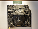 "+
"
"+
" "+
"
"+
" "+
"
"+
" "+
"
"+
" "+
"
"+
" "+
"
"+
" "+
"
"+
" "+
"",
hunlibengali : "হুনলিঃ-হুনলি, ভারতের অরুণাচল প্রদেশের নিম্ন দিবাং উপত্যকা জেলার একটা ছোট শহর। শহরটা ব্রহ্মপুত্র নদীর তীরে অবস্থিত এবং সুন্দর পাহাড় এবং ঘন বন দ্বারা বেষ্টিত। হুনলি তার প্রাকৃতিক সৌন্দর্য, সাংস্কৃতিক সমৃদ্ধি, এবং দুঃসাহসিক কার্যকলাপের জন্যে পরিচিত। হুনলির অন্যতম প্রধান আকর্ষণ হলো শহরের মধ্য দিয়ে প্রবাহিত সুন্দর ব্রহ্মপুত্র নদী, যা দর্শনার্থীদের নৌকো ভ্রমণ, ভেলা ভ্রমণ এবং মাছ ধরার সুযোগ করে দেয়। এই নদী স্থানীয় মানুষজনের, বেশিরভাগই জেলেদের, জীবিকার একটা গুরুত্বপূর্ণ উৎস। হুনলি তার সমৃদ্ধ সাংস্কৃতিক ঐতিহ্যের জন্যেও পরিচিত। শহরে বেশ কয়েকটা উপজাতি সম্প্রদায় বাস করে ও তাদের অনন্য রীতিনীতি, ঐতিহ্য, এবং উৎসব ভ্রমণার্থীদের আকর্ষণ করে । দর্শনার্থীরা স্থানীয় বাজার ঘুরে, স্থানীয়দের সাথে যোগাযোগ করে, এই অঞ্চলের সমৃদ্ধ সাংস্কৃতিক ঐতিহ্য সম্পর্কে জানতে পারেন। হুনলি ট্রেকিং, হাইকিং এবং ক্যাম্পিংয়ের জন্যেও পরিচিত। আশেপাশের পাহাড় এবং বনে, বিভিন্ন উদ্ভিদ এবং প্রাণীর আবাসস্থল, যা এই অঞ্চলকে করে তুলেছে প্রকৃতি প্রেমীদের এক আদর্শ গন্তব্যস্থল। শহরের কাছাকাছি মেহাও বন্যপ্রাণী অভয়ারণ্য ঘুরে দেখার জন্যে হুনলি একটা জনপ্রিয় বেস ক্যাম্প। অভয়ারণ্যে হাতি, বাঘ এবং চিতাবাঘ সহ বিভিন্ন বন্যপ্রাণী রয়েছে। হুনলির আর একটা প্রধান আকর্ষণ হল কুপুলির পবিত্র গুহা মন্দির, যা স্থানীয় উপজাতিদের জন্যে একটা গুরুত্বপূর্ণ উপাসনালয়। অন্যান্য জনপ্রিয় আকর্ষণ হলো মায়ুদিয়া পাস, যা সমুদ্রপৃষ্ঠ থেকে ২,৬৫৫ মিটার উঁচুতে অবস্থিত। এই পাস থেকে আশেপাশের পাহাড় এবং উপত্যকার মনোমুগ্ধকর দৃশ্য দেখা যায়, এবং ট্রেকিং ও হাইকিং উৎসাহীদের জন্যে একটা জনপ্রিয় গন্তব্যস্থল। "+
"Read More..."+
"
"+
"",
hunlibengali : "হুনলিঃ-হুনলি, ভারতের অরুণাচল প্রদেশের নিম্ন দিবাং উপত্যকা জেলার একটা ছোট শহর। শহরটা ব্রহ্মপুত্র নদীর তীরে অবস্থিত এবং সুন্দর পাহাড় এবং ঘন বন দ্বারা বেষ্টিত। হুনলি তার প্রাকৃতিক সৌন্দর্য, সাংস্কৃতিক সমৃদ্ধি, এবং দুঃসাহসিক কার্যকলাপের জন্যে পরিচিত। হুনলির অন্যতম প্রধান আকর্ষণ হলো শহরের মধ্য দিয়ে প্রবাহিত সুন্দর ব্রহ্মপুত্র নদী, যা দর্শনার্থীদের নৌকো ভ্রমণ, ভেলা ভ্রমণ এবং মাছ ধরার সুযোগ করে দেয়। এই নদী স্থানীয় মানুষজনের, বেশিরভাগই জেলেদের, জীবিকার একটা গুরুত্বপূর্ণ উৎস। হুনলি তার সমৃদ্ধ সাংস্কৃতিক ঐতিহ্যের জন্যেও পরিচিত। শহরে বেশ কয়েকটা উপজাতি সম্প্রদায় বাস করে ও তাদের অনন্য রীতিনীতি, ঐতিহ্য, এবং উৎসব ভ্রমণার্থীদের আকর্ষণ করে । দর্শনার্থীরা স্থানীয় বাজার ঘুরে, স্থানীয়দের সাথে যোগাযোগ করে, এই অঞ্চলের সমৃদ্ধ সাংস্কৃতিক ঐতিহ্য সম্পর্কে জানতে পারেন। হুনলি ট্রেকিং, হাইকিং এবং ক্যাম্পিংয়ের জন্যেও পরিচিত। আশেপাশের পাহাড় এবং বনে, বিভিন্ন উদ্ভিদ এবং প্রাণীর আবাসস্থল, যা এই অঞ্চলকে করে তুলেছে প্রকৃতি প্রেমীদের এক আদর্শ গন্তব্যস্থল। শহরের কাছাকাছি মেহাও বন্যপ্রাণী অভয়ারণ্য ঘুরে দেখার জন্যে হুনলি একটা জনপ্রিয় বেস ক্যাম্প। অভয়ারণ্যে হাতি, বাঘ এবং চিতাবাঘ সহ বিভিন্ন বন্যপ্রাণী রয়েছে। হুনলির আর একটা প্রধান আকর্ষণ হল কুপুলির পবিত্র গুহা মন্দির, যা স্থানীয় উপজাতিদের জন্যে একটা গুরুত্বপূর্ণ উপাসনালয়। অন্যান্য জনপ্রিয় আকর্ষণ হলো মায়ুদিয়া পাস, যা সমুদ্রপৃষ্ঠ থেকে ২,৬৫৫ মিটার উঁচুতে অবস্থিত। এই পাস থেকে আশেপাশের পাহাড় এবং উপত্যকার মনোমুগ্ধকর দৃশ্য দেখা যায়, এবং ট্রেকিং ও হাইকিং উৎসাহীদের জন্যে একটা জনপ্রিয় গন্তব্যস্থল। "+
"Read More..."+
" "+
"
"+
" "+
"
"+
" "+
"
"+
" "+
"
"+
" "+
"
"+
"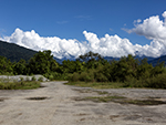 "+
"
"+
" "+
"
"+
" "+
"",
tejubengali : "তেজুঃ-অরুণাচল প্রদেশের লোহিত জেলার প্রশাসনিক সদর দপ্তর তেজু, প্রায় ছশো ফুট উচ্চতায় মনোমুগ্ধকর মিশমি পাহাড়ের মাঝখানে, এবং ব্রহ্মপুত্রের অন্যতম প্রধান উপনদী, লোহিত নদীর তীরে অবস্থিত একটা প্রাণবন্ত, এবং ঐতিহাসিকভাবে গুরুত্বপূর্ণ শহর। বৈচিত্র্যময় সাংস্কৃতিক সুরেলার মিশ্রণের জন্যে পরিচিত তেজু, মিশমি, খামতি, দিগারু এবং মিজুর মতো উপজাতিদের আবাসস্থল। মিশমিদের প্রাচীন ঐতিহ্য মহাভারত যুগের বলে বিশ্বাস করা হয়, এমনকি ভগবান শ্রীকৃষ্ণের প্রথম রানী রুক্মিণীকেও তাদের বংশের বলে দাবী করা হয়। তেজুতে মিশমি উপজাতিদের এখনও একজন রাজা এবং রানী বাস করেন। শহরটা বেশ কয়েকটা প্রাকৃতিক এবং আধ্যাত্মিক বিস্ময়ের প্রবেশদ্বার হিসেবে কাজ করে, যার মধ্যে রয়েছে পবিত্র পরশুরাম কুণ্ড, যা একটা গুরুত্বপূর্ণ হিন্দু তীর্থস্থান ও যেখানে ভক্তরা পাপ মুক্ত হবার জন্যে স্নান করেন, বিশেষ করে মকর সংক্রান্তির সময়, এবং শান্ত গ্লো হ্রদ, যেখানে হিমালয়ের উদ্ভিদ ও প্রাণীজগৎ পরখ করা এবং ট্রেকিং-এর জন্যে একটা আদর্শ স্থান। তেজুর কৌশলগত অবস্থান এটাকে নিকটবর্তী আঞ্জাও জেলার জন্যে একটা লজিস্টিক হাব করে তুলেছে, এবং লোহিত নদীতে পর্যটকদের জন্যে ট্রেকিং, হাইকিং, রিভার রাফটিং, এবং মাছ ধরার মতো অ্যাডভেঞ্চার করার সুযোগ প্রদান করে। আবার দূরবর্তী ডং গ্রামে ভারতের প্রথম সূর্যোদয় প্রত্যক্ষ করার অনন্য অভিজ্ঞতা লাভ করা যেতে পারে। "+
"Read More..."+
"
"+
"",
tejubengali : "তেজুঃ-অরুণাচল প্রদেশের লোহিত জেলার প্রশাসনিক সদর দপ্তর তেজু, প্রায় ছশো ফুট উচ্চতায় মনোমুগ্ধকর মিশমি পাহাড়ের মাঝখানে, এবং ব্রহ্মপুত্রের অন্যতম প্রধান উপনদী, লোহিত নদীর তীরে অবস্থিত একটা প্রাণবন্ত, এবং ঐতিহাসিকভাবে গুরুত্বপূর্ণ শহর। বৈচিত্র্যময় সাংস্কৃতিক সুরেলার মিশ্রণের জন্যে পরিচিত তেজু, মিশমি, খামতি, দিগারু এবং মিজুর মতো উপজাতিদের আবাসস্থল। মিশমিদের প্রাচীন ঐতিহ্য মহাভারত যুগের বলে বিশ্বাস করা হয়, এমনকি ভগবান শ্রীকৃষ্ণের প্রথম রানী রুক্মিণীকেও তাদের বংশের বলে দাবী করা হয়। তেজুতে মিশমি উপজাতিদের এখনও একজন রাজা এবং রানী বাস করেন। শহরটা বেশ কয়েকটা প্রাকৃতিক এবং আধ্যাত্মিক বিস্ময়ের প্রবেশদ্বার হিসেবে কাজ করে, যার মধ্যে রয়েছে পবিত্র পরশুরাম কুণ্ড, যা একটা গুরুত্বপূর্ণ হিন্দু তীর্থস্থান ও যেখানে ভক্তরা পাপ মুক্ত হবার জন্যে স্নান করেন, বিশেষ করে মকর সংক্রান্তির সময়, এবং শান্ত গ্লো হ্রদ, যেখানে হিমালয়ের উদ্ভিদ ও প্রাণীজগৎ পরখ করা এবং ট্রেকিং-এর জন্যে একটা আদর্শ স্থান। তেজুর কৌশলগত অবস্থান এটাকে নিকটবর্তী আঞ্জাও জেলার জন্যে একটা লজিস্টিক হাব করে তুলেছে, এবং লোহিত নদীতে পর্যটকদের জন্যে ট্রেকিং, হাইকিং, রিভার রাফটিং, এবং মাছ ধরার মতো অ্যাডভেঞ্চার করার সুযোগ প্রদান করে। আবার দূরবর্তী ডং গ্রামে ভারতের প্রথম সূর্যোদয় প্রত্যক্ষ করার অনন্য অভিজ্ঞতা লাভ করা যেতে পারে। "+
"Read More..."+
" "+
"
"+
" "+
"
"+
" "+
"
"+
" "+
"
"+
" "+
"
"+
" "+
"
"+
" "+
"
"+
"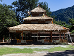 "+
"",
namsaibengali : "নামসাইঃ-অরুণাচল প্রদেশের নামসাই, স্বর্ণরাঙা এক শান্তির প্রদেশ, যেন পূর্ব দিগন্তের আলো নিজের বুকের মধ্যে ধরে রাখা এক স্বপ্নভূমি। প্রকৃতি এখানে কথা বলে নরম কণ্ঠে, বাতাস বইলে মনে হয় যেন অদৃশ্য কোনো সুরকার বাঁশির সুর তুলেছে। লোহিত নদীর ধীরে বয়ে চলা জলরেখা এই ভূমির সৌন্দর্যকে আরও গভীর করে তুলেছে, যেন সময়ও এখানে একটু ধীরে হাঁটে। নামসাইয়ের সকাল যেন রঙিন কোনো চিত্রশালার দরজা খুলে যাওয়ার মুহূর্ত। কুয়াশা ধীরে ধীরে পাতলা হয়ে এলে দেখা যায় সোনালি ধানের খেত, বাঁশঝাড়ের ফাঁকে ফাঁকে ছায়াময় সবুজ, আর দূরের পাহাড়ে সকালের রোদ লেগে থাকা মেঘের টুকরো। গ্রামের পথ ধরে চললে শুনতে পাওয়া যায় পাখির কিচিরমিচির, আর মাটির গন্ধে ভেসে ওঠে এক সরল অথচ প্রশান্ত দিনের আমন্ত্রণ।এ অঞ্চলের হৃদয় নিঃসন্দেহে বৈভবশালী কন্সাই শ্রীমাইতোদ প্যাগোডা, ভারতের মধ্যে সবচেয়ে বড় বৌদ্ধ প্যাগোডাগুলোর মধ্যে একটা। সোনালি গম্বুজ রোদের আলোয় ঝলমল করে ওঠে, যেন শান্তির এক মন্দির আকাশ ছুঁতে চায়। ভিক্ষুদের মন্ত্রোচ্চারণ, প্রজ্বালিত প্রদীপের মৃদু আলো, আর সুগন্ধি ধূপের ধোঁয়া মিলেমিশে সৃষ্টি করে এক গভীর আধ্যাত্মিক পরিবেশ, যেখানে দাঁড়ালেই মনে হয় মনটা স্বচ্ছ হয়ে যাচ্ছে।নামসাইয়ের মানুষও এই ভূমির মতোই নরম, হাসিমুখে অতিথিকে বরণ করে নেয়। তাই খামতি জনগোষ্ঠীর ঐতিহ্য, রঙিন পোশাক, কাঠের খোদাই, আর লোককথার গল্প, এই অঞ্চলের জীবনকে রাঙিয়ে তোলে। উৎসবের দিনে ঢোলের আওয়াজ, নৃত্যের ছন্দ, আর আকাশে ভেসে ওঠা লণ্ঠনের সারি নামসাইকে করে তোলে এক জীবন্ত কাব্য। সন্ধ্যে নেমে এলে লোহিত নদীর দু পাড়ে ছড়িয়ে পড়ে সোনালি অন্ধকার। নদীর জলে চাঁদের প্রতিচ্ছবি কাঁপতে থাকে, দূরের ঝিঁঝিঁ পোকার ডাক রাতকে আরও নীরব করে তোলে। সেই নীরবতা হৃদয় ছুঁয়ে যায়। এখানে দাঁড়িয়ে মনে হয়, পৃথিবী এখনও সুন্দর, এখনও শান্ত, এখনও সত্য। নামসাই তাই কেবল একটা শহর নয়, এ এক শান্ত স্বপ্ন, প্রকৃতির গায়ে লেখা কোমল কবিতা, যেখানে ভ্রমণকারী ফিরে এসে দীর্ঘদিন মনে বহন করে তার আলো, তার নীরবতা, তার সৌন্দর্য। "+
"Read More..."+
"
"+
"",
namsaibengali : "নামসাইঃ-অরুণাচল প্রদেশের নামসাই, স্বর্ণরাঙা এক শান্তির প্রদেশ, যেন পূর্ব দিগন্তের আলো নিজের বুকের মধ্যে ধরে রাখা এক স্বপ্নভূমি। প্রকৃতি এখানে কথা বলে নরম কণ্ঠে, বাতাস বইলে মনে হয় যেন অদৃশ্য কোনো সুরকার বাঁশির সুর তুলেছে। লোহিত নদীর ধীরে বয়ে চলা জলরেখা এই ভূমির সৌন্দর্যকে আরও গভীর করে তুলেছে, যেন সময়ও এখানে একটু ধীরে হাঁটে। নামসাইয়ের সকাল যেন রঙিন কোনো চিত্রশালার দরজা খুলে যাওয়ার মুহূর্ত। কুয়াশা ধীরে ধীরে পাতলা হয়ে এলে দেখা যায় সোনালি ধানের খেত, বাঁশঝাড়ের ফাঁকে ফাঁকে ছায়াময় সবুজ, আর দূরের পাহাড়ে সকালের রোদ লেগে থাকা মেঘের টুকরো। গ্রামের পথ ধরে চললে শুনতে পাওয়া যায় পাখির কিচিরমিচির, আর মাটির গন্ধে ভেসে ওঠে এক সরল অথচ প্রশান্ত দিনের আমন্ত্রণ।এ অঞ্চলের হৃদয় নিঃসন্দেহে বৈভবশালী কন্সাই শ্রীমাইতোদ প্যাগোডা, ভারতের মধ্যে সবচেয়ে বড় বৌদ্ধ প্যাগোডাগুলোর মধ্যে একটা। সোনালি গম্বুজ রোদের আলোয় ঝলমল করে ওঠে, যেন শান্তির এক মন্দির আকাশ ছুঁতে চায়। ভিক্ষুদের মন্ত্রোচ্চারণ, প্রজ্বালিত প্রদীপের মৃদু আলো, আর সুগন্ধি ধূপের ধোঁয়া মিলেমিশে সৃষ্টি করে এক গভীর আধ্যাত্মিক পরিবেশ, যেখানে দাঁড়ালেই মনে হয় মনটা স্বচ্ছ হয়ে যাচ্ছে।নামসাইয়ের মানুষও এই ভূমির মতোই নরম, হাসিমুখে অতিথিকে বরণ করে নেয়। তাই খামতি জনগোষ্ঠীর ঐতিহ্য, রঙিন পোশাক, কাঠের খোদাই, আর লোককথার গল্প, এই অঞ্চলের জীবনকে রাঙিয়ে তোলে। উৎসবের দিনে ঢোলের আওয়াজ, নৃত্যের ছন্দ, আর আকাশে ভেসে ওঠা লণ্ঠনের সারি নামসাইকে করে তোলে এক জীবন্ত কাব্য। সন্ধ্যে নেমে এলে লোহিত নদীর দু পাড়ে ছড়িয়ে পড়ে সোনালি অন্ধকার। নদীর জলে চাঁদের প্রতিচ্ছবি কাঁপতে থাকে, দূরের ঝিঁঝিঁ পোকার ডাক রাতকে আরও নীরব করে তোলে। সেই নীরবতা হৃদয় ছুঁয়ে যায়। এখানে দাঁড়িয়ে মনে হয়, পৃথিবী এখনও সুন্দর, এখনও শান্ত, এখনও সত্য। নামসাই তাই কেবল একটা শহর নয়, এ এক শান্ত স্বপ্ন, প্রকৃতির গায়ে লেখা কোমল কবিতা, যেখানে ভ্রমণকারী ফিরে এসে দীর্ঘদিন মনে বহন করে তার আলো, তার নীরবতা, তার সৌন্দর্য। "+
"Read More..."+
" "+
"
"+
" "+
"
"+
" "+
"
"+
" "+
"
"+
" "+
"
"+
" "+
"
"+
" "+
"
"+
" "+
"",
headingbengali : "অরুণাচল",
headingenglish : "ARUNACHAL",
};
"+
"",
headingbengali : "অরুণাচল",
headingenglish : "ARUNACHAL",
};